December 13, 2022 |
Multiple Authors | Public Safety
November 10, 2026
In November 2021, about a hundred heads of state and tens of thousands of delegates gathered at Glasgow’s Scottish Event Campus for COP26, the 26th United Nations Climate Change Conference. It was the largest conference the UK had ever hosted and it carried a live political charge. Protesters filled the streets outside, angry that the leaders inside weren’t moving fast enough.
The ancient city has ample places to hide improvised explosive devices (IEDs)—standpipes, maintenance holes, storm drains, and the hollow bases of lighting columns. Before the conference, in a search-and-seal exercise, police searched each opening and access panel and closed it with a tamper-proof seal.
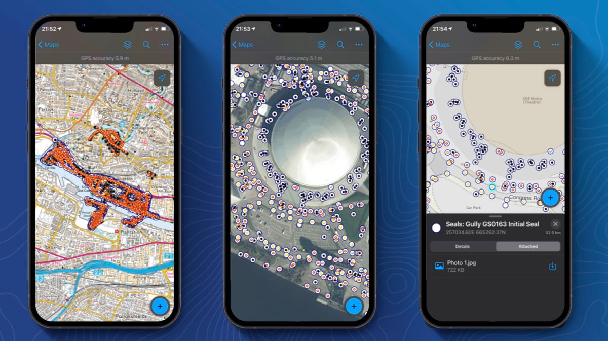
Police Scotland’s Search team logged every sealed void in an app built with geographic information system (GIS) technology. Each seal carried a unique ID number. Before COP26 began, teams used that record to recheck each location. A broken seal showed itself. A missing seal did not. Only the digital record revealed a gap where a seal should have been.
The previous process relied on paper. Officers carried forms into the field and returned them for someone else to reconcile into a single assessment of whether the site was clear. Gordon Tyler, who leads the GIS team in Police Scotland’s Digital Division, said, “The paper-based process that would have been used before simply would not have functioned.”
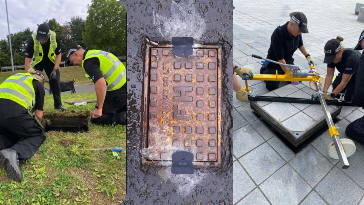
Inspector Steve Hunter, the search manager, surveyed every site around the COP26 venue with survey-grade GPS, processed the data in ArcGIS Pro, and pushed it to ArcGIS Field Maps. He built the first version from scratch, sometimes propping a laptop on top of his car to make changes the search teams were asking for. “It was very much a prototype,” he said. “The version we have now is a lot more polished and hopefully user-friendly.”
COP26 was the first time Police Scotland used the workflow, and some staff had doubts because it was unproven. Typing a seal number into a phone won them over. The alternative was copying 12 digits onto wet paper. “It was pretty obvious very early on that they loved the ease of use of the system,” Hunter said.
Specialists run the first search because they can recognize an IED. The UK built that expertise after the Irish Republican Army bombed Brighton’s Grand Hotel in 1984, during the Conservative Party conference, in an attempt to kill Prime Minister Margaret Thatcher and her cabinet. The government turned to the Royal Engineers, who had learned the work in Northern Ireland. Their collaboration with police became the Police National Search Centre, the UK’s training authority for police search advisers.
One of the design’s breakthroughs was expanding who could perform routine checks before and during an event. Once a location is sealed, checking it takes no specialist training. A person matches the seal number and records whether it is intact. Search managers now assign the task to staff on routine rounds, Tyler said. “If they mark it as damaged, that flags immediately and the trained search teams get a task to go and recheck it.”
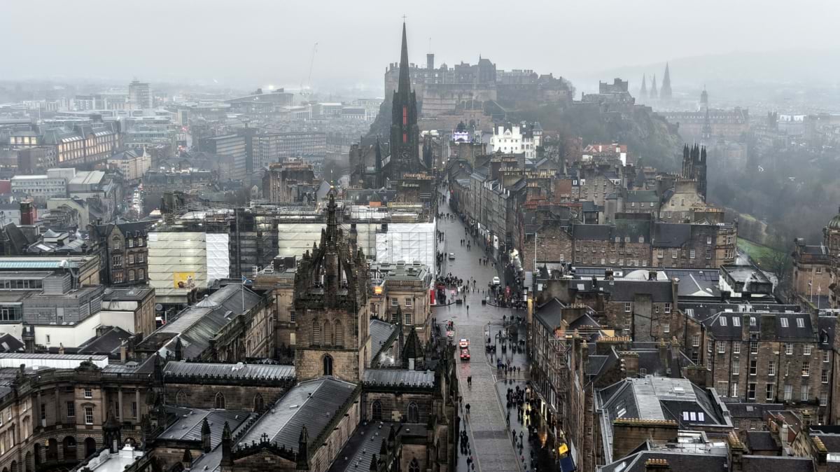
The COP26 app now secures the Royal Mile, the string of streets that climbs from the Palace of Holyrood to Edinburgh Castle. Uneven cobbles and a web of narrow closes and wynds make the route hard to navigate and hard to secure. The alleys darken early and offer quick routes out of sight.
The Royal Mile carries every royal ceremony in Scotland. The queen’s funeral cortege passed down the Royal Mile, and it’s where the king was presented the Honours of Scotland (the oldest regalia in Britain), at St. Giles’ Cathedral. The ceremonies draw crowds of onlookers and the historic route draws hundreds of thousands of visitors to Edinburgh throughout the year.
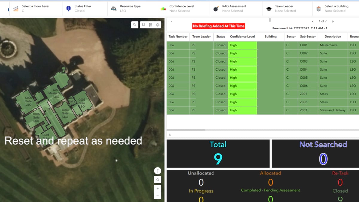
Police reactivate the workflow before each royal visit. Inside the palaces, the search itself becomes a maze. One search area alone runs to 400 sectors, floor by floor, room by room, and officers who have never been inside a working royal residence can lose their bearings fast. “It’s not the first time we’ve had officers get lost in a building because they’re so complex,” Hunter said. ArcGIS Field Maps gives them a floor plan and a GPS dot, so they know which corridor to take and how far they are from a landmark if they must evacuate. “There’s no guesswork,” he said. “If I’m across this line on my map, I’m 100 meters away from this building.”
In 2025, Police Scotland ran two search-and-seal operations at once, on short notice, when the president of the United States visited both of his golf properties in Scotland: Turnberry, on the southwest coast, and Menie, near Aberdeen in the northeast. Hunter could not be at both sites, so he taught the team members how to operate the GPS units. They quickly surveyed every void on both estates. Hunter then reviewed the data for accuracy and uploaded it for all to use. “The system again demonstrated its benefits of speed and accuracy,” he said, “across quite a large geographic spread simultaneously.”
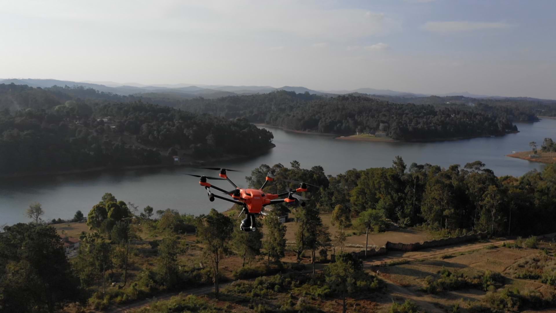
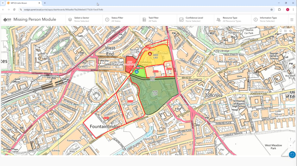
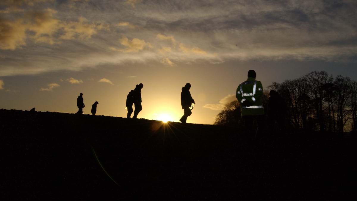
A similar app-based workflow is used for missing-person searches. A police search adviser can plan the operation in ArcGIS, assigning sectors to police search teams, canine units, drones, and dive and marine units for waterways. As teams cover ground, the map updates in real time. Most of Scotland’s missing-person cases end within hours. Someone walks out of a hospital ward, a care home, or a house, and searchers usually find them nearby.
Previously, a search adviser drew sectors on a paper map, wrote a tasking sheet for each team, and waited for signed forms to return. Now an adviser in Dundee can draw and assign sectors from a screen for a search happening on Shetland and watch them change color on a live dashboard as teams clear them. Officers in the field see only their own assigned sector, colored by status, so they know what remains without sorting through the entire operation.
Police Scotland is also working to bring this technology to Scotland’s mountain rescue network: 27 teams in total—all but four of them run by volunteers—who search for people lost in the wilderness.
Not every search in Scotland ends with someone found. When a search goes cold and years later someone asks for it to be reviewed, the record used to lie in a box of paper. Hunter has taken some of those old cases and rebuilt them inside the system as though they were new to see the patterns more clearly.
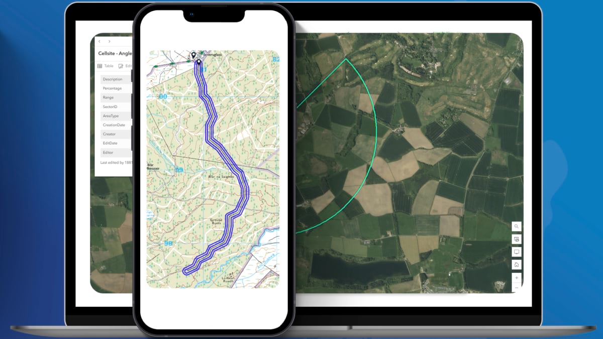
A location shows where someone went missing, but the search record shows how the response unfolded: whether visibility was 50 meters or 5, who searched each area, and whether teams swept every meter or moved quickly in failing light.
Phone data adds detail to modern searches: the last tower a phone connected to, the last call or message, and whether a device went dark suddenly or faded over hours.
Every location and time stamp holds a clue. Those details were once scattered in police notebooks, phone company records, and a diver’s memory of that day. On one map a case stops being a stack of disconnected facts. It becomes a timeline investigators can retrace sector by sector, hour by hour, and gap by gap.
GIS has gained momentum inside Police Scotland, not simply as a tool for coordinated response but as means to map risks before they become incidents. The same map that tracked sealed drains across an event campus now tracks a missing person across a city. In both cases, it shows police what is missing and where to look next.
Learn more about how police use GIS to create mobile apps that allow officers to integrate data feeds and personnel locations for a complete operational picture.