

June 27, 2018 |
Matt Ball | Mapping
This post is one of a series of Reveals that profile the power of geographic information system (GIS) technology to record and visualize things hidden from human senses or at a scale we find hard to comprehend by other means.
On September 1, 1983, Korean Air Lines flight 007 (KAL 007) was on its way from Anchorage, Alaska to Seoul, South Korea. Amid Cold War tensions, the Boeing 747 lost track of its position and mistakenly strayed into Soviet airspace with deadly consequences. All 269 passengers and crew, including US congressman Larry McDonald (D-Georgia), were killed when the plane was shot down and crashed in the Sea of Japan.
A number of technical failures and decisions contributed to the disaster, but one emerging technology might have prevented it: global positioning.
The 1983 tragedy rallied support and secured long-term funding for the US military’s Global Positioning System (GPS), which was then under development with an uncertain future.
Looking back, the realization that the program could have civilian applications seems overdue and underestimated. Now, positioning technology has become interwoven in society, changing the way we navigate from place to place and transforming how many industries operate.

Revealing Position as GPS Evolves
The first GPS carried the name Navstar, associated with “Navigation Satellite Timing and Ranging,” which describes how these satellites pinpoint position. Each satellite transmits a unique time-coded radio signal. A person with a receiver gathers these signals and when at least four satellites are within view, the receiver combines information from all signals to triangulate the receiver’s location, including latitude, longitude, and altitude.
The term evolved from GPS to GNSS (Global Navigation Satellite System) as more countries launched their own satellite constellations to provide precise position. Since 1990, the cost of receivers has dropped dramatically—from bulky early versions that could cost thousands of US dollars and were the size of a large backpack, down to the one in your pocket: the smartphone-sized receiver that only costs manufacturers a couple of dollars to include.
Global positioning has become democratized and nearly ubiquitous.
Finding the Way in Real Time
Perhaps the most well-known use of position is wayfinding—to navigate to a destination and prevent getting lost. With the capabilities of global positioning and smartphones, gone are the days of consulting a paper map or printing out directions before a road trip. Positioning can help with simple wayfinding tasks, such as locating a nearby restaurant. Yet, the capabilities extend to navigating ships through international waters, guiding snowplows in low visibility conditions, and helping military personnel move around in unknown or hostile territory.
Position and change in position reveal a number of things: location, movement, speed, bearing, distance traveled or yet to travel, time needed to reach a destination. Combined, the data gives a real-time awareness of where something or someone is, and where it or they are going.
Real-time tracking is not only helpful for guiding people to destinations, it’s also necessary for emerging technologies like autonomous cars. These vehicles need to know their precise position in real time to make the right turns at the right times. As connectivity improves, this application becomes more of a reality.
Improving the Map with Precise Data
We can think of GNSS as providing an infinite number of point coordinates–latitude by longitude by altitude. This “pointillistic” concept was a quantum leap forward in fields such as mapping and surveying. Before GNSS, a forest might have been shown on a map as a polygon, with straight lines mapping a rough estimate of the forest’s edge. With global positioning, each tree has its own point location, and each point can be mapped. The combined points of the trees indicate a forest, instead of the other way around.
Now, mappers and surveyors use positioning to record attributes of features like trees, by matching them to precise locations. They can note more information about each tree at a granular level—for example, cataloguing which trees are suffering from disease. Using GNSS, a maintenance crew can then find the same trees at a later time to treat or remove them.
Positioning also gives mapmakers a powerful tool to create new maps. For instance, they can aggregate a series of tracked routes from hikers or vehicles, using these inputs to map uncharted trails and service roads.

Visualizing Position Leads to Understanding
Position threads together the digital and physical worlds. Knowing your position isn’t enough—you need the context of a map to understand where you are and gain perspective on where to go next.
Sometimes there’s tension between what we see on a map and what we see in reality. Maybe a downed tree is obscuring a trail, a building has changed names, or new construction appears where you expected an open space. In these cases, position can be a source of truth that is unaffected by changes in the physical world, allowing us to see what others can’t.
In other cases, position supplements our knowledge of the physical world. Augmented reality technology can use precise positioning information to layer unseen objects on top of visible ones. One utility company in New Jersey layers the position of underground utility pipes on top of workers’ views of the physical road, showing them exactly where to dig to complete repairs.
Positioning at Every Level, from Routing to Enterprise to Prediction
Positioning is personal, getting you from point A to point B whenever you need to. Knowing your position helps you discover what’s around you, how far away you are from certain locations, and where to find what you need.
But positioning also operates at the enterprise level. Large amounts of position data can be collected and analyzed in a modern geographic information system (GIS) to identify patterns of movement over time. Business leaders can optimize supply chain logistics by tracking an entire operation. UPS and FedEx track the positions of their fleet vehicles and packages in near real time, using position on a large scale to plan the most efficient delivery routes.
Planners can improve event management by easing the flow of people in and out of a venue, improving safety by knowing where police officers are located and dispatching them quickly to incidents. In 2017, Chicago Marathon organizers tracked the locations of all runners in real time.
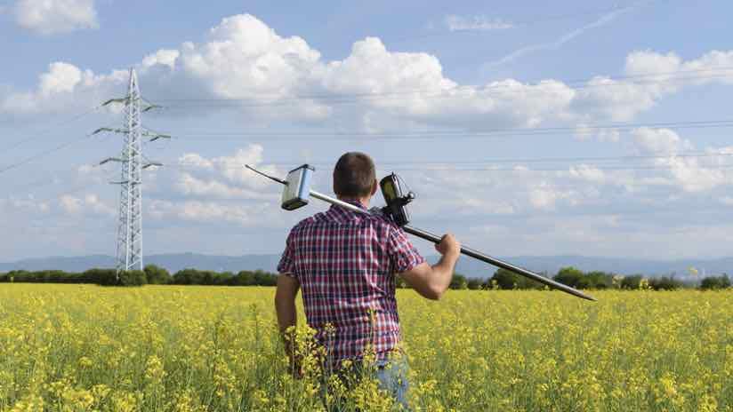
Positioning enables precision agriculture, as farmers can keep records of soil types and locations, informing which seeds to plant where. Other diverse enterprise applications include archaeology, mapping and surveying, emergency response, and even time-stamping of bank transactions.
The next level for positioning is predicting movement before it happens. Crowdsourced positioning and movement data are already used to predict how traffic will impact your trip across a big city. Cobb County in Georgia uses AI, specifically machine learning, to predict the movement of people and vehicles at Atlanta Braves games, changing traffic lights preemptively to allow massive flows of people in and out of the venue.
Improving Accuracy
When GPS first launched, a US government policy called “selective availability” slightly degraded the signal for civilians, reserving the most accurate positioning information for military uses. This policy was ended by the Clinton administration in 2000, allowing for five-meter (16 ft) accuracy. Since then, accuracy continues to increase as the US Air Force replaces satellites with newer versions, and as receiver technology improves.
The first of next-generation GPS satellites was successfully launched into orbit by SpaceX in December 2018. These new satellites are expected to increase accuracy by a factor of three. Other improvements include anti-jamming tech to prevent interference and an extended satellite lifespan.
Another factor improving accuracy is the increasing number of satellites. GPS used to be the only complete GNSS. Today, Russia, China, and the European Union also operate their own GNSS, called GLONASS, BeiDou, and Galileo respectively. The greater the number of satellites with compatible systems, the more accurate the positioning.
This is welcome news to the 4 billion people globally estimated to be using positioning technology, according to the US Air Force. When developing Navstar GPS, the US military never predicted nearly half the world’s population would adopt it. Now, with GNSS more advanced and affordable than ever, we can expect to see its expansion and refinement.
Learn how apps allow field operators to take the power of location anywhere.