
April 9, 2024 |
Matt Ball | Natural Resources
September 16, 2025
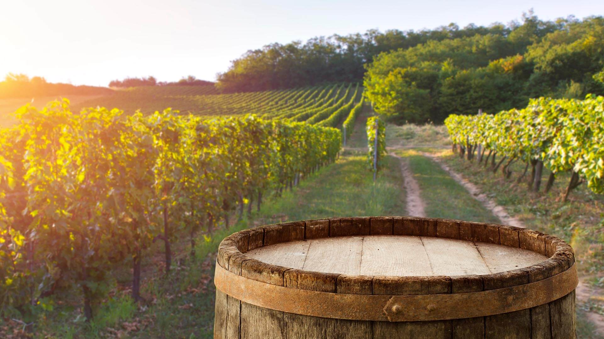
How do you give boutique-level attention to 9,000 acres of grapes?
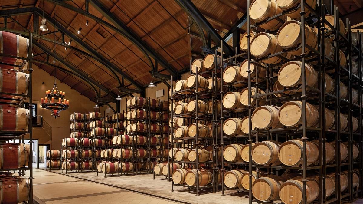
That’s the question Doug Wood set out to answer when he joined Trinchero Family Estates, the fourth-largest winery in the United States. With vineyards spanning 10 counties across California—from the fog-covered hills of Santa Barbara to the volcanic slopes of Napa’s Atlas Peak—Trinchero produces 18 million cases of wine each year. The scale is massive, but the goal is intimate: deliver the kind of quality and care typically reserved for small-lot winemaking.
“You really only get one shot a year to make up all of the investment that you put into the vineyard,” said Wood, a vineyard technologist at Trinchero.
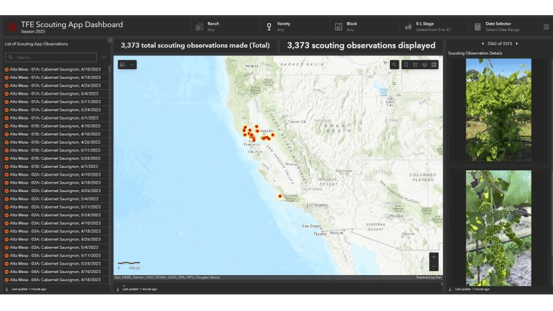
To make sure everything is done right at harvest time, Wood turned to geographic information system (GIS) technology. The mapping and analytics technology connects Trinchero’s field crews, winemakers, and executives with vital data for each vineyard block. It powers everything from crop estimation and pest scouting to redevelopment planning and sustainability tracking.
When Wood joined Trinchero in 2019, there was no GIS program—just paper maps and spreadsheets that told disparate stories. Today, the company’s digital infrastructure helps manage the complexity of large-scale viticulture while preserving the nuance and intention of boutique farming.
Trinchero Family Estates owns 35 vineyards and works with dozens of external growers. With vineyards spread across the state, the company manages a vast, varied agricultural footprint. Each region brings its own microclimates, soil types, varietals, and vineyard management practices. And each decision has cascading effects across winemaking operations, logistics, and finance.
For Wood, the challenge wasn’t just mapping this complexity—it was making it purposeful.
The existing spreadsheets detailing thousands of vineyard blocks made it difficult to answer basic questions: How many acres are in production? Which blocks are underperforming? How many tons of grapes should the winery expect this year?
GIS, which makes data easier to understand and analyze by organizing it geographically and in layers, became the foundation for answering those questions. By building a spatial database of every vineyard block, Wood created a single source of truth for the entire company.
That foundation now powers a suite of precision tools—from yield projection and scouting apps to harvest dashboards—making GIS the platform that links data to decisions across thousands of acres, dozens of teams, and one very high-stakes harvest season.
Once Wood established a digital foundation for Trinchero’s vineyard data, the next step was turning that information into action.
One of the most impactful tools he developed was a yield projection app that helps the company estimate grape production for each vineyard block. That number drives nearly every aspect of harvest planning, including crew size, truck dispatch, and tank space requirements.
“It’s not uncommon for us to need nearly 100 tractor trailers per night at a ranch during harvest,” Wood said. “And when the grapes come into the winery, there needs to be enough tank space for them, because once you pick the grapes, you’ve got to move fast. Otherwise, they start fermenting on their own.”
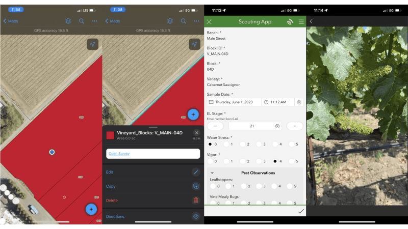
The app combines critical variables like grape cluster counts, cluster weights, and vine counts. Vineyard crews collect that information via mobile devices while the app standardizes the data and automatically geolocates and validates it.
That data flows into the office, where vineyard managers, winemakers, grower relations staff, and even finance teams use it to align on expectations and logistics. “Before GIS, there were four or five different spreadsheets with different, unreconciled numbers,” Wood said.
Now, everyone’s looking at the same data, creating a shared language for decision-making.
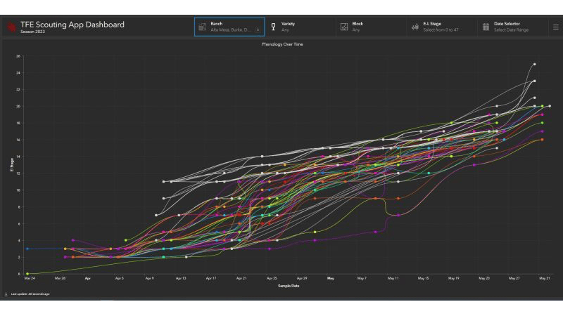
The benefits extend beyond logistics. The same geospatial infrastructure supports a scouting app that tracks pests, diseases, and vine health for every vineyard. It also powers dashboards that help winemakers monitor conditions without driving hundreds of miles between sites. “We can see what the growing conditions are in Santa Barbara the moment that data is submitted,” Wood said.
By embedding spatial data into daily workflows, these tools have transformed GIS into a vital operational asset.
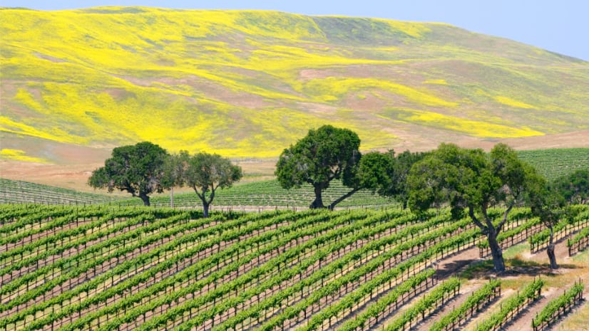
For all its scale, Trinchero’s most powerful use of GIS technology happens at the smallest unit of measurement: the vineyard block.
Each block—defined by its unique combination of soil, slope, varietal, and microclimate—can behave differently, even just rows away from its neighbor. That variability is where Wood’s work shines.
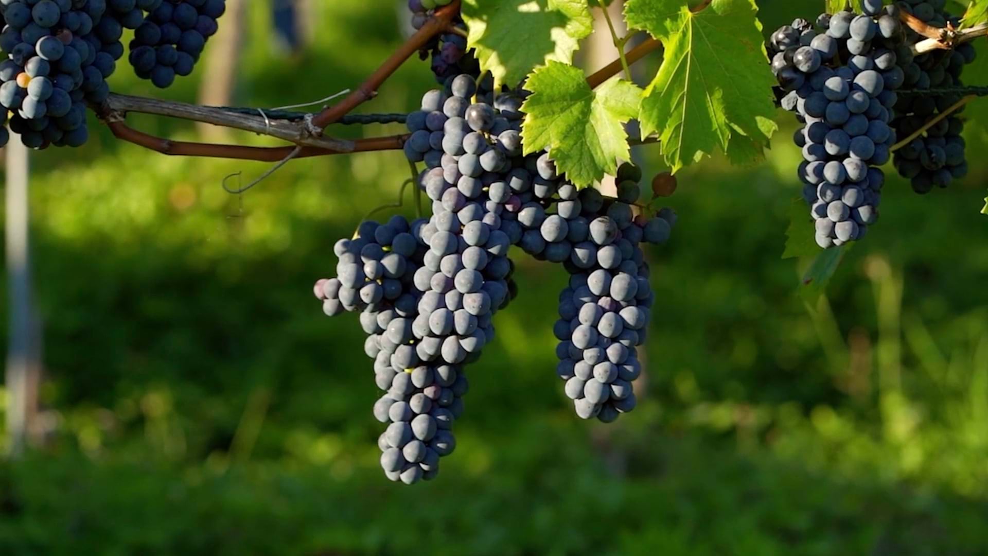
Consider Haystack Vineyard, perched on the volcanic ridges of Napa’s Atlas Peak American Viticultural Area (AVA). One cabernet sauvignon block there slopes steeply from south to north. The top of the block, where the soil is thinner and the vines struggle more, produces grapes prized by Trinchero’s luxury winemaking team. The bottom yields good fruit, but it’s destined for a different brand.
Wood created harvest maps that can direct crews to pick only the rows that met the winemaker’s criteria—taping off the rest for a later pick.
That same precision extends to redevelopment planning. By layering normalized difference vegetation index imagery with yield monitoring data from machine harvesters, Wood identified underperforming zones in large blocks. In one case, he used that insight to guide a precision agriculture technique that delivered more organic matter to struggling areas and less to thriving blocks. The result? The vineyard’s canopy was visibly more balanced the following year.
After mapping 9,000 acres and digitizing scouting and yield workflows, Wood is now expanding GIS beyond the vineyard.
Water management is one key frontier. In a state where every drop counts, Wood is developing a GIS-based system to track irrigation across Trinchero’s properties. “It’s not just about compliance,” he said. “It’s about being good stewards of the land. We want to know how much water we’re putting in, whether the vines are using it, and how that affects yield and quality.”
Climate adaptation provides another opportunity. The company operates more than 20 weather stations that collect temperature, precipitation, wind, and humidity data in 15-minute increments. Over time, that data will help the team understand how growing conditions are shifting and how to respond.
Storytelling is yet another value of the data-driven approach. As consumers become more curious about wine origins, Wood sees potential in using GIS to illuminate those stories. “People want to know where their wine came from. They want to hear about farming practices, the soil, the temperature, the climate, and the weather of a particular vintage, and the decisions that went into not just the winemaking, but the farming, too,” he said.
For now, Wood remains focused on deepening the company’s spatial intelligence. “The more we understand the data, the greater potential there is to use it to guide our farming decisions and meet our business needs in the long run,” he said.
By using a geospatial approach, Wood has enabled one of the country’s largest wineries to operate each vineyard block with the precision and attention of a boutique producer.
The sustainable agriculture transformation isn’t just technical—it’s cultural. Everyone at Trinchero now shares a common view of the land. They’re making faster, smarter decisions. They’re asking better questions. And they’re seeing how geography drives quality.
At Trinchero, smart maps aren’t just helping manage scale. They’re helping preserve the winemaking craft—one block, one vine, one vintage at a time.
“There’s still a lot of work to do, but each of these endeavors reminds me of the potential,” Wood said. “The more we understand our land, the better we can farm it.”
Learn more about how GIS technology helps farmers intelligently manage agriculture.