July 18, 2019
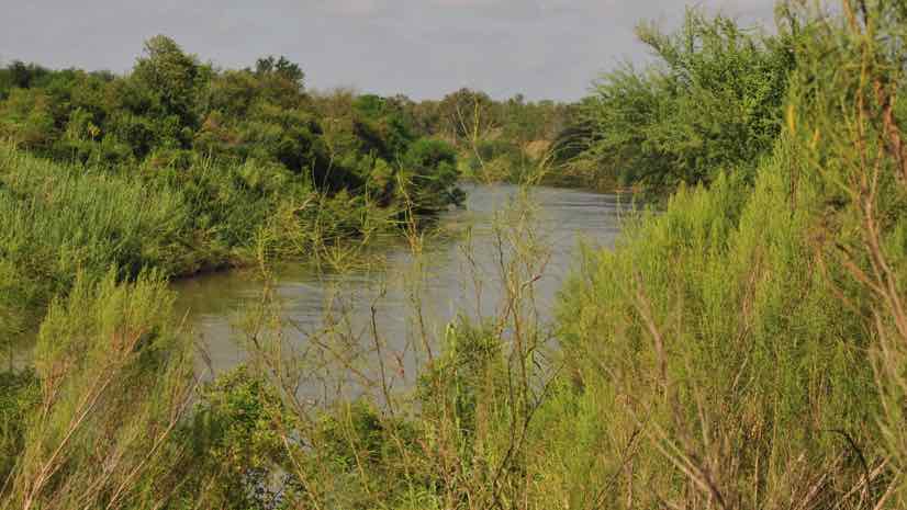
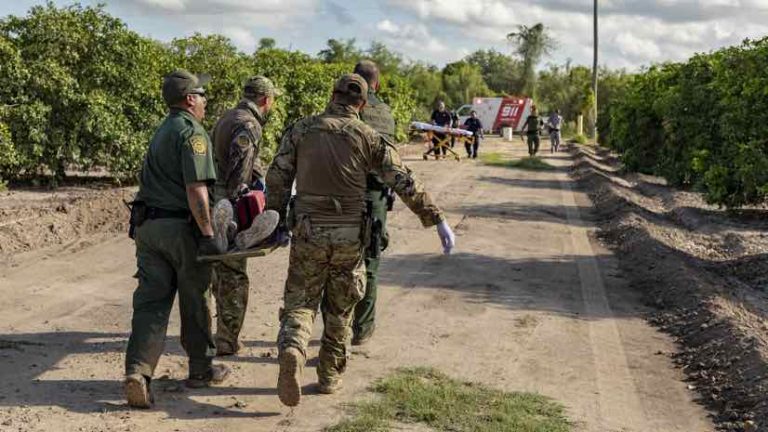
Sweltering heat and harsh treatment by human smugglers (known as coyotes) often leaves migrants sick, dehydrated, lost, and desperate for help in the scrubby and desolate ranchlands of the Rio Grande Valley at the southern tip of Texas.
“Once the coyote sees that somebody is falling behind, they’ll tell the group to keep moving, that they have someone else coming behind to help them,” said Elizabeth (Liz) Gamez, supervisory border patrol agent at the Rio Grande Valley Sector of US Border Patrol. “They don’t. They just leave them there to die.”
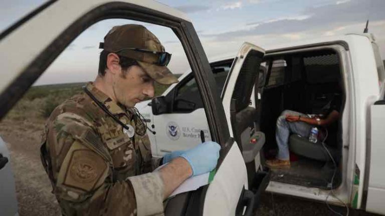
The US Border Patrol’s Rio Grande Valley Sector in Texas responds to an average of seven 9-1-1 calls per day for its coverage area of 34,000 square miles. Getting to the caller in time can prove difficult, due to vast distances and because individuals can be very hard to find in such remote places.
Widely spaced cell towers in this rural area mean a location trace is only accurate to a radius of 20 miles around the tower. There just aren’t enough towers to triangulate and achieve the 30-meter radius location trace that’s possible in urban settings. Without a better means to find the caller’s location, agents have to scour the land, flying search patterns from aircraft with on-the-ground patrols each searching grid sectors.
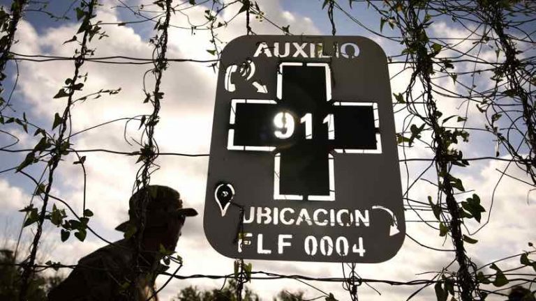
To improve its success helping those in need, Rio Grande Valley Sector recently rolled out the Missing Migrant Program. Staff installed 187 metal placards with an image of a phone and the word auxilio (help) pointing to 9-1-1 and a unique code identifying the ubicacion (location). Those calling for help can read off the code to let agents know exactly where they are.
“Search and rescue takes top priority,” Gamez said. “If we get a 9-1-1 call with individuals in distress, we’ll send all rescue assets to the call even if we’re tracking a narcotic load down the trail.”
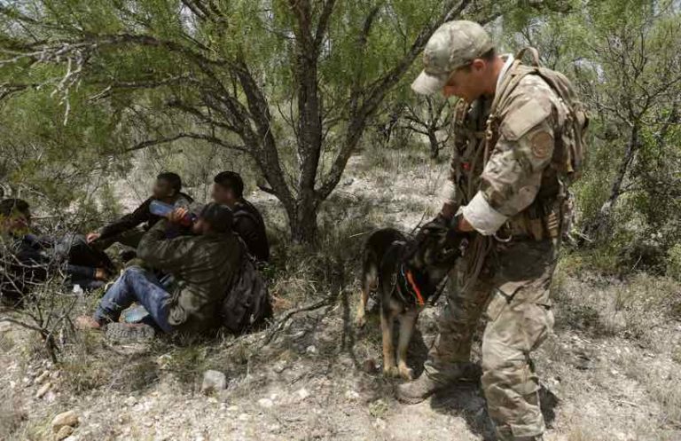
Response is swift when the Border Patrol knows where to go. A specialized unit, called the Border Patrol Search, Trauma, and Rescue Unit (BORSTAR), uses Black Hawk helicopters to find people in trouble. BORSTAR members are emergency medical technicians (EMTs) trained in rescue techniques. The team also includes search and rescue dogs that work off leash to track the scent of missing people, an integral element in the Rio Grande Valley where dense brush can hide a person just yards away. The specialty units are supported by agents in the field in all-terrain vehicles and on horseback.
Missing Migrant Program
The US Border Patrol’s Missing Migrant Program, which got its start in July 2016, has four objectives: prevention, location, identification, and reunification. The identification piece often involves a forensics specialist to find identifying clues from human remains.
“I have a total of 51 deaths so far this fiscal year, and that doesn’t even include the seven that I lost on Friday,” Gamez said in late May 2019. (This number includes Border Patrol reports as well as forensic support provided to other agencies).
From the start of the federal fiscal year in October 2018 to the end of May 2019, a total of 223,263 migrants were apprehended and processed in the Rio Grande Valley Sector. Like many US border crossings, the sector has seen a dramatic spike in the number of undocumented migrants detained. In May alone, there were 49,855. More people attempting to cross the border, means an increase in casualties.
Migrants must often place their fates in the hands of smuggling organizations that treat them more like cargo than human beings, hiding the truth about the harshness of the journey.
“They’re paying coyotes to take them to the border and are told it requires only an hour or two of walking,” Gamez said. “Instead, it takes two or three days across rough and rugged terrain, through thick brush, where there is no water, and it’s extremely hot and humid— this past weekend the temperature hit 112 degrees.”
Improving Location Information
To counteract the extremes of increasing numbers and intensifying summer heat, the Missing Migrant Program has ramped up its efforts. In addition to the metal signs, it placed eight rescue beacons with instructions for migrants in need to push a button for help. When the beacon is activated it sends an alert to the Operations Center so a rescue crew can respond.
After the placards were placed, Gamez contacted local utilities (electric, gas, and telephone) companies that have unique identifiers marked on each of their poles, wind turbines, and pipeline segments. She collected the location of thousands of utility assets but needed assistance to put all of those locations in a system where they could be mapped and shared. Gamez reached out to the US Border Patrol’s Data Science Division in Washington, DC, for help.
“We set up a solution using Esri’s Portal for ArcGIS that allows agents to enter any one of the unique codes and see it on a map,” said Rodney Washburn, associate chief of the US Border Patrol’s Data Science Division. “It also provides them with the quickest route to get where they need to go.”
Gamez continues to add more landmarks to the map. Thinking about the many parks along the border, she reached out to the Department of Fish and Wildlife and received 1,000 points with locations and unique tags for all the signs it maintains. In addition to large asset inventories, individual agents in the field log the location of landmarks to a field sheet that they submit.
“Now, my maps have the locations of more than 22,000 landmarks, so there’s a high chance of locating individuals,” Gamez said. “Just yesterday I got a call, and after I was able to calm her down, I asked the caller to look around. She told me what she could see, and with those details we were able to find and rescue her. Unfortunately, they tend to call 9-1-1 when it’s a little too late, and her husband who was with her didn’t make it.”
Spreading the Missing Migrant Program
In addition to mapping landmarks, the application created by the Data Science Division allows for shared access. Before, Gamez was the only one who could upload data, and if she was out or too busy, it would take a while before locations of new placards or assets could be shared.
“Now, it’s going to be more of an automatic update,” Gamez said. “My ops and operations planner will have the most up-to-date information, because as soon as new information is added to the map, we’ll all be able to see it.”
The new system also allows the Border Patrol to share with other Department of Homeland Security agencies. This broader sharing provides a real-time understanding of operations and facilitates communication without a conversation.
“We’re working to roll this out to the Del Rio and Laredo sectors in Texas, and Tucson has expressed an interest,” Washburn said. “We’re creating a playbook so that any sector can create a copy of this solution.”
“We’re all experiencing the problem of migrants dying on this dangerous journey,” Gamez said. “They’re just desperate to get a better life or they’re running away from something.”
If more money gets allocated to the program, additional placards and beacons will be added. The Data Science Division has already conducted spatial analysis to determine the best locations.
“We ran a suitability model against the locations migrants have been found to calculate where additional placards should be placed,” Washburn said.
The portal will also help the Missing Migrant Program prioritize where to respond first, and to send the appropriate rescue assets for the terrain.
“We are busy, they’re coming and they’re not stopping,” Gamez said. “We’re trying to get the message out that smugglers have zero compassion and that migrants should know when to stop, because it’s their life and that’s what counts.”
Explore the many ways that GIS supports public safety with real-time situational awareness. View a presentation below from the Esri 2019 National Security and Public Safety Summit