February 6, 2025 |
Katie Olson | Public Safety
June 26, 2025
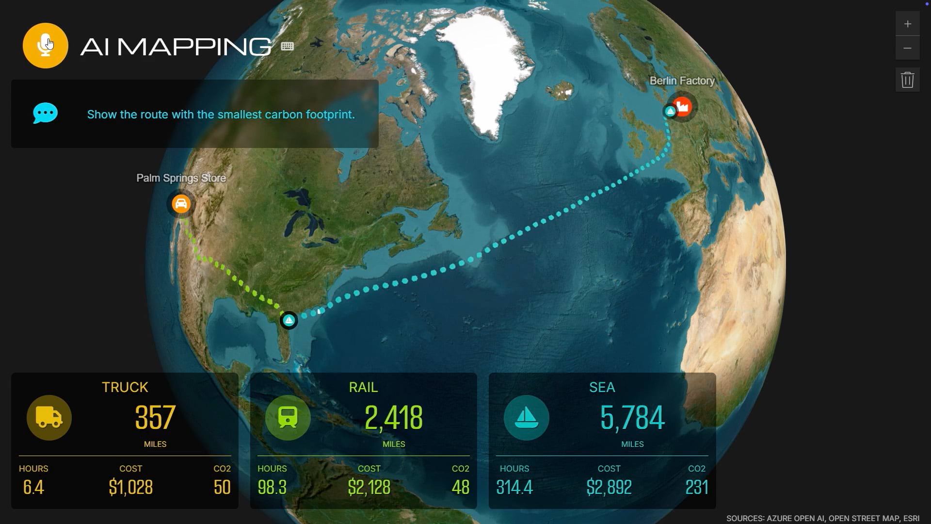
Geographic information system (GIS) technology has long helped organizations analyze data through the powerful lens of location, tackling complex business and social challenges. Now GIS enriched with AI–geospatial AI–delivers faster insights. Geospatial AI’s biggest impact is accessibility–it brings powerful spatial analysis to entire organizations, not just specialists.
Geospatial AI can rapidly process massive datasets like satellite imagery, shipping routes, and environmental records to detect patterns, make predictions, and automate tasks that previously required days or weeks. This creates transformative benefits across sectors: public officials make better informed policy decisions, business executives optimize operations strategically, and nonprofit leaders maximize impact.
Discover how AI is transforming geospatial analysis across industries.