February 20, 2024 |
David Gadsden | Conservation
All Articles
-
-
February 15, 2024 | Multiple Authors |
GIS for Good Mapping Guides Culturally Responsive STEM Education
-
February 13, 2024 |
Sunny Fleming |Resilience Massachusetts Bolsters Resilience with Accessible Climate Data and Tools
-
February 6, 2024 |
Greg Milner |Mapping Mapping the Future of Spatial Computing
-
January 30, 2024 | Multiple Authors |
Public Safety Alabama: Advancing Public Safety with High-Tech Maps and Shared Awareness
-
January 23, 2024 |
Anthony Schultz |Public Safety The New Wildfire Reality: Mapping a Response
-
January 16, 2024 |
Olivier Cottray |Public Safety Assessing the Needs of the World’s Most Food Insecure Countries
-
January 9, 2024 |
Norman Mucha |Urban Planning In Washington, DC, Planners Envision More Housing in Historic Districts
-
December 26, 2023 |
Matt Ball |Mapping Top 10 Stories from 2023
-
December 19, 2023 |
Anne Taylor |Mapping A Pacific Northwest Reminder of Tribal Connections
-
December 12, 2023 |
Greg Milner |Infrastructure What If the Urban Utopia Was Something We Could Actually Build?
-
December 5, 2023 | Multiple Authors |
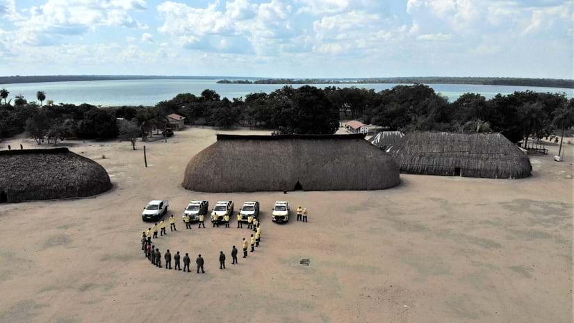
Public Safety Amazon: Tribes in Brazil Fight Wildfires with Indigenous Knowledge
-
November 28, 2023 | Multiple Authors |
Public Safety Urban Conflagrations Require New Levels of Information and Collaboration
-
November 7, 2023 |
Carl Walter |Public Safety Fusion Center Concept Evolves with Streamlined Data Sharing
-
November 1, 2023 |
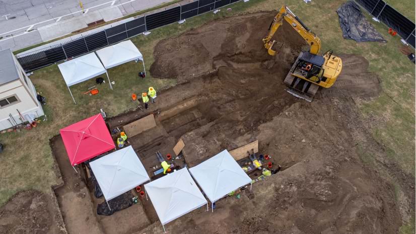
Karen Sullivan |GIS for Good The Quest to Find and Preserve Lost Black Cemeteries
-
October 24, 2023 |
Lain Graham |Mapping Putting the Maya Civilization Back on the Map
-
October 17, 2023 |
David Gadsden |Conservation Jaguar Conservation: Smart Maps Guide Ecosystem Revitalization in Argentina
-
October 11, 2023 | Multiple Authors |
Resilience More Green, Less Gray: LA County Maps Big Plans for Its Water Supply
-
October 3, 2023 |
Karen Sullivan Cities Save Lives by Mapping Communities Most at Risk from Extreme Heat
-
September 19, 2023 |
Sophia Garcia |GIS for Good LA County Documents and Addresses Racial Disparities Using GIS Technology
-
September 14, 2023 |
Cassandra Galindo |Mapping Maps Help Animal Welfare Advocates Keep Pets and People Together
-
September 12, 2023 |
Brooks Patrick |Urban Planning Inside One of Europe's Largest Urban Development Projects—aspern Seestadt
-
September 7, 2023 |
David Gadsden |Conservation Real-Time Ecological Monitoring Protects Endangered Rhinos in Kenya
-
September 5, 2023 |
Sunny Fleming |Conservation Wisconsin: Using Maps to Tackle 'Forever Chemicals'