displaying 195 results
UC San Diego mapped the sewer system to set up a building-by-building wastewater monitoring system that effectively curbed spread of COVID-19.
The wall-to-wall biodiversity and human footprint inventory are unique datasets found only at the Alberta Biodiversity Monitoring Institute.
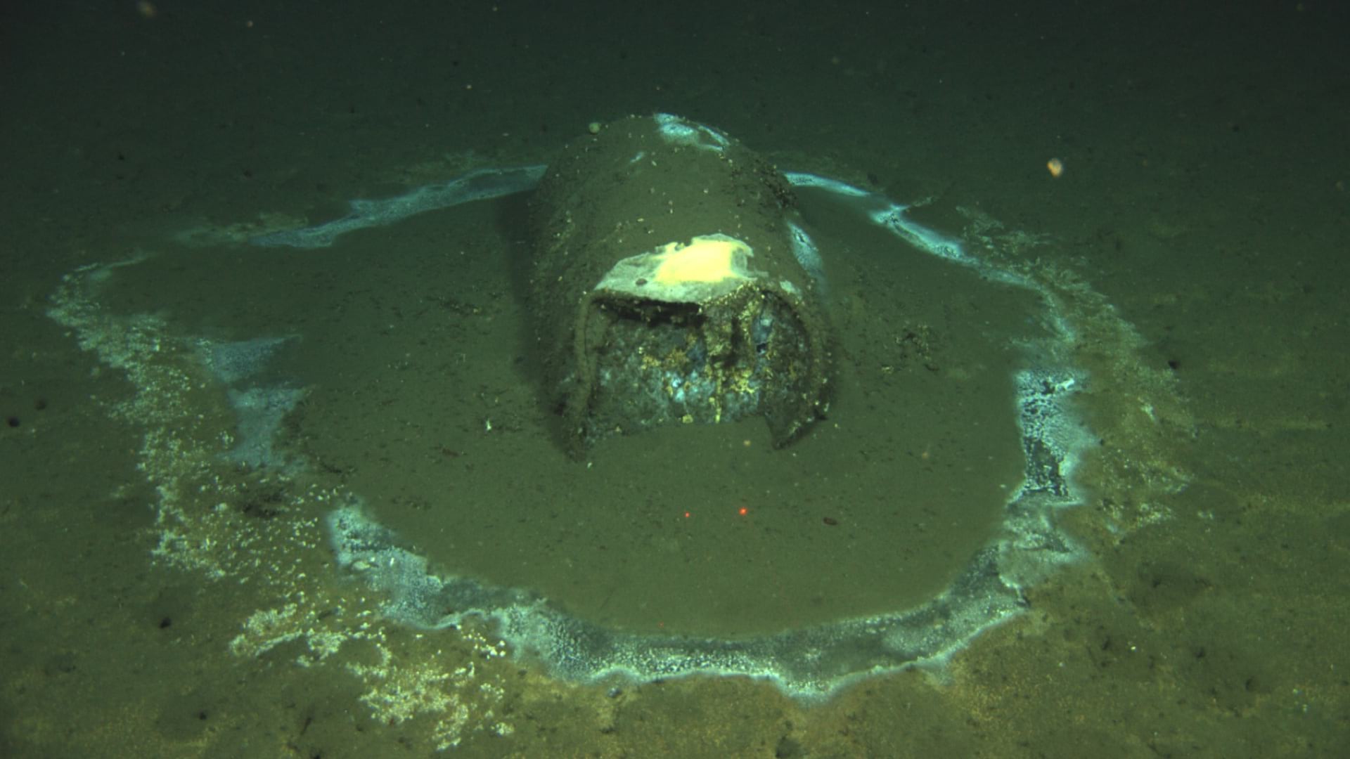
A map of dumped barrels off the coast of Southern California provides alarming evidence of ongoing environmental harm.

Visualizing the city in 3D helped planners address constraints and see possibilities.
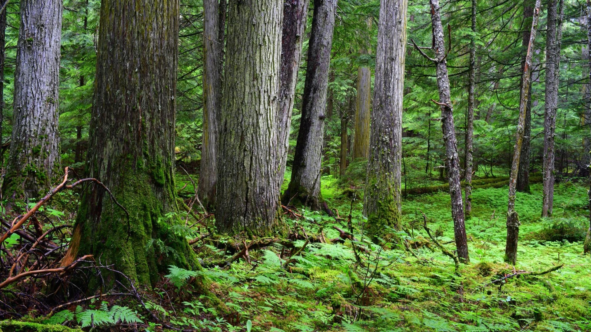
When Conservation North saw a report of old-growth forest in British Columbia, the group knew an online map was needed to activate conservation.

GIS provides the contextual awareness to analyze the complex problem of methane emissions from natural and human-made sources.
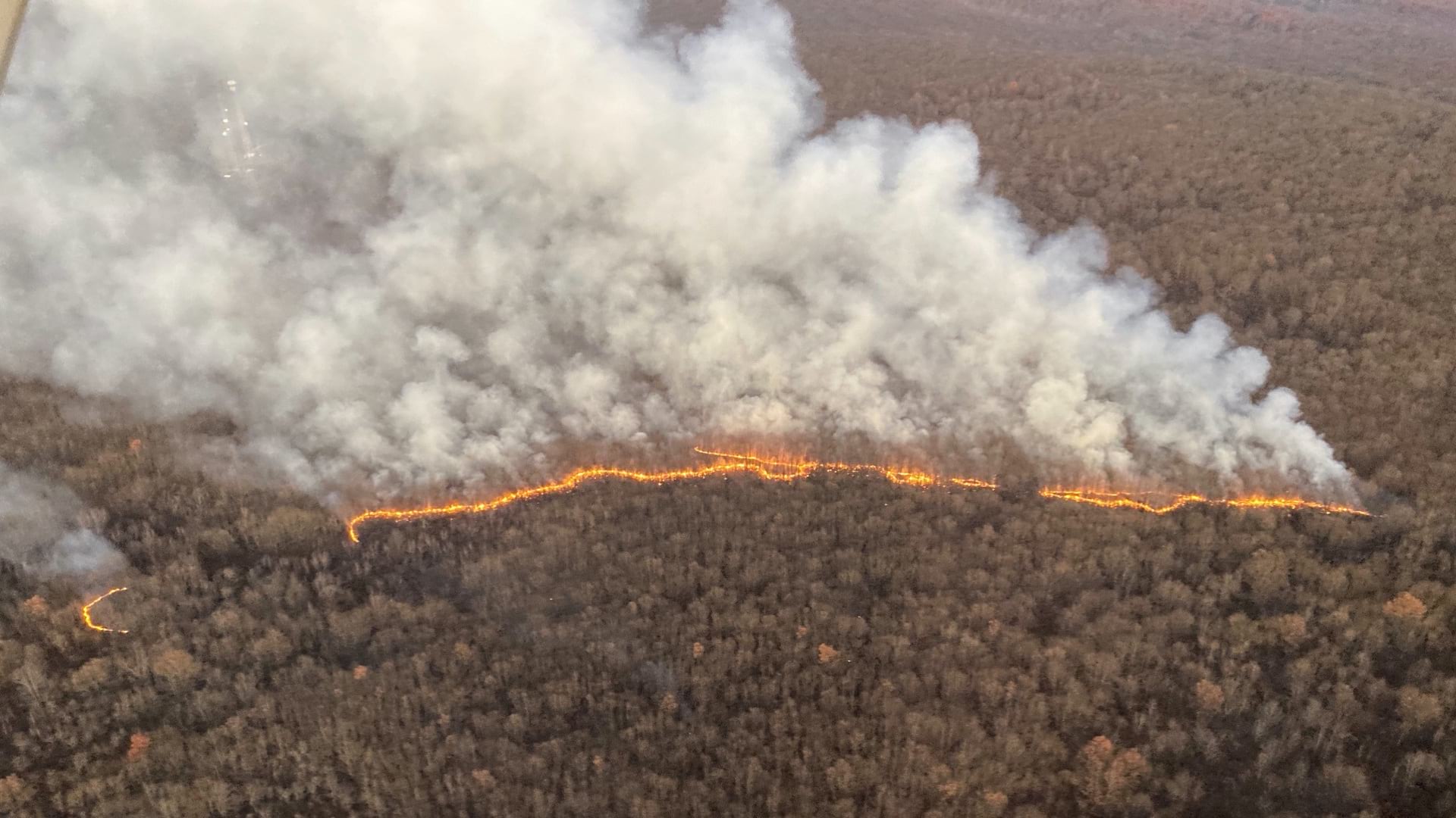
Pennsylvania firefighters deploy a live mapping tool to spot and stop wildfires before they spread.
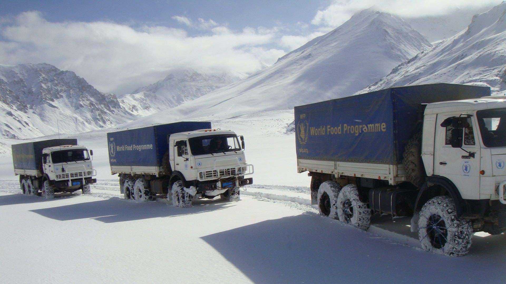
The World Food Programme uses maps, apps, and dashboards to gather and convey context and plan every mission in Afghanistan.

As the world prepares for the most complex global vaccination campaign in history, location intelligence provides essential capabilities.
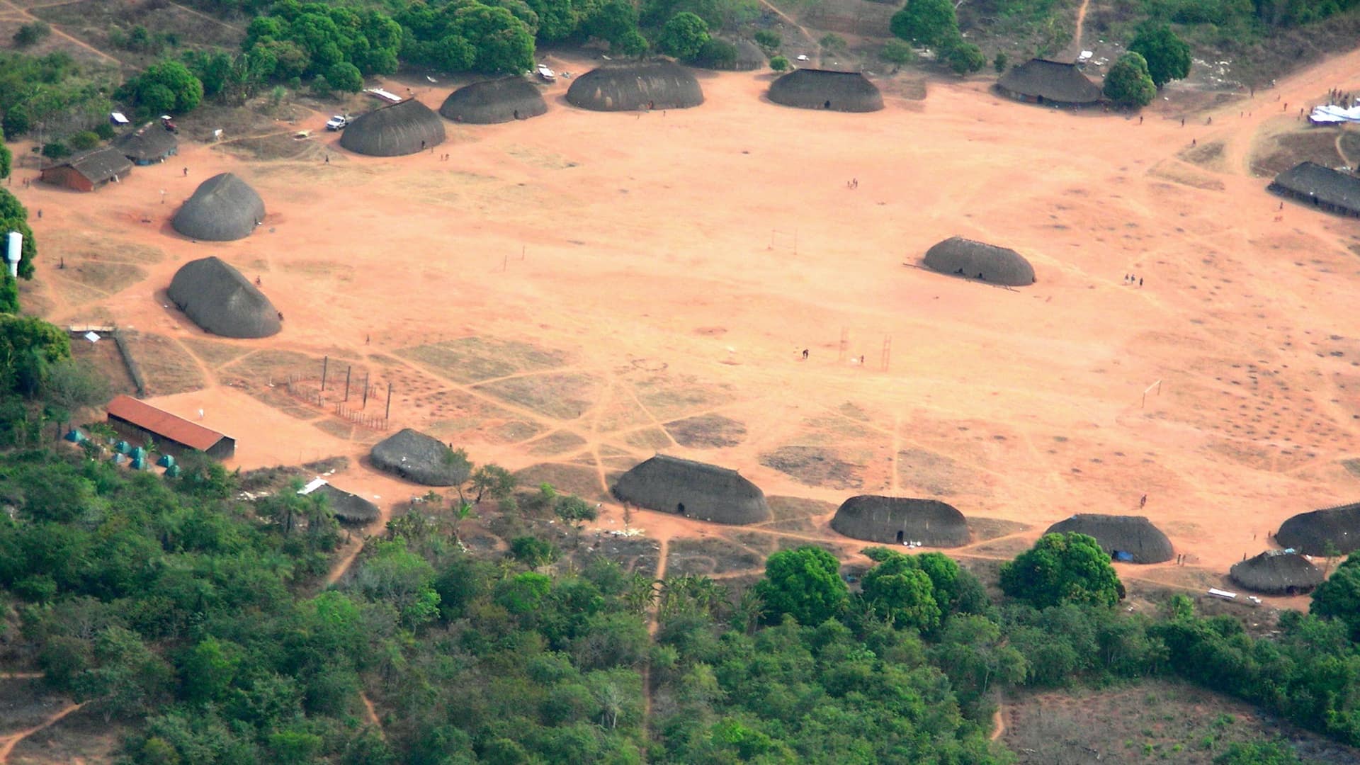
The Kuikuro tribe in Brazil’s Amazon rainforest turn from mapping their ancestors to using the same tools to protect themselves.

The Antiquities Coalition maps the illicit trade in antiquities to educate the public and the art market about the plunder of cultural heritage.
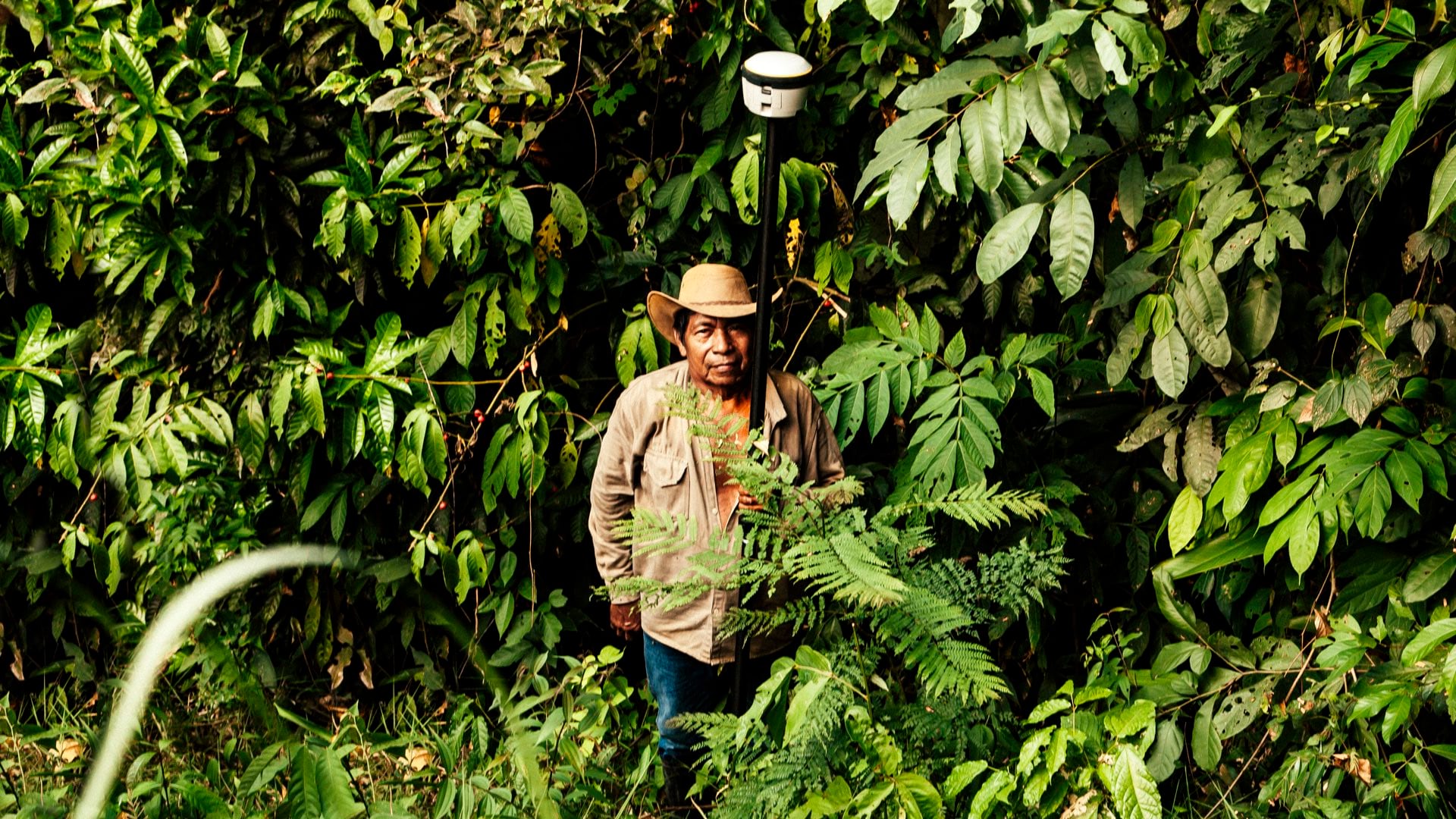
Colombians in rural post conflict areas gain stability from the recognition of ownership to their land for the first time.