displaying 295 results
Celebrate GIS Day this November by hosting or attending a program that showcases GIS technology.

GIS provides ways to mitigate climate change challenges that provide reasons for hope.
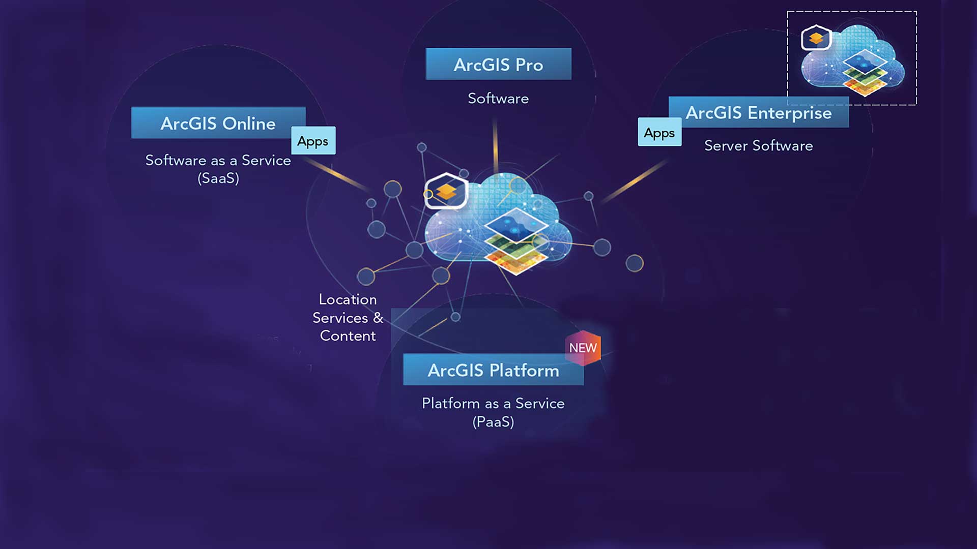
ArcGIS Platform provides developers access to ArcGIS location services and geospatial content through this location platform as a service.
he most inspiring part of today’s planning environment is that planners don’t also have to be GIS professionals.

GeoEnrichment Services can improve analyses and find the answers from your data.

Spatial Data Science: The New Frontier in Analytics, a new Esri MOOC, teaches how to use spatial data, tools, and methods.
GIS for Science: Applying Mapping and Spatial Analytics and GIS and the 2020 Census: Modernizing Official Statistics

Recreate the planning and presentation maps used by Graham Fire & Rescue to obtain a $3.5 million grant.

This tutorial shows workflow for analyzing and visualizing raster data on malaria rates.

Kevin Prouty from IDC explains how utilities use advanced analytics and the geospatial cloud to achieve sustainability.

An extension to ArcGIS Online, ArcGIS Image for ArcGIS Online makes imagery more accessible and more easily managed.