displaying 280 results
Make your maps do so much more with ArcGIS Arcade, a cross-platform expression language.

With GIS, international organizations can monitor and profile vulnerable populations to get them the help they need.

Recent releases of some of Esri’s most popular app builders help users deliver compelling digital experiences along with their maps.

Learn how ArcGIS Maps SDK for JavaScript can be used to visualize a dataset representing atmospheric temperature and pressure measurements.

Kim Morrison is helping the world’s largest gold miner improve operational performance and visibility with GIS dashboards, drones, and more.

Micrometeorologists at San Francisco State University used GIS to investigate and model the climate impacts of Burning Man.

In the free e-book, Extend the Reach of Your GIS, you will Learn to quickly configure your ArcGIS Online organization using best practices.
The latest release of ArcGIS is big. Get to know what’s new.

Want your Esri Story Map app to attract more viewers online, including members of the Esri Story Map team?
The December 2013 update to ArcGIS Online included new features and important enhancements for authoring web maps, configuring apps…
Southern California's Mediterranean climate and varied landscape of beaches, deserts, & mountains have made it one of the most desirable places…
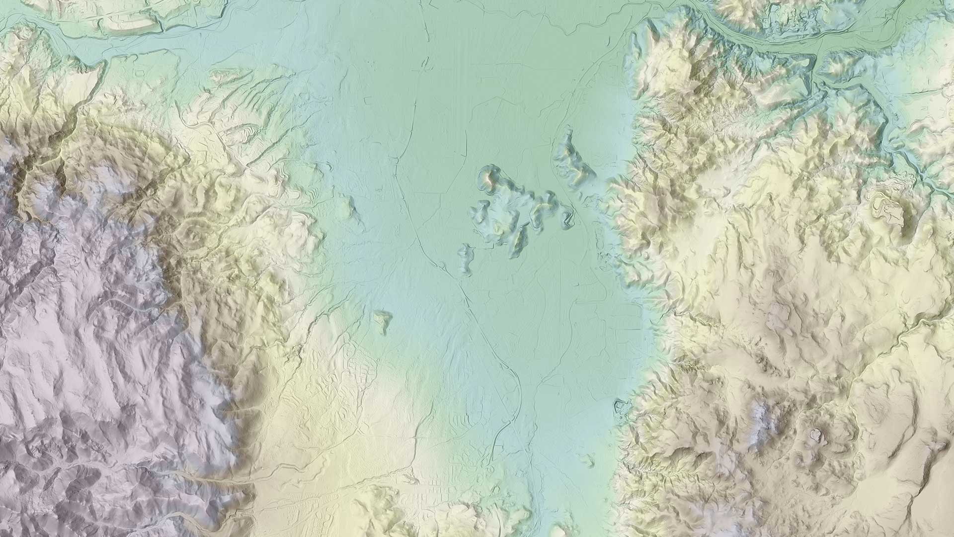
Washoe County, Nevada, generated many cartographic products from a terabyte of lidar data it processed.