displaying 557 results

Esri’s ArcGIS Indoors is suited to help businesses safely plan reopening, helping them efficiently visualize their real estate.
Beaufort County School District is located south of Charleston, SC, and serves all students within the county, an area that encompasses over 900…
GIS technology helps Lawrence Livermore National Laboratory—one of the nation's top research centers—adapt to a hybrid workforce and grow.
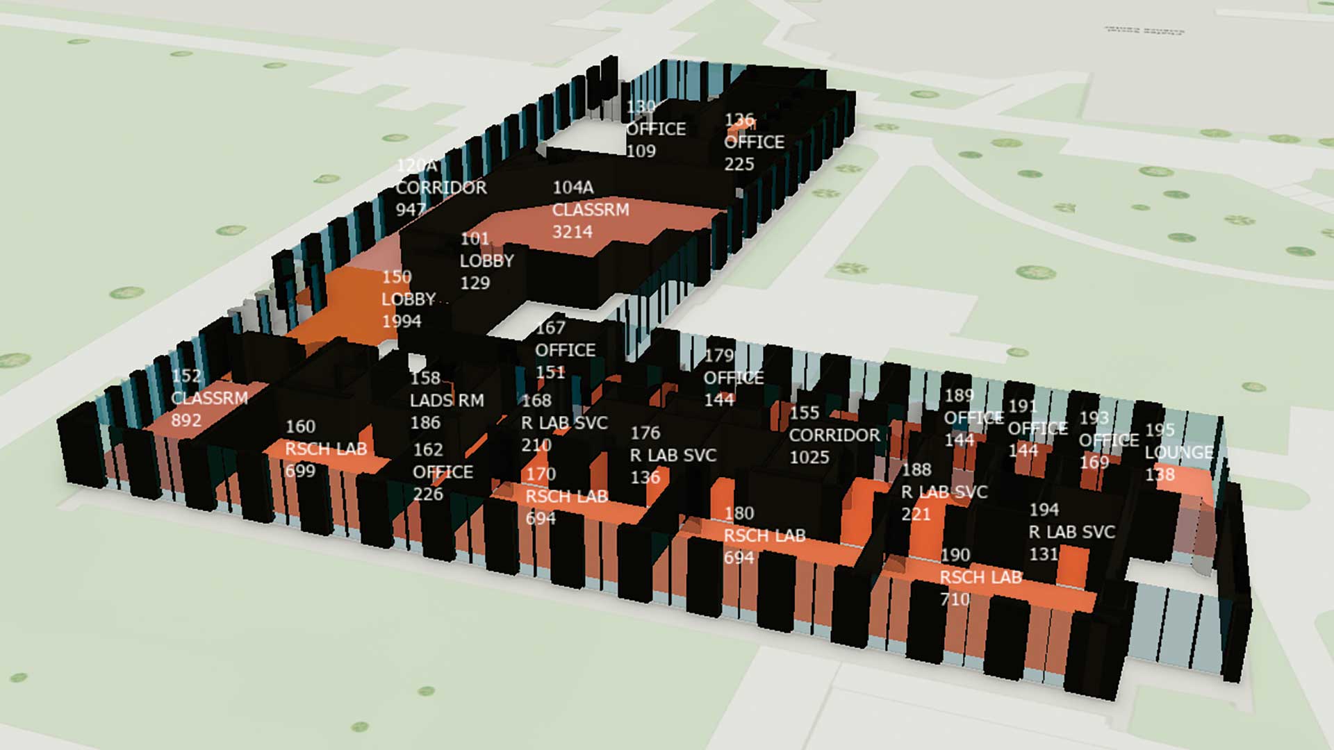
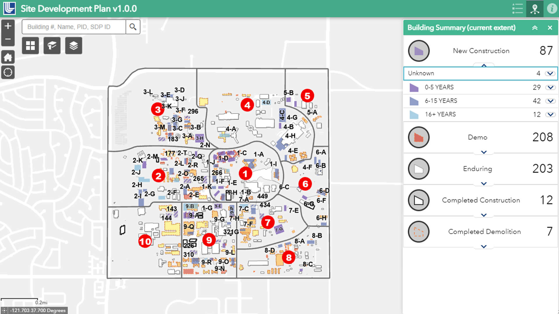
University of Rhode Island (URI) is moving to ArcGIS Indoors to manage its facilities.

The country now has a set of authoritative maps that officials can use to monitor objectives and set initiatives for the next 50 years.

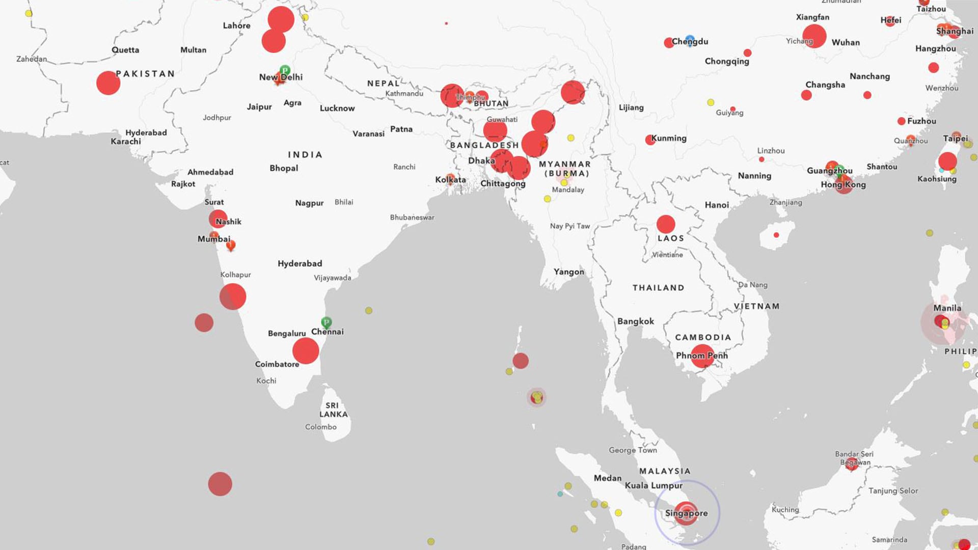
As the world prepares for the most complex global vaccination campaign in history, location intelligence provides essential capabilities.

UAE mapped its growth over 50 years and gained an authoritative map to monitor objectives and initiatives for its next 50 years.
GIS and facility mapping provide powerful insights into how we use, manage, and design our built environment.
By tracking how global supply chain disruptions impact finished goods, a real-time dashboard gives executives an edge in risk assessment.