displaying 594 results

A Colorado water and sanitation district implemented ArcGIS Data Reviewer—and will save a year of time.

Learn about the new Africa GeoPortal, how to access and use Sentinel-2 image services, and why Esri is considered a top midsize employer.
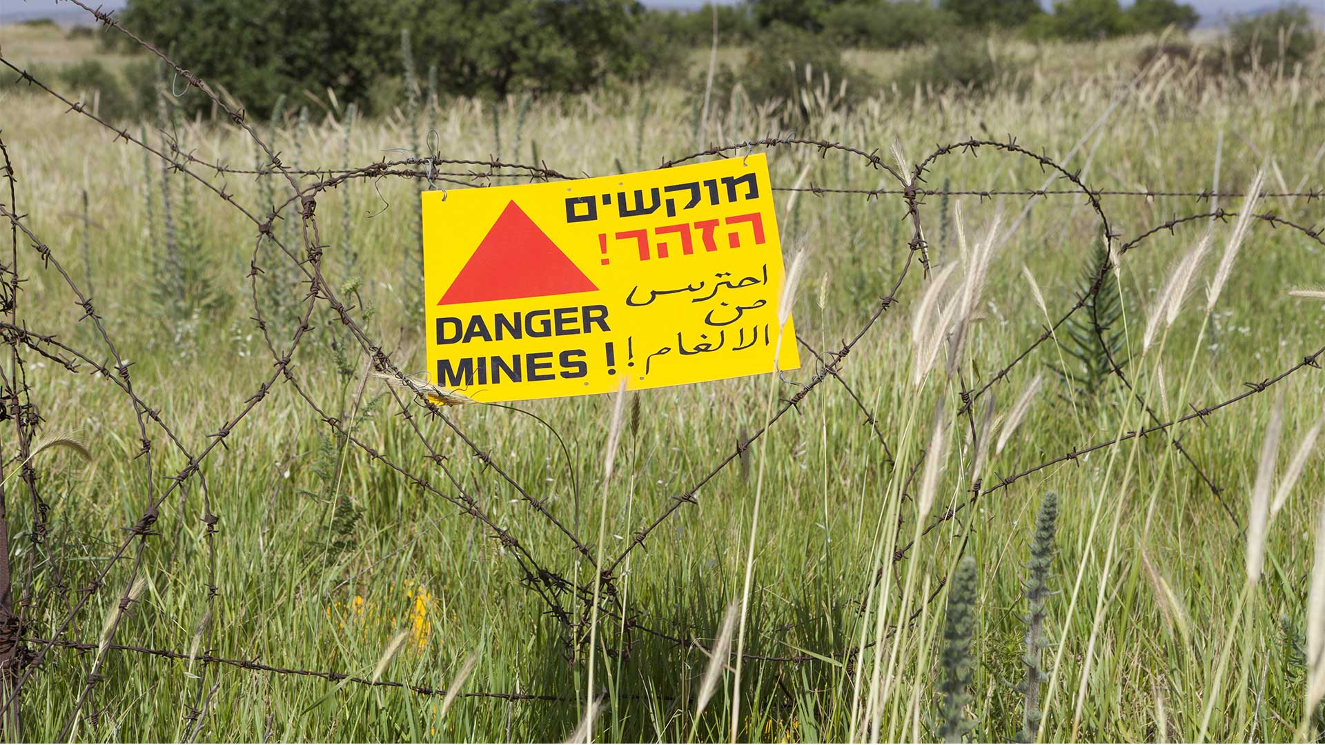
Web-based GIS helps demining organizations manage information and increase efficiencies.
Esri startup partner 2NDNATURE is employing ArcGIS to radically change how the City of Salinas, California, manages its stormwater systems.
Map complex geometries and data with ArcGIS Maps SDKs for Native Apps.

Discover how GIS is being used to create more resilient communities, systems, and infrastructure in this MOOC.
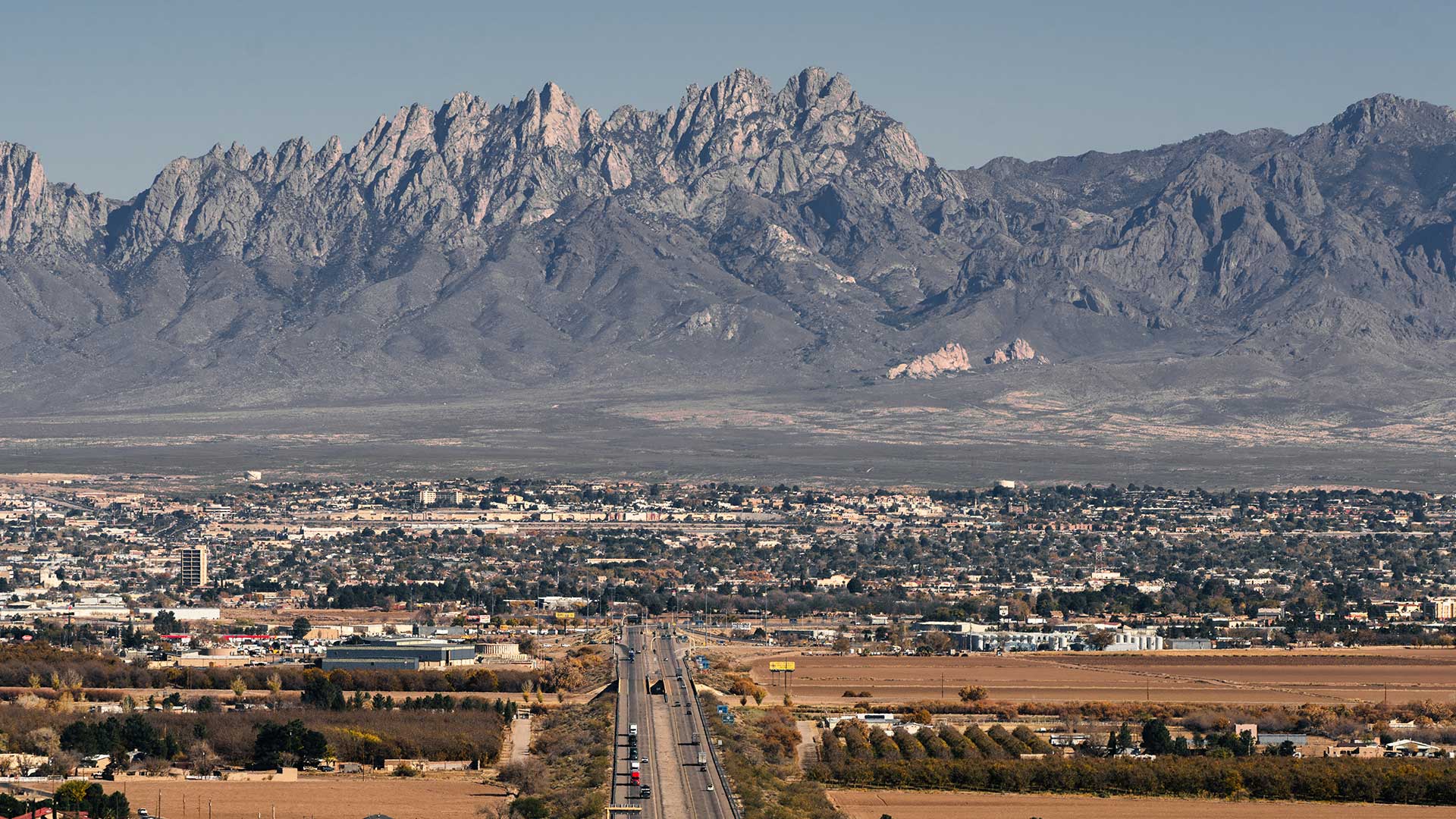
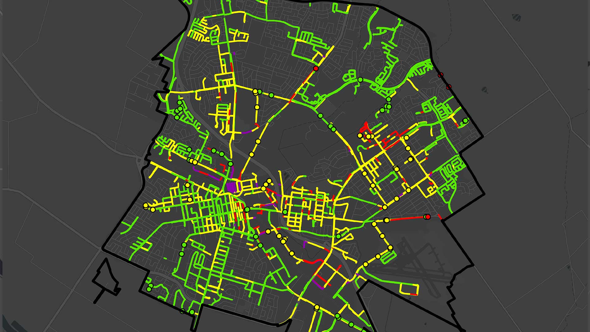
The City of Las Cruces, New Mexico, deployed a GIS adoption strategy that builds consensus for change and an enterprise mindset.

GIS provides ways to mitigate climate change challenges that provide reasons for hope.

The theme of the 2022 Esri User Conference (Esri UC), GIS—Mapping Common Ground, encapsulates the most pressing task of GIS professionals today.

After a pandemic-induced virtual hiatus, the Esri User Conference (Esri UC) was back as an in-person event July 11-15, 2022.
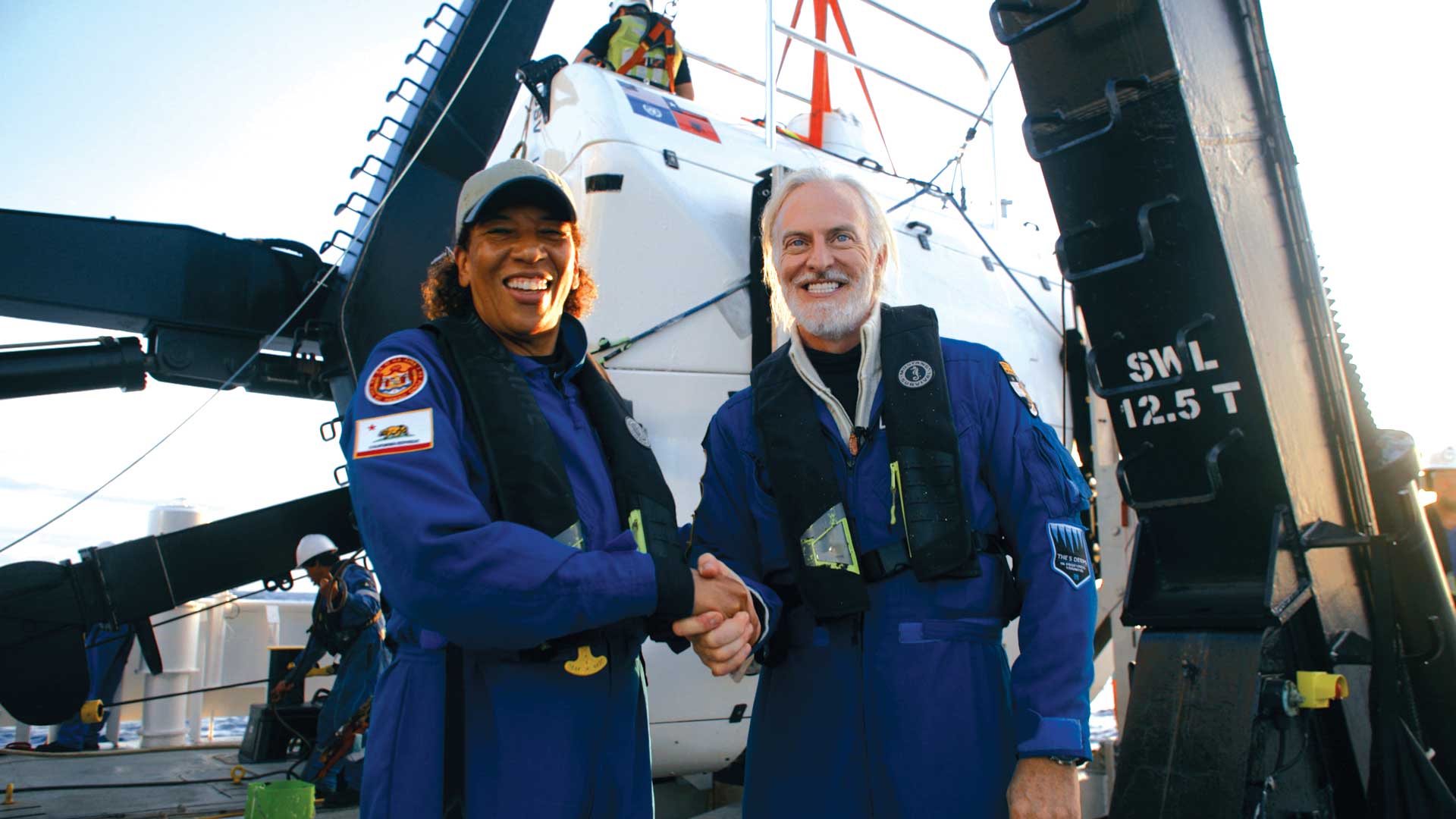
Explorer Victor Vescovo and Esri chief scientist Dawn Wright made an historic trip to to the deepest known point in the Earth’s ocean.
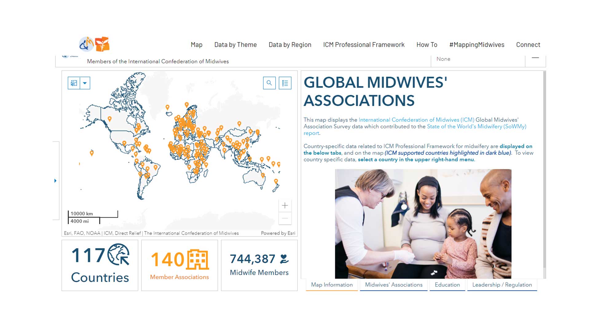
GISCorps volunteers aids Direct Relief to create a data sharing site for the International Confederation of Midwives.