The theme of the 2022 Esri User Conference (Esri UC), GIS—Mapping Common Ground, encapsulates the most pressing task of GIS professionals today: working together to meet the challenges of climate change and biodiversity loss. Doing this will require a far better understanding of the Earth and its processes than we currently possess. However, the real question is can enough be done—fast enough—to make a difference in the end?
Esri president Jack Dangermond has emphasized that effective action will require scaling up the geographic approach, which “is integrative in nature. It’s science based and holistic, and emphasizes collaboration.”
Rapid advances in IT, such as machine learning, cloud computing, and unstructured data analysis, benefit GIS technology as it becomes more tightly integrated with mainstream IT. These advances have been incorporated into GIS technology and were highlighted at Esri UC.
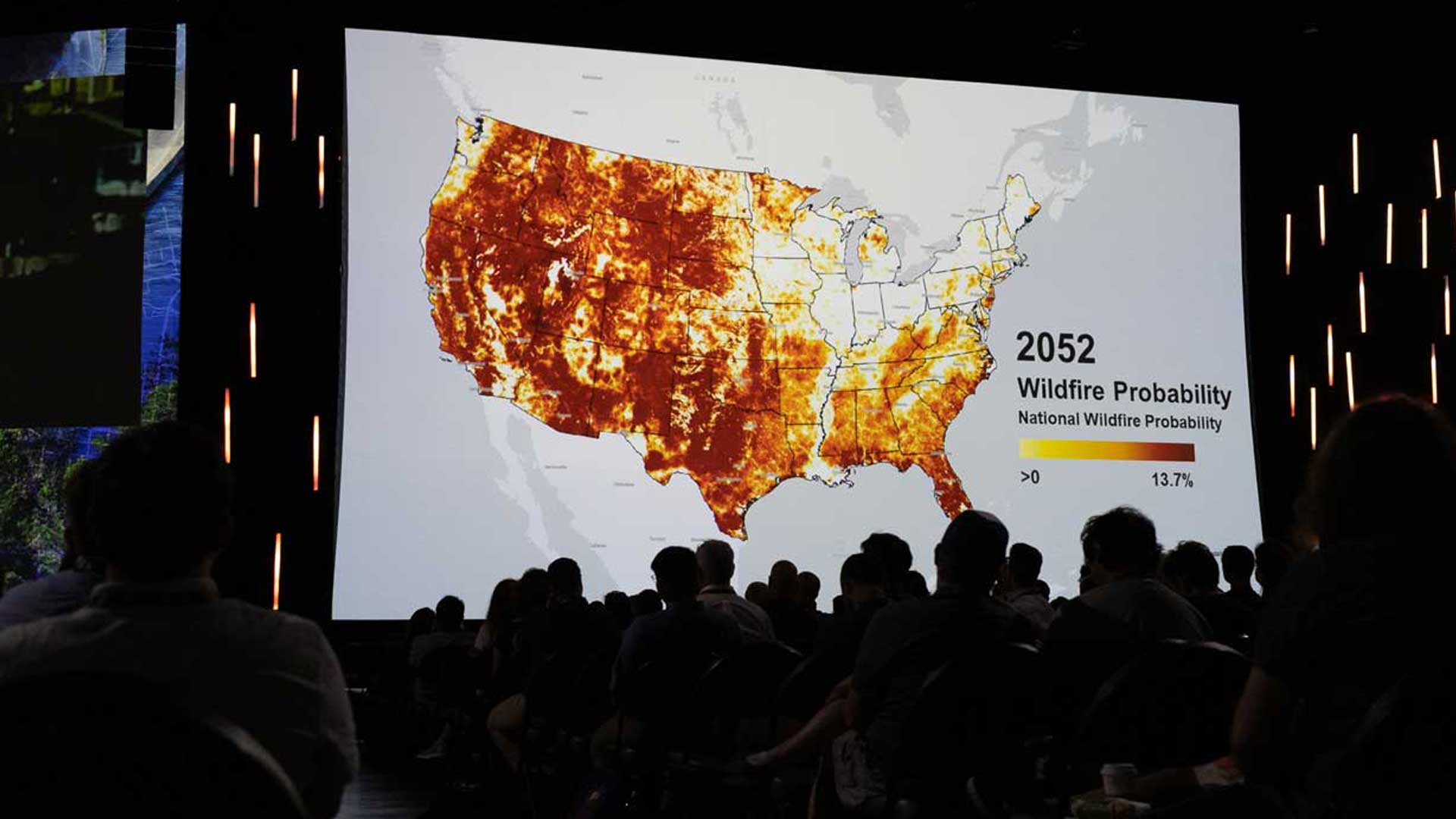
With more powerful tools, GIS is helping to close the gap in our knowledge of the Earth. With the help of machine learning, an abundance of information is being extracted rapidly from imagery captured via satellite, lidar, and aerial photography.
Mobile GIS apps, such as ArcGIS Field Maps and ArcGIS Survey123, improve data collection by increasing accuracy and sharply decreasing the interval between data collection and availability.
Sites built with ArcGIS Hub centralize the maintenance of data and the creation of information products such as web maps and apps, which enhance collaboration within and between organizations. The adoption of data standards makes data more discoverable and useful. Creating a geospatial community of practice (CoP) within an organization strengthens its processes, increases collaboration, and supports the use of GIS in that organization.
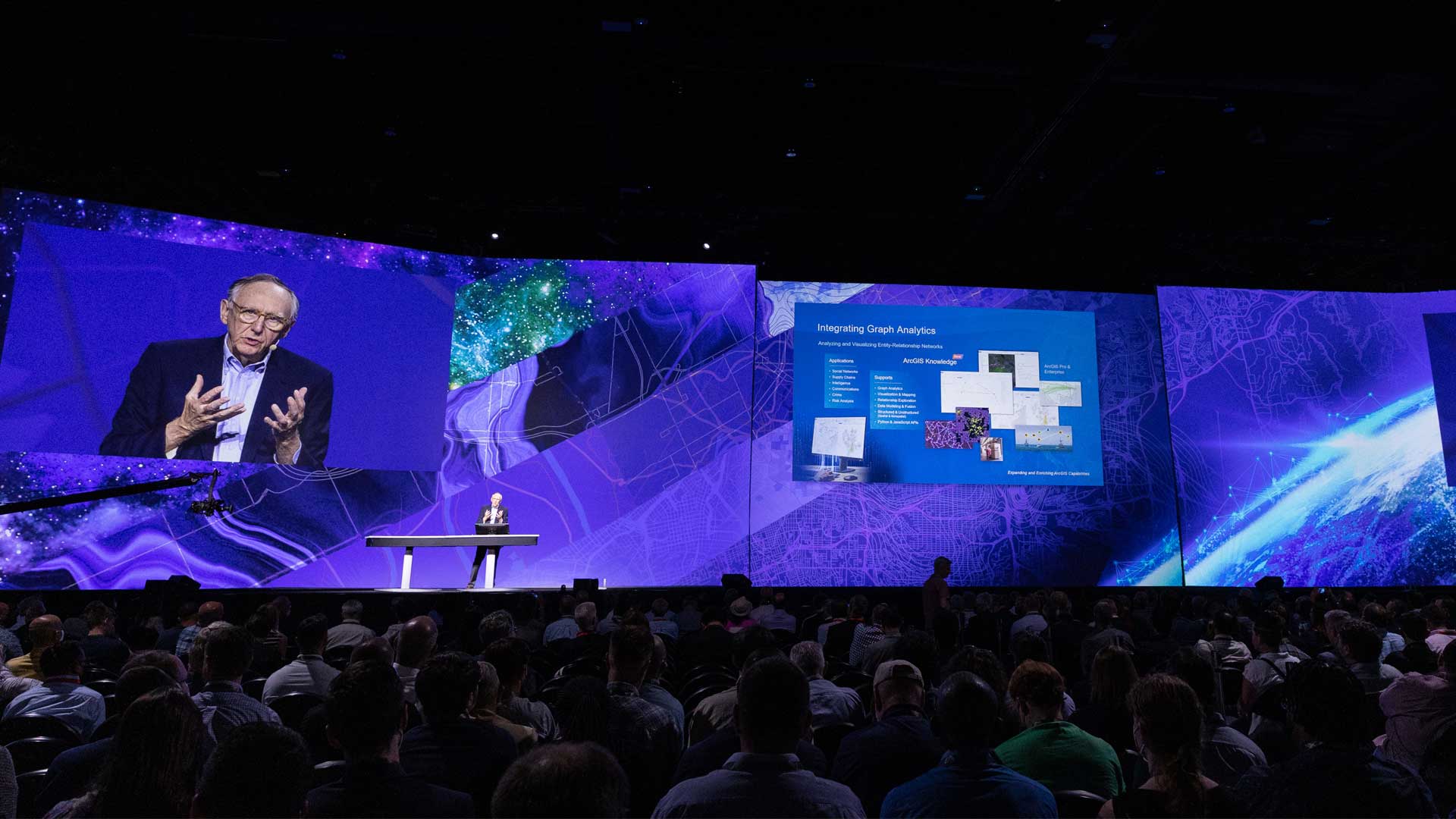
The augmented analysis tools available in ArcGIS GeoAnalytics Engine and ArcGIS Knowledge, both announced at Esri UC, provide new ways to ramp up the conversion of data into knowledge. ArcGIS GeoAnalytics Engine, an independent product, is a Spark-native library that allows organizations to deploy spatial analysis tools alongside data in the cloud. With ArcGIS Knowledge, users can explore and analyze spatial, nonspatial, unstructured, and structured data to perform analyses more quickly and comprehensively.
However, these and other expanding capabilities of ArcGIS won’t be sufficient, according to Dangermond. “But just the technology aspects or even the data aspects won’t be enough,” said Dangermond. “It’s about you and how we can together create effective solutions, learn how to collaborate across some of the dividing lines that separate us and—above all—act with urgency to create a more sustainable future.”
About the author