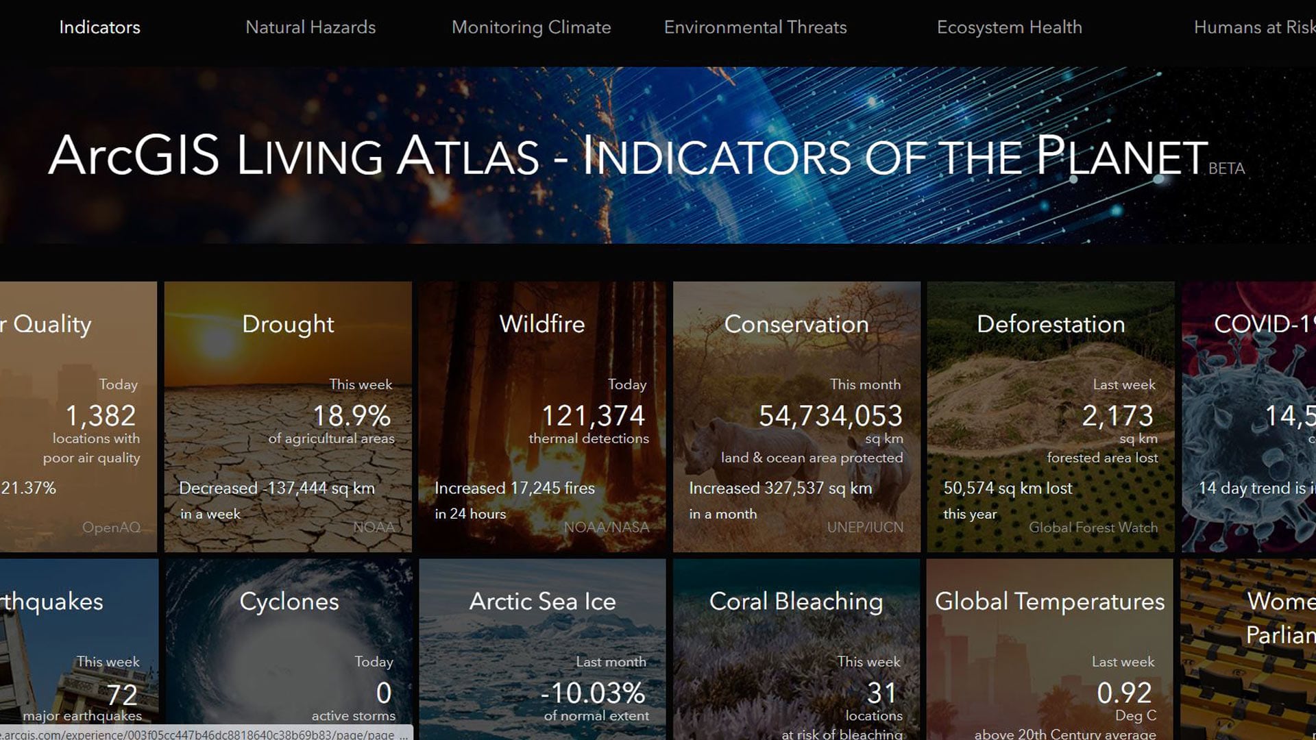
displaying 998 results

Geospatial professionals need to more carefully consider the impacts of their work on the everyday spatialization of public space.

New books from Esri Press cover ArcGIS Pro, ArcGIS Desktop, crime analysis, and more. And three new children’s books teach kids about GIS!

Kuwait has been on the cutting edge of geospatial technology for decades, and now it is blazing trails in machine learning.

Advanced technology from Esri startup partner VODA.ai reduces nonrevenue water loss by finding pipe weaknesses before they fail.
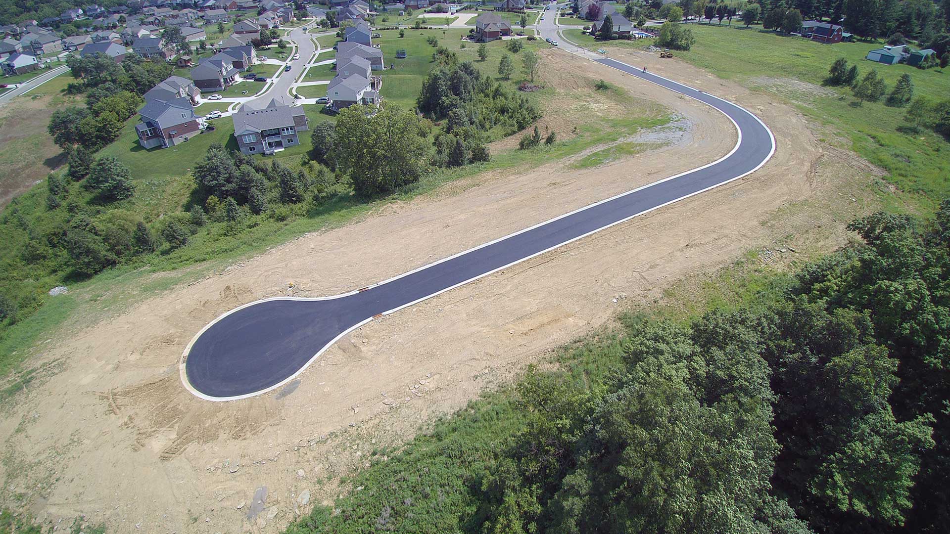
A drone and ArcGIS Drone2Map is changing how a planning agency in Kentucky collects and processes data for planning studies and inspections.
The National Geographic Society and Esri are teaming up to create new digital experiences that leverage geography and GIS.

Esri honored several organizations with awards at the Esri User Conference this year, including the creators of a popular COVID-19 dashboard.

Mission Blue, founded by oceanographer Sylvia Earle, uses ArcGIS StoryMaps to showcase Hope Spots, marine areas in need of protection.

At the 2020 Esri Partner Conference, Esri recognized 19 partners for their important and innovative contributions to GIS.

The Burnaby Public Library uses ArcGIS Navigator to efficiently deliver books to patrons who are unable to make visits themselves.

The Topeka Public Works Department uses ArcGIS Insights to organize and present budget information in an easy-to-understand way.

Terese Flores shone brightly as a GIS hero during the COVID-19 crisis in New York City—as she does every day as a manager at NYC Parks.