displaying 603 results
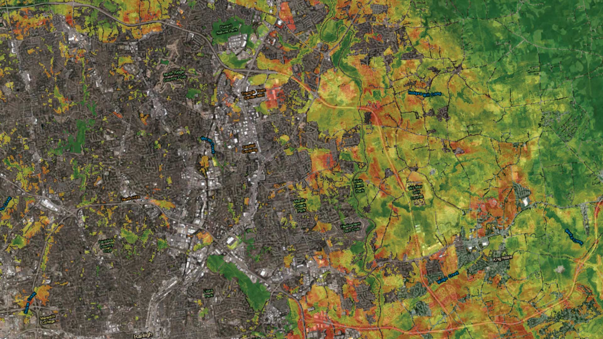
An urban growth prediction model empowers city planners and other to make informed urban policy decisions.
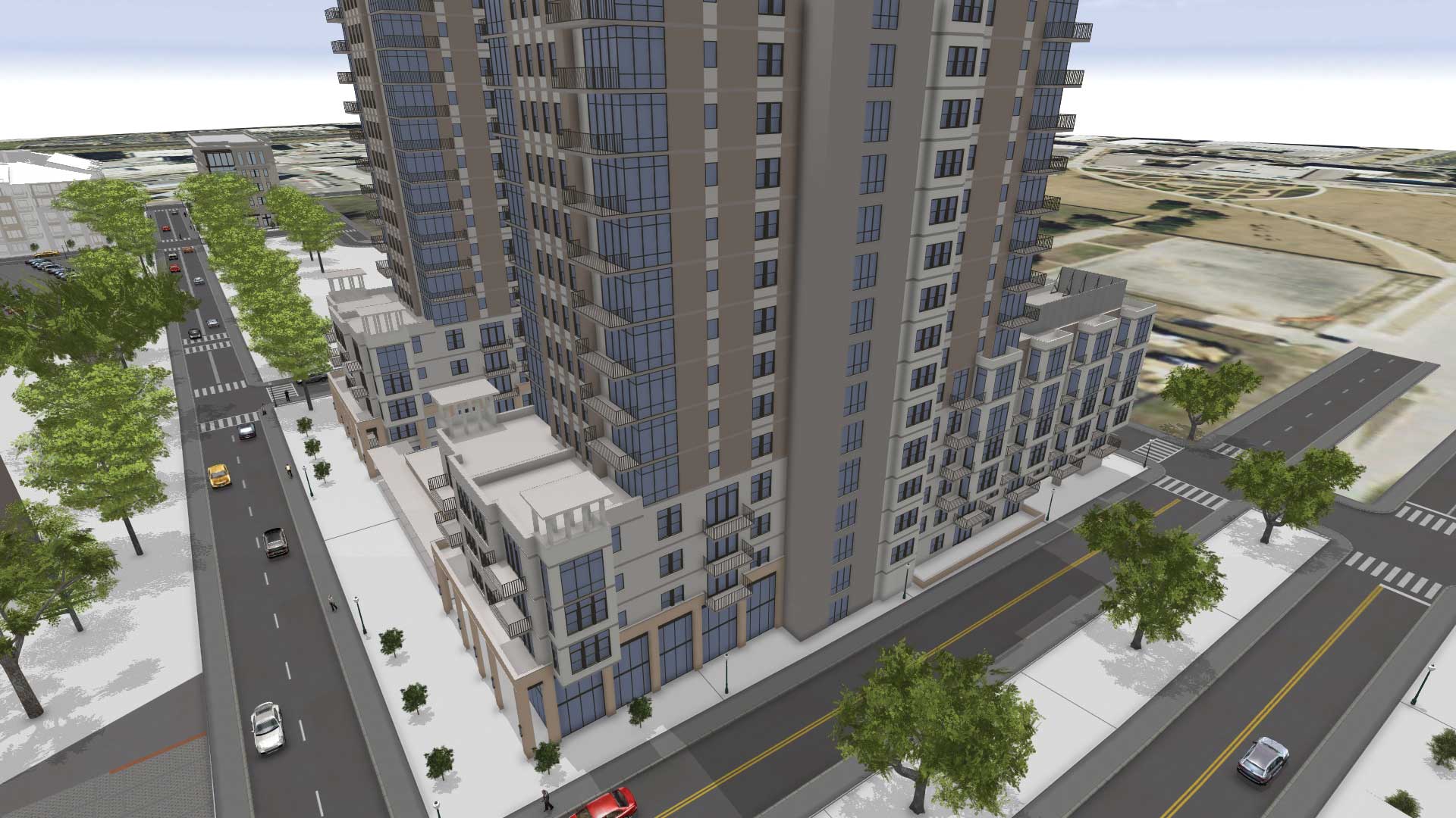
A civil engineering firm used ArcGIS to create a virtual reality tour to preview a proposed construction project.

Devon Humphrey of Waypoint Mapping discusses the use of UAVs for GIS data capture.
The Internet has provided a connected, digital environment that allows much of the world’s population to enjoy the benefits of exchanging a wide
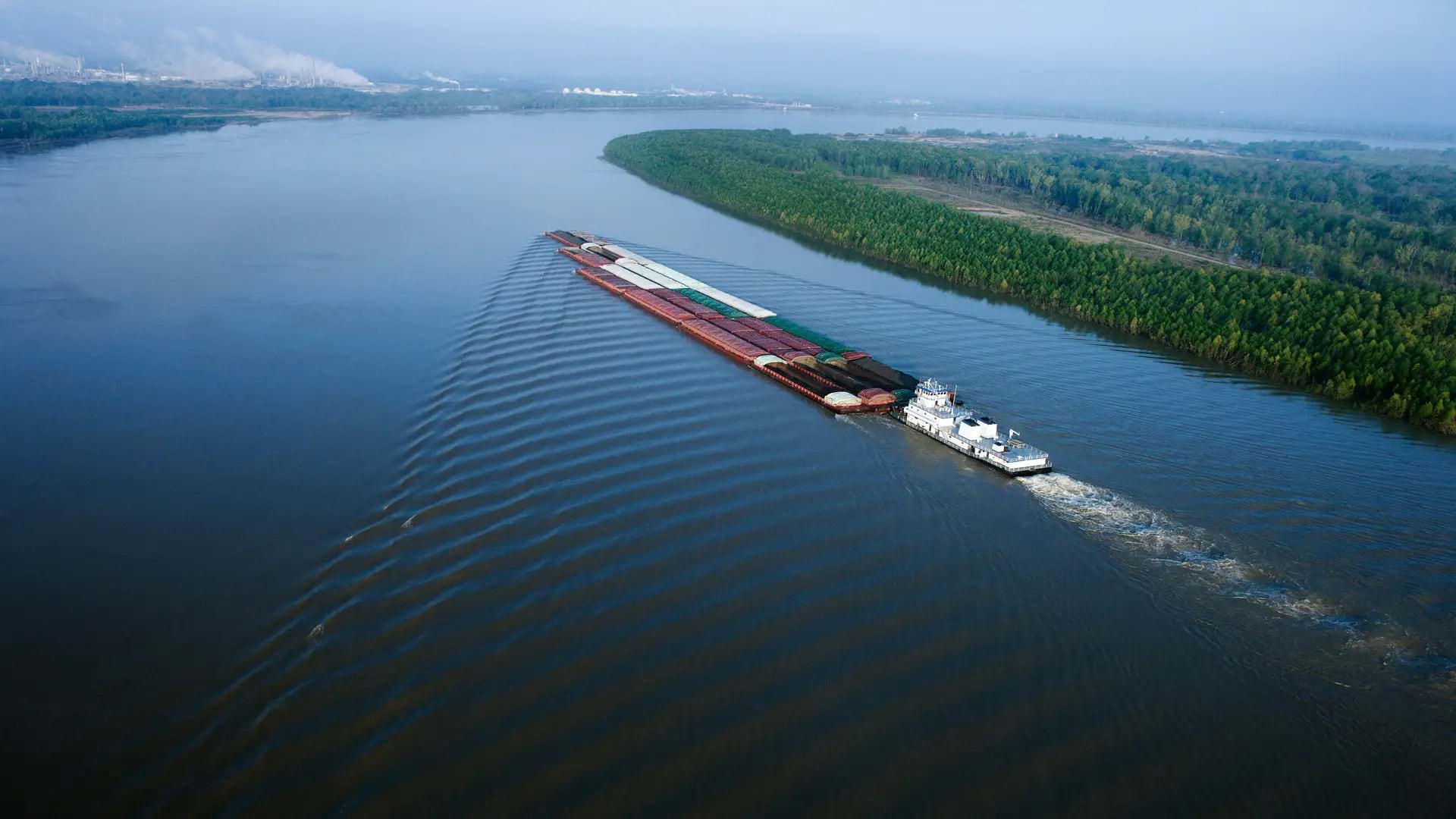
Ned Mitchell from the US Army Engineer Research and Development Center discusses supply chain sustainability on America’s second longest river.
If you work in retail development or commercial real estate, you are constantly on the go, looking for new locations to expand your business...

Electronic navigation charts (ENCs) created using ArcGIS guide a growing number of commercial vessels up and down the Changjiang River in China.
The Shopping Center Group, a commercial real estate company with offices in 12 states, offers a wide variety of advisory services to retail tenan

Chief sustainability officers might want to borrow a planning technique from the city of Koprivnica, Croatia.

As buzzwords go, big data and the Internet of Things are high decibel. It's time for a reality check on what's real and what's hype.