displaying 873 results
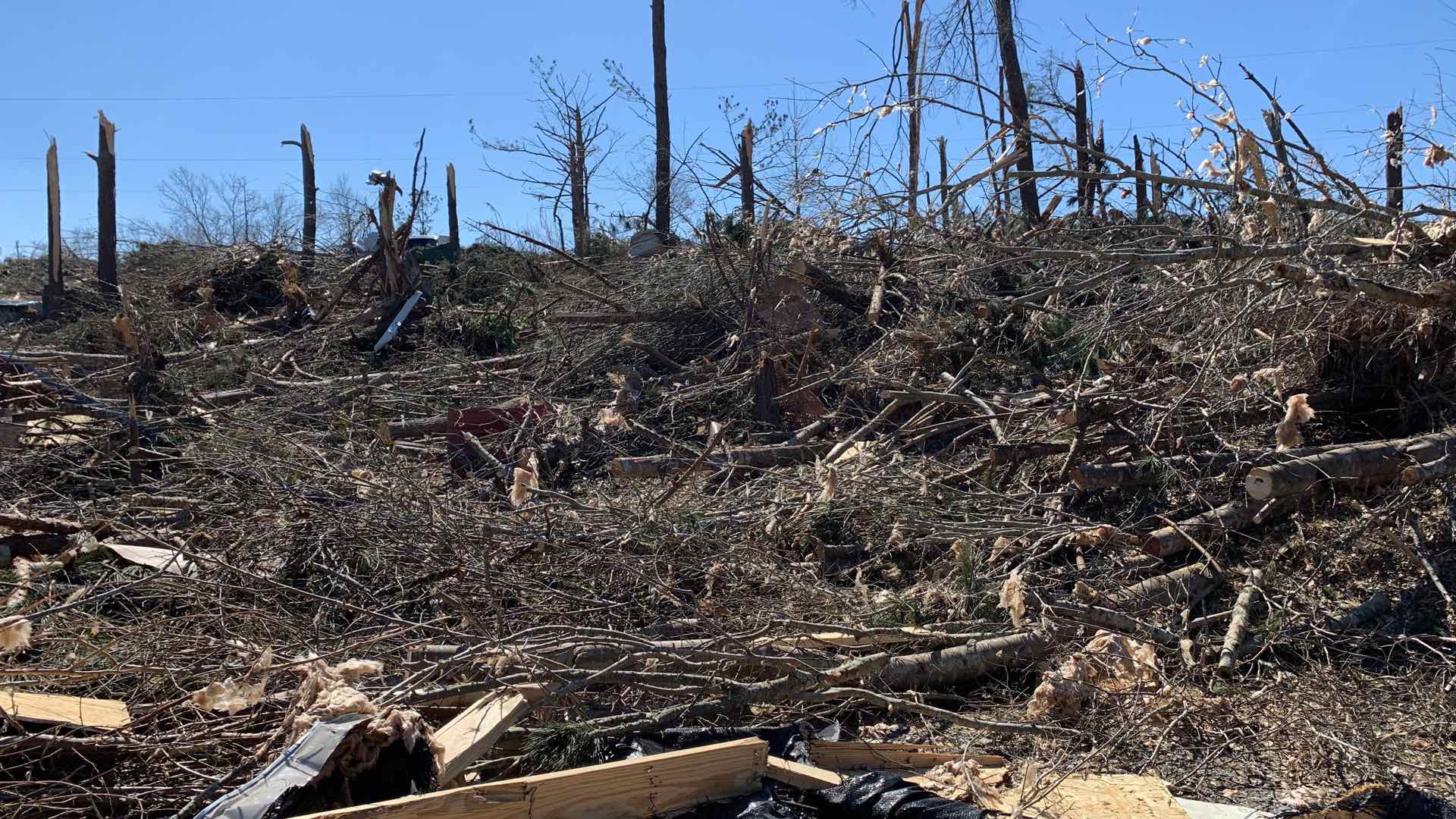
Lee County, Alabama used GIS to gather the needs of individuals and deliver what was needed following a deadly tornado disaster.

A real time understanding of weather helped the Pasadena Fire Department manage public safety at the 2019 Rose Parade.
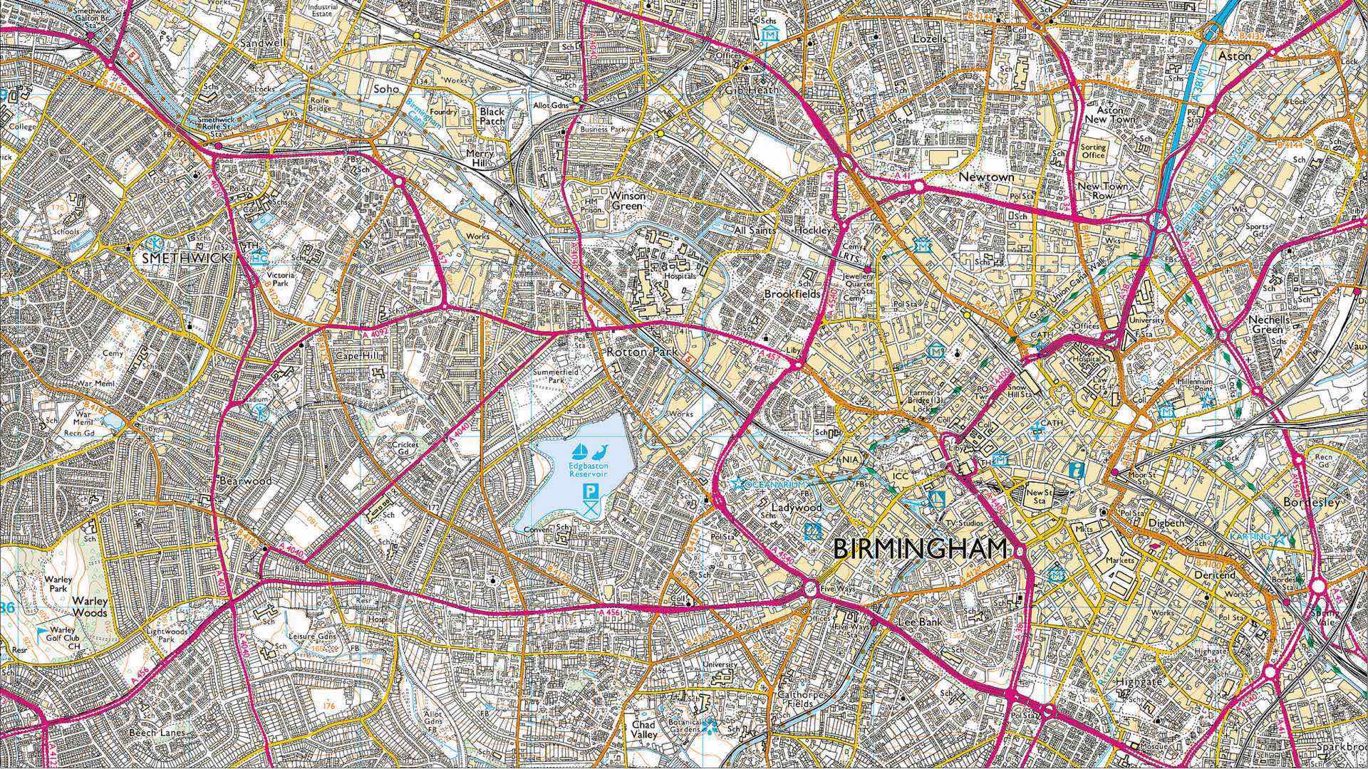
Ordnance Survey continues its role as the world's leading mapping agency by embracing innovation through automation.

Kuwait is heavily investing in GIS implementation with an emphasis on building national GIS expertise.

San Antonio deployed real-time location intelligence to combat fears and enhance public safety during the NCAA Final Four events.

Boston’s digital twin, a 3D GIS model of the city, helps city planners, developers, and citizens to evaluate proposed development.

The power of GIS rises from the unique way it connects seemingly unrelated information through location.
Explore how ArcGIS technology empowers companies to grasp and navigate the impacts of rural broadband deployment.
Wastewater is often a reflection of a community’s health. Explore how different communities use GIS to monitor their wastewater effectively.
Learn about geospatial solutions for the electric, gas and telecommunications industries at the Esri GeoConX Conference in October 2019.