displaying
Use # to search tags and @ for authors

By Jian Lange | ArcGIS Pro |
Learn about the best practices of using the Reclassify tool in ArcGIS Pro Spatial Analyst extension, especially when migrating from ArcMap.

By Multiple Authors | ArcGIS Pro |
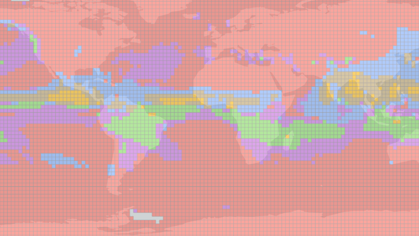
ArcGIS Pro 2.5 comes with even more capabilities for working with multidimensional rasters for time series and dimensional analysis.
By Lynne Buie | ArcGIS Pro |
Learn how to use the Space Time Pattern Mining toolbox with raster data.

By Emily Windahl | ArcGIS Pro |
OptimizeRasters 2.0 is a downloadable tool to convert rasters to optimized file formats, move data to cloud storage, and create raster proxies.
By Multiple Authors | ArcGIS Enterprise |
A new Learn ArcGIS lesson allows you to configure and use distributed raster processing in ArcGIS Enterprise to analyze landslide risk.

By Jeff Liedtke | ArcGIS Enterprise |
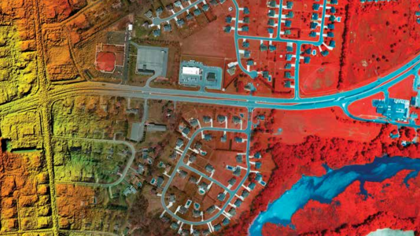
Imagery can add valuable information and context to a wide array of GIS projects. For example, you can detect impervious surfaces for sto...
By Aileen Buckley | ArcGIS Pro |
By Aileen Buckley, PhD, Esri Research Cartographer In 2008, I wrote a blog post about how to make and symbolize an aspect-slope map. Thi...

By Daniel Siegel | ArcGIS Online |
Processing templates are a powerful tool for expanding the capabilities of image services. By chaining together a series of raster functi...
By kevin_butler | ArcGIS Enterprise |
Storing large volumes of data in the cloud Storing large volumes of imagery in the cloud and transmitting the data to client application...

By Jeff Liedtke | ArcMap |
Users of elevation data or other continuous data such as temperature or air pressure, take note!