
The upcoming Esri Developer & Technology Summit is taking place from March 10–13, 2026, in Palm Springs, California. This conference is dedicated to everyone specialized on building, customizing, and automating spatial solutions. The agenda is packed with exciting keynotes from Esri users that will inspire you to build your own ArcGIS apps and solutions. Learn about the latest ArcGIS advancements from the people behind the technology you’re using every day, get hands-on experience, and answers to all your questions. Connect with peers during social events and networking opportunities, and more.
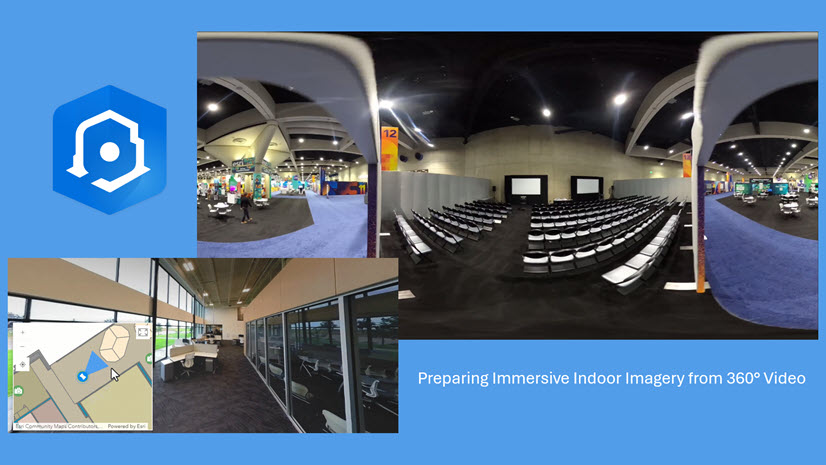
Indoor GIS is a unified floor-aware ArcGIS system for visualizing, analyzing, and managing indoor spaces and facilities. It enables organizations to make their operations and maintenance activities more efficient and ensures better experience for building occupants and visitors. Indoor GIS is powered by indoor maps created with ArcGIS Indoors with the ability to overlay indoor positioning through ArcGIS IPS.
Indoor GIS can be used to better plan the way you use space, more easily locate specific points of interest and find your way there. In addition to space management, you can also optimize your indoor asset management, help facilities’ mobile workers complete work orders efficiently, and enhance safety and security through increased location awareness and analysis.
If your interest lies in enhancing indoor spaces with GIS, there are activities you can attend to deepen your knowledge. Check out the details below or visit the event webpage.
Visit us in the Tech Zone
Enhance operational efficiency and smarter decision-making within facilities. Experts from the indoor GIS team are available in the showcase to help answer any questions you might have or to show you the latest advancements in the technology. You can learn how indoor mapping and indoor positioning support the use cases mentioned above, how you can enhance insights and engagement with(in) your facilities, as well as how to build custom applications leveraging indoor GIS technology.
Explore the Event Map
The Esri Tech Zone is located in Oasis 1-2, where you can find the indoor GIS team in the highlighted area below. Check out the interactive indoor event map powered by ArcGIS Indoors to navigate there, find session locations, and other points of interest.

Esri Tech Zone schedule
| Date | Time | Location |
| Tuesday, March 10 | 1:00 PM–6:30 PM | Oasis 1–2 |
| Wednesday, March 11 | 10:30 AM–6:30 PM | Oasis 1–2 |
| Thursday, March 12 | 10:00 AM–3:30 PM | Oasis 1–2 |
Attend our Sessions
Here are our Indoor GIS sessions that you won’t want to miss:
Indoor GIS: Developer Options for Building Indoor Mapping Apps
Technical Session | Intermediate | Thursday, Mar 12 | 10:30 AM – 11:30 AM PDT | Primrose C | PSCC
In this technical session, speakers demonstrate building indoor mapping apps by covering the floor-aware ArcGIS Maps SDK for JavaScript and ArcGIS Maps SDKs for Native Apps, as well as how to use ArcGIS Experience Builder to build an indoor mapping experience.
With web components being the new standards-based replacement for widgets, we encourage web developers currently using the FloorFilter widget to attend this session to explore how to implement the new FloorFilter web component. Native mobile app developers will learn more about the ready-made FloorFilter toolkit UI component for iOS and Android. If you prefer low-code or no-code, this session has got you covered as well, demonstrating how to use a configurable floor filter in Experience Builder.
Indoor GIS: Building Indoor Mapping Web Applications
Demo Theater Presentation | Intermediate | Thursday, Mar 12 | 1:00 PM – 1:30 PM PDT | Demo Theater 3: Mesquite DE | PSCC
In this demo theater presentation, learn how to use the ArcGIS Maps SDK for JavaScript to build indoor mapping web applications for floor-aware maps. Additionally, see how to build indoor mapping experiences with low or no code using ArcGIS Experience Builder.
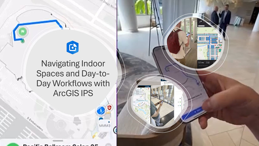
Indoor GIS: Developing Indoor Positioning in Native Mobile Applications
Technical Session | Intermediate| Friday, Mar 13 | 8:30 AM – 9:30 AM PDT |Primrose C | PSCC
Whether you’re building apps for airports, hospitals, campuses, factories, or corporate offices, users increasingly expect the blue dot experience indoors just like they are able to when outdoors.
Join this session to go beyond just theory and towards how to build a custom native iOS or Android app leveraging indoor positioning. We’ll show you how to bring ArcGIS IPS directly into your apps using ArcGIS Maps SDK for Kotlin and for Swift. This session connects all pieces from the technology background and data preparation workflows to ArcGIS Pro requirements and more. It is designed for developers who want to add an indoor blue dot experience to their indoor maps.
Don’t miss this opportunity to connect with industry leaders, expand knowledge of indoor GIS capabilities, and explore what’s possible with the latest advancements.
We look forward to meeting you at the summit. If you are unable attend, feel free to check out our resources for indoor GIS, ArcGIS Indoors and ArcGIS IPS.

Commenting is not enabled for this article.