It’s that time of year when geographers don our Stormy Kromer wool hats, pull the zipper a bit higher on our discounted Patagonia fleece vest, and venture out into the world of holiday social gatherings where we will, after sharing our profession in conversation, bear the patient burden of being asked, “hasn’t everything already been mapped?” or “so you mean like Google Earth?” It’s ok. We’re used to that and have a bevvy of responses all cued up, like “well occasionally there’s a volcano and we all rush to our desks to update the world’s maps” or “yeah…a bit like that…but with less Google and more Earth.”
So in the spirit of the season, here is a Christmas ornament for you and your fellow map-minded minions to whip into being. Yes, this is a great time of year, but it’s even better when we get crafty with our map skills and chew up paper, printer ink, glue, and gumption, and spit out glorious orthographic baubles. Ready?
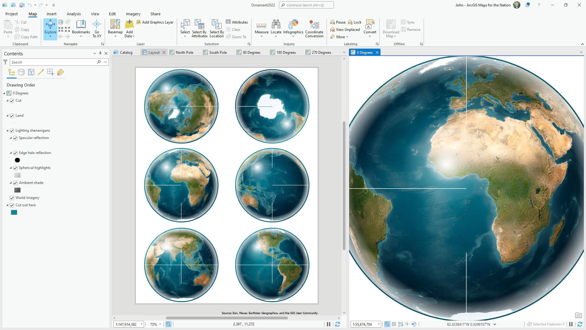
Click these images to open a high resolution version and print them out. Also, here is an ArcGIS Pro project package if you are feeling dangerous and want to change the globe to some other style of map. You have the power.

and…

Also, feel free to try your hand at four previous years’ papercraft globe ornaments, if you dare!
Enjoy! And if you make one of these things, please share the results on Twitter or Instagram! I’d love to see what you come up with.
Love, John
P.S. This ornament was designed primarily with the World Imagery basemap, from Living Atlas, with an orthographic projection. An orthographic projection mathematically approximates a perspective of the earth from space, but if you were at an infinite distance. I use it a lot. Then the globes got radial gradient fills applied to the trusty old Global Background layer (a rectangle that covers the whole world and is insanely useful) and a dash of blend modes to make it look all 3D and realistic and cool. Many thanks to colleague Bojan Šavrič for the fun conversation and collaboration leading up to the making of this bauble.
Here again is the ArcGIS Pro project if you’d like to roll up your L.L. Bean sleeves (presumably this is a Christmas party where you are making these globes, so I’m imagining all of us wearing our finest cartographically appropriate accoutrement -yes, I’m there too in this fantasy party scenario) and alter the cartography of this bauble. As is your right. Otherwise, just save the images above and print away!


Article Discussion: