The Watershed and Trace Downstream tools are FREE to use with an ArcGIS Online for Organizations Account.
Watershed and Trace Downstream are online tools that create upstream drainage areas or downstream flow paths in seconds at points around the world. These tools are built on datasets from the USGS and the World Wildlife Fund. In the United States, the tools use 10m and 30m resolution elevation data from the USGS. 90m resolution elevation data from the World Wildlife Fund fuels the tools in other countries. Please refer to the locator map for detailed information about available areas.
Watershed and Trace Downstream are supported in ArcGIS Online, ArcGIS Pro, and ArcMap.
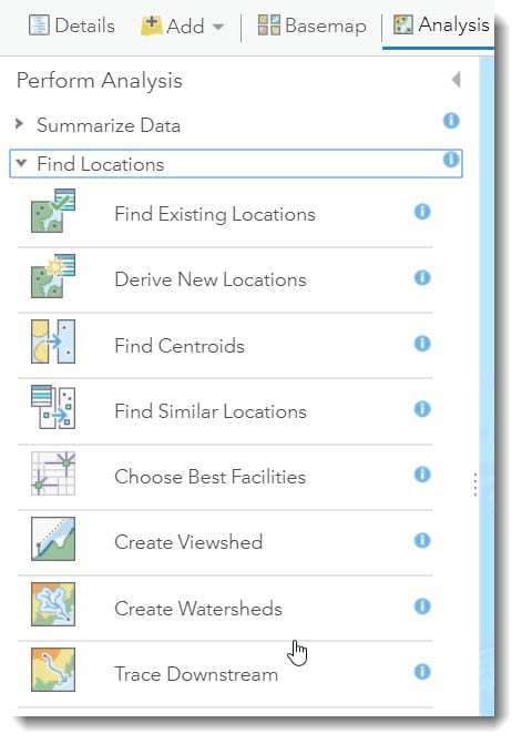
In ArcGIS Online, find Create Watersheds and Trace Downstream in the Perform Analysis Menu:
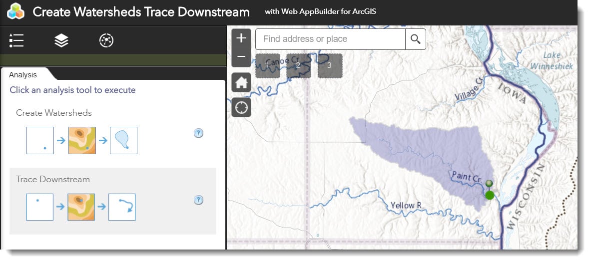
You can even use Create Watersheds and Trace Downstream in Web App Builder:
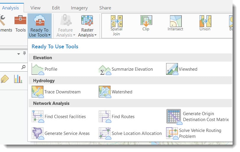
In Pro, find Watershed and Trace Downstream in the Ready-to-Use Tools:
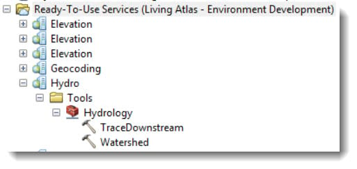
And, In ArcMap, Watershed and Trace Downstream are also under Ready-to-Use Tools:
The Watershed and Trace Downstream tools have been available since 2013, and have proven to be great time-saving tools for over 1 million users from all around the world. You can save hours and even days on elevation analysis and hydroconditioning, and now you can do it without accruing credits. Use the resulting watersheds and downstream flow paths in your next water resources project, engineering project, or hydrology curriculum.
- Create an upstream drainage area and geoenrich it with population, Hydrologic Soil Group, or one of many other environment variables found in the Living Atlas.
- Create a downstream flow path and see where the water will end up. It could drain all the way to the Mississippi River and end up in the Gulf of Mexico!
For more detailed information about how to use these tools, please see the developers page and also this No Dumping – Drains to Ocean ArcGIS Learn Lesson. We hope you find these tools useful, and if you have any feedback, please email CScopel@esri.com.



Commenting is not enabled for this article.