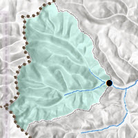
 Your efforts have made possible the official release of the Elevation Analysis Geoprocessing Services – Watershed, Trace Downstream, Profile, Viewshed, and Summarize Elevation. Delineate a watershed, trace downstream, see the elevation profile and calculate the viewshed on every continent. These Geoprocessing services were vetted over the past year, and we listened. We’ve made adjustments, and TODAY we release the official tools!
For every 1000 input points processed there is now a 1 credit charge. In other words, for every 1000 watersheds, your ArcGIS Online organizational account will be charged one credit.
Access the Elevation Analysis services through the Ready-to-use Services link in ArcCatalog (ArcGIS 10.2 and later) or connect to hydro.arcgis.com/arcgis/services to access Watershed and Trace Downstream, or elevation.arcgis.com/arcgis/services to access Profile, Viewshed and Summarize Elevation and login with your ArcGIS Online Organizational account credentials.
We are seeking additional content at greater resolutions to fuel these services. Please see the Hydrology Tools Data Coverage map and the Elevation Services Data Coverage Map.
If you have questions or comments, please email us at HydroTeamRC@esri.com.

Article Discussion: