The November 2022 ArcGIS Online update introduces new features and key updates throughout the site. The same applies for ArcGIS Instant Apps, as we have introduced many updates and new features to our existing apps, further improved choosing and managing your apps on the Instant Apps home page, and addressed various bugs and enhancements to help stabilize and improve your experience across the site. See the highlights below.
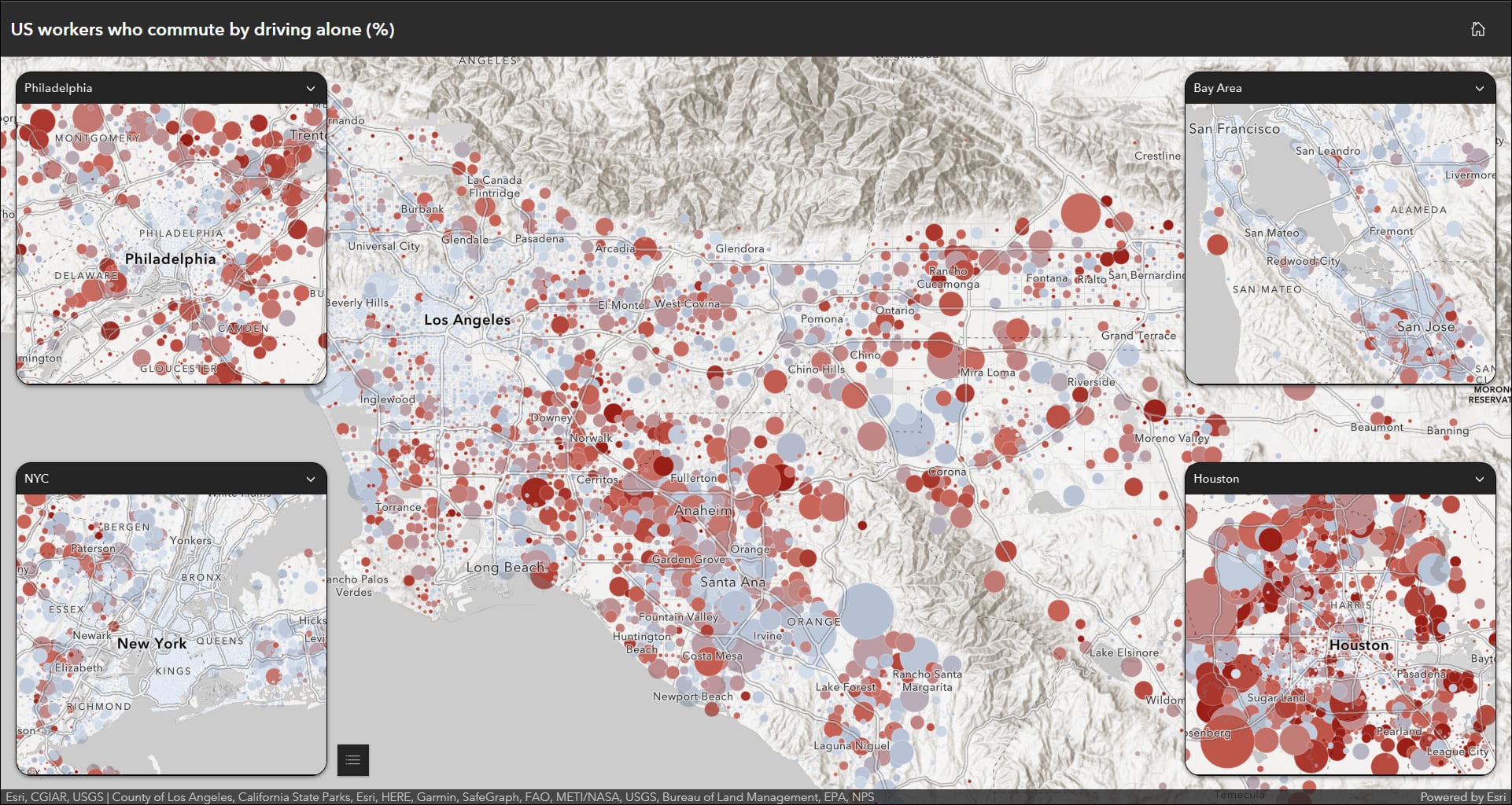
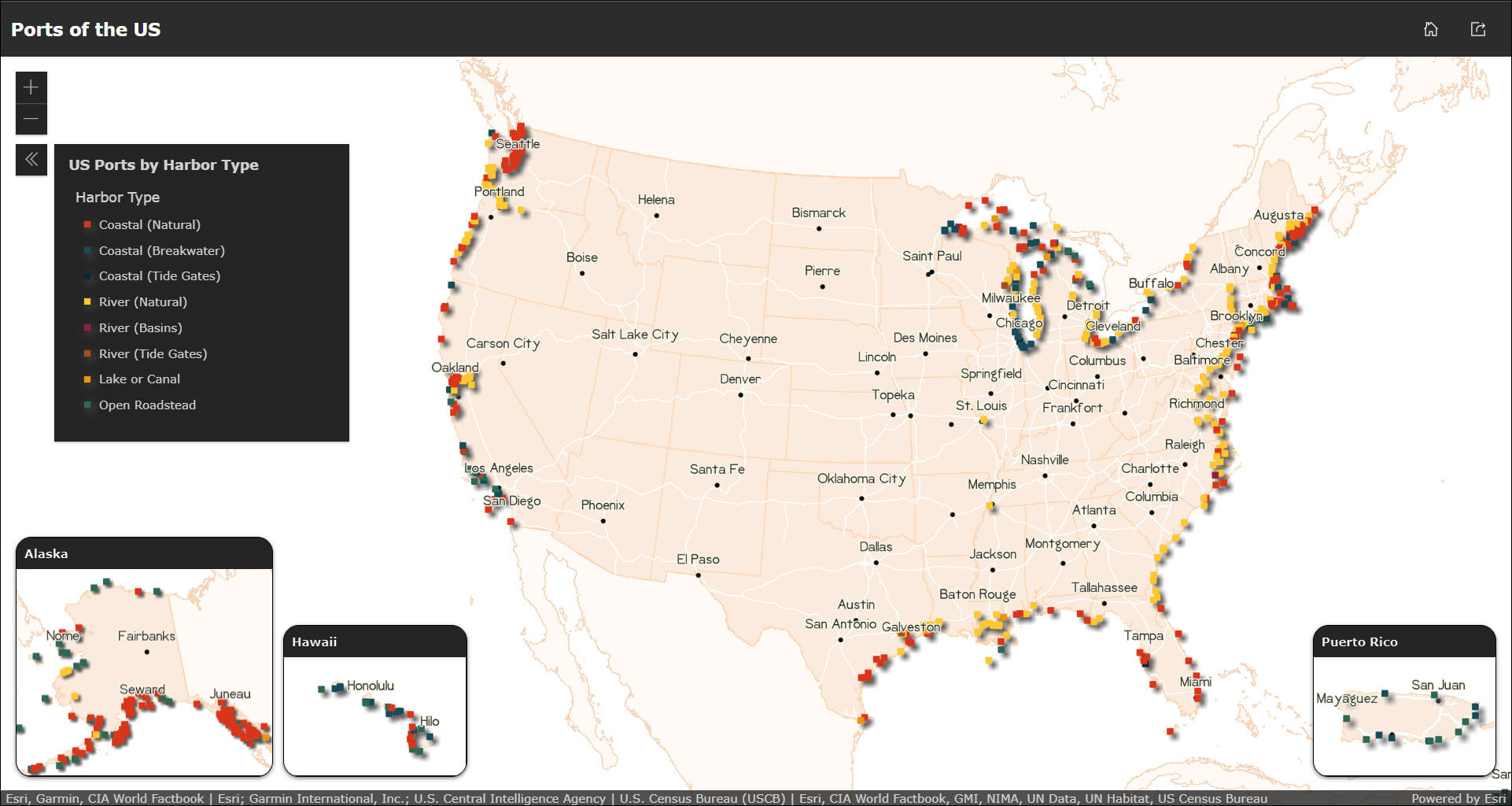
Introducing: Insets (beta)
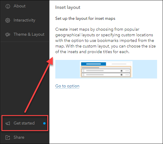
Display noncontiguous geographic locations using the new Insets (beta) app. Pick from a list of predefined geographic layouts or customize the inset locations with the option to use bookmarks from the map. Apply theming by picking an inset style and adding title headers. The Custom mode lets you import bookmarks from your web map to automatically generate insets, or you can create brand new insets directly in the app configuration and position them in the layout using the Position Manager which is found on the Theme & Layout section of the app configuration. Use Custom mode when you want to keep the look and feel of your web map and define your own inset locations.
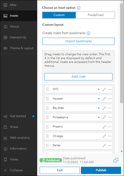
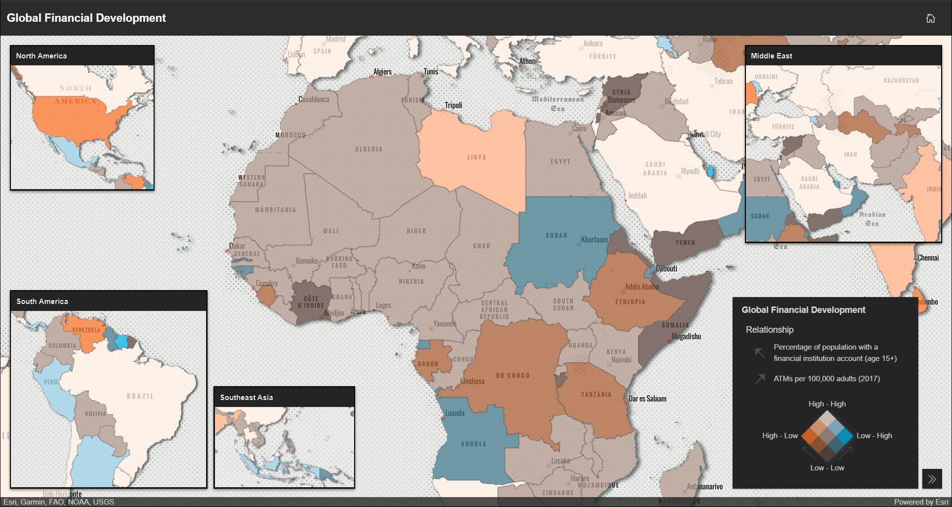
Predefined mode currently offers layouts for the US, with more on the way in coming releases. In Predefined we have set up the inset extents and locations, and applied suitable map projections. For example, limit distortion when you use the predefined US + Alaska and Hawaii layout as Alaska displays in Alaska Albers Equal Area Conic and Hawaii in NAD 1983 UTM Zone 4N.
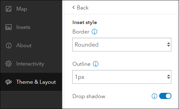
Choose between a light or dark mode for the inset headers and the main app header, pick a specific font, and add a custom logo that fits nicely with your app. For the insets, apply a square or rounded style, choose an outline width for the borders, and apply a drop shadow effect.
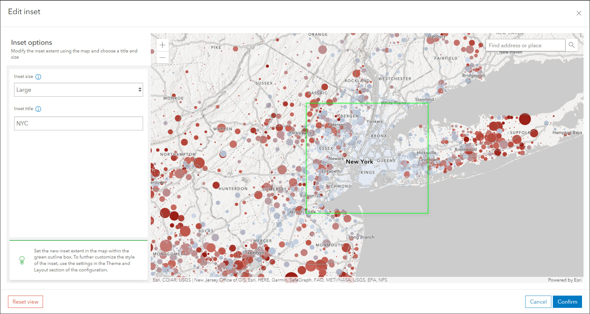
For Custom mode, configure the sizes of each individual inset within the inset’s editing window. Here is where you can set the size, title, and extent to fit your area of interest wherever it is on the map. Use the green bounding box as a guide to confirm what is contained inside the inset when the app loads.
App configuration updates
- App-specific onboarding: Onboarding messaging helps introduce key options and settings in the configuration and is common across all Instant Apps templates. New at this release are onboarding messages that are app-specific and include information about settings that are only included in that app. For example, the ability to toggle the layout option mode in the new Insets (Beta) app. This message only shows in that app’s configuration. You’ll notice these helpful app-specific messages in most apps as you create and configure.
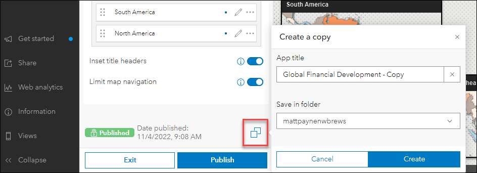
- Copy app: Create a copy of your published app directly from the configuration. This will create a new item with the same configuration as that of your app. Note that changes saved in the draft will also be reflected in the copied app’s draft. The new copy button is found at the bottom of the left side panel of the configuration.
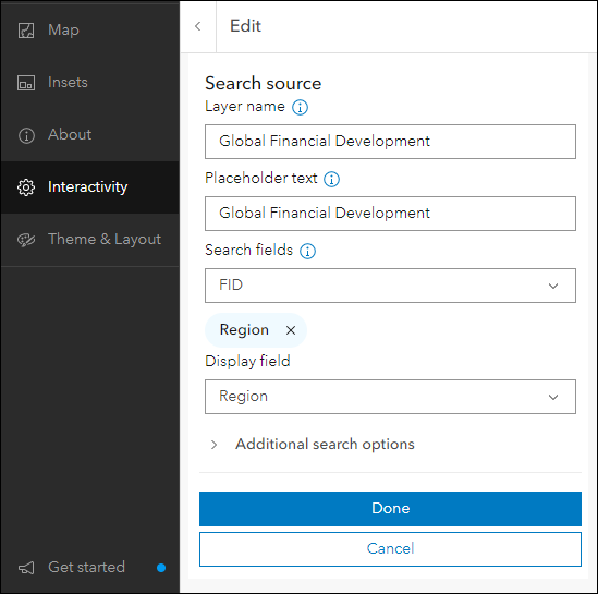
- Search configuration redesign: The search configuration lets you set up feature and location search and is found in all Instant Apps. We have simplified how the collection of settings are offered to make setting up search an easier and more comprehensive process.
- Standardized rich text editor: The rich text editor has been standardized across all app configurations to offer a simple way to add text, links, and small graphics to various places of your apps. A few places this editor is used include introduction panels, details and results panels, and section descriptions. The editor opens as a callout window with generous space to craft your custom messaging within the app configuration.
Instant Apps home page
The Instant Apps home page offers a centralized place to browse, choose, create, and manage ArcGIS Instant Apps. We have included updates to several key areas of the page this release. First, the My Apps tab now offers the ability to filter apps by several different criteria. Filter for apps that you own or apps that are owned by members of your organization. Discover apps that have been created using a specific app template, for example, filter for all apps created using the Interactive Legend template. This filter lets you select multiple values so that you can view results for multiple app templates at once. Also included is the ability to filter by sharing status.

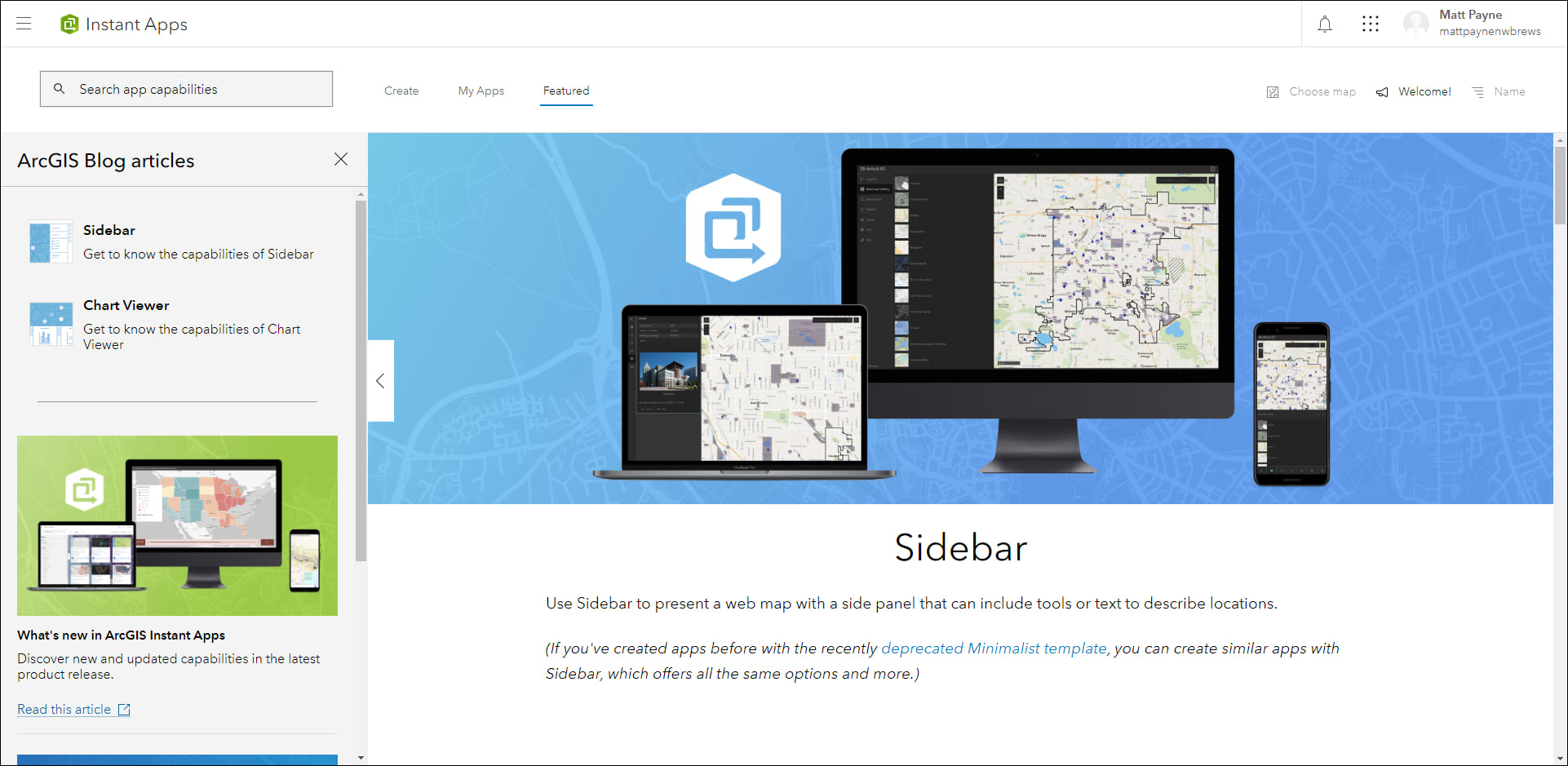
Second, the Featured tab has been updated with a new featured article. Get to know the capabilities of Sidebar by scrolling the main stage on this tab for information and visual examples. Newly added to the side panel of this page is a section to access previously featured articles. For example, click Chart Viewer to read about it in the main stage.
Last release we added the ability to choose or change the web map that is used to initialize creating an app directly in the home page. This option is found on the top right of the header called Choose map. This option lets you browse for maps to help filter app choices based on compatibility criteria and preview what it would look like before creation. Apps that are compatible with your map will filter to the top on the Create tab, apps that are not compatible will filter below under the Additional Apps section. You can change to a different map, or simply clear it by clicking the “X”.
For more details please check out our Introducing ArcGIS Instant Apps blog.
Chart Viewer updates
Chart Viewer leverages charts authored in Map Viewer to display data-based graphics alongside a map. Focus on specific data in the chart by selecting features in the map using the new map selection tool to create a bounding box. This updates the selection in the chart automatically and applies to all if your app has multiple charts. To clear the selection click the Clear selection button in the map. You can also create selections by clicking and dragging inside the chart area to directly select chart elements. This highlights the features in the map as well.
For more information, please check out our app-specific Chart Viewer blog.
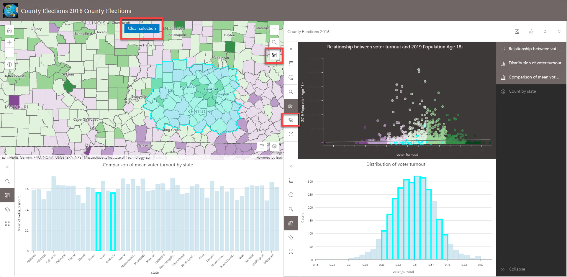
Exhibit updates
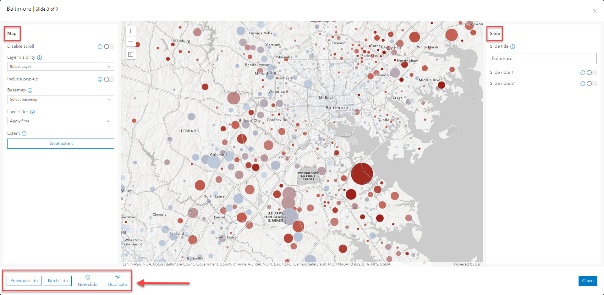
Design an interactive presentation of your map using Exhibit. Tell a linear story by choosing specific areas of your map to highlight using slides that offer interactivity options such as toggling layer visibility and choosing a unique basemap. This release we have redesigned the slide configuration to help streamline creating and editing slides without leaving the window. Toggle to previous and next slides, create a new slide, or duplicate the slide all within the same slide configuration window. Settings for both map and slide are included in the same view for a more comprehensive editing experience.
Check out our updated blog to get more details on how you can Build an interactive map presentation with Exhibit.
Slider updates
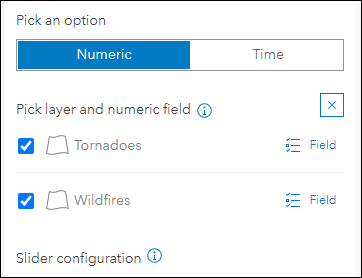
Animate through temporal or numeric data using the Slider Instant App. We’ve added the ability to animate through multiple layers at once using numeric data with this update. For example, animate through a wildfire layer and a tornado event layer at the same time based on total destruction cost to see which events had similar impacts on communities. In this example, instead of animating through time, the new update allows you to animate data using the numeric field containing destruction cost values that is common between the two layers. Find this option in the Slider section of the app configuration to enable multiple layers and select the common field.
For more information, please check out our app-specific blog on Slider.
Documentation update: App capability matrix
Find out which tools and capabilities are available in all Instant Apps templates. We’ve included a new capability matrix table that will help compare which options certain apps have compared to others. Find this table and more within our Template capabilities doc page.
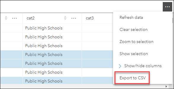
Export to CSV in Instant Apps
The ability to select records from a table and export to CSV has been added to 3D Viewer, Media Map, and Sidebar. This option is part of the “Add show table option” setting in 3D Viewer and Media Map in the Interactivity section, and is found on the Sidebar section of the configuration in Sidebar. When enabled, the Open table button in the layer list includes the option to Export to CSV. Note that the layer list in the app configuration must be enabled to expose the “Add show table option” setting.
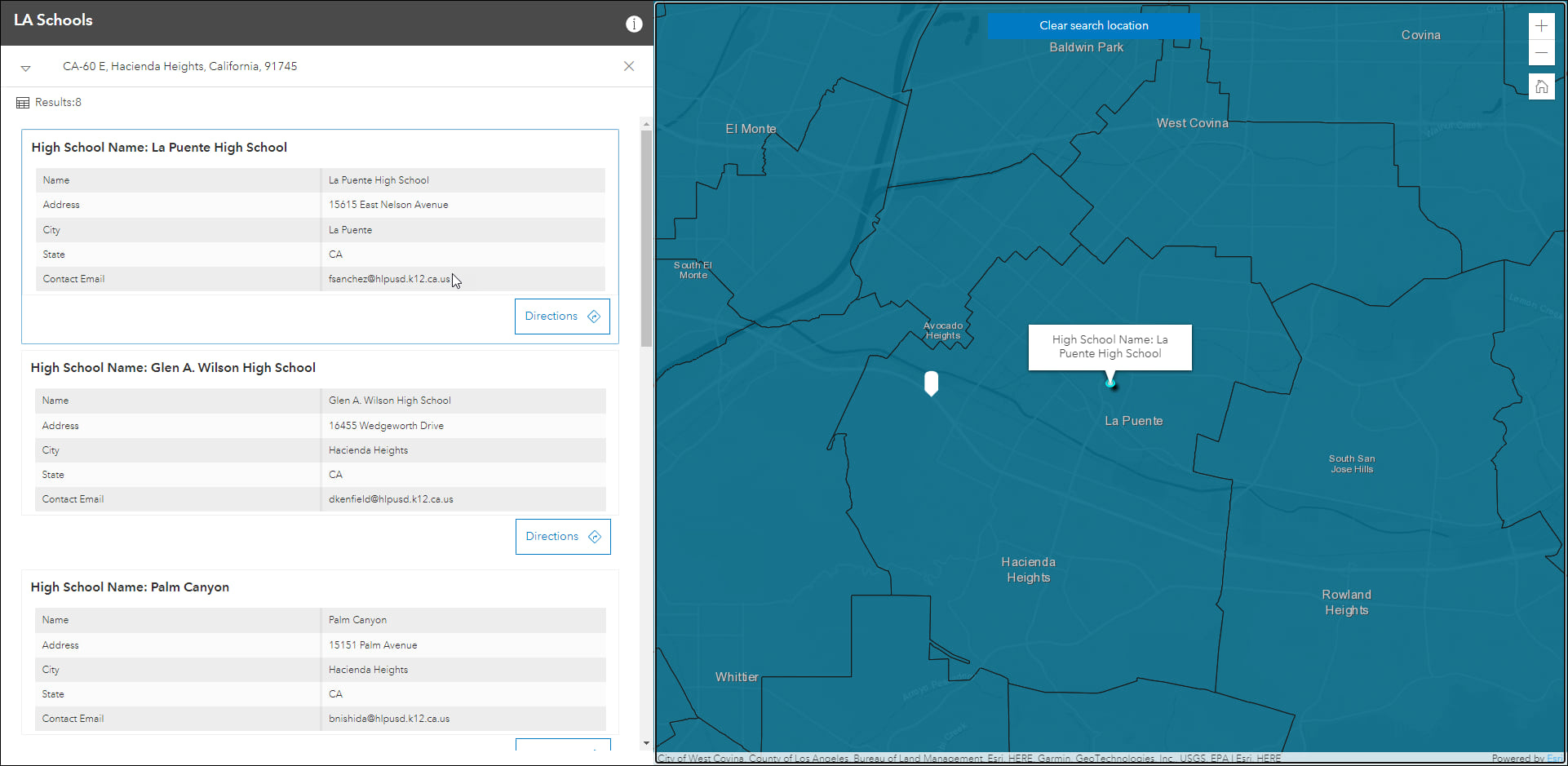
Zone Lookup updates
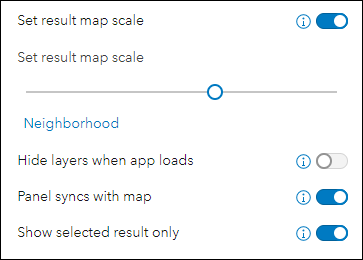
Discover locations within a zone or region to provide information using Zone Lookup. This app is great for identifying school districts, store regions, emergency evacuation zones, and more based on current location or a location provided by the app user. We’ve made a couple updates to generating and accessing result features. First, the app configuration now offers an option to set the desired scale level that the app will zoom to when you generate results. For example, set the scale level to use “Neighborhood” when you are looking for nearby parks. Second, the option to show only the selected result has been added. After results have been generated, select a results feature in the side panel by clicking on it and any other features included in the results will be hidden in the map temporarily.
For more information, please check out our app-specific Zone Lookup blog.
Portfolio updates
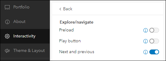
Use Portfolio to showcase different types of content all in one place by curating multiple resources related to a specific topic. This release we have added a new setting to the app configuration that will show or hide the next and previous buttons. These buttons show in the control panel and provide manual abilities to move forward and back through content in the app. For more details about Portfolio please check out this app-specific blog: Display a collection of content with Portfolio
Sidebar updates
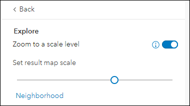
Sidebar offers a range of tools for exploring, understanding, and managing data. A panel containing these tools displays alongside the map and includes data editing, feature filtering, pop-up information, bookmarks, layer list, and more. With this release we have updated the app configuration with two new settings. First, you can now choose a map scale to be used when zooming to a selected feature. Find the “Zoom to a scale level” setting on the Interactivity > Explore/navigate section. When enabled, drag the slider to set your desired scale level to be used in the published app.
And second, we’ve added a toggle to show or hide the snapping tools from the app when editing data. When enabled, the app user can snap vertices of a feature that is currently being drawn or reshaped to that of an existing feature’s vertex, edge, or end point. Find this new setting on the Sidebar section of the app configuration by enabling the “Edit tools” setting.
For more information, please check out our app-specific Sidebar blog.
Minimalist moved to deprecated status
The Minimalist template showcases a web map with minimal tools and options to put emphasis on the map with a clean and modern user interface. We have moved this template to deprecated status and suggest using Sidebar as the recommended Instant Apps solution moving forward. All existing apps you have made using the Minimalist template will continue to work but new apps can no longer be created. Sidebar has a similar configuration experience as Minimalist, plus more optional capabilities, such as editing, custom theme settings, and more. Please take a look at our Minimalist Deprecation in the ArcGIS Online November 2022 Update blog for more details about this process and how to move forward with Sidebar.


Article Discussion: