When Map Accuracy Matters
In late 2022, Kaufman County began exploring how to correct inaccuracies in the labels displayed on Esri basemaps. After contacting an Esri representative to ask where the labels originated and how errors could be reported, the county was directed to Esri Community Maps—a program that enables organizations to provide feedback and contribute authoritative geographic data.
The issue was more than a cartographic concern. Inaccurate basemap information was creating confusion for people relying on maps to understand local roads and properties. Kaufman County saw an opportunity to help improve that information by sharing its local knowledge and authoritative data.
Understanding the Source of Confusion
Kaufman County had maintained a GIS portal for years, providing the public with access to local geographic information. Users of the county’s portal and the Kaufman Central Appraisal District’s GIS portal relied on the same underlying basemaps. Because the information appeared consistently across both applications, users naturally assumed it was accurate.
That consistency, however, could be misleading. Many users believed the basemap was simply another layer controlled directly by the organization building the map. In reality, the basemap is a separate source of geographic information, and correcting an error may require working with the organization responsible for that content.
Through Community Maps, Kaufman County found a way to report errors and help improve the shared geographic foundation on which many mapping applications depend by using Esri’s Basemap, Geocoding, Imagery & Routing Feedback App.
From Reporting Errors to Sharing Authoritative Road Data
Kaufman County initially used the Community Maps website to submit feedback whenever staff became aware of incorrect information. That participation soon expanded to sharing the county’s road centerlines.
The need was particularly evident in new developments, where residents eagerly awaited updates to see newly constructed roads represented on the basemap. Without timely, accurate road information, maps could fail to reflect the places where people lived and traveled.
Rural areas presented a different challenge. Long driveways could appear on the basemap as roads, creating the impression that they were public routes or provided access to other properties. Real estate professionals and prospective buyers sometimes reported these driveways as roads, illustrating how seemingly small mapping errors could lead to misunderstandings about property access and addressing.
By sharing its authoritative road centerlines and continuing to provide feedback, Kaufman County is helping improve the distinction between actual roads and other features that may otherwise be misrepresented.
Community Road Centerlines
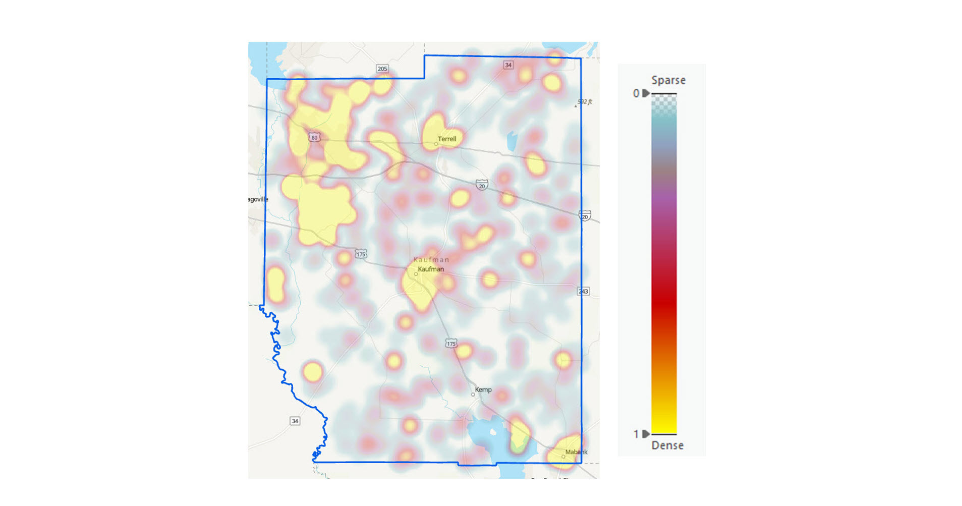
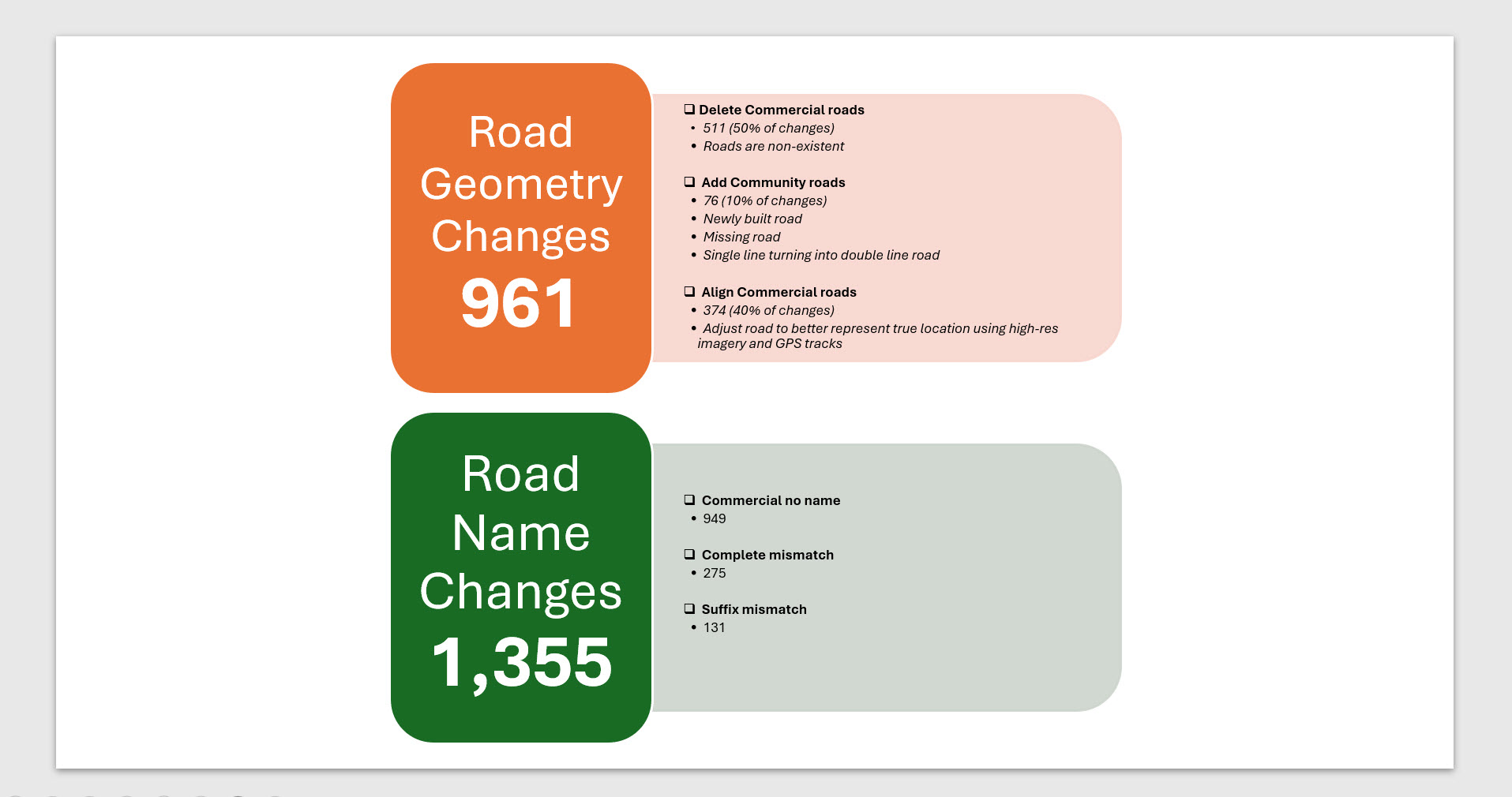
Roads change faster than most maps do. New neighborhoods appear, old streets disappear, and a single wrong suffix can send a driver the wrong way. For Kaufman County, the latest Road Compare cycle closed that gap with 961 road geometry changes and 1,369 road name changes, all verified and published to the basemap.
Where the changes happened: yellow areas show the densest clusters of road updates across Kaufman County.
Click to enlarge
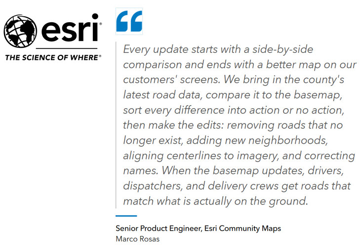
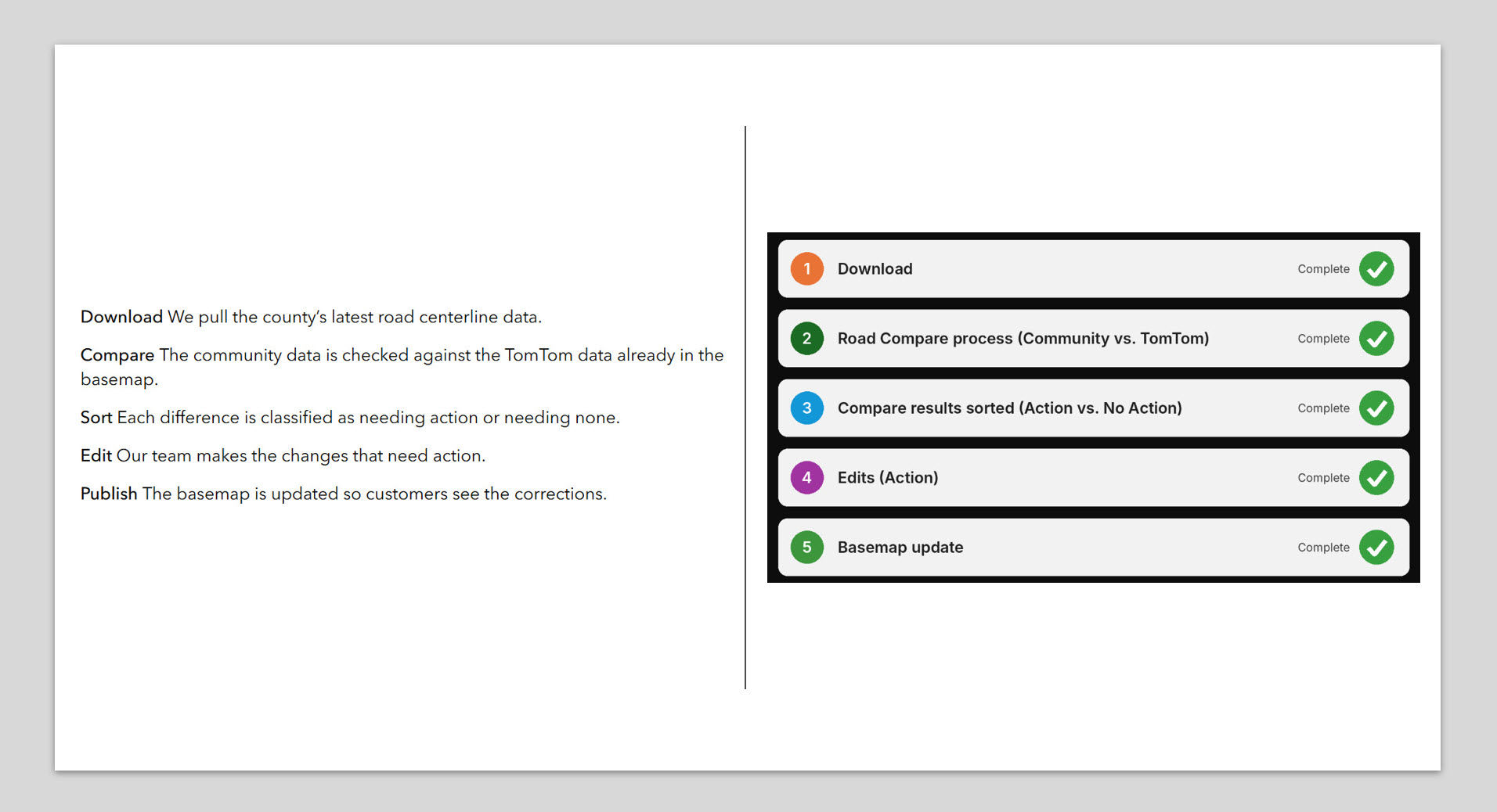
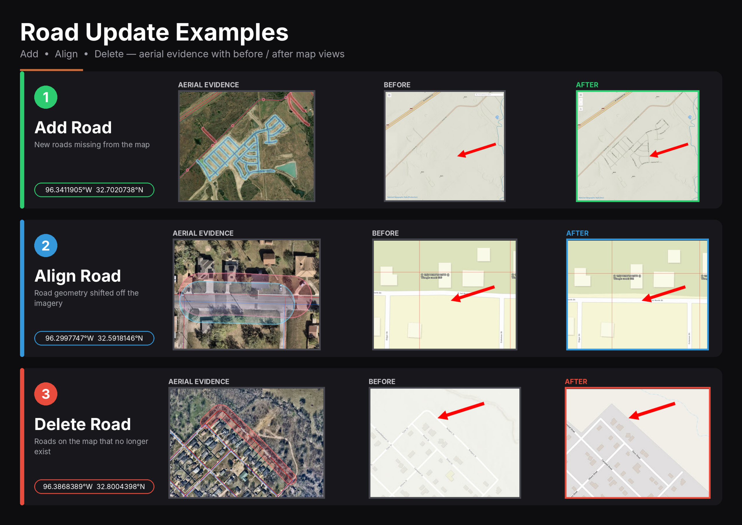
How a road update works
Click to enlarge
The Results
Click to enlarge
Three real examples from Kaufman County
Click to enlarge
What this means for the County
- Fewer wrong turns. Roads that no longer exist are gone, so routes do not send people toward dead ends.
- New neighborhoods you can find. Newly built streets show up on the map, which matters for deliveries, service calls, and emergency response.
- Road alignment. Aligned centerlines mean your location, your route, and the pavement agree.
- Road labels you can search. Filling in missing names and fixing mismatched ones and suffixes makes addresses and streets easier to look up.
Making Public Information Easier to Access
For Kaufman County, improving basemap accuracy is part of a broader commitment to making public information accessible and understandable.
Many calls to the county’s department involve helping residents locate or interpret information available through its GIS system. When people can confidently find and understand that information independently, staff can devote more time to other departmental responsibilities while residents gain the flexibility to answer questions at their own convenience.
Accurate maps support that goal. When geographic information is clear and dependable, the public can more effectively use it to understand local roads, properties, and surrounding areas.
The county’s work with Community Maps helps support this public-facing mission by improving the shared geographic context in which local information is viewed.
Connecting Local GIS Data With Public-Facing Applications
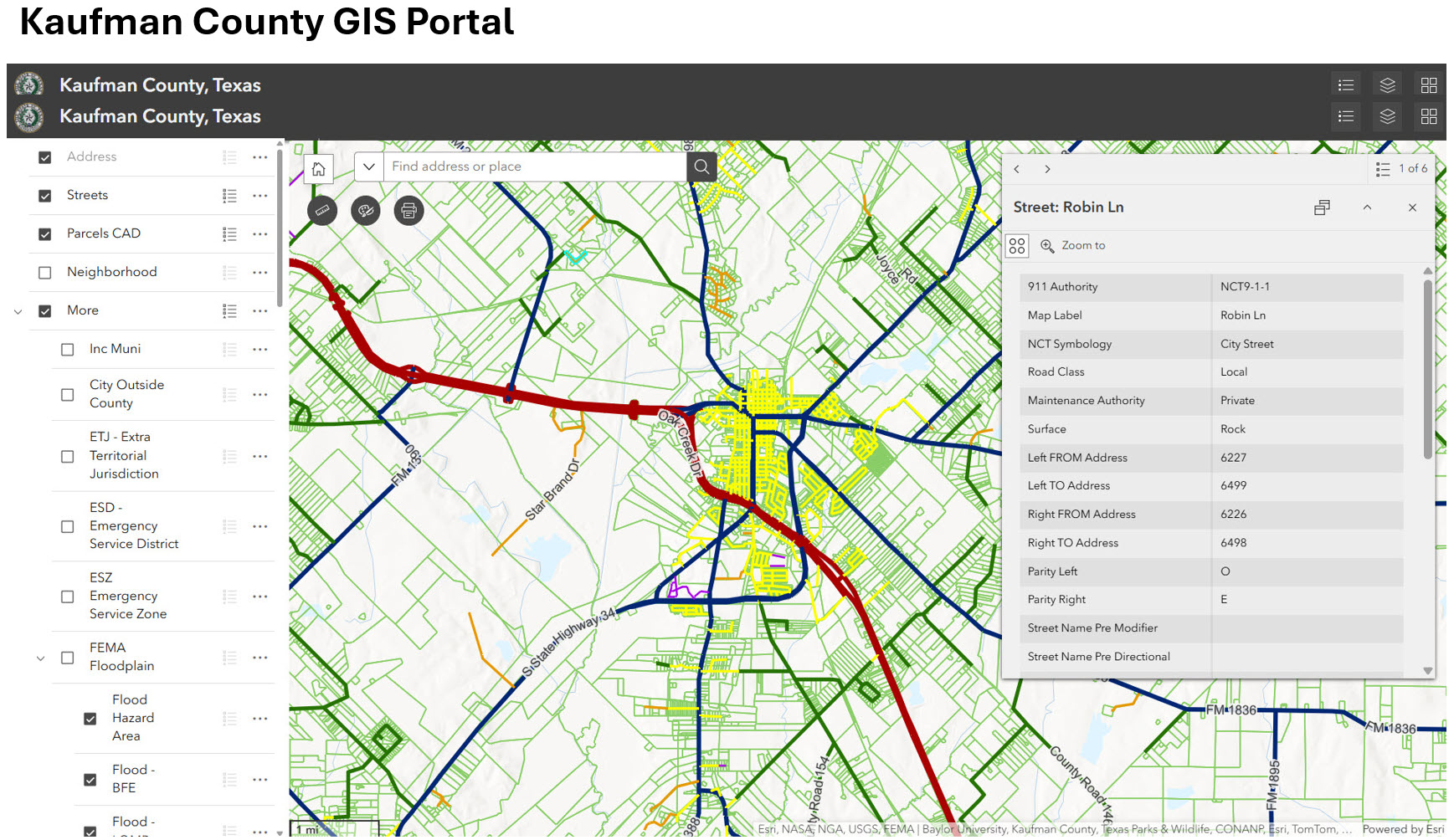
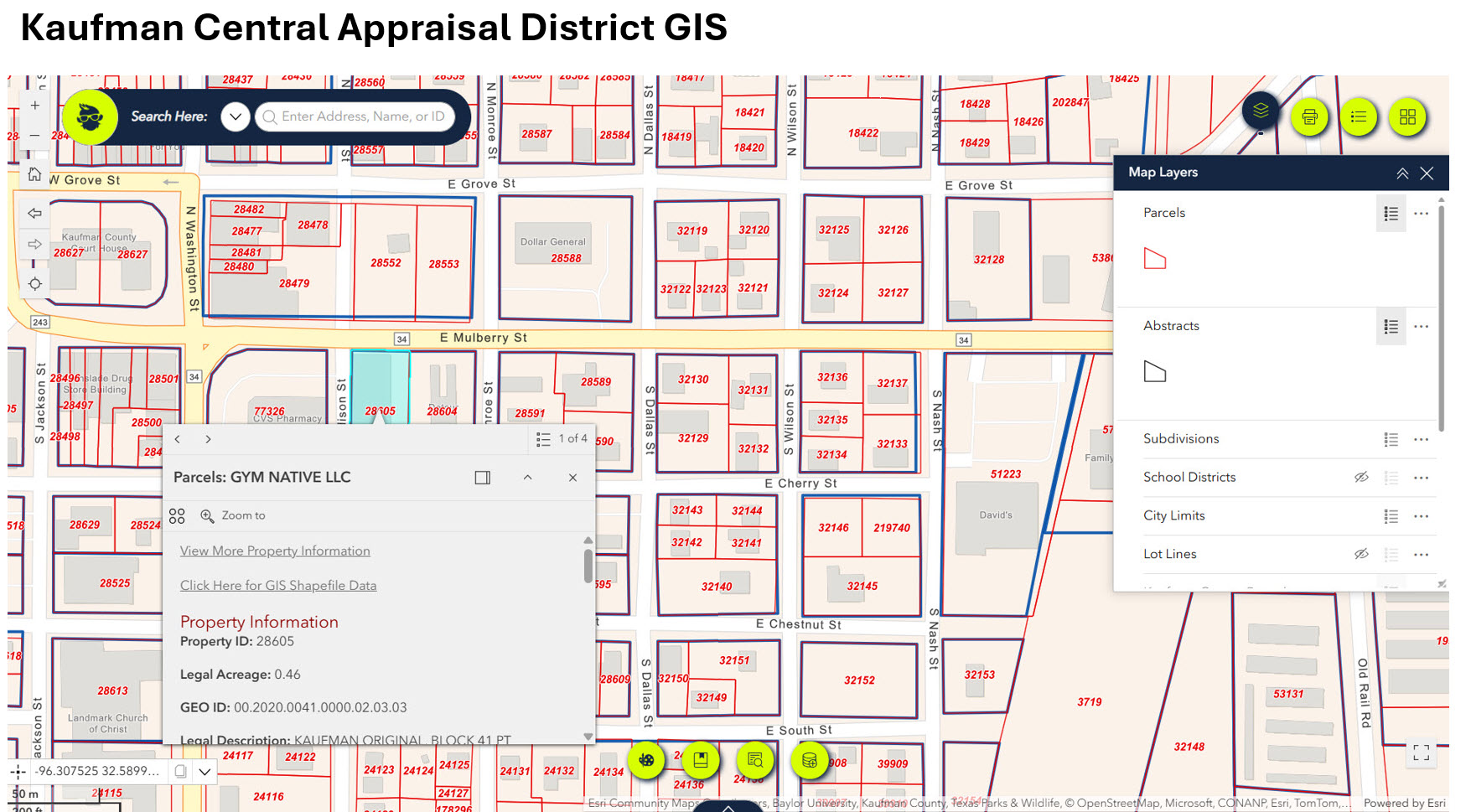
Kaufman County uses a single public-facing web portal to make its spatial information available to the community. The county also works closely with the Kaufman Central Appraisal District, from which it obtains parcel boundaries.
These complementary resources support access to geographic and property information while demonstrating the importance of coordination between organizations that serve the same community.
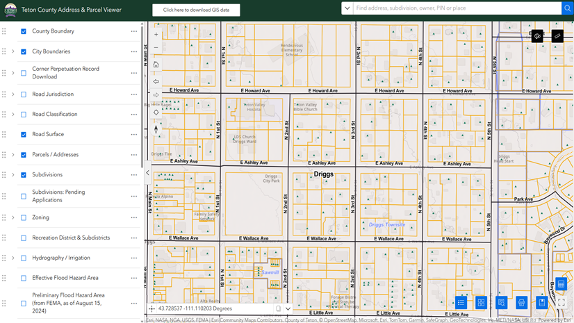
Explore Kaufman County’s GIS resources by clicking the images below:
Building Greater Consistency Through Collaboration
Kaufman County plans to continue sharing authoritative data to help align geographic information across the platforms people use every day.
The goal is not simply to correct individual map errors. It is to help ensure that the information people encounter is clearer, more consistent, and more reflective of conditions on the ground.
For local governments, contributing authoritative data and providing feedback can extend the value of existing GIS investments beyond their own applications. For residents, real estate professionals, and other map users, better-aligned information can reduce confusion and support more informed decisions.
Through its participation in Esri Community Maps and its broader data-sharing efforts, Kaufman County is demonstrating how local knowledge can contribute to a more dependable shared mapping experience.
Learn More About Esri Community Maps
Esri Community Maps provides opportunities for organizations to contribute authoritative geographic data and feedback that help improve the shared basemaps used across the ArcGIS ecosystem.
By bringing local knowledge into a shared mapping environment, participating organizations can help make basemaps more useful for the communities and applications that depend on them.
Resource Guide
Community Road Centerlines Video
Questions? Email us: CommunityMaps@esri.com


Article Discussion: