ArcGIS Pro 2.4 introduces its real-time API for real-time analysis. This opens up a lot of possibilities for developers to work with real-time data and integrate it with the rest of the ArcGIS Pro ecosystem. You can perform simple exploratory task or very complex spatial analysis such as flood forecasting with real-time data, or send out notifications via email, text etc. as incidents happen.
Here are some examples:
As a taxicab drives down on a street, you can find all nearby coffee shop locations, and display them in a pane.

You can—for security reasons—find the areas in a 3D space that are visible from police cars.

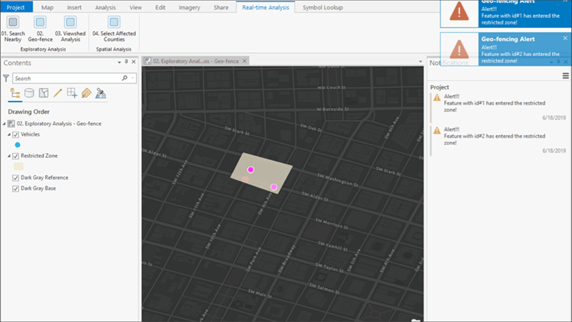
You can define a geofence and send alerts as vehicles enter or leave any restricted zone.

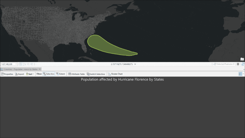
Or you can automatically perform spatial analysis to find all the counties and the total population that will be affected by an approaching hurricane.

In short, the real-time API in ArcGIS Pro SDK for the Microsoft .NET Framework allows a developer to react as features are streamed in real time, by subscribing to a stream layer. Stream layer is a relatively new layer type—introduced in the ArcGIS Pro 2.2 release just over a year ago—for consuming real-time data from a stream service. This API is very powerful and easy to use and gives developers absolute control and flexibility.
A sample Visual Studio solution, with sample code for above mentioned use case, and an ArcGIS Pro project with data can be downloaded from ArcGIS Online – https://arcg.is/0jH09i.

Article Discussion: