When I was making the absurdly long Appalachian Trail journal map, I soon found that a conventional scalebar just wasn’t going to do the trick. Do I put one at the top, and it’s almost immediately hidden when the map reader unfurls the map a bit? At the bottom where you can’t even see it until it’s all the way unfurled? Or should I repeat a scalebar every so often so it’s never totally out of sight? Meh!
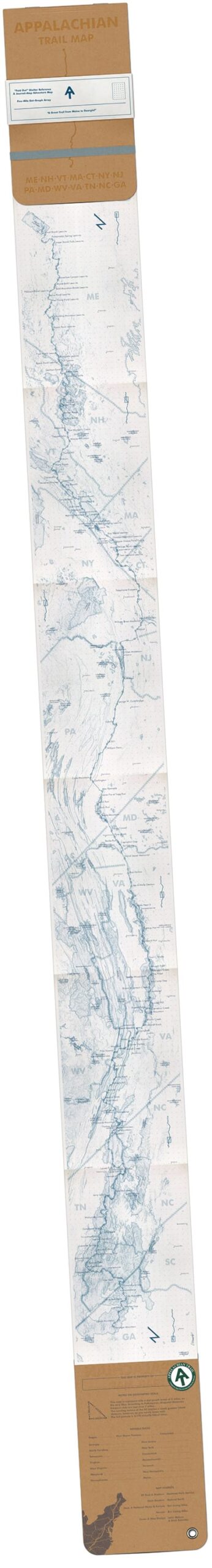
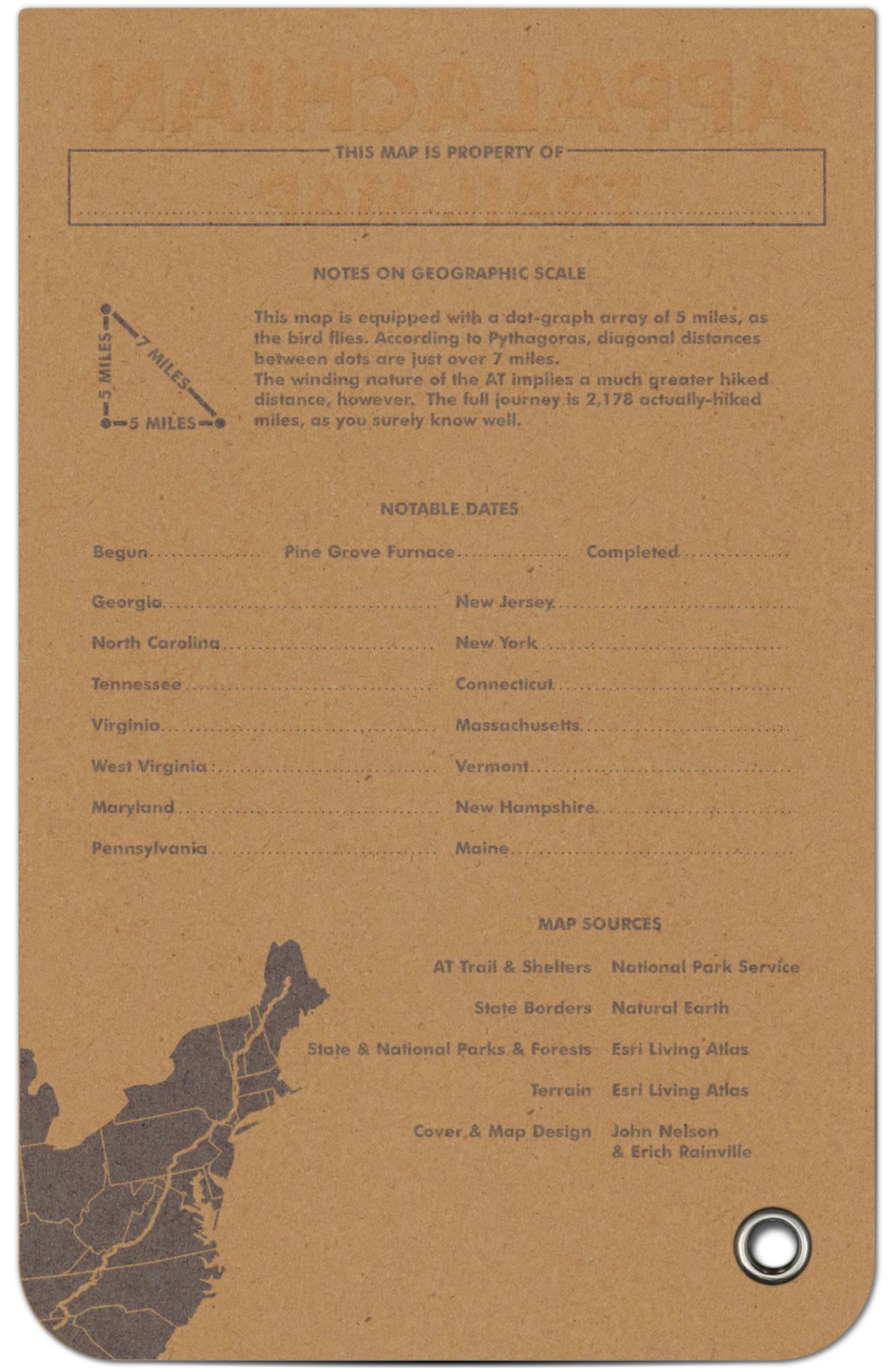
This scale reference method takes a page from notebooks and sketchbooks and drops a uniform grid of dots to indicate a distance reference. No matter where you look…there’s a scale reference. And it’s more reliable than your leaky working memory, or fingers held at a scalebar’s width apart—no matter how consistently you try to hold them!
There are always lots of ways to do things in the majestically varied landscape of GIS features. In this video I’ll cover two different methods (can you think of any others? I think I can think of one more). The first option shown is hacking the Tessellation geoprocessing tool, and the second option shown is legitimately using the Layout’s measured grid tool as designed (thanks to Aubri Kinghorn for the lowdown on grids).
There is no wrong answer. So enjoy the video and tuck this technique into your arsenal of crafty cartographic crowbars.
A couple of notes to consider though! Since a dot array of equal distances isn’t as immediately recognizable as a scale bar would be, you’ll need to add some note about its use as a reference for distance and what distance is. And, since it’s a rather pervasive element (dots all over!) you’ll have to be pretty conservative in how you style them.
If you are interested in checking out the Appalachian Trail map used in this demo, you can find it here.
Love, John


Article Discussion: