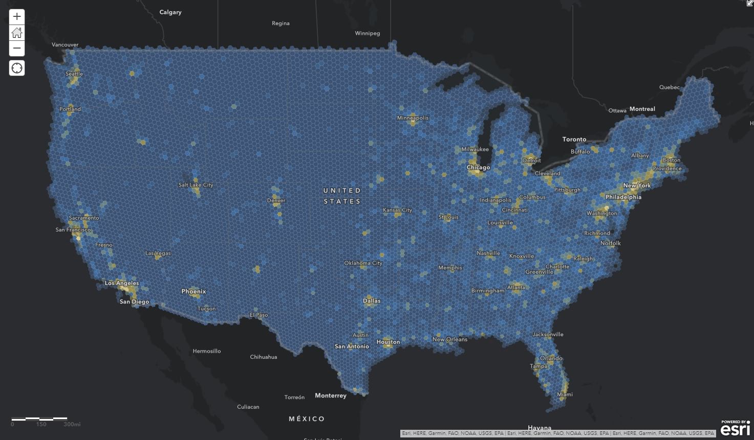
Here is a nice neutral equal-area hexagonal mesh covering the continental United States all pre-stuffed with population data. Use this map to roll your human geography data into (spatial join) or run some crazy enrichments on it in ArcGIS Online.
Why This?
Most population data happens to be available in political geographic units (like counties or census tracts, or even the bizarre mysterious Zip Code Tabulation Area, etc.). That’s cool, but political polygons are inherently pre-disposed to wild scale and population differences and can result in some potentially misleading, or just insight-occluding, Choropleth results. This layer tries to isolate those variables by giving you a geographic layer where each cell (which, of course, happens to be hexagonal) is the same size (30KM), the same shape (you know, mostly), and comes pre-stuffed with population counts so you can readily normalize your data.
For Example
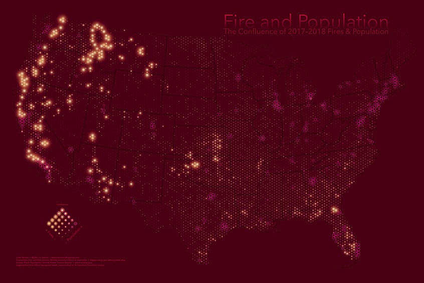
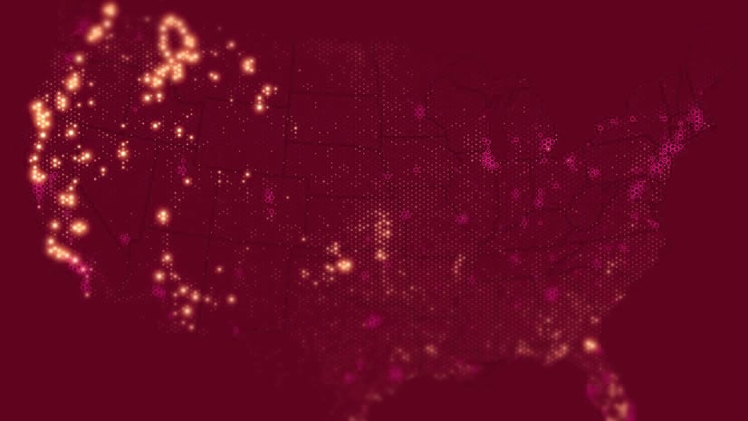
I used this layer to add up all the instances of two seasons of wildfire (spatial join) to show it in the context of population. That sort of thing.
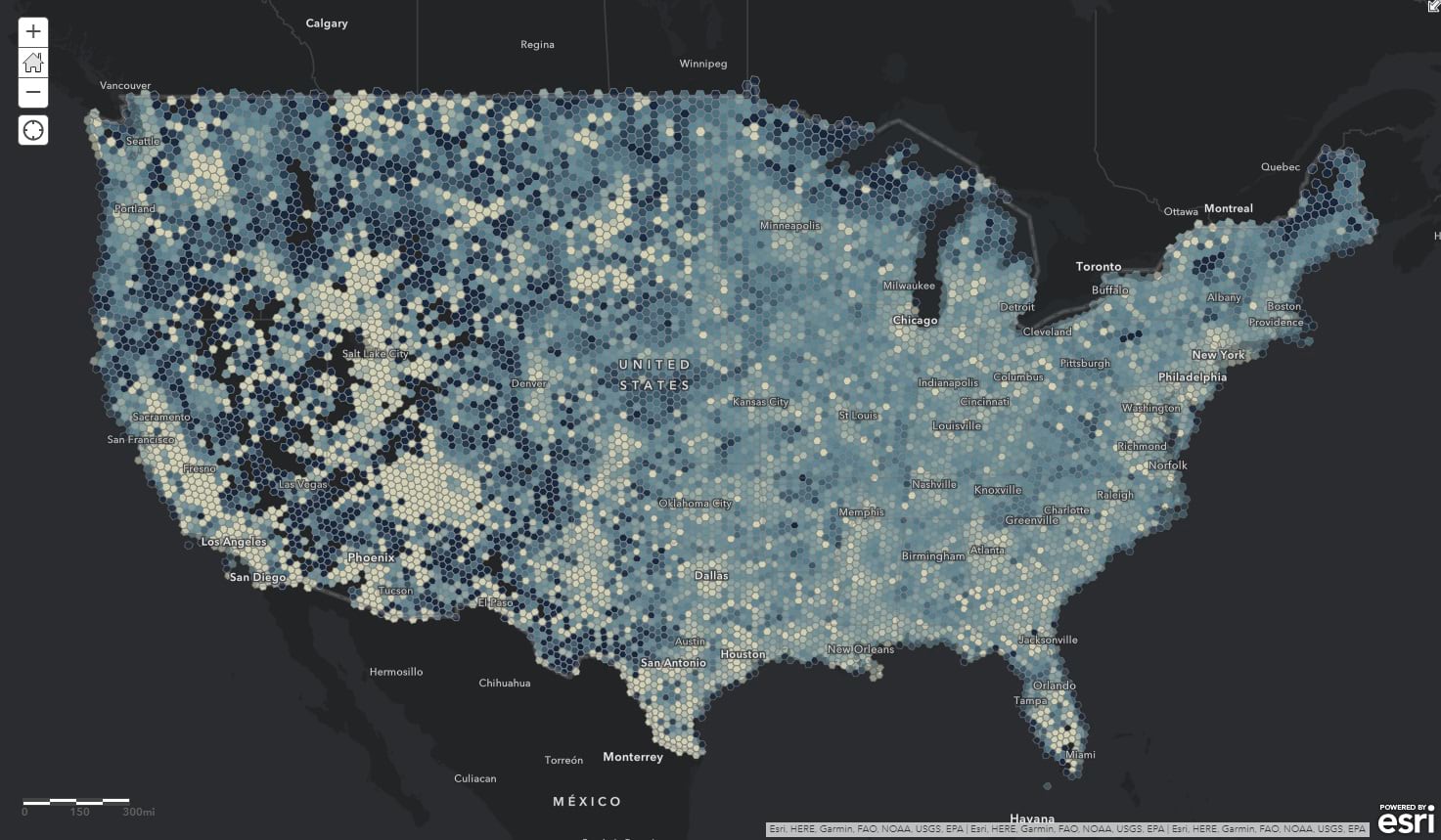
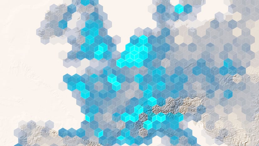
But you don’t need to aggregate data into this to start having fun. There are all sorts of insights to glean just by normalizing some of the population attributes by each other. Like this map that shows household size normalized by overall population, which hints at average family size…
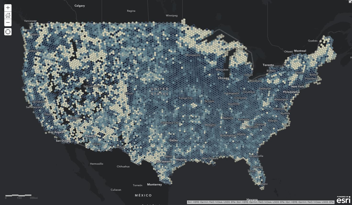
Or this map that normalizes the number of housing units by overall population, to sort of show rates of vacancy (or housing availability, to put a more positive spin)…
Anyway, download it here; use it for your own GIS adventures. It’s hard to get population data in a nice even surface like this so there are lots of new visualizations to explore. Such as…
- Farmers markets in the context of family size
- Mortgages normalized by housing units
- Comparing Starbucks to Dunkin
- UFO sightings per capita (obviously)
Happy Normalized Spatially Equitable Human Geography Mapping! John Nelson


Commenting is not enabled for this article.