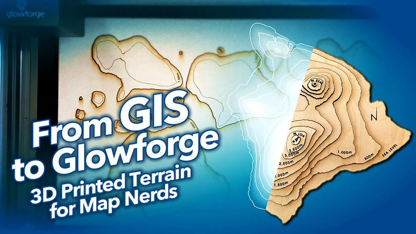
Last summer I had the amazing chance to spend a half hour or so with my son, Bear, collaborating on a little 3D elevation-extrusion illustration sort of graphic that I’d been wondering about. Then a bit later I saw a luscious bathymetric cutaway graphic created by Aldo Lopez for the GIS Day poster last year. It just looked so charming and tangible and made me feel like it was a small slice of the earth itself, in a way that a conventional map perspective didn’t. I wondered if I could make one of these things in ArcGIS Pro. After a handful of versions (like this illustration of weathered dome geology) to get the steps down to something simple and repeatable, I settled on this:

There is a lot of opportunity to customize what sort of graphic you drape into the cutaway walls of the landscape, depending on your area and goals. Gregory Buck made a version showing the Grand Teton mountains erupting from a cross-section of the moon. GI.Rahul Gawai drew in geologic layers beneath the Colorado River. James Wilson made a detailed volcanic cross-section of Mount Mazama. Jakob Hogenkamp made his two mountain-scapes floating handsomely on nothing at all. Wanmei Liang created a Mt St. Helens diorama with clouds and steam. Heather Sauerland scooped out a cube from the Owyhee Canyon. Dhaval Jariwala applied this trick to Kangrinboqe Peak/Mt Kailash.
Here’s how to make one…
…
0:00 Another low-production-value introduction, but hey.
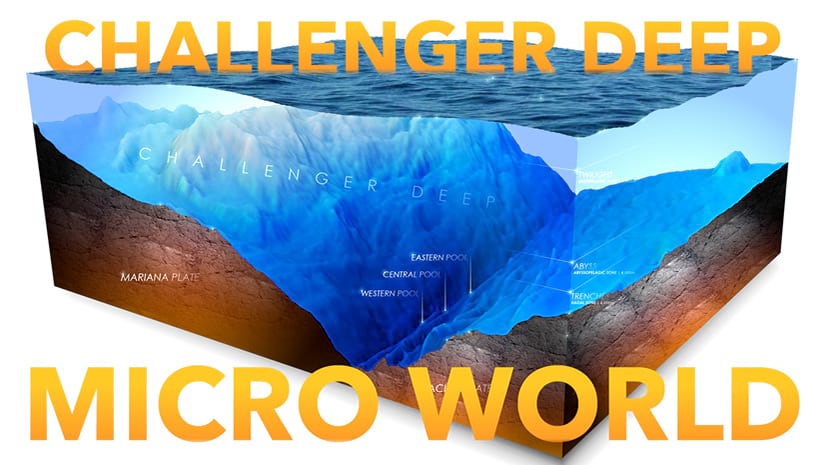
0:10 I’m going to follow-up this video later on with something focused on making an undersea diorama, maybe like this one (a series with Jesse van den Kieboom who will make one using the JSAPI).
0:15 Here’s a cheat sheet if you’d rather just skip right over to making…
- Clip out an area of interest from a digital elevation model
- Add it to a 3D scene
- Give the “ground” a transparent background and turn off the “stars and halo” option in the scene’s illumination properties.
- Add it to a layout and just, like, draw fake underground walls around it and stuff.
0:35 Add the “terrain” digital elevation model image service from Living Atlas.
1:43 A trick for extracting a georeferenced portion of the DEM.
3:35 Convert from 2D to a 3D scene.
3:55 Exaggerate the elevation to taste.
4:40 Set the ground background to transparent.
5:07 Open the 3D map properties and turn the “show stars and halo” option in the illumination properties.
5:29 Insert a layout and add the 3D map to it. Position to taste.
7:10 Coloring and shading the terrain.
8:25 If you want to add in a polygon, here’s how to do that.
9:46 Here’s how you can do an easy rippled water-line sort of effect for water polygons.
11:42 You are done with the GIS stuff. You can export now, or…
12:30 Add cool fake extruded sides to this thing by drawing sneaky little polygons! We’re hacking!
…
I hope you give this a shot. It’s so fun and I assure you you’ll be cranking out astounding little 3D diorama scenes all over the place. I’ve already been blown away by the things my fell map nerds are making. It’s a thing of joy and I encourage you to jump in.
Here is another version of this sort of thing where I make an underwater scene (slightly different and a bit more technical) in ArcGIS Pro, and then my colleague Jesse will follow that with how to make it using the JavaScript API!


Article Discussion: