Adding a faint coastal halo to your map’s water bodies can help the eye visually distinguish between land and water. It’s a pleasing effect, but also practical.

Use the gradient fill type for the water’s polygon symbology. Choose the absolute extent so the coastal halos are the same size for all water polygons. I like to set the interval (the number of steps transitioning between the two colors) to be the same number as the distance (the total distance of the gradient transition), so the gradient is smooth rather than stepped in appearance. Optionally, open up the gradient editor to make the transition less linear so the coast is darker and fades slowly into the overall water color.
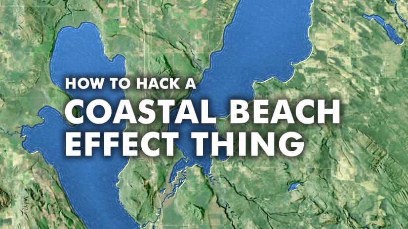
What color should you make the coastal halo? As a general guideline, I like to use a tone that contrasts with my basemap. So if the basemap is light, I use a darker version of the water color for the halo. If the basemap is dark, I use a lighter version of the water color for the halo. Here’s an example with a relatively dark imagery basemap and thus a lighter blue halo along the coasts…

But this is just a suggestion; you know what’s best for your own map. Here’s a quick one-minute how-to if you feel like following along…
…
Happy coastal halo-ing! John


Article Discussion: