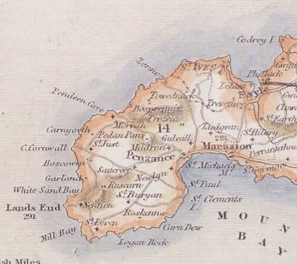
A coastal cake—I mean rake is a sweet fluffy delicious decorative effect for water bodies that you may have seen out in the wild. Horizontal lines stretch away from coasts and taper into finer and finer lines (ultimately, into oblivion—you know, like our own vaporous time on this earth). You might see them in old yellowed maps of the Caribbean or something, but the technique can be used for a modern aesthetic, too. Here’s a paper with lots of examples and a great discussion of the aesthetic and merits of historical map effects (including the sassy and classy coastal rake effect), from colleagues Aileen Buckley, David Barnes, and Jaynya Richards.
It’s this sort of thing:
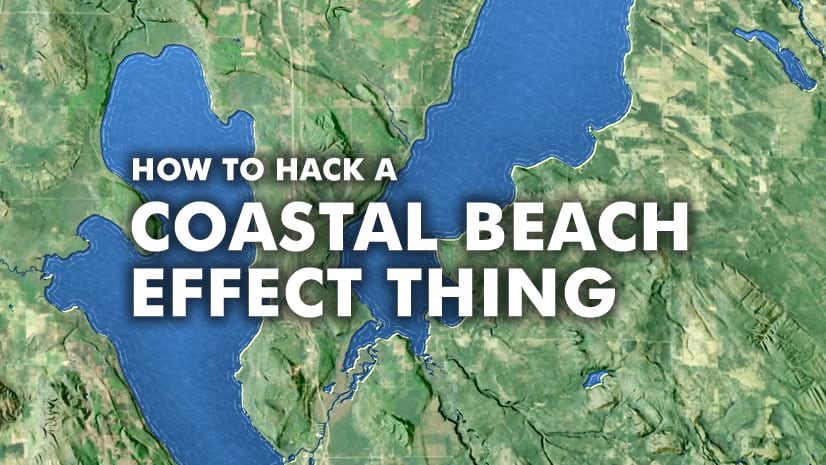
Getting this effect in ArcGIS Pro turns out to be pretty simple. Here’s the Cliff’s Notes version: Apply a horizontal hatched fill pattern to a water polygon, apply a “donut” effect so the fill pattern only renders along the perimeter, then duplicate the symbol layer increasing the donut distance and making each consecutive fill pattern finer (either thinner or more transparent). Here’s what I mean:
Now, if you look around for historical examples of this effect, you’ll likely see that the coastal rake lines are dashed, and they fall away into oblivion by transitioning to a sparser and sparser dash pattern. Well guess what, when you aren’t drawing that by hand but relying on a computer program, you get into a repeating dash effect really fast. I have a hack to alleviate that a bit, and it involves first creating a series of sparser and sparser dash patterned line styles, then applying them in a series of wide hatch patterns that stack together into a fine and regular hatch spacing. Whew. I got tired just typing that. I’ll show you how in another blog post someday. It’s cool.
In the meantime, I hope you try out one or two of the coastal rake effects demonstrated here to bring your water bodies a bit more panache!
Happy Panache-ing! John


Article Discussion: