One of the questions I see asked frequently is how to get a map that is built and designed in ArcGIS Pro, into Illustrator so a graphics design team can work on it. This is something I need to do occasionally, too, so I thought I’d share my process.
1 Build the Map Layout
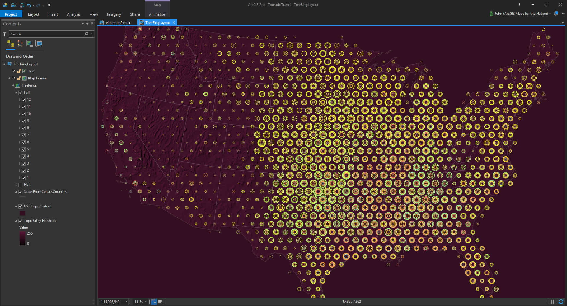
Here is a map layout of seasonal tornadoes, symbolized as stacks of graduated symbols atop a dark topographic hillshade basemap.
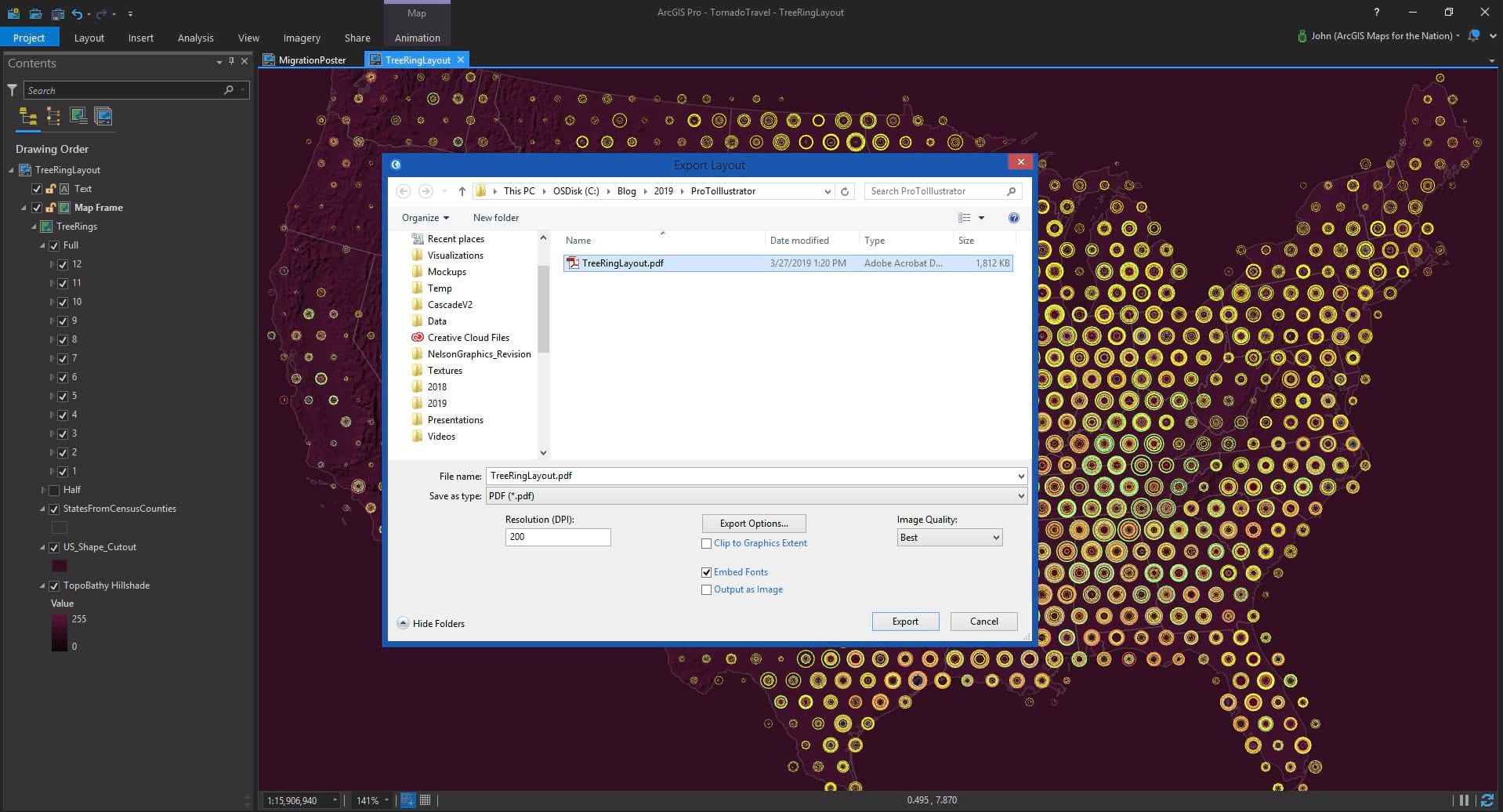
2 Export as PDF
In the share tab, there are a host of data formats available to export as. Choose PDF.
Any raster elements will be baked into the PDF as image layers, but vector layers will remain vectors. And text is honored, too, retaining the font and style.
If vector content has a style that Pro supports but isn’t supported natively in the PDF spec, it gets baked as a raster. But only if it has to.
Why no AI export option in Pro? Adobe closed the AI spec some years ago, so developing in the dark would be a dangerous game. But I’ve had nothing but success with this PDF route.
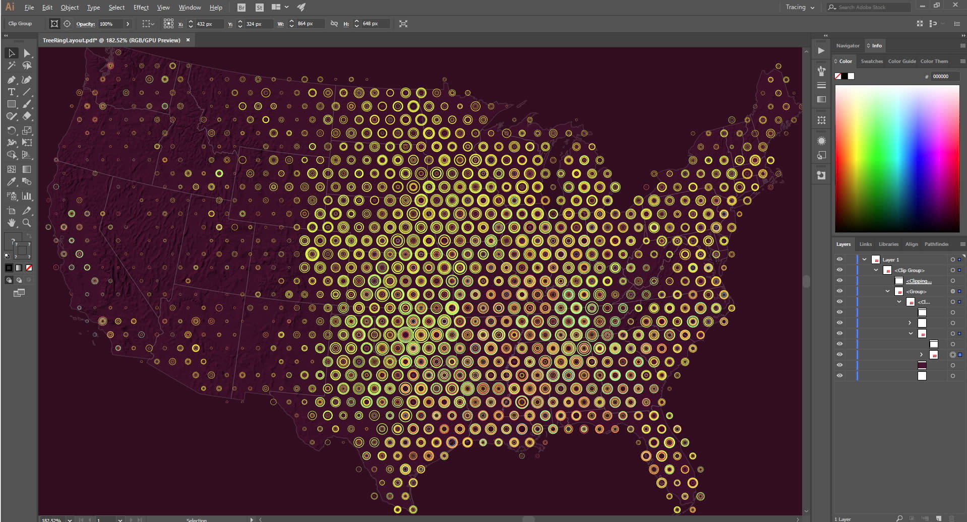
3 Open the PDF in Illustrator and Go Nuts
The PDF should look pretty solid in Illustrator. In my experience, the first order of business is to open up the layers list and dig deeeeep to find the actual content within the nested clipping masks. But I just drag them up out of the nest and tidy them up to whatever degree suits the task.
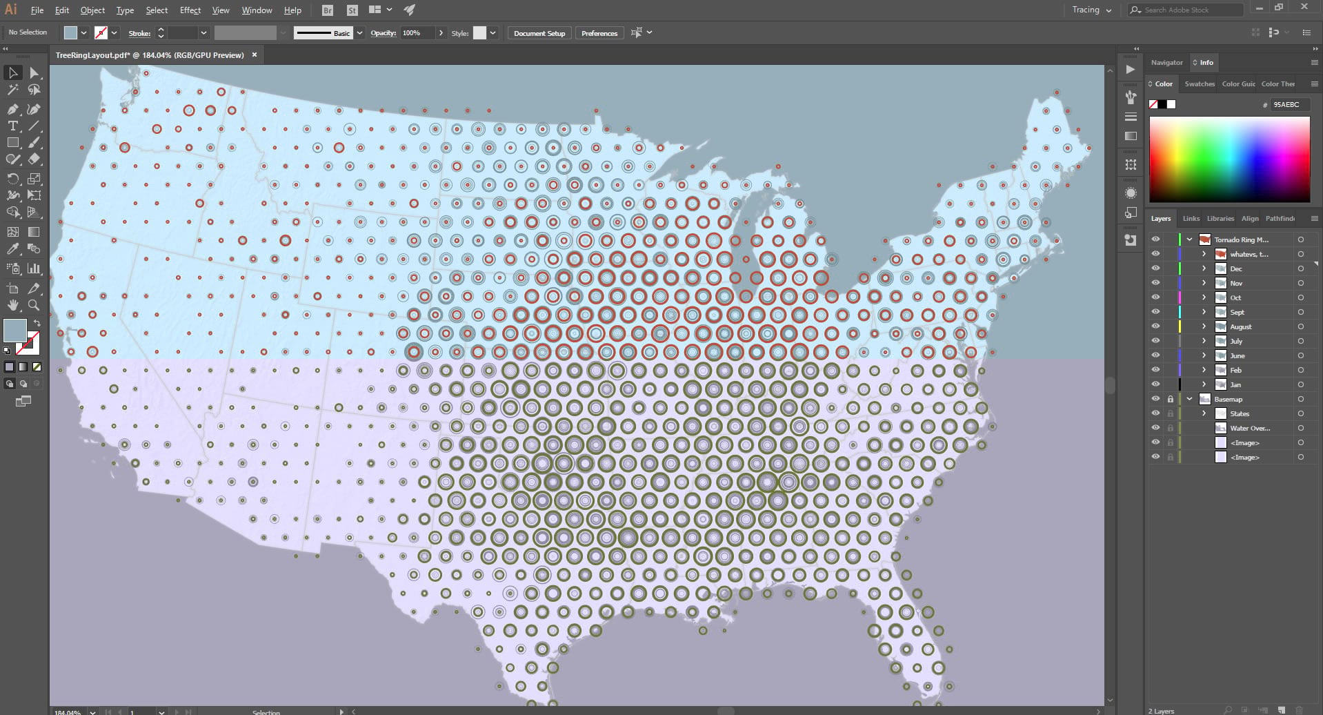
And since it’s now a living breathing Illustrator document you can do whatever it is that you want to do in Illustrator. Sometimes I use Illustrator do draw wacky legends or layer up indulgent graphic filters or assemble accompanying info graphics or do trippy things with titles or labels.
Questions You Might Be Asking
Do I really have to use Illustrator to make a finished map? Not really. About 80%-90% of the static maps I make are done so fully in Pro. The layout features and the symbology options are a total blast and often all I need to cross the finish line. But sometimes you just have/want to do some assembly and design in good old illy.
Why would you want to open/edit a map document in Illustrator if you have Pro? Many organizations have processes that involve graphic design staff, design assets, and workflows, including cranking out maps. Also, the Adobe suite is a longstanding industry leader for graphic design and its creative users are legion; they can’t all become cartographers overnight (it’s more like a six-week journey). For a print project last year that required 50+ maps, the book template, specs, palettes, and other assets were in Illustrator. I used this process and it worked wonderfully.
What about ArcGIS Maps for Adobe CC? This is a helpful tool that bridges the gap between ArcGIS Online and Adobe. There isn’t currently a connection to Pro. But word on the street is the team is working on a Pro-Adobe capability…which would totally and utterly and severely rule.
Who does John think he is? These are just my opinions, and steps that I’ve used to close the loop between Pro and Illustrator, which have turned out to be handy. I struggle to keep handy map-making tidbits to myself.
Happy Mapping! John

Commenting is not enabled for this article.