Since its launch on April 20, 2022, we have genuinely appreciated the enthusiasm our customers have shared for Esri’s direct-to-consumer storytelling solution, StoryMaps. We also understand there is a bit of confusion out there about the two storytelling offerings from Esri as we have ArcGIS StoryMaps, the professional storytelling tool and StoryMaps, the personal storytelling tool. To help, we thought we’d share a little (true) story about StoryMaps.
A bit of background
As a professional storytelling tool integrated into the ArcGIS system, Esri made ArcGIS StoryMaps in 2019 to help GIS professionals give context to their GIS work. It is not always easy for all audiences to understand what maps illustrate. However, by adding text and multimedia – like images, videos and audio – ArcGIS StoryMaps gives GIS professionals the power to create dynamic interactive content and explain their work in ways everyone can understand.
Fast forward to 2023, and there are over a million stories made with ArcGIS StoryMaps (and thousands more made every day). Interestingly, before StoryMaps was introduced, these stories were not all about GIS work. Esri noticed its professional storytelling solution was being embraced by storytellers around the world to tell their personal stories about local hiking spots, family vacations and more.
Given that these stories were being housed in organizational content – which allowed anyone in the organization to see them – Esri realized people needed a way to share engaging digital content with maps about topics important to them outside of work.
Recognizing this need would exist in others who really do not need the entire ArcGIS system, but are interested in bringing a geographic approach to their digital content, Esri decided to build a personal storytelling tool from the ground up. The result? A consumer-friendly storytelling product, StoryMaps, which looks similar to its cousin and shares similar features and capabilities. However, although they are related, they are not twins. StoryMaps is its own product with its own roadmap and its own purpose.

What’s the difference between StoryMaps and ArcGIS StoryMaps?
Both of Esri’s storytelling solutions generate engaging digital content referred to as stories. It’s also possible to combine stories under one URL referred to as a collection. From there, there are some unique differences between the two products.
1. ArcGIS StoryMaps is part of the ArcGIS system.
ArcGIS StoryMaps is for GIS professionals and is included in the ArcGIS system as an app. It allows organizations to seamlessly bring their GIS content, such as web maps and surveys, into the story builder. It’s designed to integrate with the system and requires a foundational user type to gain access to it. For more information about ArcGIS StoryMaps, please visit esri.com/arcgisstorymaps.
On the contrary, StoryMaps is built separately from the ArcGIS system. To access StoryMaps, you need to create a personal account on StoryMaps.com.

2. StoryMaps focuses on consumer-friendly features.
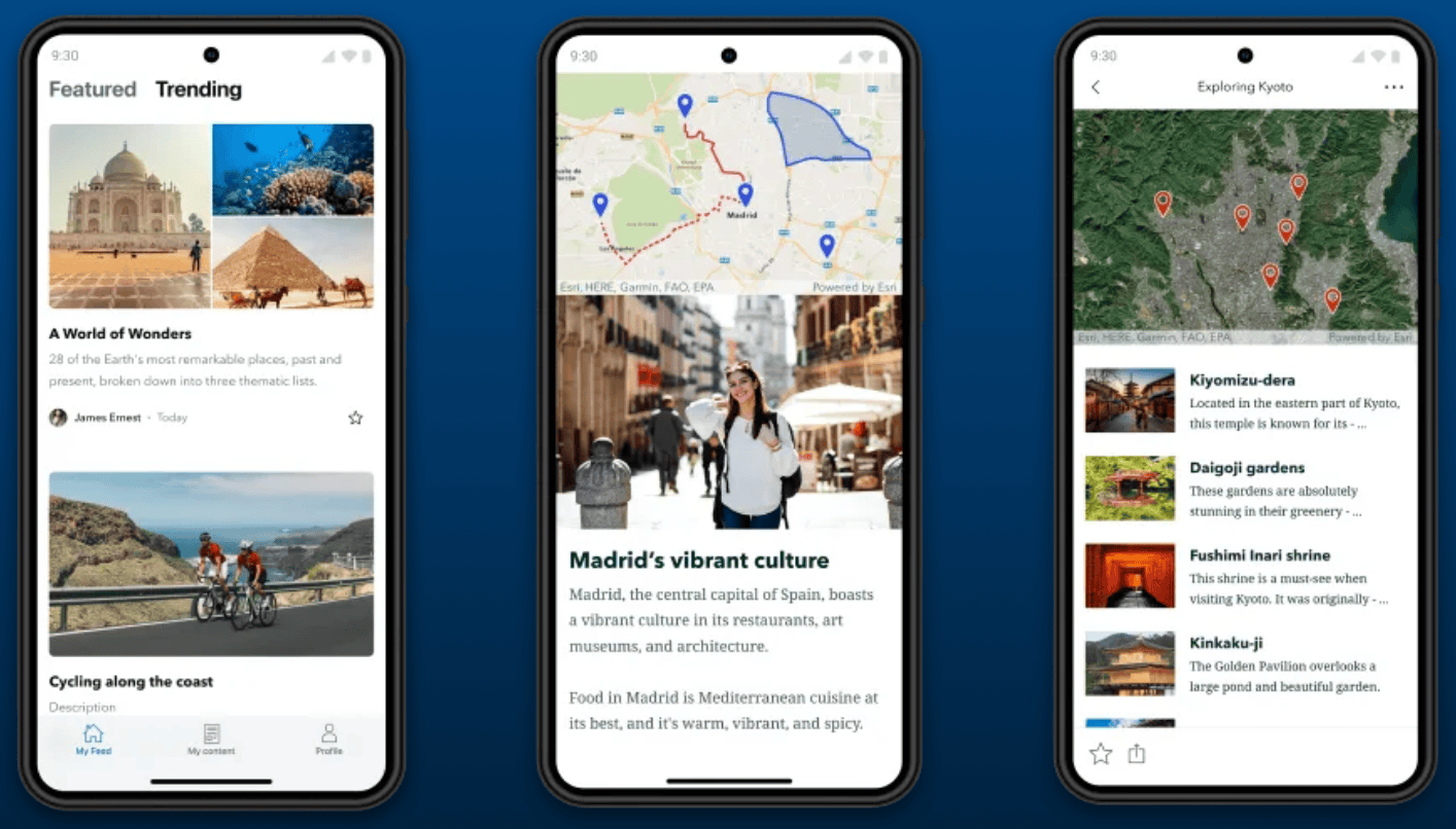
StoryMaps is truly designed to make anyone a storyteller. It’s easy to sign up with an email or with an existing ID, like Apple, Google or Facebook. It makes map-making fun and easy with interactive map tours, thematic maps, express maps, and ready-to-use maps curated from the ArcGIS Living Atlas of the World. It is also integrated with sources of existing stock content, like Giphy, Coverr and Unsplash, so people can make beautiful stories – even if they don’t own photos and videos. They can also easily access tools to improve their images like cropping them into shapes, annotating on them, and adding filters. Being for the general public’s use, StoryMaps comes equipped with capabilities people expect of shared content today including the ability to like stories and view them in a feed. You can learn more about the latest StoryMaps features on the StoryMaps YouTube channel.
3. StoryMaps has an Author Profile Page
Every StoryMaps author can create a profile so readers can get to know the writer behind the great content they’re reading. The profile page not only provides a short bio with optional social media links but also combines the author’s stories in one place.
4. StoryMaps Mobile App
Recognizing people will want to read stories on-the-go, StoryMaps offers readers an iOS and Android app. Along with reading featured, trending, and favorite stories, it’s also an easy way for authors to update their profiles. By the way, exciting things are coming to the app later in 2023. Stay tuned!
5. StoryMaps Free Account and Trial
Everyone who signs up for StoryMaps receives full access to the product and its storytelling features with a free 30-day trial of the Premium subscription. After 30 days, it’s possible to keep a free, Basic account with essential storytelling capabilities or pay to continue with the Premium subscription. ArcGIS StoryMaps requires a license and is accessed via a user type within an organization. Here are some helpful links: ArcGIS StoryMaps Pricing Page and StoryMaps Pricing Page
Though a powerful content creation tool with extensive capabilities, StoryMaps is only nine months old. As it matures, it is expected to have more of its own identity and capabilities that reflect the needs of consumers.
Story Examples
It is much easier to see the differences between the products by reading stories made with them.
ArcGIS StoryMaps Examples
See how organizations are using ArcGIS StoryMaps to give context to their professional GIS work.
StoryMaps Examples
Check out these stories to see how everyday people are using this powerful technology to provide more in-depth information about their experiences.
Common Questions
Which storytelling solution is right for me?
If you work for an organization and you are making digital content on behalf of the organization, use ArcGIS StoryMaps. It allows you to collaborate with colleagues, is integrated in the ArcGIS System allowing you to make engaging content like crowdsourced stories and aligns with your corporate software policy. With ArcGIS StoryMaps, you will most likely write about topics important to your organization’s purpose and priorities, and create reports, presentations and other work-related content.
If you’re looking for a way to create compelling content outside of work, about your family, friends and personal experiences, use the personal storytelling solution, StoryMaps. You can learn more about the two solutions on Esri.com/StoryMaps.
Can I sign up for StoryMaps with my ArcGIS Online account?
To sign up for StoryMaps, you will need a personal email address. Any existing ArcGIS Online account information will not work as that is for access to ArcGIS StoryMaps.
Is it okay to refer to ArcGIS StoryMaps by its nickname, StoryMaps?
We recognize that, in the past, people referred to ArcGIS StoryMaps as simply StoryMaps. In fact, Esri did, too. However, after completing research on the name, consumers felt it described the stories they would create well, and the name stuck. As such, Esri includes the professional prefix, ArcGIS, at every mention of the professional product, ArcGIS StoryMaps, for clarity. StoryMaps (without the prefix) will now exclusively be used for the personal storytelling solution.
Why does Esri want a consumer product?
Esri believes geographical literacy is imperative to helping humans sustain life on earth. By enabling people to share their part of the world, we can collectively understand it better and consciously consider how our actions make an impact on the planet. Esri is proud to provide a powerful content creation tool that can give everyone a voice who chooses to use it.
If you have questions, please put them in the comments below. For more information, please visit esri.com/storymaps.


Article Discussion: