ArcGIS Data products provide users with authoritative data and ready-to-use capabilities that support spatial analysis and enhance decision making. From ready-to-use premium demographic data to self-hosted data products ArcGIS Data provides a wide range of global location data meeting diverse organizational needs.
The June 2026 release introduces powerful enhancements across imagery, 3D mapping, geocoding, and data enrichment, helping you derive deeper insights, work more efficiently, and deliver richer geographic analysis. Let’s tale a look at some ArcGIS Data products that are getting enhancements this release:
Content Store for ArcGIS is an app that streamlines premium imagery access by connecting users directly to leading imagery data providers from directly within ArcGIS. This release it continues to expand its imagery offerings, now including on-demand drone imagery from Spexi alongside satellite and aerial data.
This update gives you the flexibility to:
- Zoom from large geographic projects down to small sites
- Purchase only the imagery you need, exactly when you need it
- Access ultra-high-resolution data for localized decision-making
Whether you’re monitoring infrastructure, planning developments, or analyzing change over time, drone imagery provides the clarity needed to act with confidence. Learn more in the short video below.
Google Photorealistic 3D Basemap (Preview) is a three-dimensional, photorealistic basemap using data from Google Maps Platform, available in various ArcGIS products. The Basemap addresses the growing shift from traditional 2D mapping to immersive, photorealistic 3D experiences. The basemap is now in preview and users are able to purchase additional sessions as needed via the Esri Store. Please note that a session begins when a user first opens the Google Photorealistic 3D basemap and ends when the user closes the map, or after 3 hours – whichever comes first. For more detailed information check out our blog.

ArcGIS Geocoding helps users convert addresses and place-names into coordinates and display them on a map. This release ArcGIS Geocoding will now locate the address between two known point addresses instead of between two known intersections. This is known as interpolation and is valuable as it helps users get a better location for a potential address. See the image below for reference.
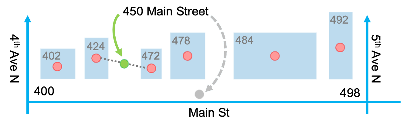
This improvement leads to better mapping accuracy, enabling more reliable analysis, routing, and operational decisions.
ArcGIS GeoEnrichment is a data enrichment tool used to quickly join existing customer data with global demographic, behavioral, and places data to obtain additional geographic context and insights. The demographics data update this release allows users to enrich the most up to date demographic, socioeconomic, spending, and business data.
These updates ensure your reports not only deliver richer insights but are also more inclusive and aligned with modern design standards. The classic Esri report style, accessed via ArcGIS GeoEnrichment has been replaced with a newer and more modern template that is Americans with Disability Act (ADA) compliant. This update impacts products that utilize the ArcGIS GeoEnrichment service to generate demographic reports, so make sure to review our blog series around this update.
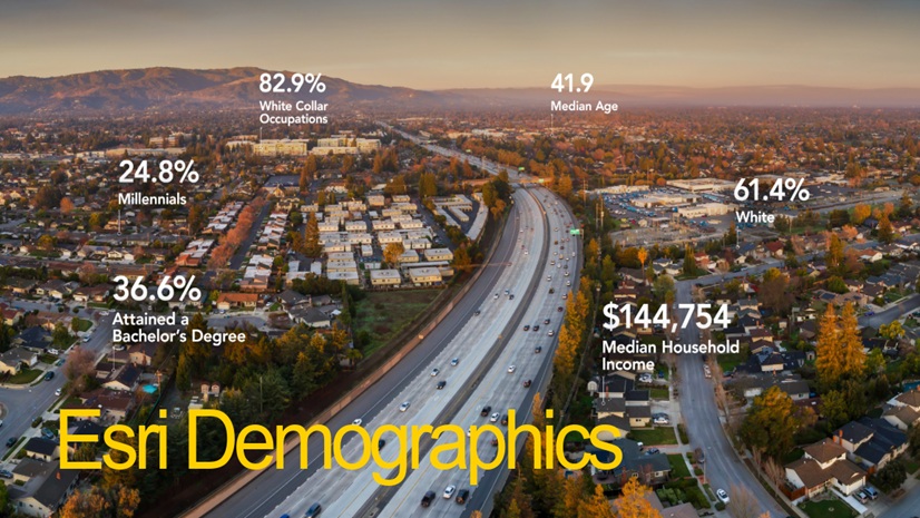
Esri Demographics consists of a comprehensive collection of demographic, socioeconomic, spending, and business data. This release brings a broad set of updates, delivering more detailed and current data to power your analysis. The following datasets were updated:
- U.S. datasets: Esri Updated Demographics, Urbanicity Type Data, ArcGIS Tapestry, Consumer Spending, Retail Demand, Market Potential, Census, ACS, Business Summary, and Crime Indexes
- Canada datasets have all been updated
- SIC Codes summaries no longer available-NAICs based business summaries available to be used in its place
- New U.S. Geography Levels: Neighborhoods, ZIP Code Tabulation Area (ZCTA), and Combined Statistical Area (CSA)
These are just a few of the Esri Demographics release items, please visit our blog to learn more.
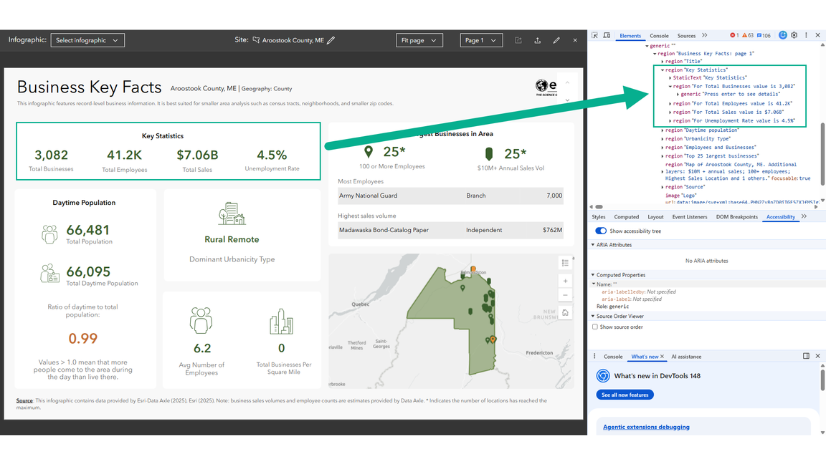
Esri Demographics Data Guides provide insight into what is possible when leveraging the Esri Demographics data sets. This release not only includes updates to the data and data-driven capabilities, but the team has completely revamped the resources available that help users understand how to use the data, how to best access it, and explains the methodology behind it. The guides dive into Esri Urbanicity Types, Daytime Population data, and Age Dependency ratios to name a few. Whether you are just getting started or looking to dive deeper into the data portfolio these data guides have resources for the full journey of your data analysis. Access these guides today.
These updates are designed to help you create richer maps, deliver more accurate analysis, and communicate insights more effectively across your organization. Learn how to access in the “Where to find ArcGIS Data” documentation.


Commenting is not enabled for this article.