Reality mapping across the ArcGIS platform continues to evolve, bringing faster processing, scalable cloud workflows, improved mission planning, and more streamlined production from data capture through delivery. This release introduces advancements across the full portfolio, alongside targeted innovations within each product. Whether you’re collecting drone imagery, processing aerial projects, or creating photorealistic 3D outputs, these updates help you work more efficiently and deliver higher-quality results.
Advancements Across Reality Mapping
Photorealistic 3D with Gaussian splats—now in the cloud
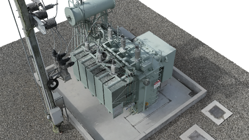
Gaussian splats continue to push the boundaries of photorealistic 3D visualization, delivering improved fidelity for thin structures, vegetation, and complex urban environments. Enhancements in this release increase accuracy and detail, resulting in even more realistic and dimensionally precise representations. These capabilities are available across ArcGIS Reality Studio, ArcGIS Drone2Map, and ArcGIS Reality for ArcGIS Pro. They are now also available in Site Scan for ArcGIS through cloud-based workflows, enabling high-quality 3D outputs without requiring dedicated GPU infrastructure.
Rapid mode for time-sensitive workflows
A new rapid processing mode enables significantly faster generation of True Orthos and digital surface models, making it possible to access actionable outputs sooner. Available in ArcGIS Reality Studio and ArcGIS Drone2Map, this capability is especially valuable for emergency response, construction monitoring, and validating datasets before full production workflows, helping teams reduce time to insight and act more quickly.
Faster performance across reconstruction workflows
Performance improvements across the platform accelerate production by enabling more concurrent processing stages and streamlining output finalization. Available across the capability, these enhancements reduce overall processing time, particularly for large or complex datasets, helping organizations move from imagery to deliverables more efficiently.
Simplifying access to reality mapping capabilities on desktop in ArcGIS
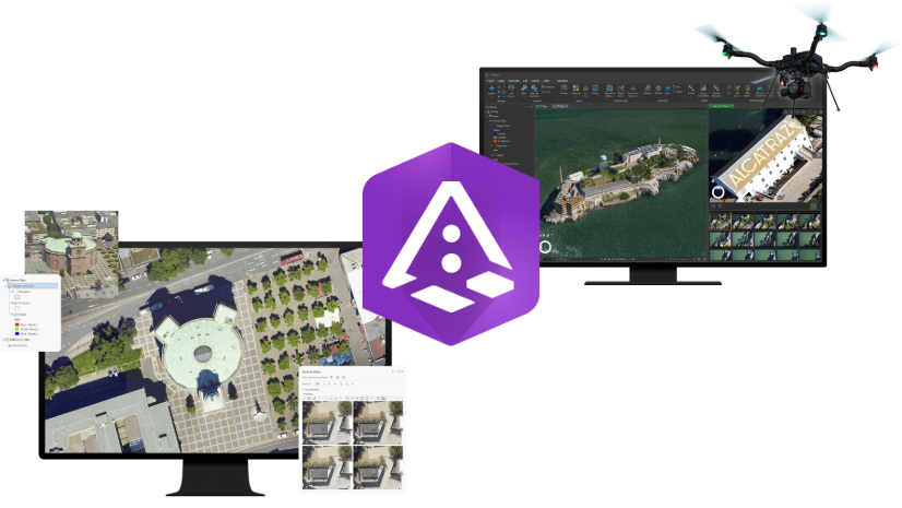
We’re introducing a new, simplified way to access reality mapping capabilities across ArcGIS, with expanded support for desktop workflows. The new Reality Mapping user extension brings ArcGIS Drone2Map and ArcGIS Reality for ArcGIS Pro together under a single user-based model, making it easier to scale across teams.
Learn more about what’s changing and what it means for your workflows in this blog.
Product Highlights
Site Scan for ArcGIS
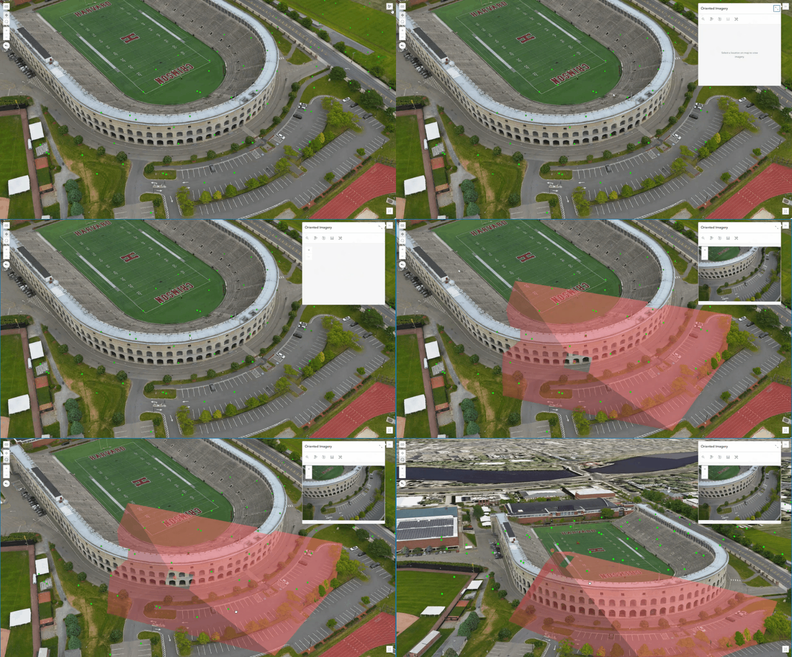
Site Scan for ArcGIS expands its ability to support larger, more data-intensive drone missions while improving how imagery is shared and used across workflows. With increased processing performance, higher limits on mission size, and the ability to publish 360° panoramic imagery as oriented imagery layers in ArcGIS Online, organizations can handle greater data volumes and deliver richer visual context for inspection, monitoring, and collaboration.
Read the full Site Scan for ArcGIS release blog to explore all updates in detail.
ArcGIS Reality for ArcGIS Pro
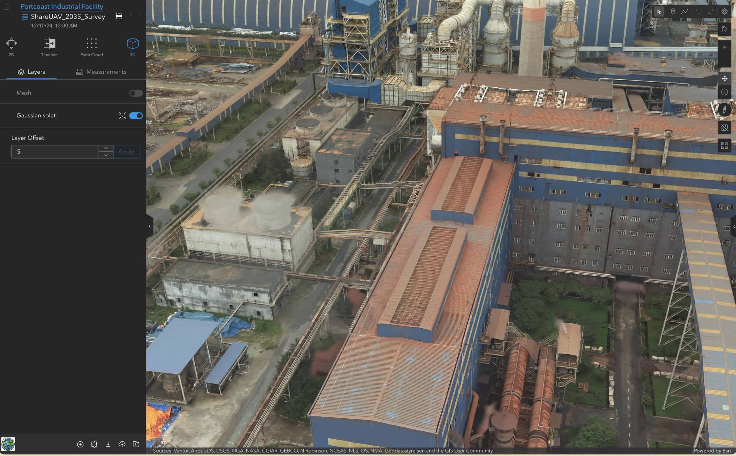
ArcGIS Reality for ArcGIS Pro introduces enhancements that improve both accuracy and efficiency while expanding supported data sources. Automated ground control point detection reduces manual effort in high-accuracy workflows, while added support for Cartosat-2 and Cartosat-3 satellite imagery enables new applications in mapping, planning, and environmental monitoring, extending reality mapping beyond drone and aerial data.
Read the full ArcGIS Reality for ArcGIS Pro release blog for more details.
ArcGIS Drone2Map
ArcGIS Drone2Map introduces improvements that streamline workflows and make high-quality outputs more accessible. With the addition of the Drone2Map Assistant (beta), enhanced support for cloud-optimized output formats, improved ground control workflows, and the ability to create and share oriented imagery layers, users can move more efficiently from data collection to analysis and sharing within their GIS environment.
Read the full ArcGIS Drone2Map release blog for complete details.
ArcGIS Reality Studio
ArcGIS Reality Studio continues to scale production workflows and improve collaborative output generation. With support for cloud-based processing, organizations can dynamically scale projects without relying on fixed infrastructure, while enhanced quality assurance workflows allow teams to review, validate, and refine results collaboratively, improving consistency and reducing rework in large-scale mapping projects.
Read the full ArcGIS Reality Studio release blog to explore all updates.
ArcGIS Flight
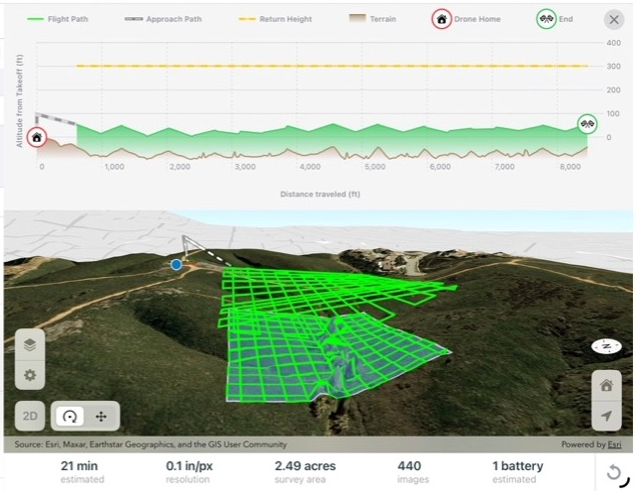
ArcGIS Flight enhances mission planning with greater control and consistency, enabling terrain-following flights using user-provided elevation data for more accurate and reliable data capture in dynamic environments. In addition, the shift to a calendar-based versioning model brings alignment with the broader ArcGIS platform, improving consistency across products and releases.
Read the full ArcGIS Flight release blog to learn more.
ArcGIS Reality Server (Beta)
ArcGIS Reality Server introduces a scalable, self-hosted approach to reality mapping within ArcGIS Enterprise, enabling organizations to generate high-accuracy, photorealistic 2D and 3D outputs across distributed environments. Designed for large-volume production, it provides the control and performance needed for organizations managing sensitive data or requiring on-premises processing at scale.
Learn more about ArcGIS Reality Server in this introductory blog and how to participate in the beta.
Bringing It All Together
This release reflects a continued investment in making reality mapping more accessible, scalable, and connected across the ArcGIS platform. By improving processing speed, expanding cloud workflows, enhancing automation, and strengthening interoperability, these updates help organizations accelerate time to insight and deliver more reliable results.
Explore each product release to see how these advancements support your workflows and how the ArcGIS reality mapping portfolio continues to evolve.
Stay Connected
If you have any questions or ideas, we’d love to hear from you! Visit the Esri Community page and let us know what you think.

Article Discussion: