
Reality mapping is entering a new era. For years, textured meshes have been the standard way to transform aerial, drone, and terrestrial imagery into immersive 3D experiences. Then came Gaussian splats, delivering photorealistic scenes that often look surprisingly closer to reality than the meshes many of us have spent years producing.
So does that mean meshes are becoming obsolete? Not quite. Both representations have strengths, limitations, and ideal use cases.
In this article, we’ll explore what makes them different, where each excels, and how to decide which one best supports your workflows.
Why are Gaussian splats suddenly everywhere?
If you’ve spent any time in the reality mapping community recently, you’ve probably seen Gaussian splats generating excitement. The reason is simple: They often look amazing.
The first time many users compare a Gaussian splat against a traditional mesh, the differences can be striking. Vegetation appears fuller, powerlines remain visible, reflective surfaces can look more natural, and complex scenes often feel closer to what someone would experience standing on site. In many cases, viewers describe splats as looking more “real” than the meshes they are accustomed to work with. These characteristics have made Gaussian splats increasingly popular for visualization, stakeholder communication, cultural heritage experiences, and other applications where realism is the primary objective.
However, visual realism is only one dimension of reality mapping. Looking convincing, supporting analytical workflows, and enabling long-term data management are all important aspects of reality capture, but different representations often emphasize them in different ways. That is where the story becomes more interesting.
What is the fundamental difference?
Think of the two products as two different ways of describing the same world. While both originate from the same imagery, they optimize for fundamentally different outcomes. Meshes represents geometry as closed surfaces, which makes them ideal for certain analytical workflows. Gaussian splats optimize for realism, detail preservation, and faithful scene representation.
Importantly, this distinction does not mean that Gaussian splats are limited to visualization or that meshes are the only option for analysis. Both representations can support a broad range of workflows, and can accurately represent the location, dimensions, and shape of real-world features; but they achieve it through fundamentally different approaches and strengths.
The difference also influences how they respond to image coverage. Both benefit from redundant observations, but Gaussian splats tend to benefit more from imagery captured across a wider range of viewing angles, as their visual quality can be more dependent on the observer’s perspective. Meshes, by contrast, reconstruct explicit surfaces and apply textures to them, resulting in a more consistent appearance regardless of viewing direction.
For best practices and optimization tips, see How to Create the Best Gaussian Splats in ArcGIS Reality.
Because meshes rely on explicit surfaces and textures, they can also maintain a stable appearance from viewpoints that differ significantly from the original image acquisition positions. Gaussian splats often excel at preserving fine details, complex structures, and view-dependent effects that are difficult to represent with traditional surface-based approaches.
Ultimately, neither representation is universally better. The most suitable choice depends on the characteristics of the scene, the intended workflow, and the outcome you are trying to achieve.
Why are meshes still the foundational for reality mapping?
Meshes remain the foundation of many reality mapping workflows because they represent reality through explicit surfaces that software can directly analyse, measure, and interact with. Behind every roof, road, bridge, and building is a structured surface that software can understand, measure, and interact with.
Organizations use meshes to measure distances and areas, extract features, perform engineering analysis, integrate with BIM models, and build digital twins. In many organizations, reality meshes become the visual and geometric foundation upon which digital twins are built, providing the real-world context needed to support analysis and decision-making.
Learn more in Reality Mapping isn’t a Digital Twin. It’s the Visual Foundation That Makes One Trustworthy and Keeps It Up to Date.
A mesh is therefore not simply something you look at. It is something you can build upon.
Meshes and Gaussian splats represent reality in fundamentally different ways. Mesh-based workflows have benefited from more years of ecosystem development, while Gaussian splats represent a newer approach whose tooling and integrations are rapidly evolving.
When are Gaussian splats the right choice?
The most meaningful way to compare reality representations is through the problems they help solve. Rather than asking which technology is better, it is often more useful to consider the types of applications and environments where each representation can provide distinct advantages.
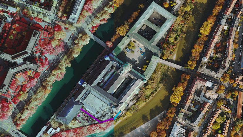
1. Vegetation and natural environments
Vegetation has always been challenging for mesh reconstruction. Overlapping branches, moving leaves, and highly irregular structures make it difficult to generate clean surfaces without losing detail.
Because Gaussian splats focus on reproducing appearance rather than explicit surfaces, they often preserve vegetation more naturally, creating fuller and more lifelike scenes.
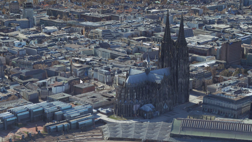
Dortmund City Center. Contributor: Aerowest GmbH
2. Small and complex structures
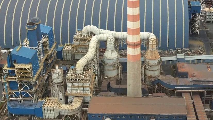
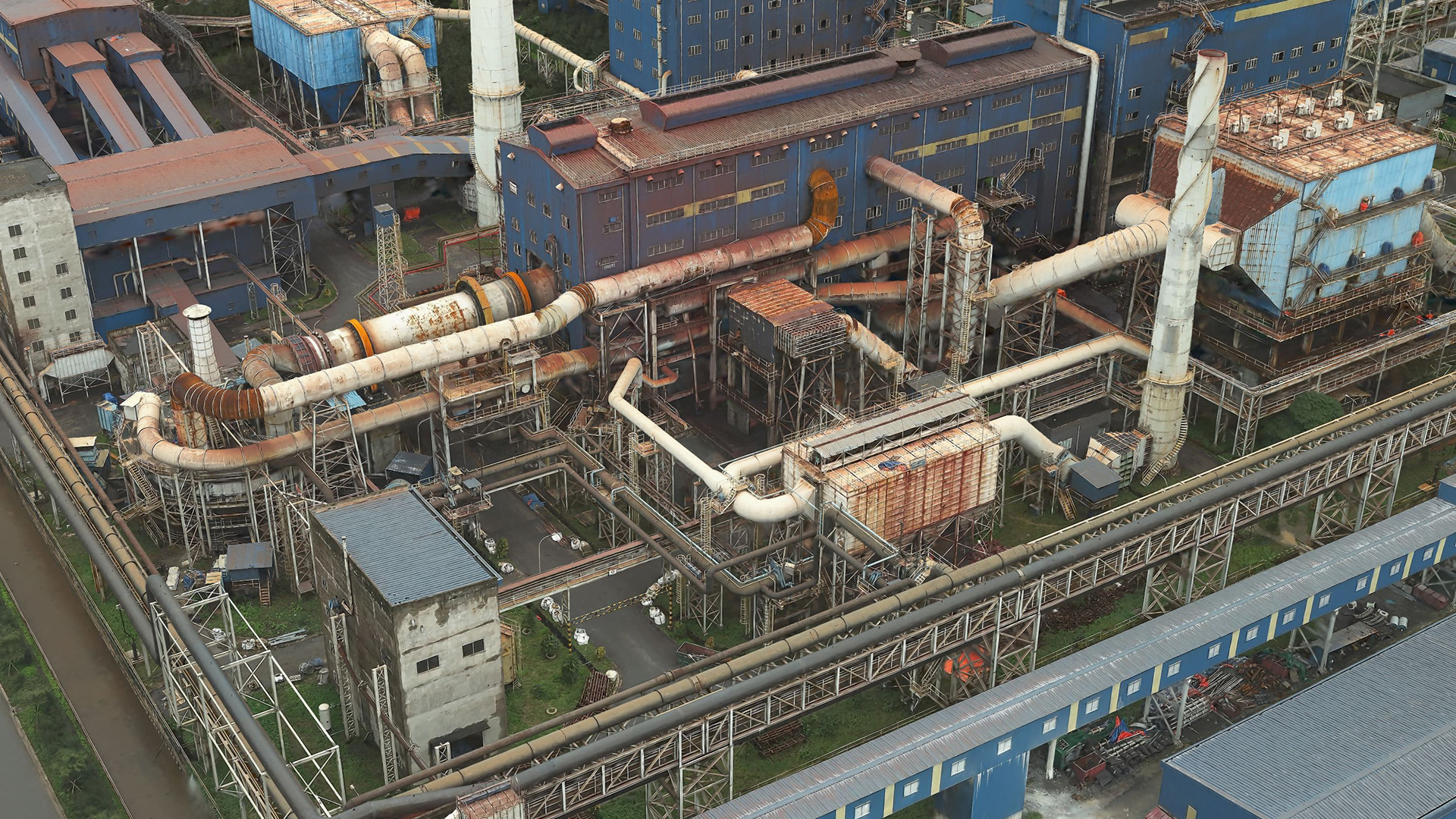
Features such as powerlines, antennas, utility infrastructure, fences, scaffolding, and complex vegetation are often difficult to represent efficiently as explicit surfaces, particularly when they occupy only a few pixels in the source imagery.
Gaussian splats frequently retain these details more successfully, making them particularly effective for utility, industrial, and telecommunication infrastructure environments.
Quang Ngai Province area, Vietnam. Contributor: Portcoast Consultant Corporation
3. Immersive experiences
When visual fidelity is explicitly emphasized, in addition to geometric precision.
Whether showcasing cultural heritage, reporting project progress, or engaging stakeholders, Gaussian splats often create a stronger sense of presence and realism.
Schloss Münster. Contributor: Con terra GmbH/ Geolyser GmbH
4. Rapid visualization
Another advantage is efficiency. Gaussian splats can represent complex, highly detailed environments with a relatively small data footprint, reducing storage and transfer requirements. Combined with the level-of-detail capabilities of ArcGIS Reality Gaussian splats, this enables fast loading and smooth visualization experiences, including over the web.
When are meshes the right choice?
While Gaussian splats excel at visual realism and continue to expand into new workflows, there are still many scenarios where meshes offer advantages due to their mature ecosystem and explicit surface representation.
1. Surface measurements
When decisions depend on surfaces, whether in construction, utilities, infrastructure, inspection, or asset management, accuracy matters as much as appearance.
Meshes provide a structured surface that supports reliable measurements, analysis, and downstream workflows. While measurements can also be performed on Gaussian splats, meshes often integrate more naturally into workflows that depend on explicit surfaces.
2. Integration with existing GIS workflows
The geospatial industry has spent years building standards, tools, and workflows around mesh-based representations.
As a result, meshes integrate naturally with 3D layers, BIM ecosystems, digital twins, and analytical GIS workflows, making them particularly well suited for enterprise deployments. Gaussian splat support is also advancing rapidly across the industry, with new tools, standards, and workflows continuing to emerge as adoption grows.
3. Editing and extraction
Need to extract buildings, generate footprints, modify geometry, or create additional derivatives? Meshes support these workflows directly.
Because many editing and extraction workflows were originally designed around explicit surface geometry, these operations are currently more mature and widely supported for meshes. As Gaussian splat ecosystems continue to evolve, new approaches and tooling are beginning to emerge.
Do you actually need to choose?
Not necessarily.
Many organizations evaluate both representations against their specific applications and workflows, often finding that each contributes unique value to the same project.
The same imagery collection can produce both a mesh and Gaussian splats, allowing each representation to contribute different strengths within the same workflow. The choice often depends less on who is using the data and more on what they are trying to accomplish.
Learn more about the advantages of splat-based visualization in 3 Key Benefits of Gaussian Splat Layers.
Digital twins provide an excellent example. A city, campus, or infrastructure digital twin may use a mesh as the authoritative geometric foundation for analysis, measurements, simulations, and integration with GIS or BIM data, while simultaneously using Gaussian splats to preserve visual detail, communicate context, and provide highly realistic representations of the environment.
Rather than replacing one another, the two technologies complement each other remarkably well. Meshes continue to underpin many established reality mapping workflows, while Gaussian splats are rapidly gaining adoption as new tooling, standards, and capabilities emerge across the industry.
Future workflows may increasingly combine both representations for different parts of the same environment. Buildings and terrain may benefit from explicit mesh surfaces, while vegetation, utility infrastructure, and other complex features may benefit from Gaussian splat representations.
The future is not meshes versus splats: It is meshes and splats together.
How do you choose the right representation?
While every project is different, the following guidance can help you decide which representation may be the best starting point for your workflow:
Consider Gaussian splats when you need to:
- Preserve complex vegetation and canopy detail
- Inspect powerlines, antenna towers, or other thin structures
- Create immersive visualization experiences
- Capture reflections, transparency, and view-dependent effects
- Rapidly produce highly realistic scene representations
Consider meshes when you need to:
- Perform volume calculations and surface-based analysis
- Support flood modelling and other workflows requiring continuous surfaces
- Extract features, footprints, or additional derivatives
- Integrate with established GIS, BIM, and engineering workflows
- Model buildings, terrain, and other solid structures used in simulations
Consider both together when you need to:
- Build digital twins
- Support stakeholder engagement and engineering analysis in the same project
- Combine realistic visualization with authoritative geometry
- Model environments containing both solid structures and complex vegetation
- Maximize the value of a single imagery collection
This is only a starting point. The most effective workflows increasingly use meshes and Gaussian splats together, leveraging the strengths of each representation where they provide the greatest value.
Experiment and stay connected
In ArcGIS Reality, the same imagery collection can generate both meshes and Gaussian splats, allowing you to evaluate each representation against your own requirements and workflows.
Whether your priority is measurement, analysis, digital twins, stakeholder communication, or immersive visualization, the best way to understand the strengths of each approach is to experience them side by side.
To learn more about ArcGIS Reality, you can visit our product page and check the resources. Contact us for more information.
If you have any questions, ideas or simply want to share the results of your experiments, we’d love to hear from you! Visit the Esri Community page and let us know what you think.

Are the Quang Ngai Province area scenes reversed?