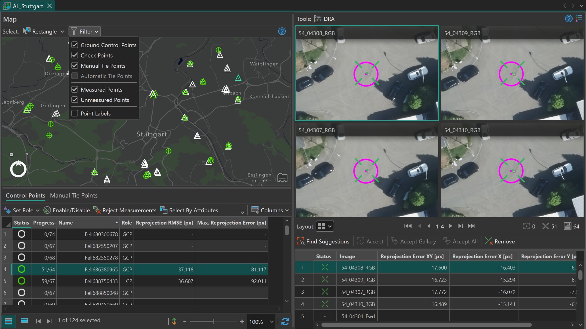
The Image Measurement Tool in ArcGIS Reality Studio
Data courtesy for all images in this article: City of Stuttgart and GeoFly GmbH
This article explains why control points are key to survey-grade accuracy and how the Image Measurement Tool in ArcGIS Reality Studio helps you measure and manage them more efficiently.
Why do I need control points for survey-grade accuracy?
Photogrammetry allows large areas to be mapped efficiently. After capture, however, one of the most time-consuming steps is measuring ground control points (GCPs) and check points (CPs). Despite the effort, this step is important for ensuring accurate results and facilitating a thorough quality assessment.
During bundle block adjustment, overlapping images are aligned relative to each other. This results in strong internal consistency, meaning the geometry within the dataset is precise. However, the absolute accuracy of the subsequent reconstruction depends on the quality of the input trajectory, that is, the camera positions and rotations during image capture. If this information is not sufficiently accurate, the entire block may be shifted or misaligned in real-world coordinates. Ground control points anchor the block to accurate known coordinates and ensure correct absolute positioning.
Control points also enable quality assessment. By defining some points as check points, you can independently evaluate the accuracy of your aligned results. As their 3D coordinates are not used during the adjustment, their 3D residuals (the difference between known and estimated positions) provide a clear and unbiased indication of how well the model fits reality.
In multi-flight projects, ground control points also connect separate image blocks into one consistent result. Shared control points allow these blocks to be connected and aligned, creating a consistent overall result and helping compensate for systematic effects.
How can I measure control points efficiently?
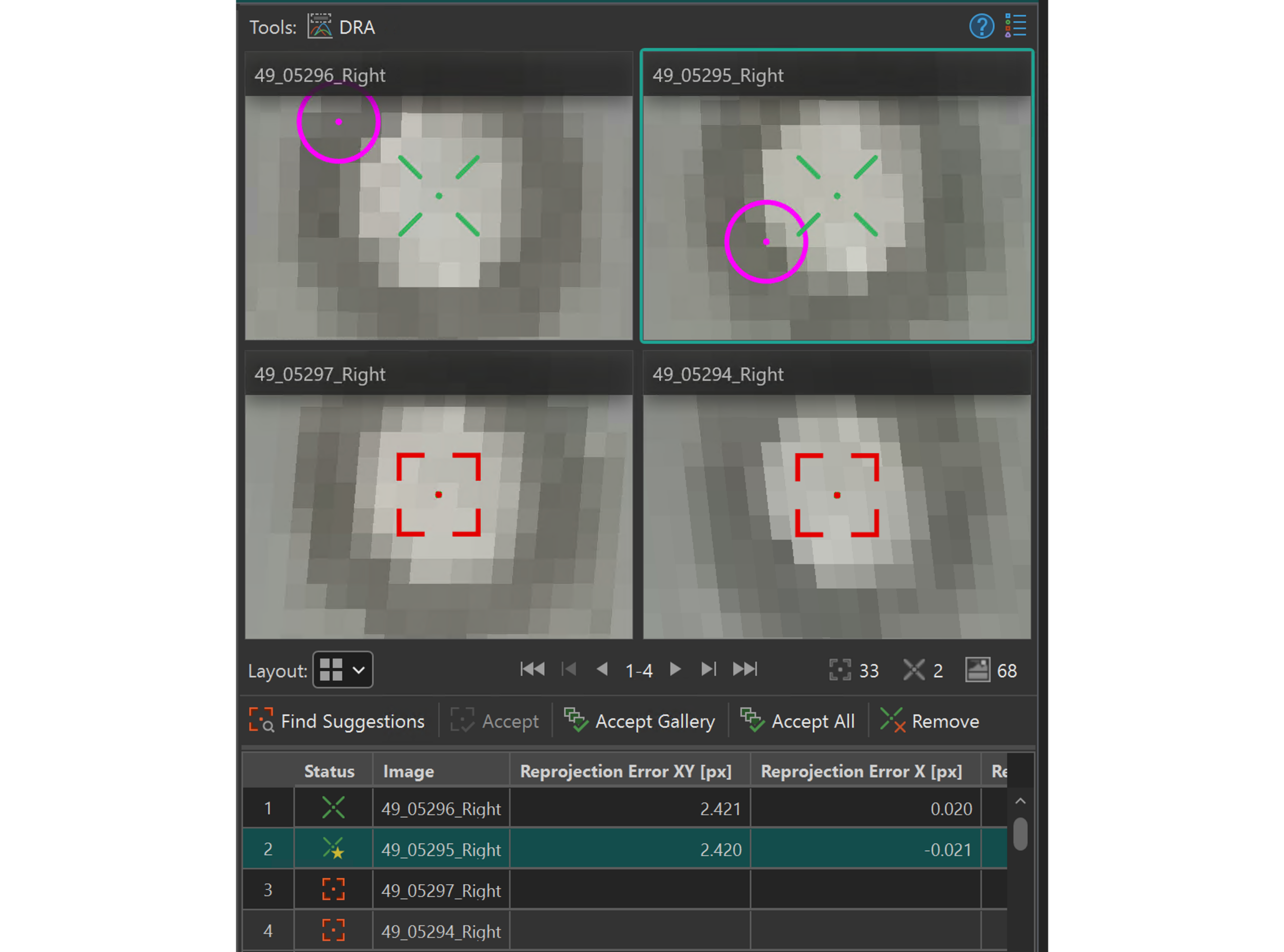
Each control point must be measured in multiple images to link its real-world coordinates with pixel positions. While two measurements are sufficient to triangulate a point, additional observations improve robustness – especially when captured from different viewing angles.
In practice, measuring the same point across many images can quickly become the most time-consuming part of the workflow.
To support this, the Image Measurement Tool in ArcGIS Reality Studio provides point suggestions. After measuring a point in two or more images, the tool suggests its location in additional images. This reduces the need for manual search and speeds up the process significantly.
Performing an initial alignment in advance enhances both the quantity and reliability of point suggestions, as the optimized camera positions provide a stronger foundation for accurate predictions.
How does the map support point management?
Accurate georeferencing depends not only on precise point measurements but also on a well-planned spatial distribution of ground control and check points. Being able to evaluate this distribution early in the workflow is key.
The Image Measurement Tool introduces a map-centric approach that helps you do exactly that.
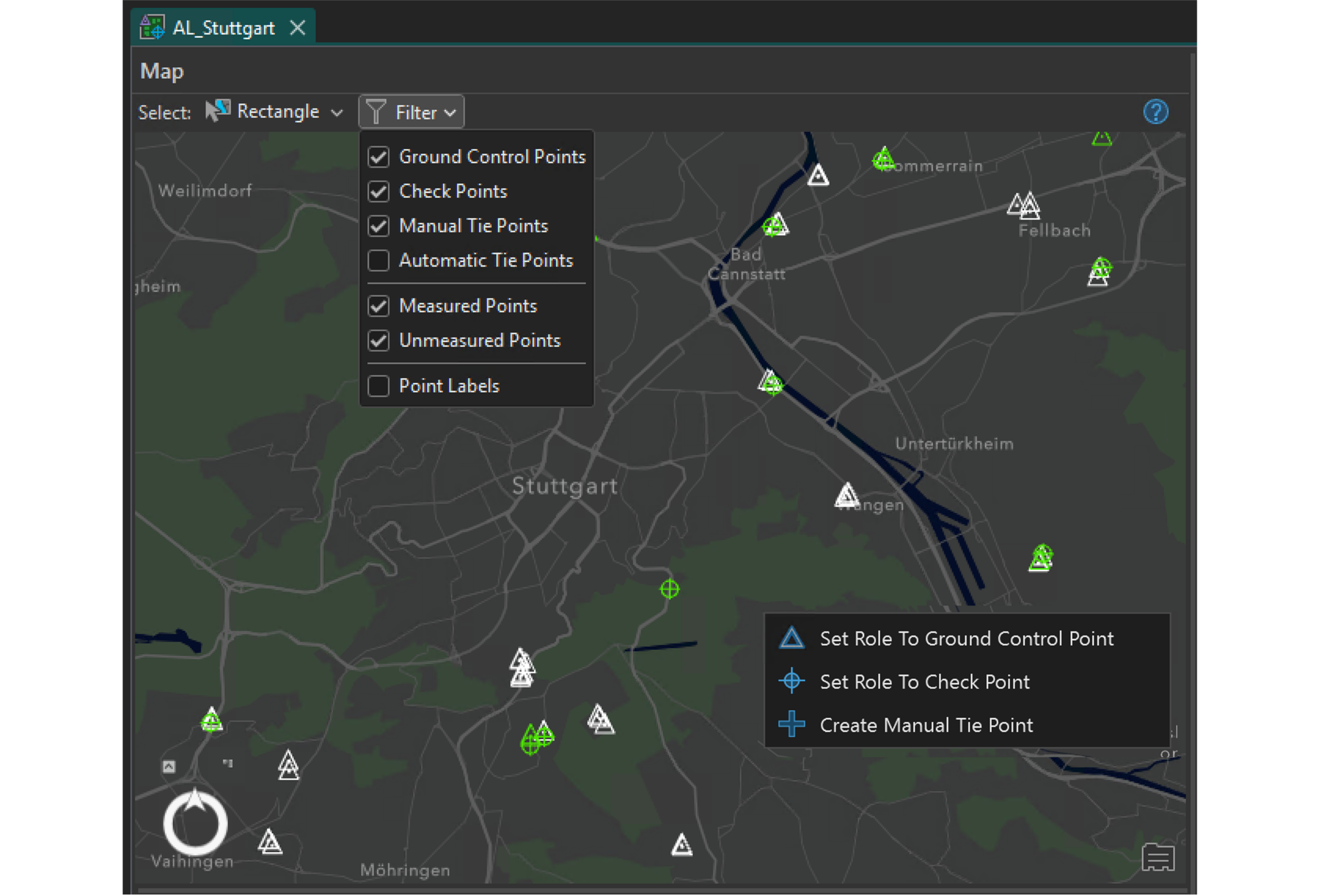
From the map view, you can select, filter, and create points directly within the project area. Once a point is selected, you can immediately measure it in the images. This connection between map and image space helps you quickly decide where additional measurements are needed. The map centric user interface helps to achieve a good spatial coverage across the entire project while keeping the measurement process efficient.
Filtering options support a quick assessment of how ground control points and check points are distributed. A well-balanced set of ground control points contributes to stable georeferencing, while evenly distributed check points allow for meaningful accuracy evaluation across the full extent of the dataset.
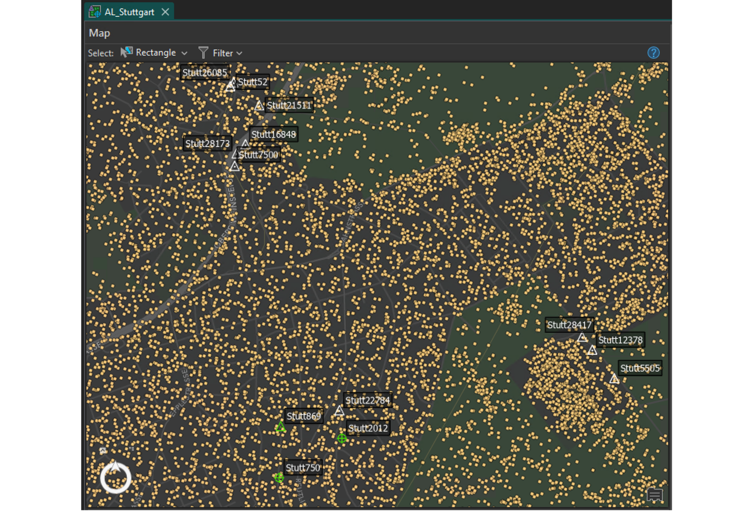
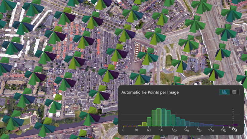
By visualizing the automatic tie points generated during the Alignment, the map also helps identify areas with weak connection. In such regions, you can create manual tie points – points without known field coordinates – that strengthen the block by adding image observations where automatic tie points are sparse.
How can I evaluate measurement quality?
Points’ measurement quality and distribution directly influence the accuracy of the alignment and of the derived final outputs. Understanding and interpreting this quality is therefore an important step in the workflow.
The Image Measurement Tool provides these indicators to identify inconsistencies or gaps in the dataset and guide further refinement:
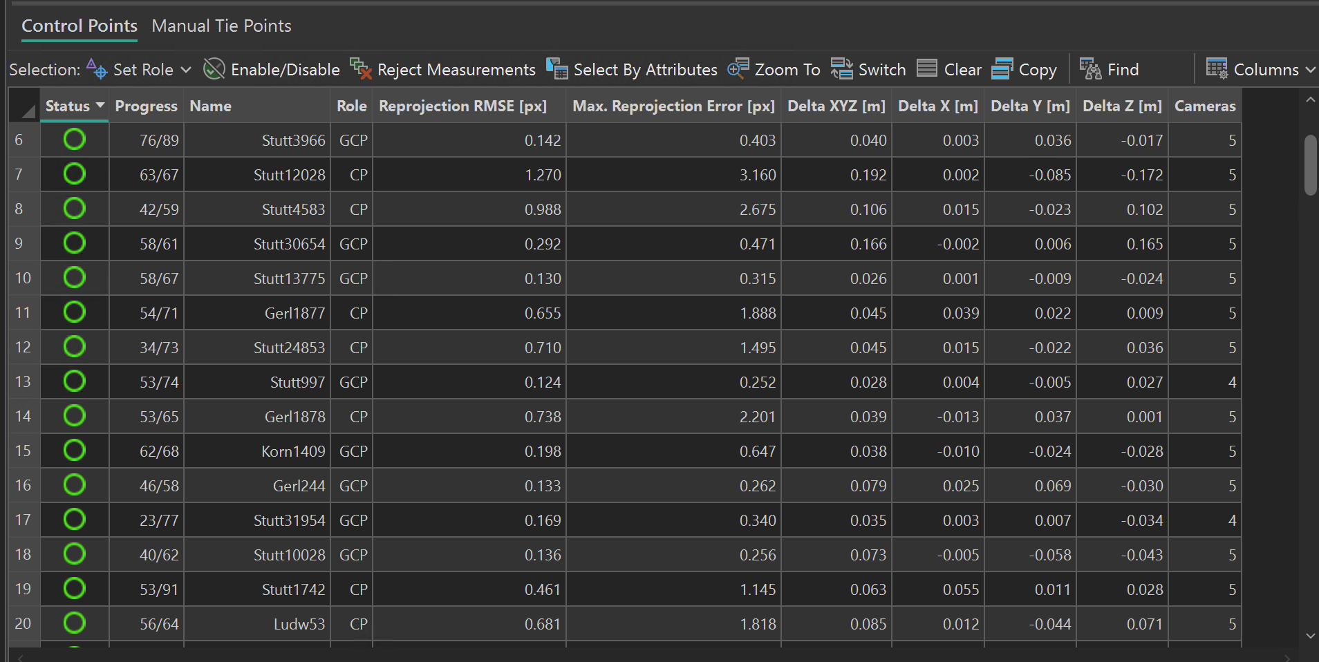
- Reprojection error describes how well a 3D point fits its observed image positions. It is calculated as the difference between the measured pixel location and the projected position of the reconstructed 3D point back into the image. Higher values (e.g. above 2 pixels) often indicate inconsistent or imprecise image measurements.
- 3D residuals represent the difference between the known real-world coordinates of a point and its estimated position after adjustment. They provide a direct measure of positional accuracy in object space.
- Point distribution on the map reflects how well ground control points and check points are spread across the project area. A balanced distribution is essential for a stable and reliable solution.
A high reprojection error may suggest revisiting image measurements for that point, while large 3D residuals can indicate issues with point accuracy. An uneven spatial distribution of points may highlight areas where additional control points or manual tie points are needed to stabilize the solution.
Key benefits of the Image Measurement Tool
Control points remain essential for achieving survey-grade accuracy, but they have traditionally required significant manual effort. The Image Measurement Tool in ArcGIS Reality Studio streamlines the measurement process and improves both efficiency and quality.
Key benefits include:
- Faster measurements through intelligent point suggestions, reducing manual effort across images
- Map-based point management that allows you to create, filter, and evaluate control and check points directly in spatial context
- Better control over spatial distribution by visualizing point coverage and identifying gaps early in the workflow
- Informed decision-making with clear quality indicators such as reprojection errors and 3D residuals that guide refinement and ensure reliable and accurate results
Together, these capabilities make measuring and managing control points more efficient, transparent, and scalable – helping you achieve accurate and consistent reality mapping results with less effort.
Get started with the Image Measurement Tool
For a step-by-step introduction to the workflow, explore this video series that goes through everything covered in this article!
For a detailed written overview, you can check out the ArcGIS Reality Studio documentation as well.
To learn more about ArcGIS Reality, you can visit our product page and check the resources. Follow us on LinkedIn to receive recent development updates on Esri’s Reality products.
If you have questions, suggestions, or would like to share your experiences and results, we would be happy to hear from you. Join the conversation on the Esri Community page and let us know your thoughts.


Article Discussion: