The 2022 Esri User Conference is just around the corner and the ArcGIS CityEngine team can’t wait to be there in person for Esri’s first ever hybrid UC! Whether you plan to join us in San Diego or tune in online, we’ve got tons of exciting ArcGIS CityEngine content coming your way. Read on for a complete list of sessions, activities, and info on how to meet the CityEngine team.

ArcGIS CityEngine: Advanced Design
- Wednesday, Jul 13, 8:30 AM – 9:30 AM PDT
- Session Type: Technical Workshop (Intermediate)
- Access Type: In-Person, Recorded (recording available August 11, 2022)
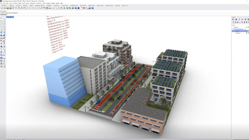
ArcGIS CityEngine is a powerful tool for generating urban systems’ 3D content, but the effectiveness of the tool relies very much on the quality and depth of useful information provided by your data. In this session you will learn how to leverage advanced procedural tools to elevate your designs and how to take advantage of the connections to ArcGIS Urban to support planning workflows.
Add this session to your calendar
ArcGIS CityEngine: Integrating with Other Systems
- Wednesday, Jul 13, 2:30 PM – 3:15 PM PDT (5:30 PM – 6:15 PM EDT)
- Session Type: Demo Theater Presentation (Advanced)
- Access Type: In-Person
ArcGIS CityEngine is an advanced modeling software that can be used in conjunction with other tools to enhance 3D workflows. This session will provide an overview of how to leverage the power of Twinmotion, Game Engines and NVIDIA Omniverse, and how to take advantage of CityEngine Plugins as well as PyPRT, a Python binding for CityEngine Procedural Runtime.
Add this session to your calendar

Immersive Collaborative Urban Planning
- Wednesday, Jul 13, 11:15 AM – 12:00 PM PDT
- Session Type: Demo Theater Presentation (Intermediate)
- Access Type: In-Person
With advances in graphics hardware and software, game engine technology is being applied in numerous domains, including GIS, to provide users with immersive, interactive, and visually compelling experiences to explore data. In this session, the presenters will discuss workflows for consuming content from ArcGIS Urban into Virtual Reality (VR) to explore and share urban plans and BIMs through interactive experiences.
Add this session to your calendar
ArcGIS: Leveraging Extended Reality (XR)
- Thursday, Jul 14, 2:30 PM – 3:30 PM PDT (5:30 PM – 6:30 PM EDT)
- Session Type: Technical Workshop (Advanced)
- Access Type: In-Person, Recorded (recording available August 11, 2022)
Attend this session to get an overview of Esri’s vision on how extended reality applies to GIS. We’ll discuss how Esri technology can used to power augmented reality (AR) and virtual reality (VR) experiences across a variety of industries. We’ll also demonstrate how GIS data can be use with game engines, Unity and Unreal Engine, to create immersive AR/VR experiences on mobile devices and headsets such as Microsoft HoloLens and Oculus Quest.
Add this session to your calendar
ArcGIS Urban: An Introduction
- Tuesday, Jul 12, 2:30 PM – 3:30 PM PDT
- Session Type: Technical Workshop (Intermediate)
- Access Type: In-Person, Recorded (recording available August 11, 2022)
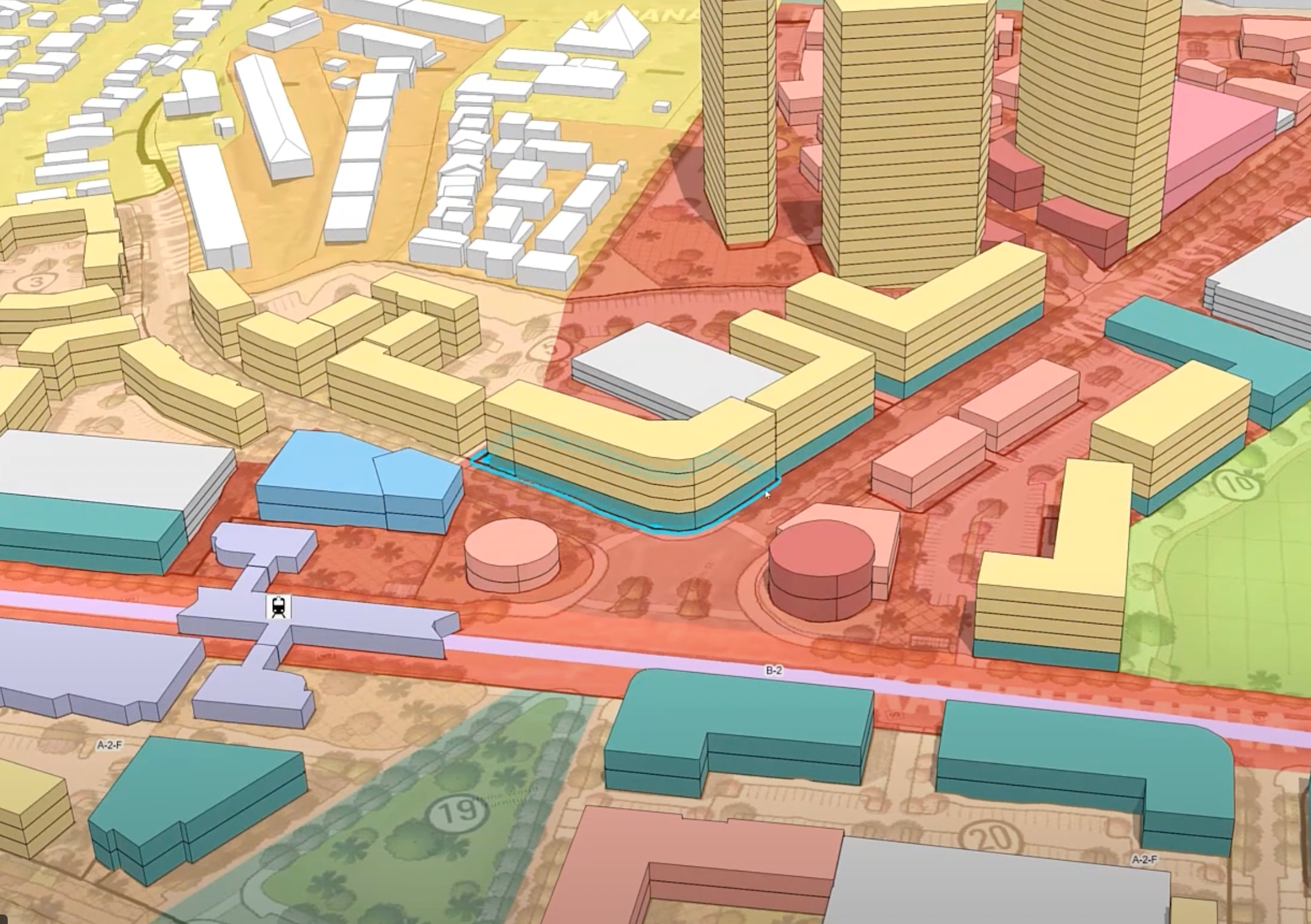
ArcGIS Urban is a web-based 3D scenario planning tool for creating land use and zoning plans, and keeping track of development updates within a digital twin of your city. Traditional processes are being reorganized and every aspect transferred to online platforms. The “mainstreaming” of geospatial tools to enable adaptation and scenario planning work best if integrated into the everyday planning practice. Attend this session for an introduction to ArcGIS Urban, its latest released features and how to get started with it in your own community.
Add this session to your calendar
Don’t forget to check out the other ArcGIS Urban UC sessions!
Stop by and say hi!
And finally, for those who are attending UC in person this year, don’t forget to visit us at the ArcGIS CityEngine booth on the Expo floor! We’ll even have exclusive ArcGIS CityEngine buttons and stickers! You can also book meetings (both in person or online) with the ArcGIS CityEngine team:
- Schedule a meeting with Taisha Fabricius – Product Manager, ArcGIS CityEngine
- Schedule a meeting with Dominik Tarolli – Director, Smart Cities
If you haven’t already, be sure to register for UC now!
To learn more about ArcGIS CityEngine, visit our website or sign up for a free 21-day trial. And don’t forget to follow us on Twitter to take part in the #EsriUC conversation!


Article Discussion: