Previously on “Do it! Incorporate XR into your workflows”…
If you haven’t yet read my first blog post on this topic, then please do so here.
_______________________________________________________________________________________________________
Now where did we leave off? Ah yes, I was telling you that XR is really useful and that you should think about bringing it into your workflows.
You should totally do that and here are some areas where you can…
Urban Planning
As the rate of urbanization continues to increase rapidly, we’re confronted with the fact that it will become harder and harder to design, build and manage cities and population growth.
You don’t need to be an urban planner or Batman to realize that urban centers are becoming more densely populated. This fuels demand for services like housing, transportation, water, energy etc.
…aaaand to top it all off, climate change is forcing cities to increase their commitment to sustainability and resilience, while looking after our planet and reducing harm to the environment. I think we can agree that things are changing and urban planning is becoming more crucial than ever.
By using XR, we really do have the opportunity to change the urban planning “status quo” and provide cities and stakeholders with a toolset that can support them in decision making. City planners can show off their plans for future developments or even present the current progress of a project.
A really huge plus though, is that VR can turn complicated things like architectural designs or engineering plans into user-friendly forms that are more easily understandable by everyone.
Using VR experiences to visualize future projects essentially brings everyone onto the same page and helps to form a common understanding.
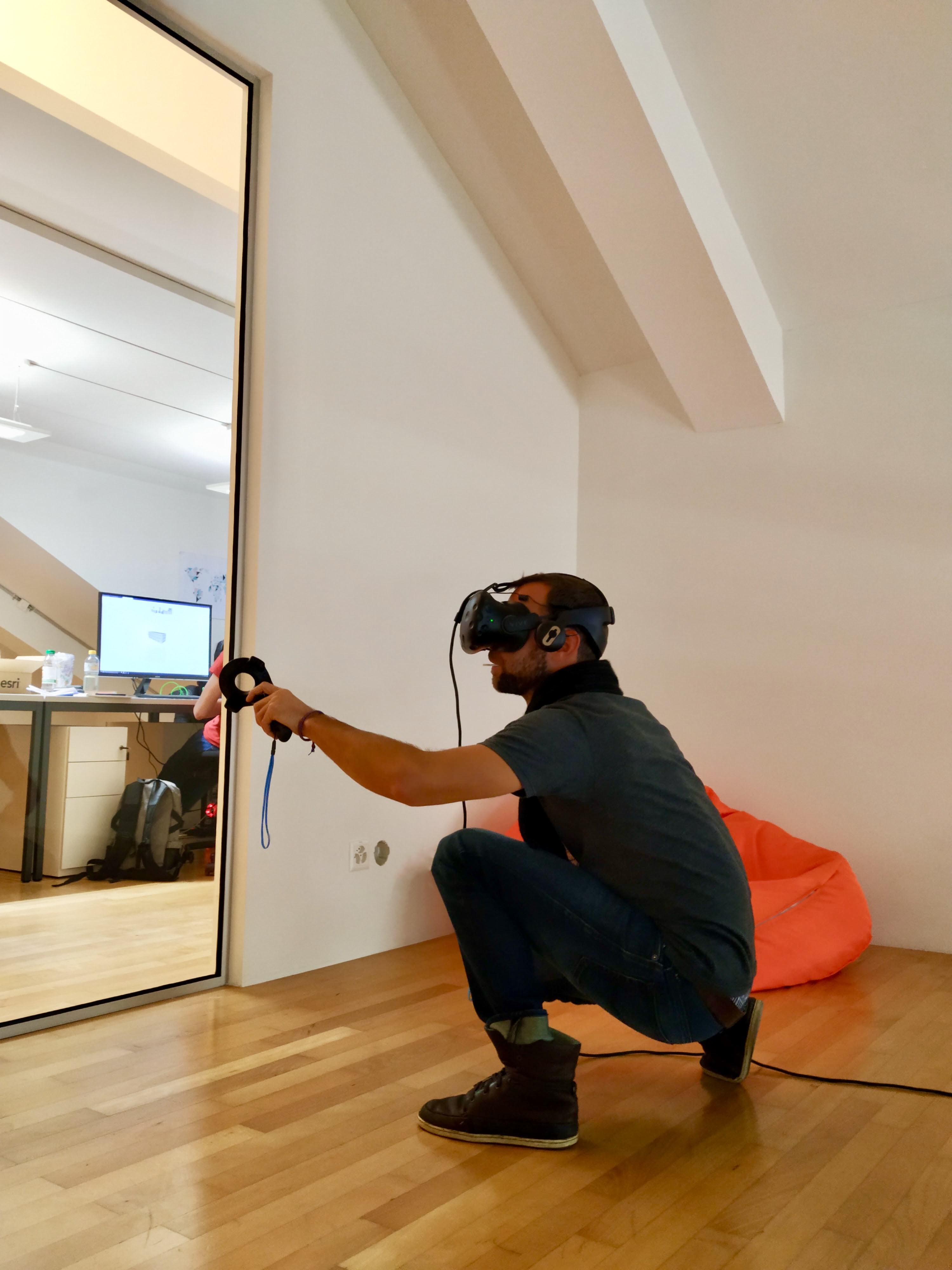
Imagine a place where people can put on a VR headset and be immersed into an urban development scenario. They could stand on the street and experience first-hand what impact a project might have on their city (or even on their own lives!).
Right now here in Zürich, people are voting on whether or not a new football stadium should be built. If there was a way to view this proposal in VR, then I think a lot of questions could be answered more easily.
Not only can valuable feedback be gathered this way, but it also leaves a lot less room for misinterpretation.
Here at Esri, we have created a couple of different ways to do just this.
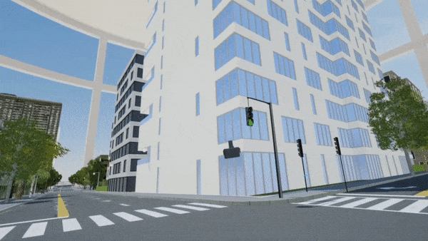
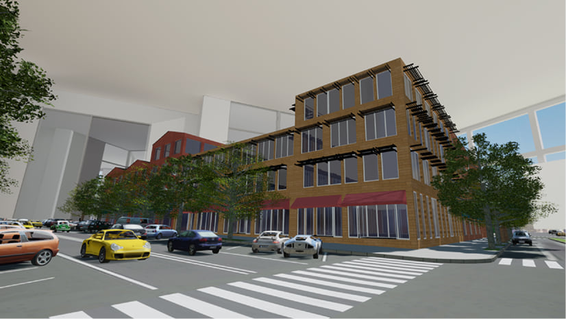
CityEngine VR Experience
One option we have is an out-of-the-box VR Experience for urban planning. We partnered together with Epic Games for this one. They are the creators of Unreal Engine, one of the leading Game Engines (and the guys behind “Fortnite”).
We built a free template into which you can easily import your CityEngine cityscape so that you can view and interact with it in VR.
That’s all you need to do: Export from CityEngine and import into the VR Experience. The VR functionality, look and feel and ease-of-use is provided for you through the template.
You’re left with a beautiful version of your proposed urban development placed on a table in a virtual office.
If you want to find out more about this, then you can do so by reading this blogpost.
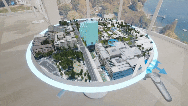
ArcGIS 360 VR
You can also take your urban designs into VR is by using the ArcGIS 360 VR solution.
This experience requires nothing more than a Samsung Gear VR headset (which is retailing at the moment for around 120 USD —> one of the cheapest VR headsets out there!) and an Android phone (…and even these requirements will change soon, I’ll keep you posted). The fact that you have no cables and nothing making you go out and buy a new fandangled (a word us Australians like to use for “fancy”) computer, means that you can take this VR experience anywhere.
This VR solution provides you with the ability to travel around static view ports (static means that you are stationary) in your scene and switch between different building proposal scenarios. You can get the ArcGIS 360 VR solution here.
On the one hand, a truly valuable advantage of presenting design proposals in VR is the fact that you can easily switch between multiple proposed developments based on different development scenarios (this means that there is so much more flexibility and also allows for on-the-fly changes!) and on the other hand, its more cost and resource effective compared to more traditional methods (imagine you had to build physical models of each proposal!).
Besides, the immersive experience really beats just looking at nicely rendered stills.
Get started
If you have a copy of CityEngine and have not already tried to incorporate VR into your workflows, then I highly recommend trying out one of our solutions…it’s such an easy introduction into the VR world!
If you don’t have a copy of CityEngine yet, then you can download a free 30 day trial from here.
Oh yeah, and get excited for the next blogpost and my announcement!
In the meantime, here’s a tiny sneak peek…do you notice anything special in this picture?

Commenting is not enabled for this article.