This article is about the RenewMI Project Viewer from the Experience Builder gallery. Part of the Get inspired with ArcGIS Experience Builder series.
- The need for remediation work
- RenewMI Project Viewer
- Interview with Kate Berg and Jeff Hukill
- Exercise: Design a layout in ArcGIS Experience Builder
- Exercise: Optimize an app layout for mobile
- More information
The need for remediation work
ANN ARBOR, MICHIGAN – In November 2023, the US Environmental Protection Agency (EPA) determined that the Gelman Sciences hazardous waste site is eligible to become a federal Superfund site because of significant threats to human health and the environment. The plume, which encompasses four square miles under Ann Arbor and Scio Township, is contaminating local groundwater with 1,4-dioxane, a compound that Gelman Sciences, Inc. used to manufacture medical filters from 1966 to 1986. The compound can harm the eyes, skin, lungs, liver, and kidneys, and may also cause cancer according to the Centers for Disease Control and Prevention.
Across the United States, there are thousands of properties contaminated with hazardous chemical waste. These sites include leaking underground storage tanks, abandoned mines, retired factories, and more. Many are the result of decades of accidental or intentional polluting.
At the federal level, the EPA’s Superfund program aims to clean up some of America’s most contaminated land. “Superfund” is the colloquial name of a law passed by Congress in 1980 that gave the EPA the authority to force responsible parties to either clean up their sites or re-imburse the government for remediation work. If no responsible party exists, which is the case for many sites where companies went out of business decades ago, the EPA can fund the cleanup.
According to the EPA, 73 million people, or roughly 22% of the US population, live within three miles of a Superfund site. Black Americans, Asian Americans, Hispanic Americans, Americans living below the poverty line, and Americans with less than a high school education are all disproportionately likely to live within three miles of a Superfund site, making Superfund sites a critical environmental justice issue.
RenewMI Project Viewer
Michigan is one of the many US states investing in cleaning up contaminated land. The state has some sites on the Superfund National Priorities list, but many more sites are managed at the state level by the Michigan Department of Environment, Great Lakes, and Energy (EGLE). Like the EPA, EGLE has the authority to hold liable parties responsible, or to use state funds if no liable party is available.
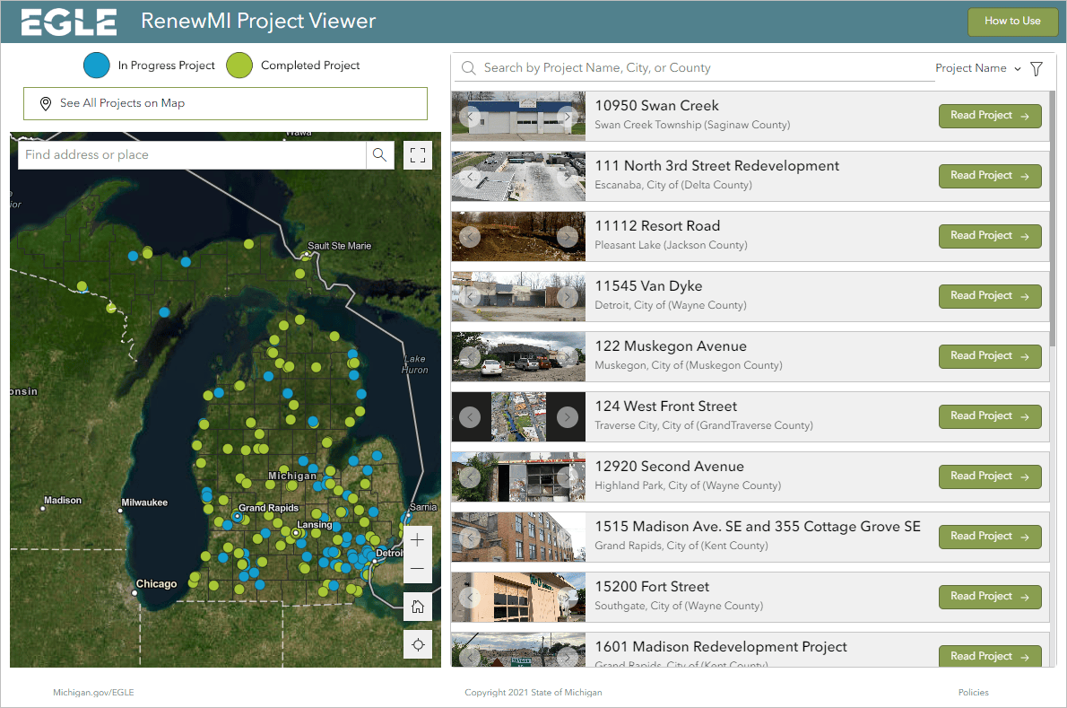
The state makes information about its remediation projects publicly available on michigan.gov/renewmi with the RenewMI Project Viewer. In addition to viewing which sites are near them, residents can use the application to learn the following:
- Short histories of each site’s contamination and cleanup.
- Amounts and sources of funding.
- Outcome metrics such as property tax revenue generated, number of new jobs created, number of new housing units built, tons of contaminated soil removed, and gallons of contaminated groundwater removed.
The web application, made by EGLE’s Kate Berg, is built with ArcGIS Experience Builder.
To learn more about Experience Builder, visit Try ArcGIS Experience Builder for explanatory videos and walkthrough tutorials.
Interview with the creators
Kate Berg, GIS Lead, and Jeff Hukill, Brownfield Administrator, both from EGLE, answered a few questions about the project.
Why did you choose ArcGIS Experience Builder to make the RenewMI Project Viewer?
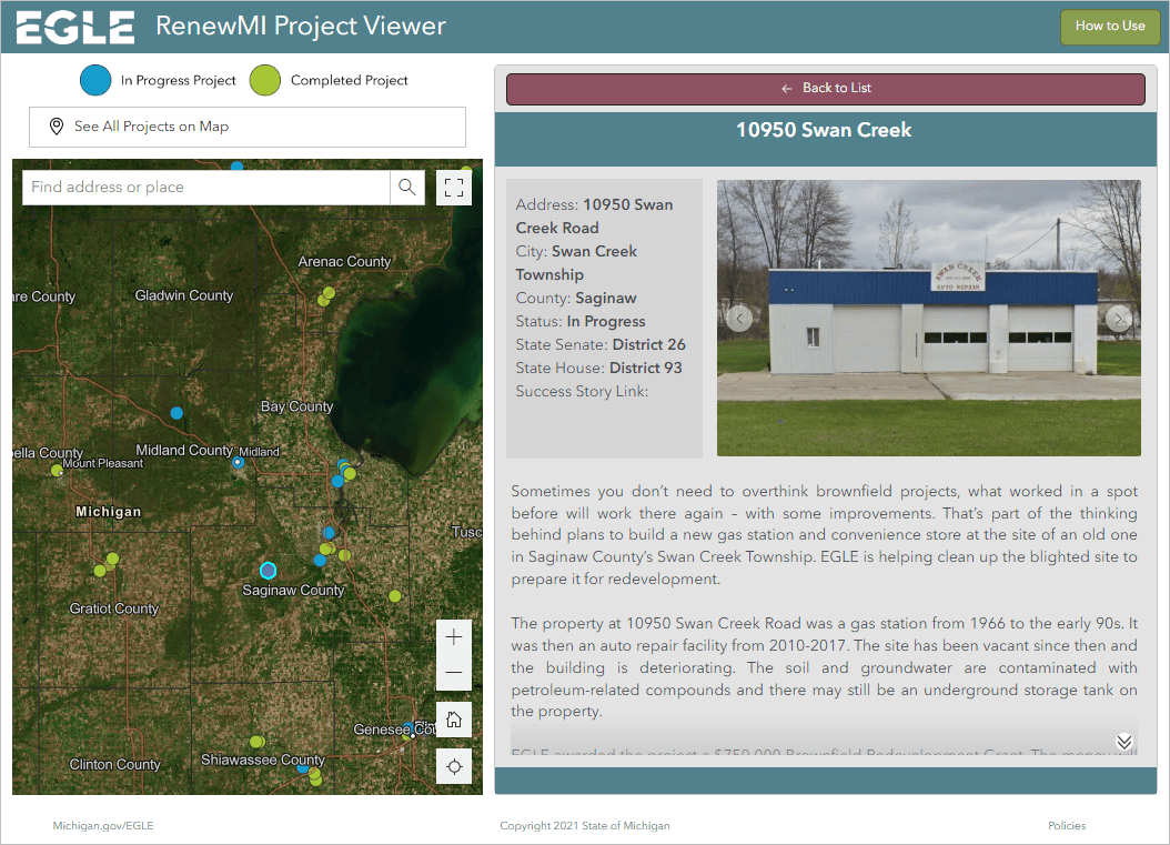
Kate: This app contains past and present projects from EGLE’s Remediation and Redevelopment Division (RRD). These projects include those where staff are directly overseeing environmental remediation efforts, and sites where a brownfield grant and/or loan has been provided to incentivize economic development. We needed a tool to share individual project success stories that was simple to create and update. Experience Builder allowed us to put our 200+ sites into a single feature layer and use the dynamic text options to pull the project descriptions and pictures so that each project details page was created automatically for us!
Who is the app’s main audience, and how did you expect Michiganders to use the information about clean-up and redevelopment projects?
Jeff: The audience for this tool is residents of Michigan who live near or commute past one of our redevelopment projects. We place signs onsite where we provide redevelopment funding. The signs steer interested parties to the michigan.gov/renewmi website where they can find out a little more information about the site they just passed or is sitting in their neighborhood.
How did you decide on the app’s layout?
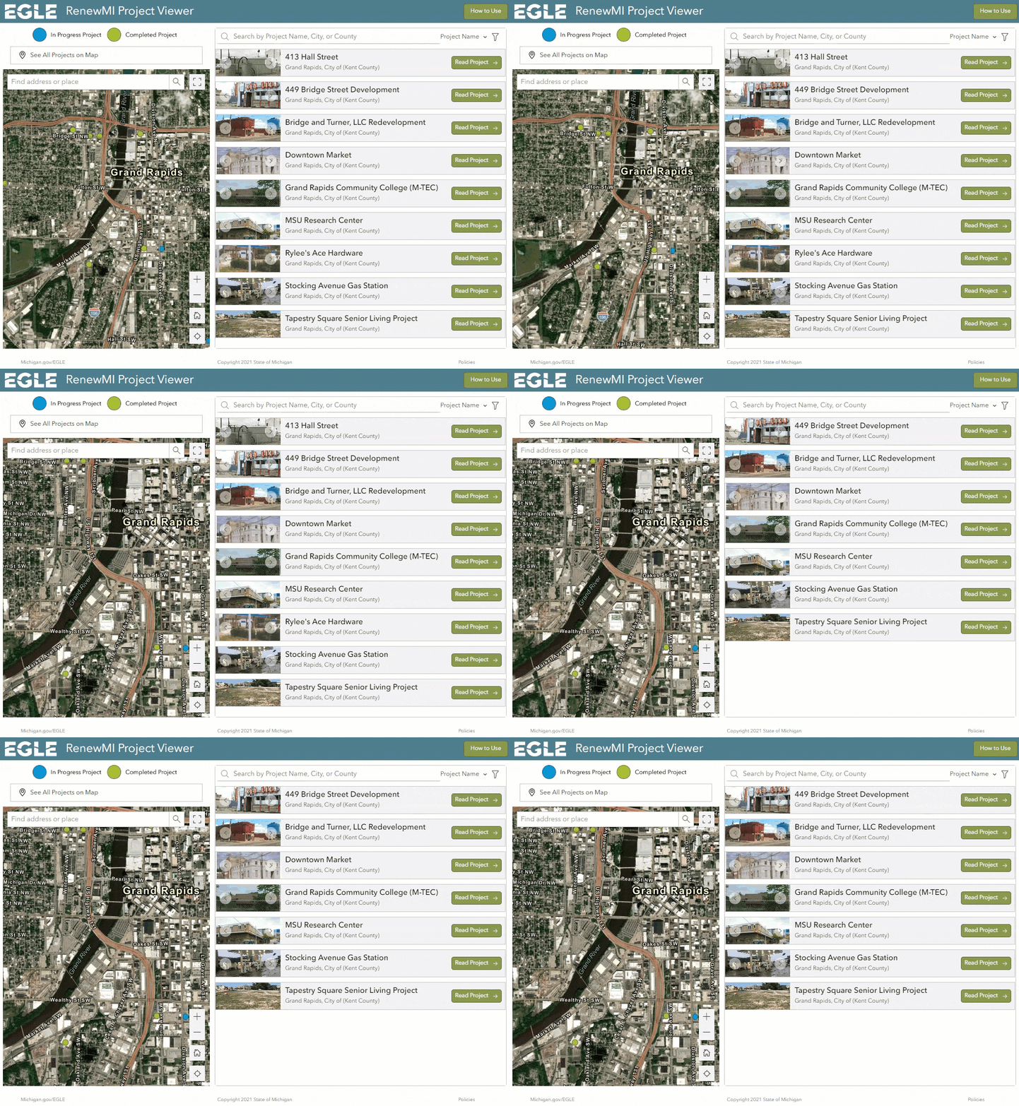
Kate: Our goal for this app was consistency and to look as close as possible to what it looked like in the first version (Story Map Classic Tour template). So, we have the map on the left and the list/project descriptions portion on the right.
What would you tell your counterparts in other states if they are interested in making similar apps?
Kate: Experience Builder has a tough learning curve, so it’s important to take the time to understand the fundamentals of the tool before trying to build something. If you’d like to create an app like ours, you’ll want to explore how to create “views” using “Sections” in Experience Builder. Our List view and “Read Project” details view are part of the same Section widget. This is a great way to have multiple widgets occupy the same real estate on the screen.
Another key we’ve found for creating high quality apps that work across screen resolutions is to rigorously use the “Layout Options” widgets. Add a “Row” and then add a “Section” in the “Row” AND THEN add another “Row” to that “Section”. Also, the “Page” > “Outline” part of Experience Builder is your best friend in navigating different parts of your page – be thorough in your naming of components there so it’s easier to keep track!
How does EGLE use GIS to accomplish your mission of protecting the environment and public health?
Kate: EGLE uses GIS across its many fields – from air quality to water resources. We have over 200 staff members using GIS in a variety of ways, such as to inform decisions, improve workflows, or communicate about what we do. For example, one of our air quality analyst uses GIS to analyze emission reductions and increases of methane. Field staff use GIS to collect authoritative data in a more efficient and effective way. To learn even more, check out our story called What Makes EGLE Spatial?!
Exercise: Design a layout in ArcGIS Experience Builder (1 hour 15 minutes)
In this five part tutorial series, you’ll build a custom web app for a web map. You’ll learn about layout widgets, windows, and mobile optimization features.
Exercise: Optimize an app layout for mobile (20 minutes)
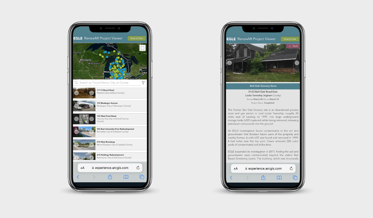
EGLE’s app has a responsive design that adapts to different screen sizes. This is important, because they expect residents to look up their website on mobile devices after seeing signs around Michigan. In this tutorial, you’ll learn about Experience Builder mobile optimization features by editing the home page of a park information app for Great Smokey Mountains National Park.
More information
You can find this and other web applications in the Experience Builder gallery. To learn more about Michigan ELGE’s GIS, data, and environmental work, visit www.michigan.gov/egle.
For more information about Experience Builder, see the following resources:
- ArcGIS Experience Builder overview
- Try ArcGIS Experience Builder
- Get inspired with ArcGIS Experience Builder
- ArcGIS Experience Builder Help: What’s new
The banner photo of Grand Rapids, Michigan is cropped from Panoramic Grand Rapids, Michigan, USA, copyright Henryk Sadura. Licensed January 2023 through stock.adobe.com.



Article Discussion: