Vineyard managers commonly use a combination of vineyard assets, soil mapping information, weather data, and aerial imagery to map or explore vineyard operations. These layers of information can highlight differences within the vineyard and enable the monitoring of changes from year to year and throughout a growing season. This information can then be used to make vineyard management decisions that impact the quality of the grapes.
ArcGIS Explorer is a mobile app that enables access to your organization’s maps from a smart phone or tablet. Search, discover and explore your organizations assets in the field even when disconnected. With mark-up tools, you can communicate ideas and consequently share them with others. Explorer can be used on its own with minimal training or in combination with other ArcGIS field apps like Workforce, Navigator, Collector and Survey 123.
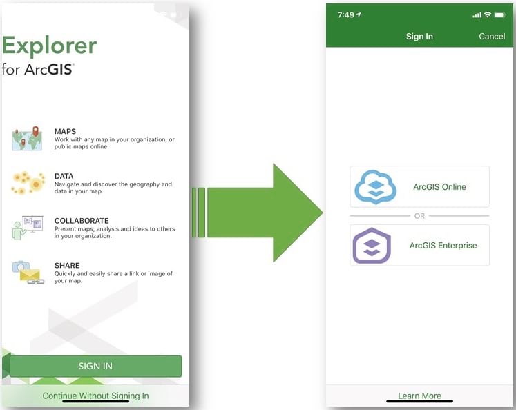
To get started, first download and install ArcGIS Explorer on your preferred device. Log into ArcGIS Online or ArcGIS Enterprise for access to public maps as well as your organization’s authoritative maps.
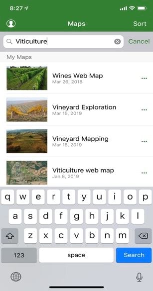
Once logged in you are immediately presented with your organization’s maps. The search tool can be used to find maps of interest. In this example I am a vineyard manger charged with managing all viticulture activity. By typing in Viticulture after logging into my ArcGIS Online or ArcGIS Enterprise portal, all the maps tagged accordingly are presented as options for my selection. We can now begin further exploration of our operation.
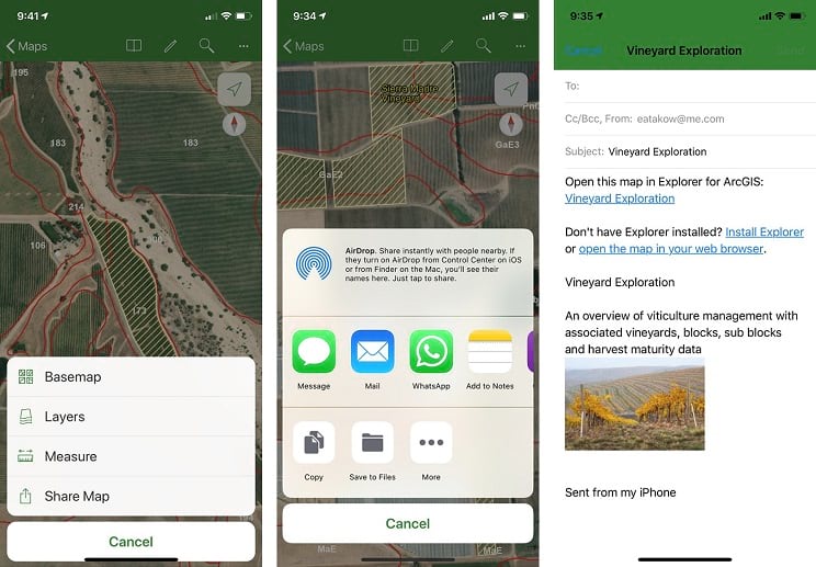
ArcGIS Explorer presents you with standard functionality Esri users have become all too familiar with such as Search, Bookmarks, Basemaps gallery, Layer list, Measure tool and much more.
Other tools include the ‘Share’ option which allows users to share via email or even a text message which will reference the item id of the item being shared. When sharing by email the recipient is provided a URL to the map and prompted to download ArcGIS Explorer if they have not already done so.
Additionally, users can optionally Markup a map and share those markups back to the organization. This is done by authoring a markup or using markers, arrows, lines, and shapes. You can add notes and labels to the markup to communicate additional information.
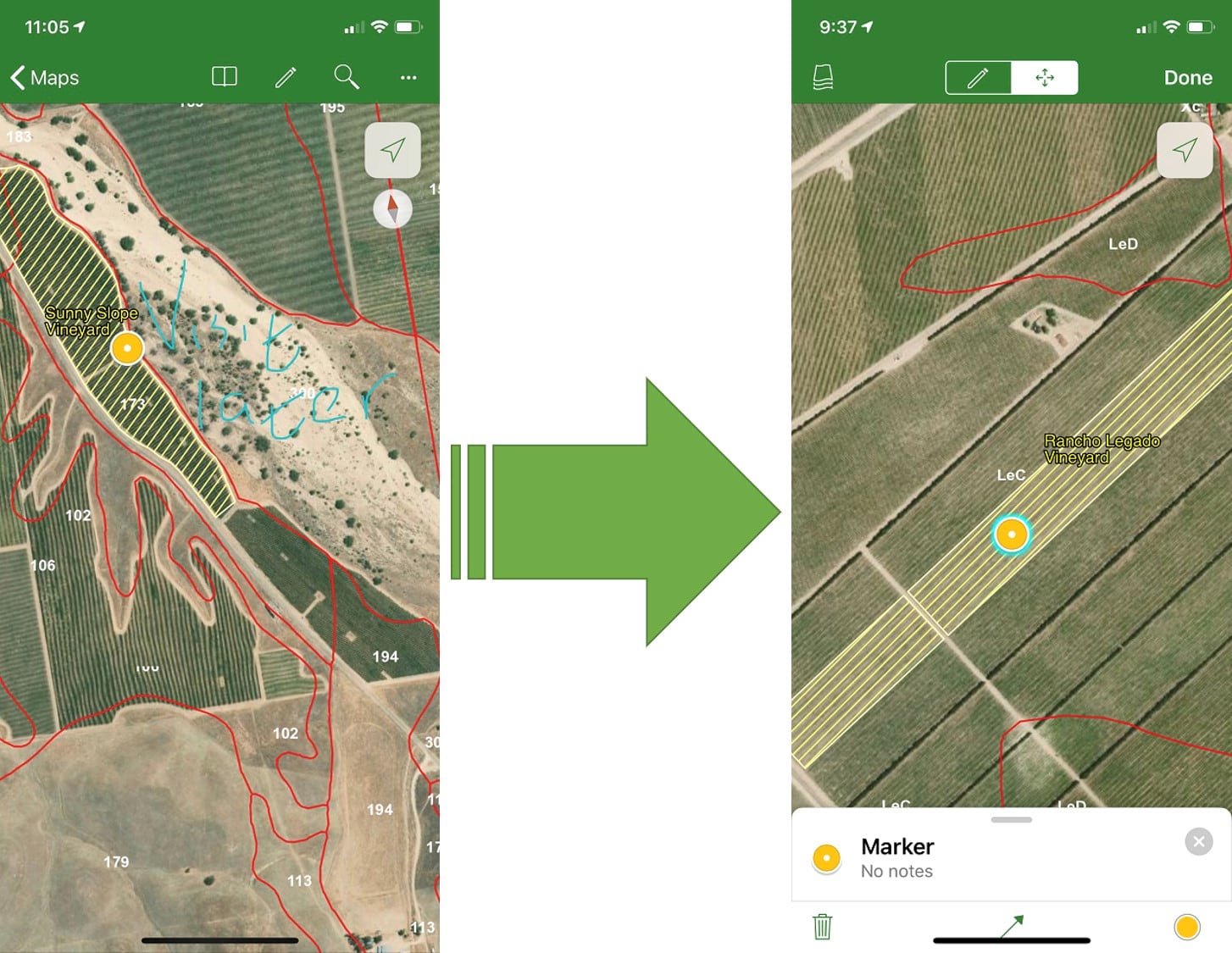
When viewing a map, select Markup to add to or modify your markup layer. The toolbar will then change, and you see the markup tools. The map’s context also changes to support this markup. At this stage, gestures on the map are used for markup-specific behavior. As such, you can no longer drop pins or view details about pins or features. Other gestures such as zoom in and out, map rotation, and pan using two fingers can still be carried out.
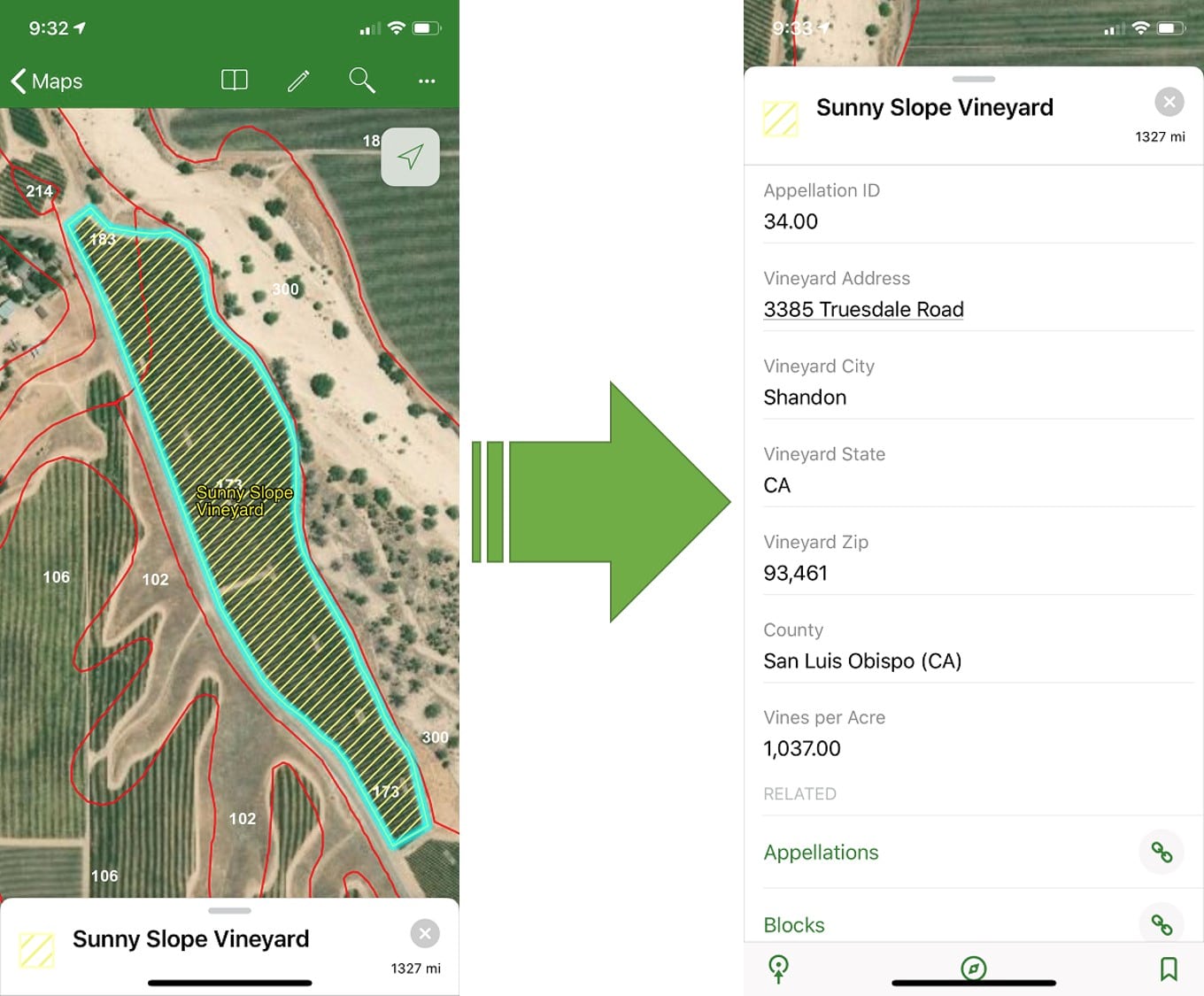
To begin further exploration of the vineyard let’s focus on a block and get more information. By clicking on an area of interest, the area is selected as the user zooms in for more detail. The details pane is presented with all the relevant details about the vineyard or block in question. We also have access to all the related records about our vineyard of interest.
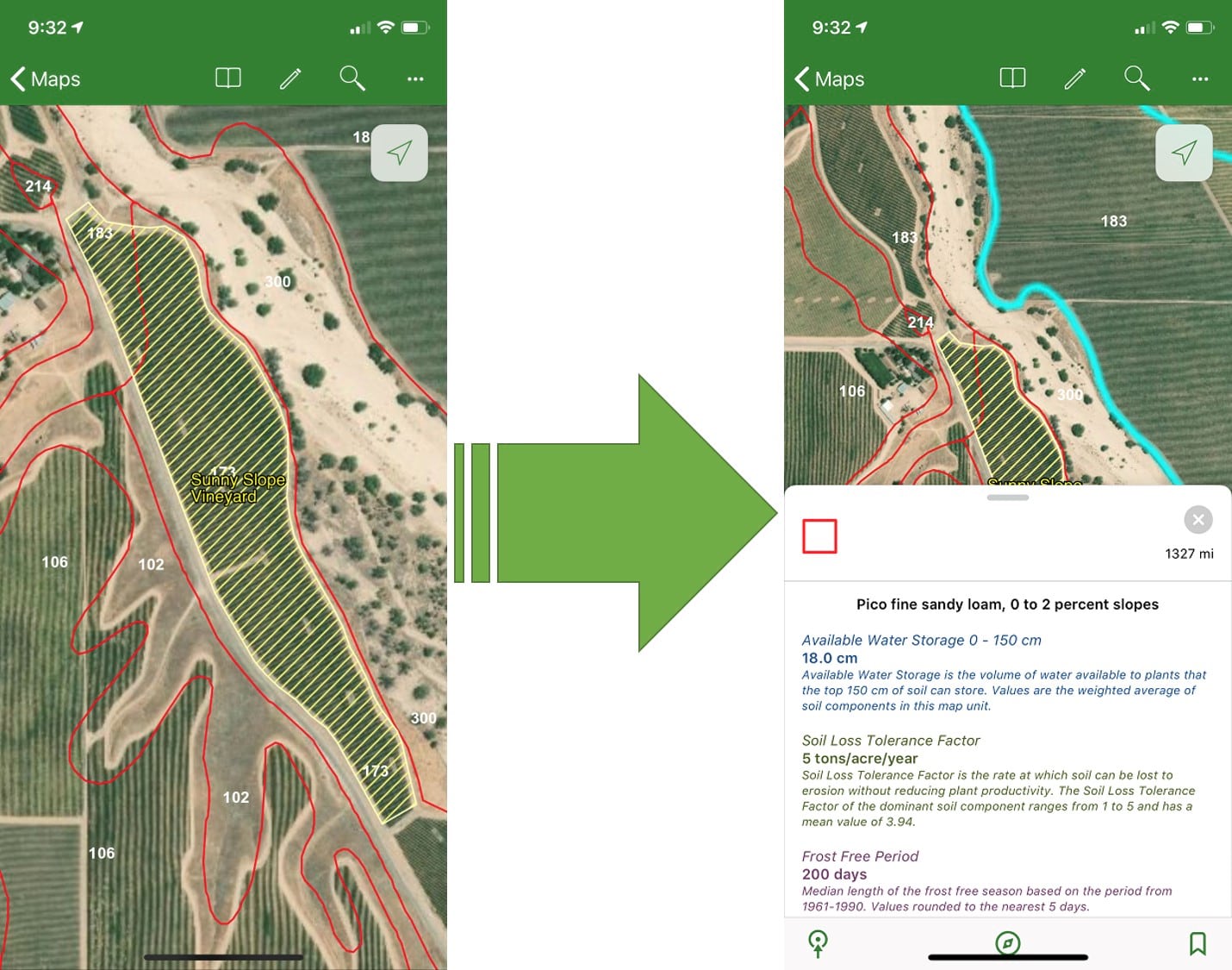
Soils are one of the most frequently mentioned traits in viticulture. As such, using ArcGIS Explorer, users can assess soils characteristics by simply selecting a soil map unit.
The Living Atlas provides Esri users with access to geographic content from around the globe. Examples include the USA Soils Map Units which displays soils of the US from the Soil Survey Geographic Database (SSURGO). This layer can be added to a vineyard web map as a soils reference layer. Viticulturalists can now use this layer in Explorer to make on site decisions.
With access to soil information such as soil type, available water capacity, crop index and percent slope, decisions regarding the operation of the vineyard can be made in place.
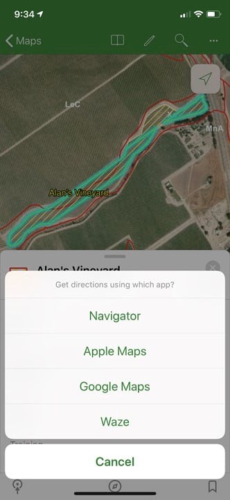
Finally, built in integration with ArcGIS Navigator, Google Maps, and Waze navigation is only a few clicks away. With ArcGIS Navigator, users can incorporate a custom road network for turn to turn navigation. The Compass tool will facilitate obtaining your bearings in the vineyard while the measure tool allows users to validate row spacing while calculating distances.
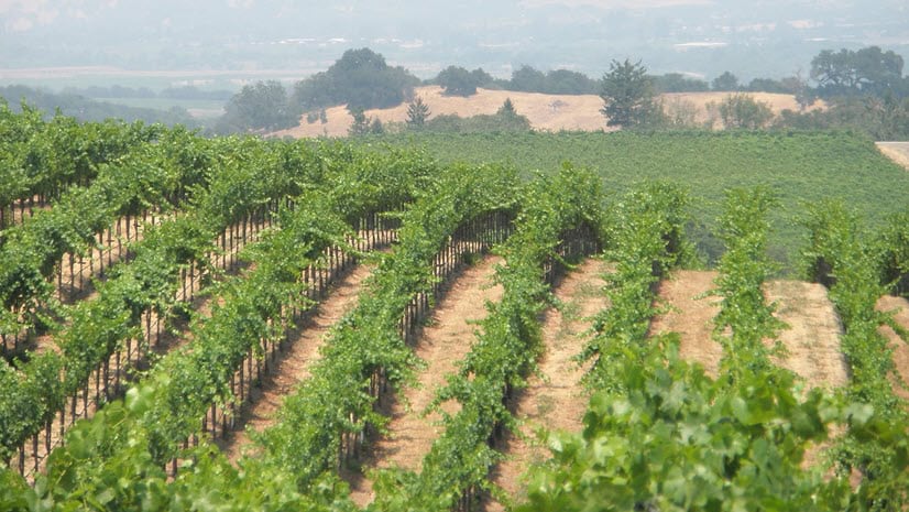
Knowledge of what is going on in a vineyard and the ability to make split decision is key to success in viticulture. You can now incorporate this information into your own workflows while thinking of new ways to use Explorer in a viticulture specific setting. With maps in either ArcGIS Online or ArcGIS Enterprise, you can sign in and begin to use ArcGIS Explorer. Take your maps with you in the vineyard—even while offline!


Commenting is not enabled for this article.