Project Managers at Architecture, Engineering, and Construction (AEC) firms are facing ever-increasing pressure to do more with less.
Time and money are constantly being squeezed. Teams are battling with disparate data on multiple platforms, and many are deploying custom-built solutions that eat into project margins. Project Managers still struggle to provide a streamlined, authoritative view of project progress for transparent and secure communication with key stakeholders. That’s where ArcGIS GeoBIM can help!
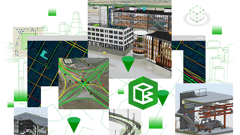
ArcGIS GeoBIM delivers an innovative, easy-to-use web-based experience for project teams to explore and collaborate on BIM projects and issues using data from multiple systems in a geospatial context.

What are major delivery challenges facing Project Managers?
The data dilemma
Even small projects can generate enormous amounts of data! Much of this information ends up siloed in disparate systems needing rework, or translation, to be useful within other processes.
From conceptual designs to as-built records, data is often duplicated between different databases so team members with distinctive focuses can access and work within their discipline. Often, this means time and effort spent on data translation, or even data re-creation, which eats into project budgets and causes delays.
Data translation can lead to static uses of outdated information, which can cause incredibly costly errors—not just within ongoing project phases, but in future downstream delays where financial penalties damage firms as well.
Context, content, and custom applications
It can be difficult to get the right mix of context and content for different sets of stakeholders. Field teams need access to asset information and part numbers, designers need updated existing conditions, while clients want dashboards detailing the project progress in real-time.
Project Managers need to review and present status information in a way that makes sense for each of their stakeholders. Very often, this means their teams are continually creating ad hoc reports, printed maps or plans, and even one-off custom applications that solve a single problem for only one project.
Communicate securely and effectively with multiple stakeholders
Not only do Project Managers need to ensure stakeholders have the project data they need, they have to make sure data is provided securely, and in a way that protects the integrity of the information. Many projects have sensitive information where various user groups require different access levels, and making sure data is not exposed to incorrect individuals remains paramount.
Often, viewer applications that come with different software packages require desktop deployment, which means teams need to spend time not just installing the apps, but teaching their stakeholders how to use them as well. Desktop viewer apps may provide functionality that is too complex for one set of users, and at the same time not robust enough for another group. All of this can eat into available resources needing to support extra services that were never anticipated within early project estimates and planning.
Program managers, design managers, construction managers, and project managers are just some of the people who need to organize projects without reorganizing data and people, minimize rework, and use out-of-the-box, enterprise-ready tools to provide tailored user experiences for different sets of stakeholders.
What is ArcGIS GeoBIM?
ArcGIS GeoBIM enables the linking of AEC projects and workflows by connecting ArcGIS with the Autodesk Construction Cloud and BIM 360.
Within ArcGIS GeoBIM projects, your technical staff can link location-based ArcGIS features with Autodesk records—meaning that it’s easier than ever to access related data, understand where information exists, and query project documentation from multiple sources.
ArcGIS GeoBIM also makes it easier to communicate and collaborate within a secure, web-based environment, which can be tailored to the needs of multiple stakeholders.
Three ways ArcGIS GeoBIM helps empower Project Managers:
1) Your teams will spend dramatically less time exchanging data
ArcGIS GeoBIM links directly between BIM and GIS data stored in their native environment. ArcGIS features representing boundaries or assets can be linked to multiple dynamic BIM datasets resulting in teams spending far less time searching for information, and reducing efforts on data rework or cumbersome data translation processes.
Tools in ArcGIS GeoBIM automatically create linked georeferenced data from DWG or Revit models. Link rules provide mapping connections between features to their digital model elements, while select links can be made to reports showing the most recent version, part catalogues for an MEP system, or progress photos.
If a geographic feature is linked to a model that has been updated, or a work order that has changed within the Autodesk Construction Cloud, that information is available immediately. The need for data to be moved, duplicated, or converted is greatly reduced.

2) Configure scalable web apps for every project and stakeholder
ArcGIS GeoBIM allows Project Managers to get the right balance of context and content for different audiences and users. Projects can be organized within each system without having to move data back and forth repeatedly throughout a project’s timeline. Reusing GIS and BIM together within configurable apps for different purposes on multiple projects within the same geographic region means data acquisition costs and data duplication can be minimized.

Links can be tailored to the needs of stakeholders, to show complete sets of construction documents, digital models, or work reports. In addition to tailoring data and links to the needs of stakeholders, it’s also possible to tailor app functionality.
ArcGIS GeoBIM apps can include functionality for adding and viewing issues, dashboard and timeline tools, 3D widgets, and more. These widgets can simply be switched on or off as needed from the authoring interface for each app. This means that teams no longer need to rely on custom-built apps or ad hoc reports to communicate project status with different groups of stakeholders. Instead of hiring coders to build custom solutions, you can easily configure repeatable apps at scale to meet different project types.

3) Maintain industry-standard security on project data and communications
ArcGIS GeoBIM gives Project Managers and their teams a highly configurable environment connected to the Autodesk Construction Cloud. ArcGIS GeoBIM provides industry-standard security through the ArcGIS named user model, enabling project teams with complete control over who can access specific apps and datasets.
In doing so, ArcGIS GeoBIM inherits the security permissions within both ArcGIS Online and Autodesk Construction Cloud. Rest assured, sensitive information is only accessible to the right groups that your teams define.
Summary
ArcGIS GeoBIM delivers an innovative, easy-to-use web-based experience for project teams to explore and collaborate on BIM projects and issues using data from multiple systems in a geospatial context. AEC teams can work with linked data from multiple systems in configurable web apps that simplify communication and collaboration with teams and stakeholders. With ArcGIS GeoBIM, teams spend less time on file conversion, thus increasing access to reliable, up-to-date data. ArcGIS GeoBIM enables secure access to project information, including BIM content, reality capture, documentation, and issues so that project teams can see active information for better decision-making and collaboration.
It’s time to start connecting your projects in context, save on resourcing for improved margins, and put your projects on the map!


Article Discussion: