The November 2026 ArcGIS Online update brings new templates, enhancements to existing apps, and easier ways to choose a template in ArcGIS Instant Apps. Explore the highlights below.
Explore multiple indicators in one app
Your data has more than one story to tell. A single dataset might include population, income, employment, health outcomes, and other measures for the same geographic areas. But creating a separate map for each indicator can quickly become time-consuming and difficult to maintain.
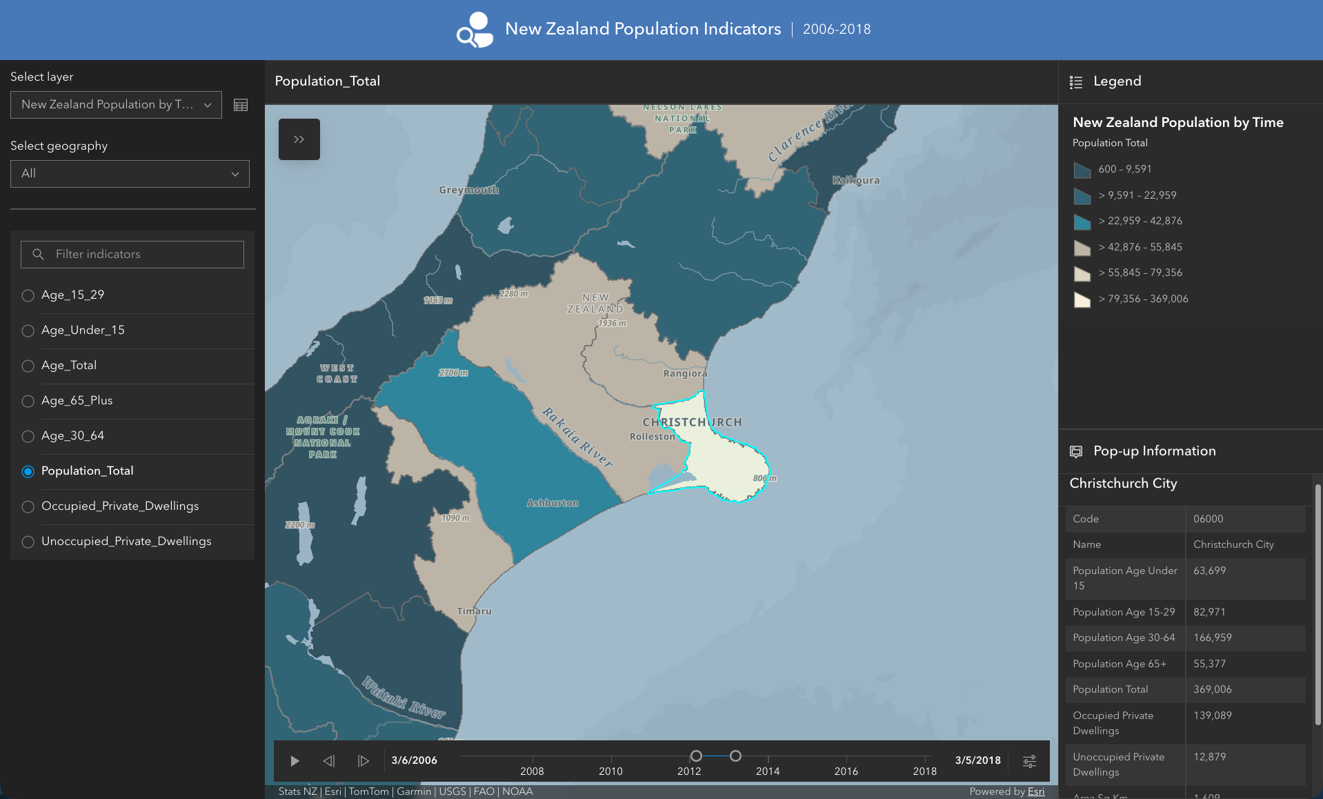
The new ArcGIS Instant Apps Indicator template brings those measures together in one interactive app, giving your audience a simple way to explore different aspects of your data without switching between maps. You can use your existing data as it is, there’s no need to reshape, pivot, or copy your layer.
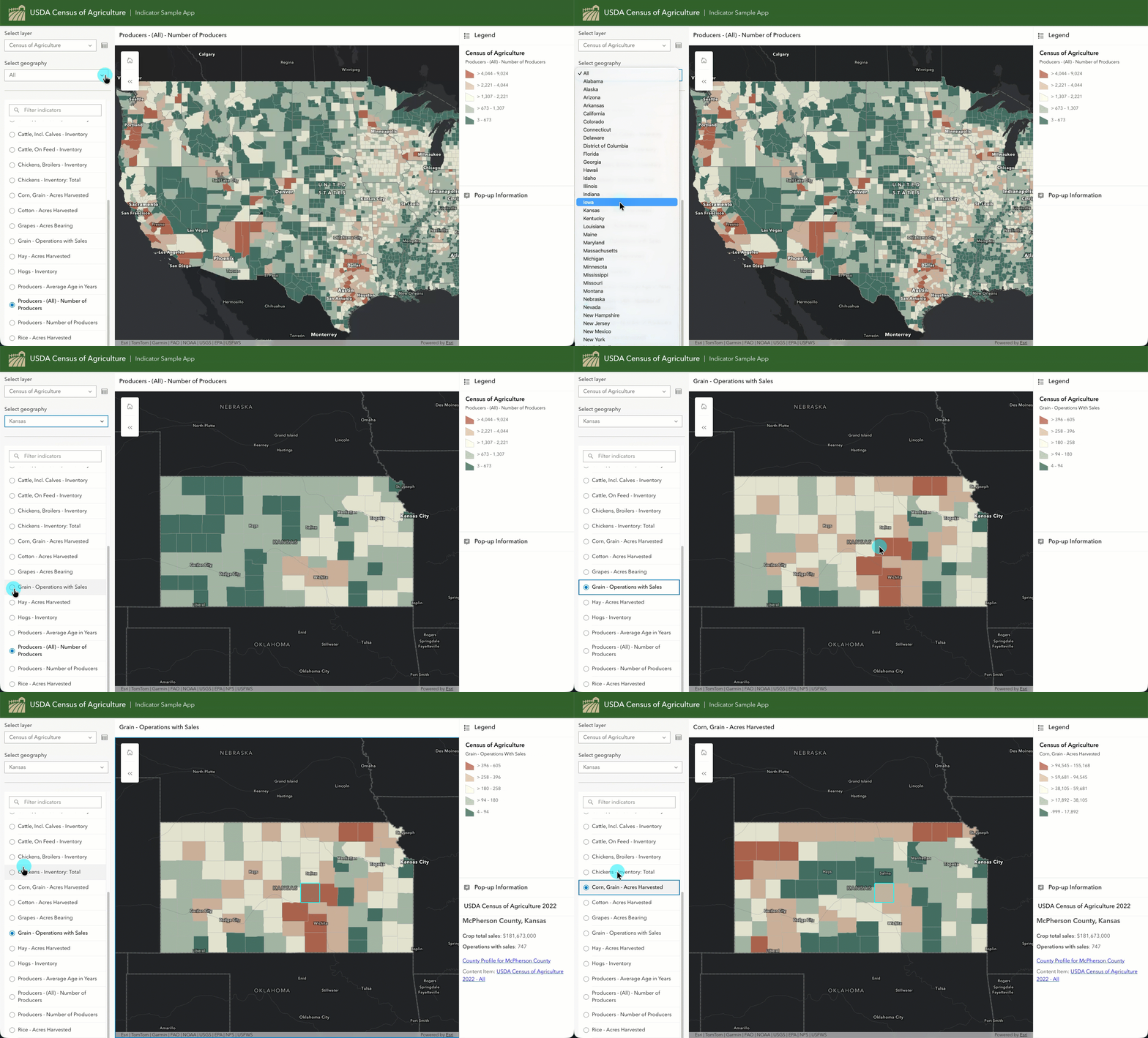
With Indicator, viewers can choose a measure, focus on a geographic area, or filter indicators by category, such as economy or health. The map visualization and legend update dynamically with each selection, adapting to measures expressed as percentages, indices, or values in the millions.
Setup is straightforward: Indicator supports both wide data, with a field for each indicator, and tall data, with a row for each place and indicator combination. When you select your feature layer, the app automatically detects its data structure and asks you to confirm the choice.
App authoring improvements for further customization
New customization options give authors more control over how their apps look, how tools are organized, and how users access important information. This makes it easier to create apps that reflect your organization’s brand while putting the most relevant tools and resources within easy reach.
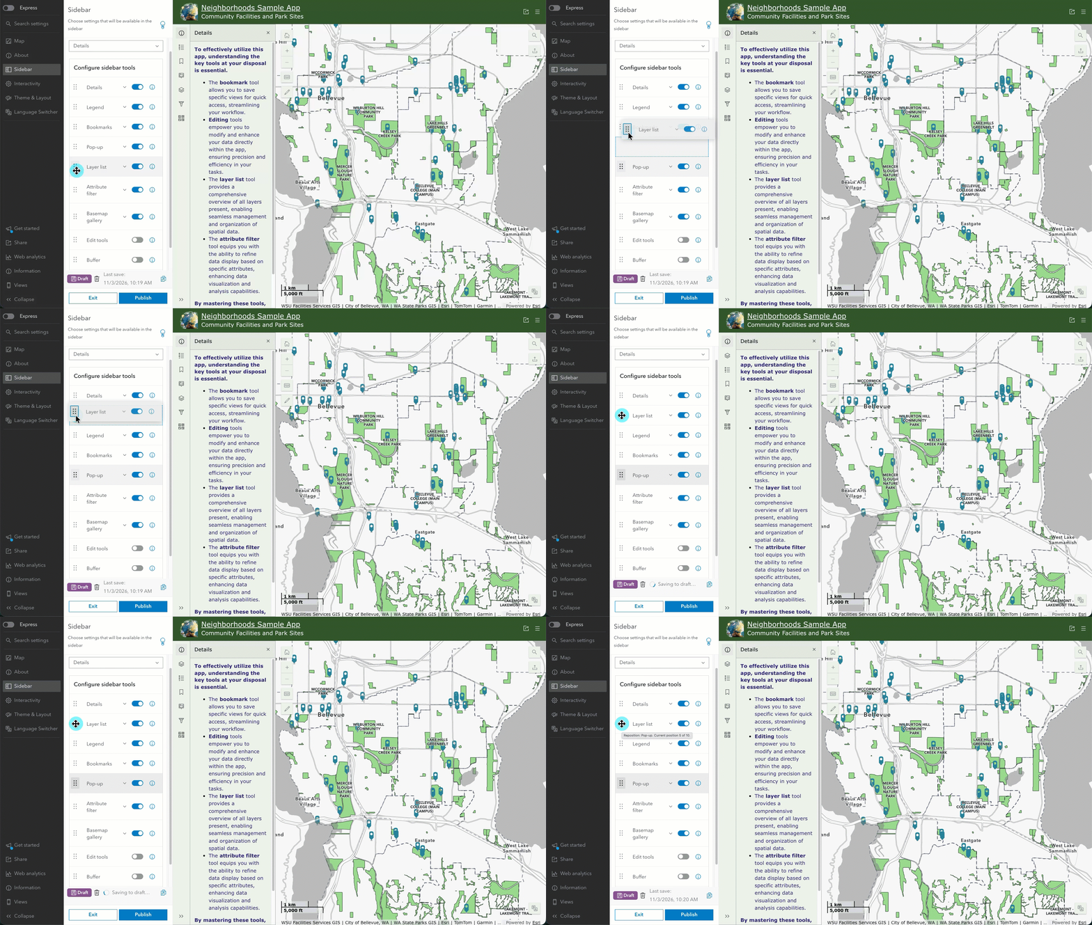
In Atlas and Sidebar, a new drag-and-drop experience lets you reorder tools in toolbars and side panels, making it easier to prioritize the functionality that matters most to your audience. Instead of relying on a predefined order, you can organize tools around the needs of your app and help users more quickly find the capabilities they need.
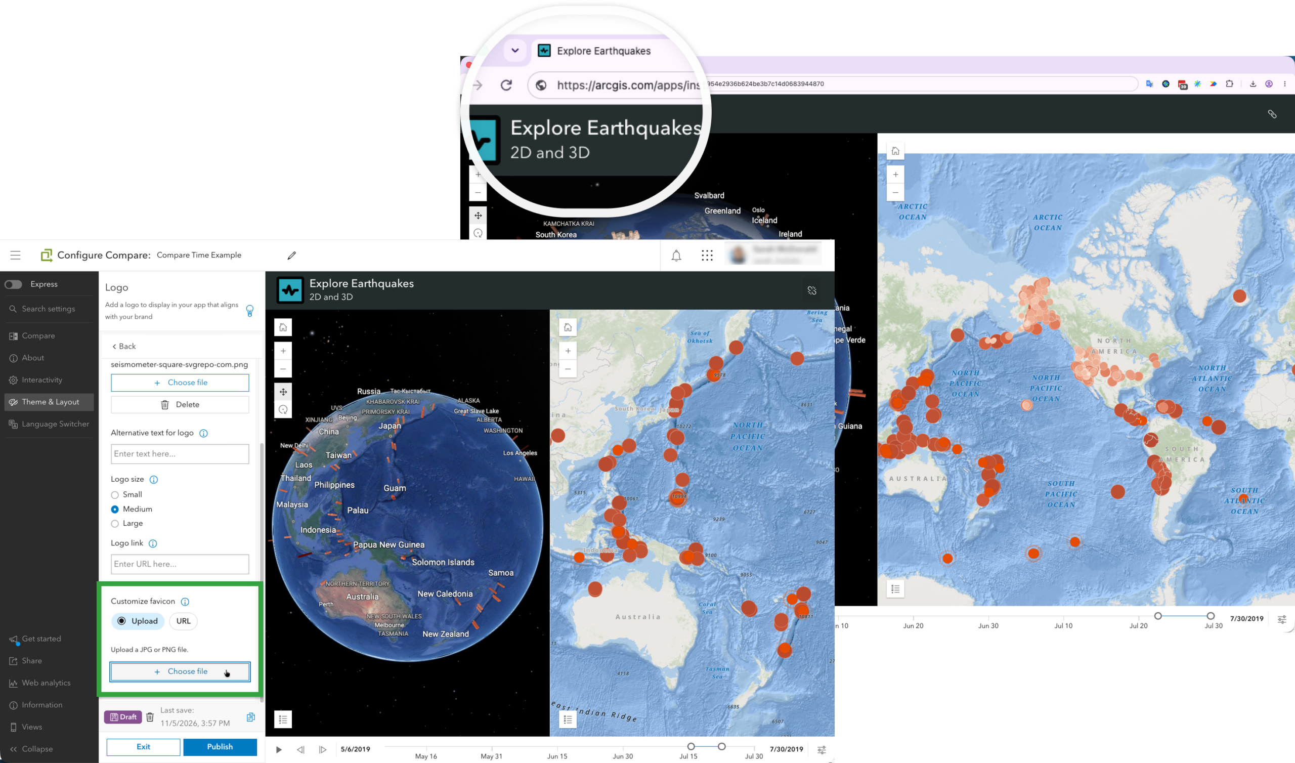
Across Instant Apps, you can now add a custom favicon by uploading an image or providing an image URL. This gives you another way to carry your organization’s branding throughout the app, including the browser tab, and makes your app easier to recognize when users have multiple tabs open.
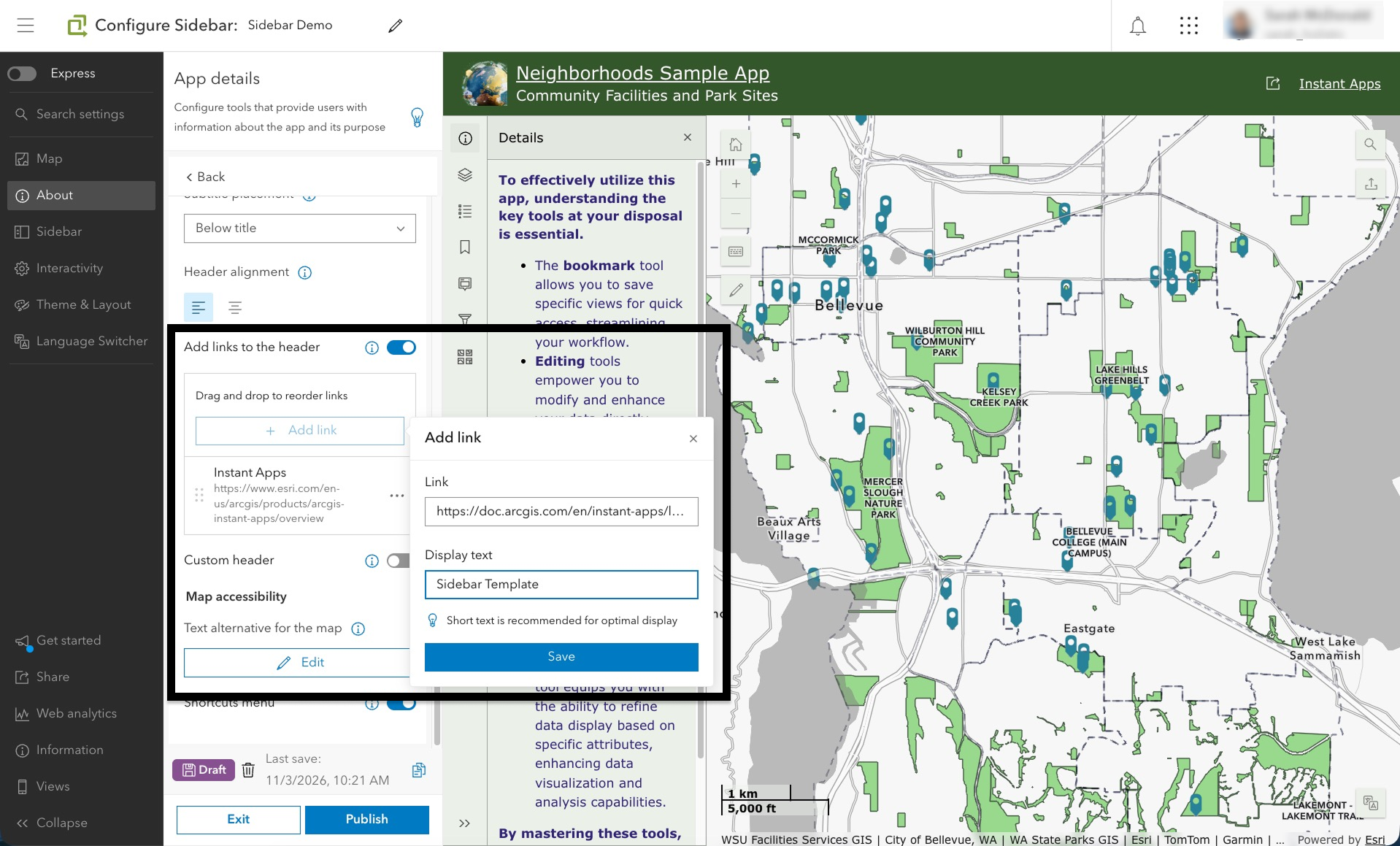
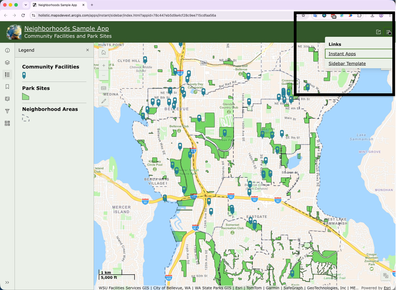
You can also add links directly to the app header, giving users convenient access to instructions, supporting resources, related content, or other important information without having to build that guidance into the app itself. Header links are available in both desktop and mobile views across Instant Apps, helping you provide users with useful context wherever they access your app.
New tools for exploring and managing data in Atlas
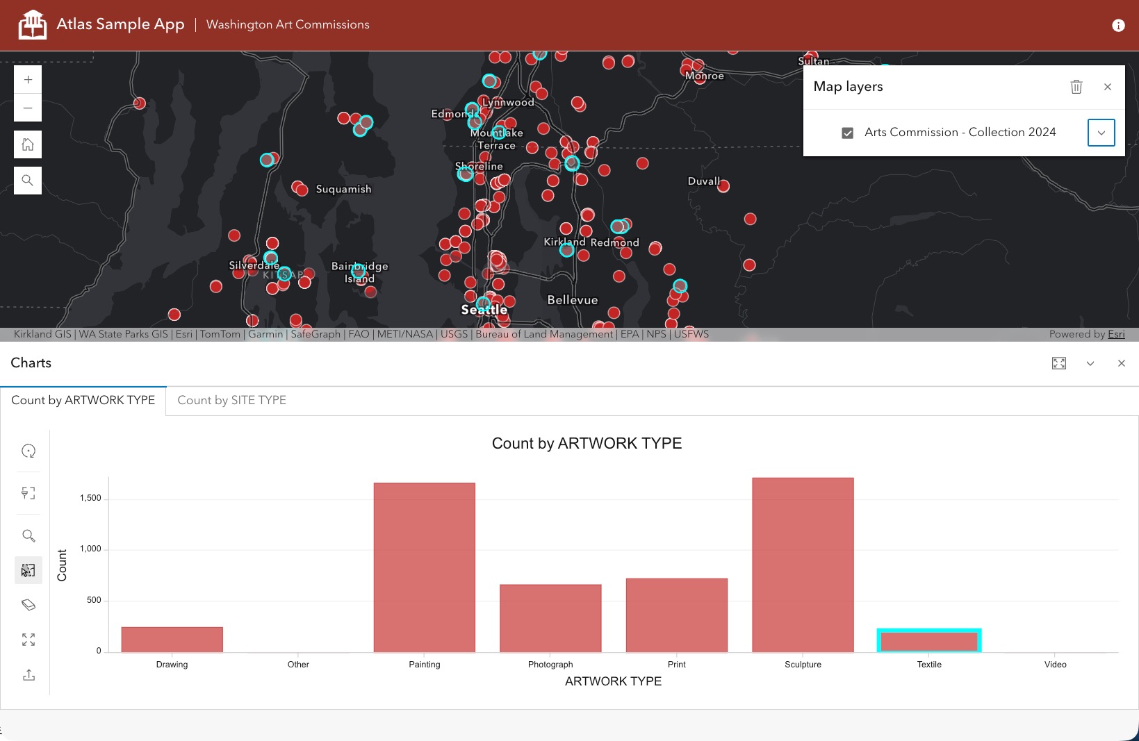
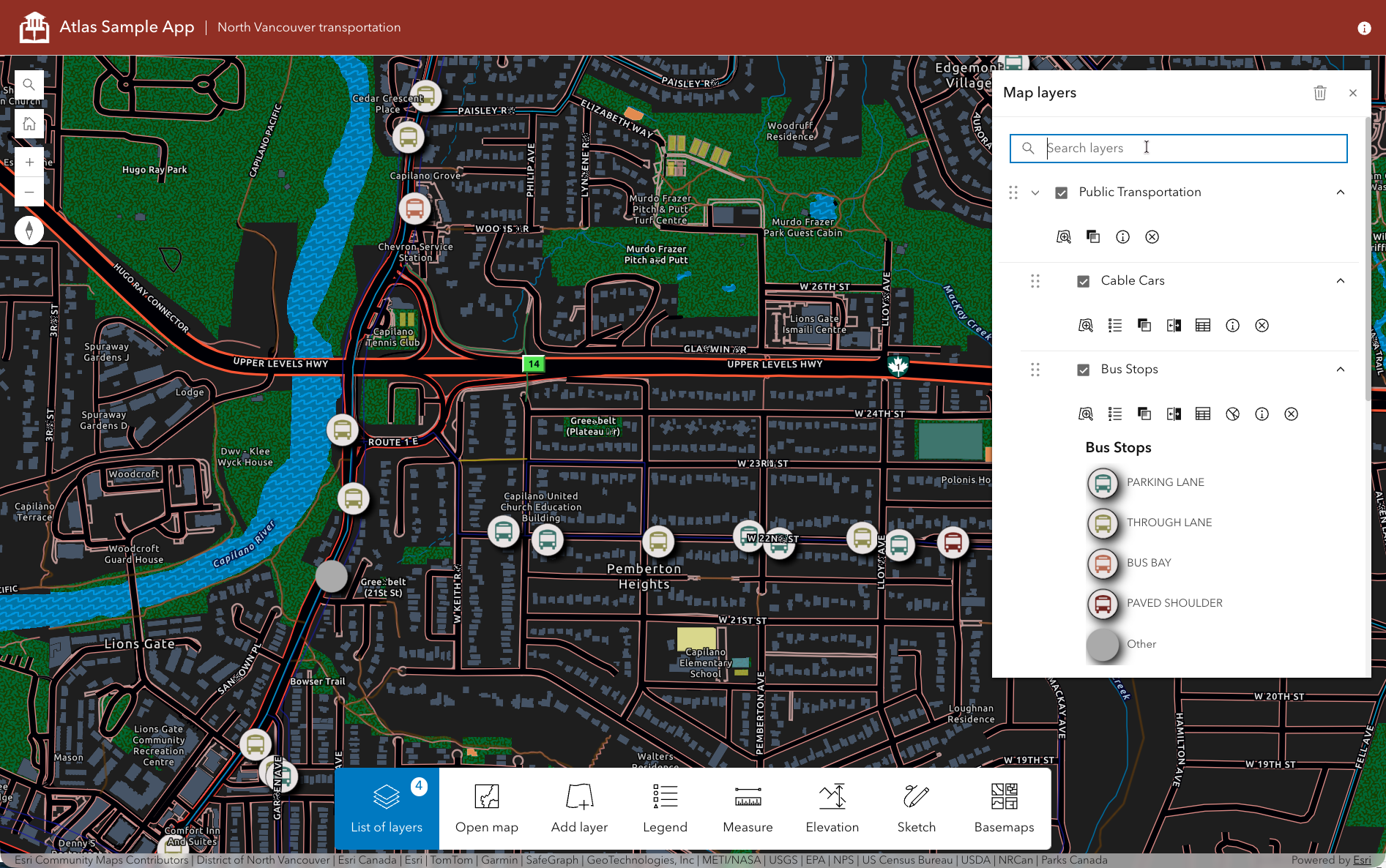
As users bring more maps and layers into Atlas, finding, comparing, and making sense of all that information can become difficult. New layer tools simplify that experience by letting users open multiple attribute tables in tabs, view charts configured in Map Viewer alongside their data, and search the current layer list to quickly find a specific layer.
Users can also remove all layers at once when a map becomes crowded and they want to start a new exploration. Atlas also adds support for Parquet feature layers, providing another option for workflows where scalability, efficient data storage, and optimized visualization performance are critical. Together, these enhancements make it easier to explore, compare, and manage complex collections of data in Atlas.
Less searching, more building: find your template
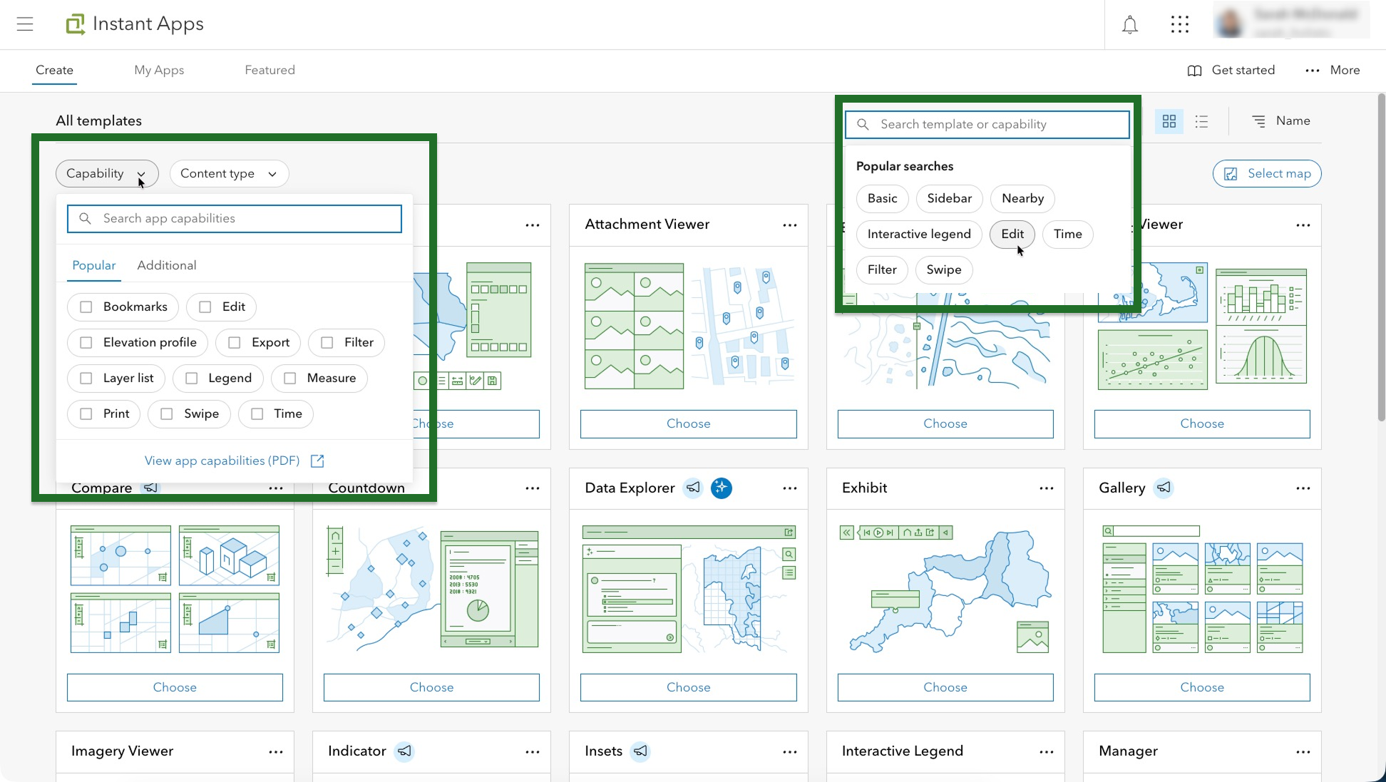
Have a workflow in mind but aren’t sure which template has the tools you need? Comparing templates to find the right fit can take time. Refreshed filtering and search tools on the Create tab of the Instant Apps home page help take the guesswork out of that choice. Pick the tools and capabilities you need from the filtering dropdown or type specific criteria into the search box. The gallery updates to show matching templates, so you can quickly narrow your options. So, whether you’re looking for editing tools or a way to display time-enabled data, the new filtering and search options make finding the right template for your use case easier than ever.
Improved responses in Data Explorer (beta)
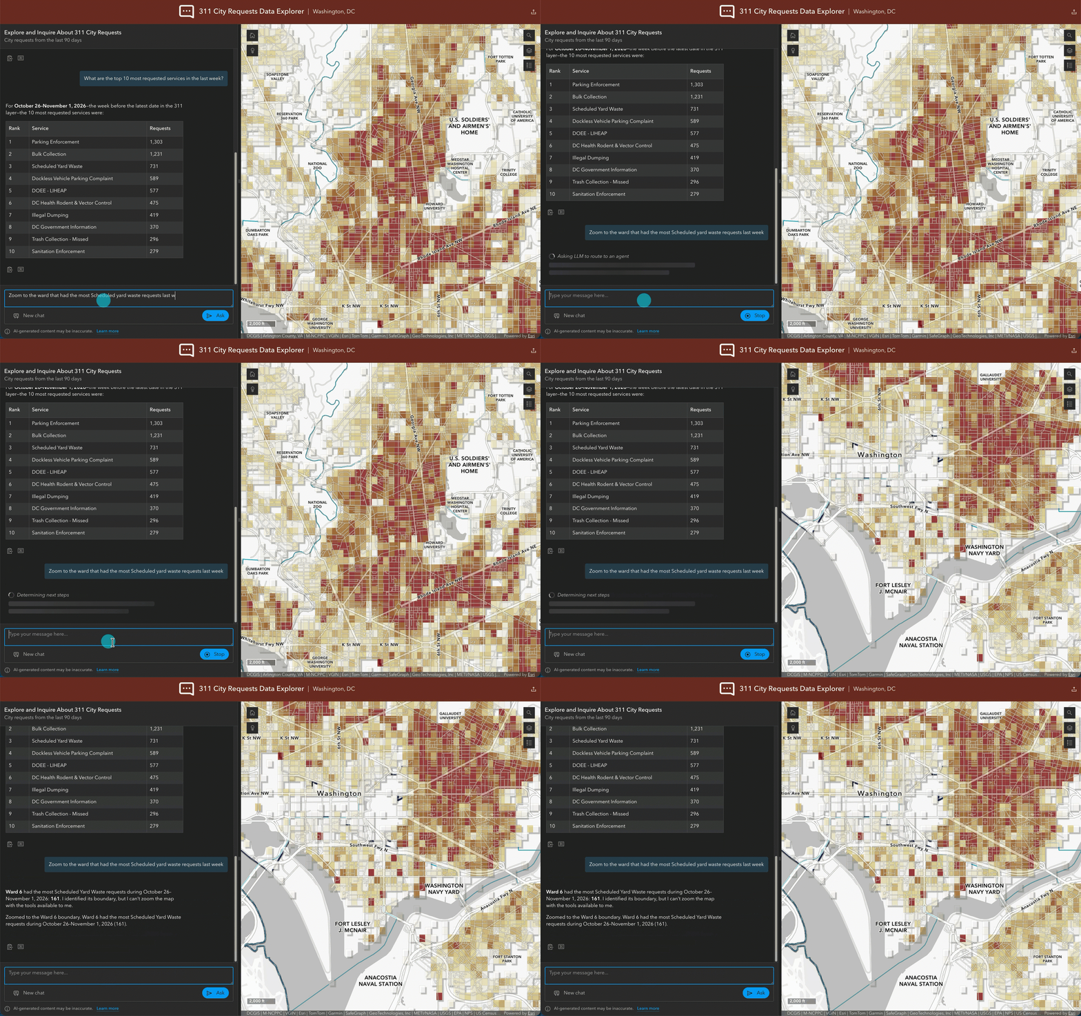
Data Explorer uses the Navigation, Data Exploration, and Help agents in the ArcGIS Maps SDK for JavaScript to support tasks within the app. Updates to these agents improve responses through a skill-based approach designed to deliver more accurate, reliable, and transparent answers, with clearer qualifications where needed.
New ways to understand and interact with data in Manager
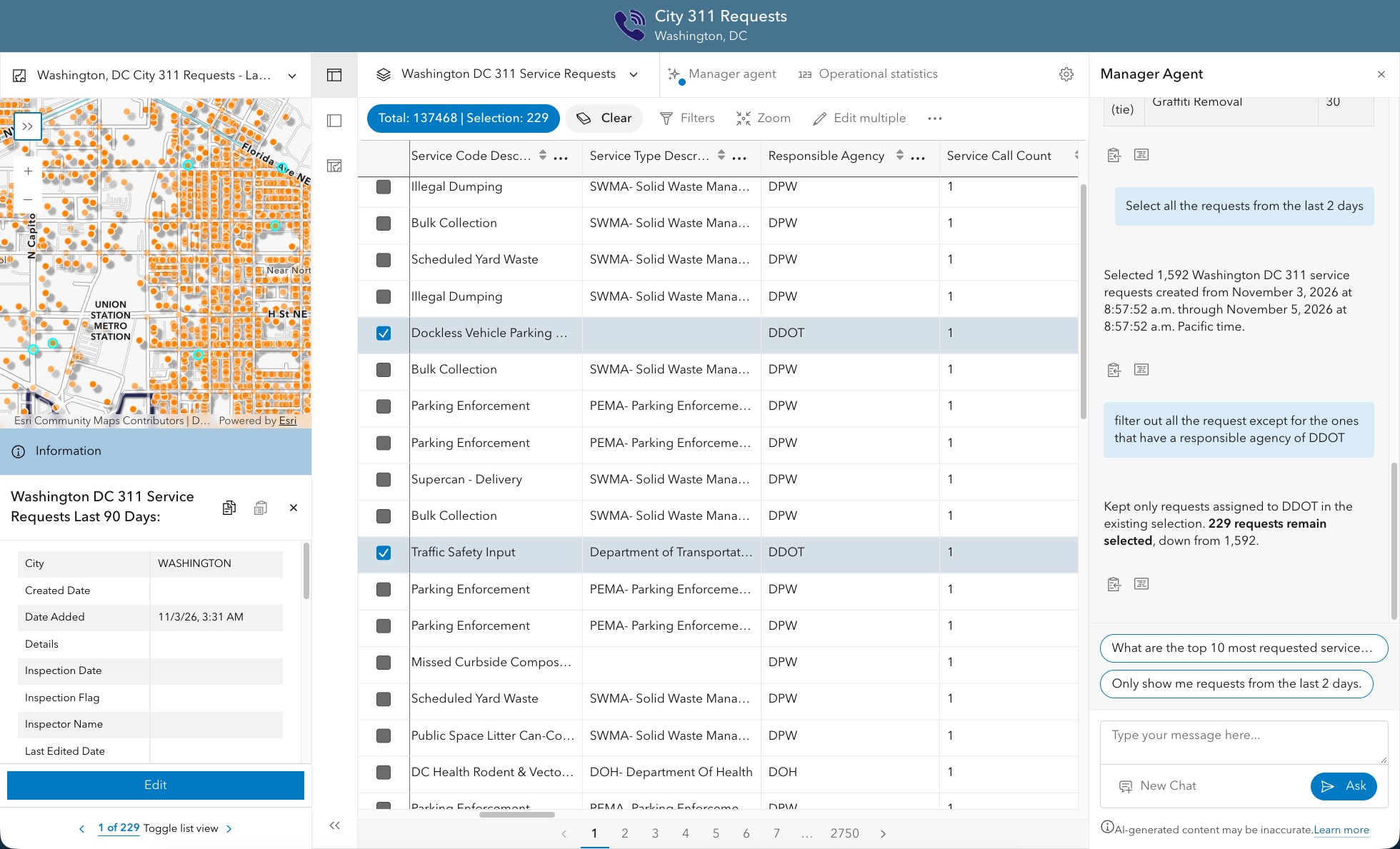
Two new beta features in the Manager template help users get a quick overview of their data and complete common data management tasks:
Operational statistics and the Manager agent
When a map contains many tasks or requests, reviewing individual records can make it difficult to see the overall picture. Operational statistics address this need by giving users an at a glance view of the data in their map. App authors can configure statistics based on layer attributes, including counts, averages, sums, and minimum and maximum values. For example, you can highlight how many tasks or requests are unassigned or in progress, helping users quickly understand the current state of their work without having to inspect each feature.
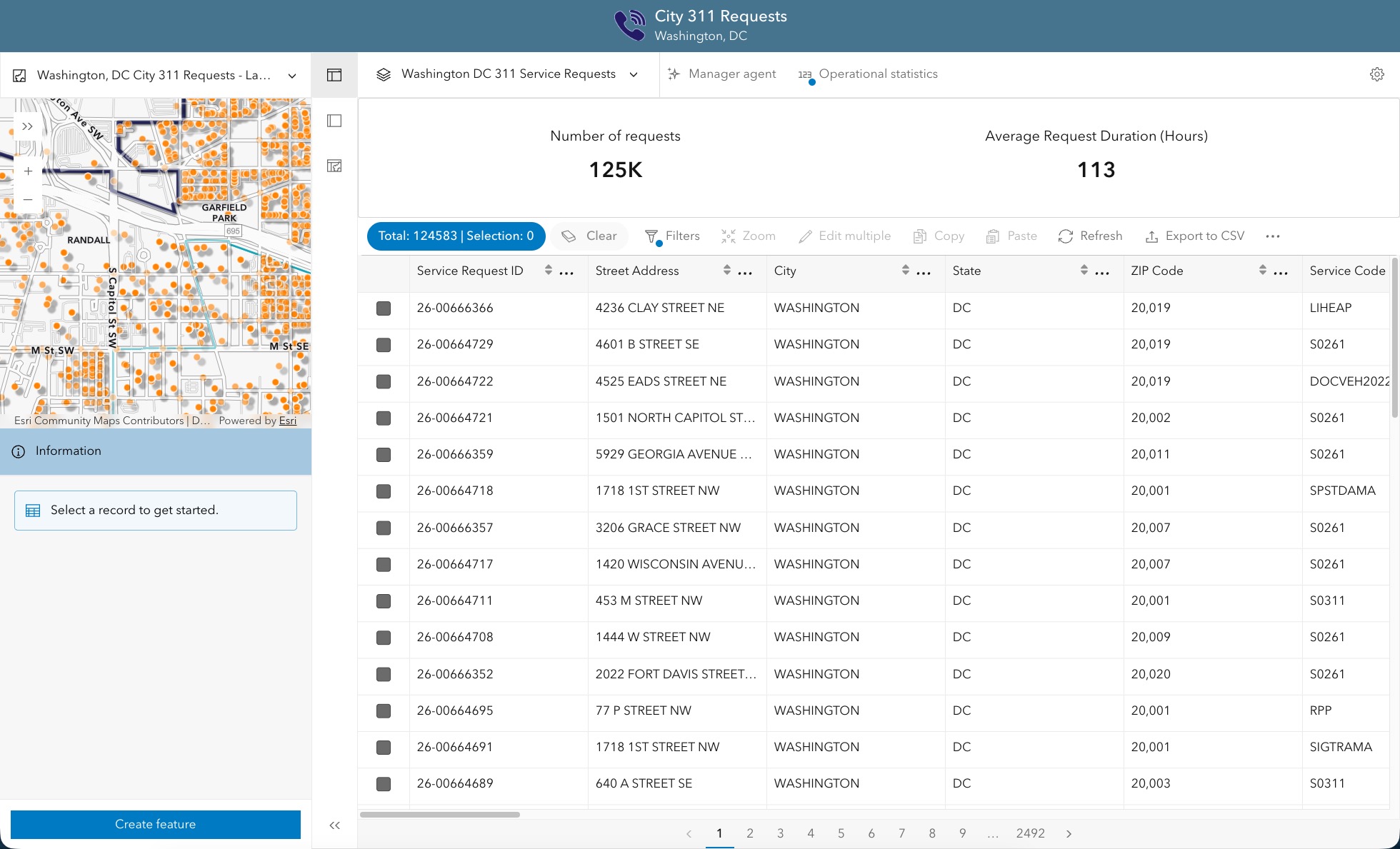
Finding and updating features can require several steps, from navigating the map and building queries to selecting records and editing attributes. For users less familiar with mapping tools, these steps can make routine data management tasks difficult to complete. The new Manager agent, available in beta, offers a conversational alternative. Users can enter plain-language prompts to navigate the map, query data, select features, and edit feature attributes.
For example, you can ask, “Show me streetlights in the downtown neighborhood that require inspection,” or “Which type of 311 requests are most common in this area?” You can also request an update: “Select all the requests that were created yesterday and update the status to assigned.”
This conversational workflow helps users focus on the task they need to complete rather than figuring out which tools to use, all while making sure to keep the human in the loop.
Quick bites
Here’s a quick look at more enhancements now available across Instant Apps.
- View feature counts in the Interactive legend tool.
- See item counts for each category in the item browser.
- Use the export tool to take a screenshot of the map in the app.
- Support for the new Buffer tool.
- Support for custom print services and custom print layouts with the Print tool
- Add text graphics and change sketch colors on the fly with the Sketch tool.
- Apply your theme to more elements throughout the app.
- Expand group layers in the Layer list tool.
- Text and Image extraction are now generally available.
- Use voice-to-text within Text extraction.
- View time animations with time-enabled layers.
- View time animations with time-enabled layers.
- Combine selected features from multiple layers in a single list.
- Use Parquet feature layers, including support for time-enabled data.
- Use the time bar with playback rate, loop, and time zone options.
- Open the elevation profile tool from a line feature’s pop-up.
- Filter attributes in Parquet feature layers.
Nearby and Zone Lookup
- Use Parquet feature layers.
- Reset filters, the map extent, searched addresses, and the layer list, not just results with the clear button.
- Improved responsive cards in the grid layout prevent overstretching and distorted thumbnails.


Article Discussion: