New geospatial AI capabilities are ready to help boost productivity and execute advanced spatial analytical workflows. Learn how to equip AI agents, such as Anthropic’s Claude or Microsoft Copilot Studio, with geospatial context, turn data and imagery into insights faster with AI premium services and embeddings, and bring trusted assistants across ArcGIS into your workflows. Let’s dive in.
Table of contents
Agentic AI: Make maps and data conversational. Give AI agents geographic context.
We’re bringing AI and geography closer together in two ways. First, we’re connecting ArcGIS to the agentic ecosystems your teams already use through MCP (Model Context Protocol), equipping AI agents like Anthropic’s Claude and Microsoft Copilot Studio, with foundational geospatial capabilities such as finding places, planning routes, and querying spatial data so they can answer location-related questions accurately. Second, we’re helping you make maps and data conversational so people across your organization can ask questions and get answers from your GIS content.
Equip AI agents with geospatial context
Any external AI agent can now be equipped with geospatial context, connecting to ArcGIS through MCP to understand where things are, search spatial data, and uncover what’s nearby or at risk. For example, in the demo below, you’ll see that you can get answers to questions like “which 5 assets within 0.25 miles should I inspect next? Prioritize them based on the last inspection date”.
Currently, MCP support in beta is available in ArcGIS Location Platform and ArcGIS Enterprise, with general availability coming later this year in their next respective releases. Existing ArcGIS maps, layers, and services can be leveraged by the agents that teams already use, augmenting those agents with geospatial context.
Interact with maps and data through conversation
With or without code, your organization can now get answers from maps through conversation.
Build tailored, conversational apps around your organization’s needs
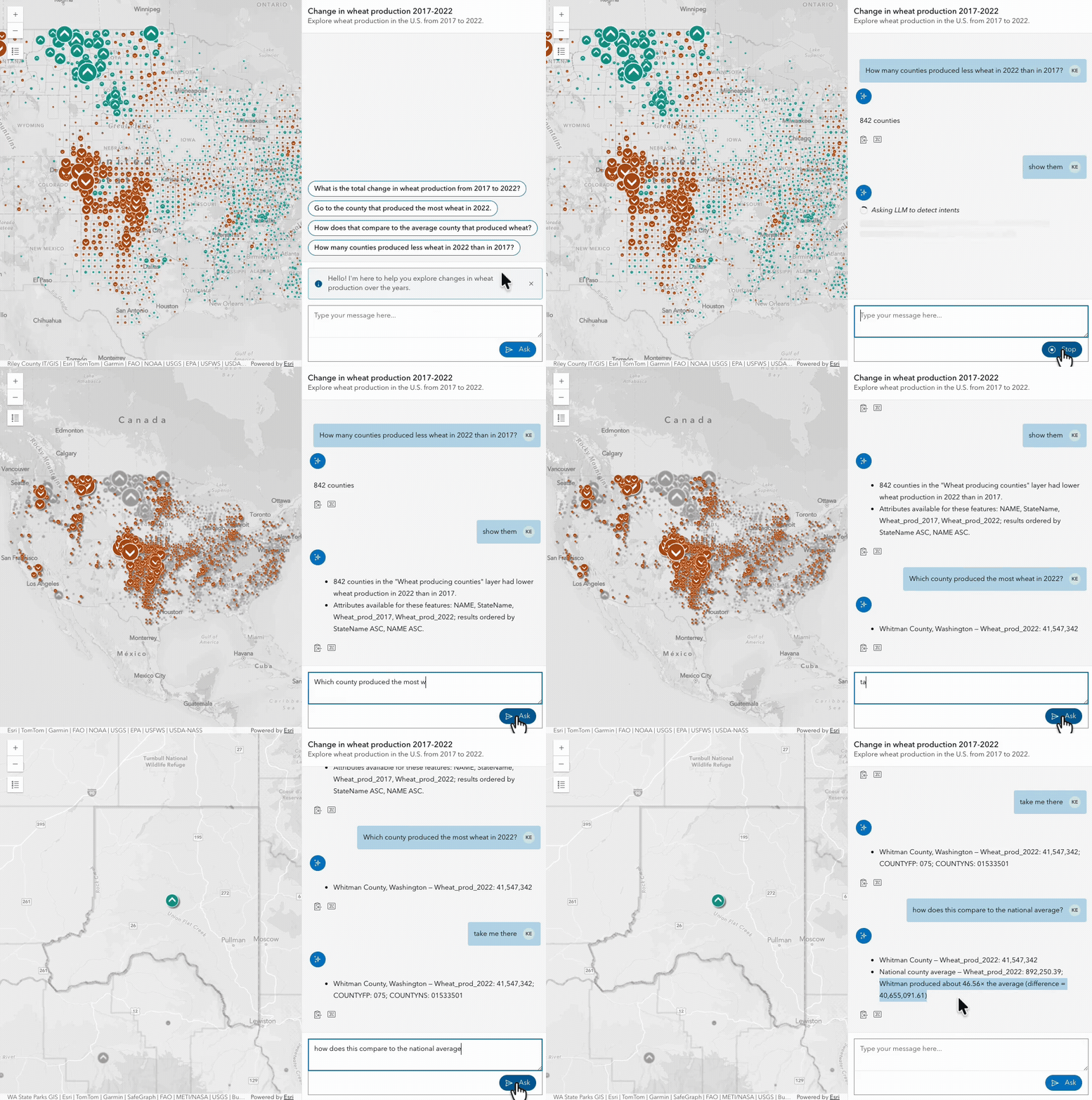
Developers can now build agentic mapping applications powered by out-of-the-box geospatial agents and custom agents you can create in both ArcGIS Enterprise 12.2 and ArcGIS Online using AI components (beta) in the ArcGIS Maps SDK for JavaScript. Users across your organization can interact with these custom mapping applications to find answers backed by geospatial data, asking questions like “How many counties produced less wheat in 2022 than in 2017?”.
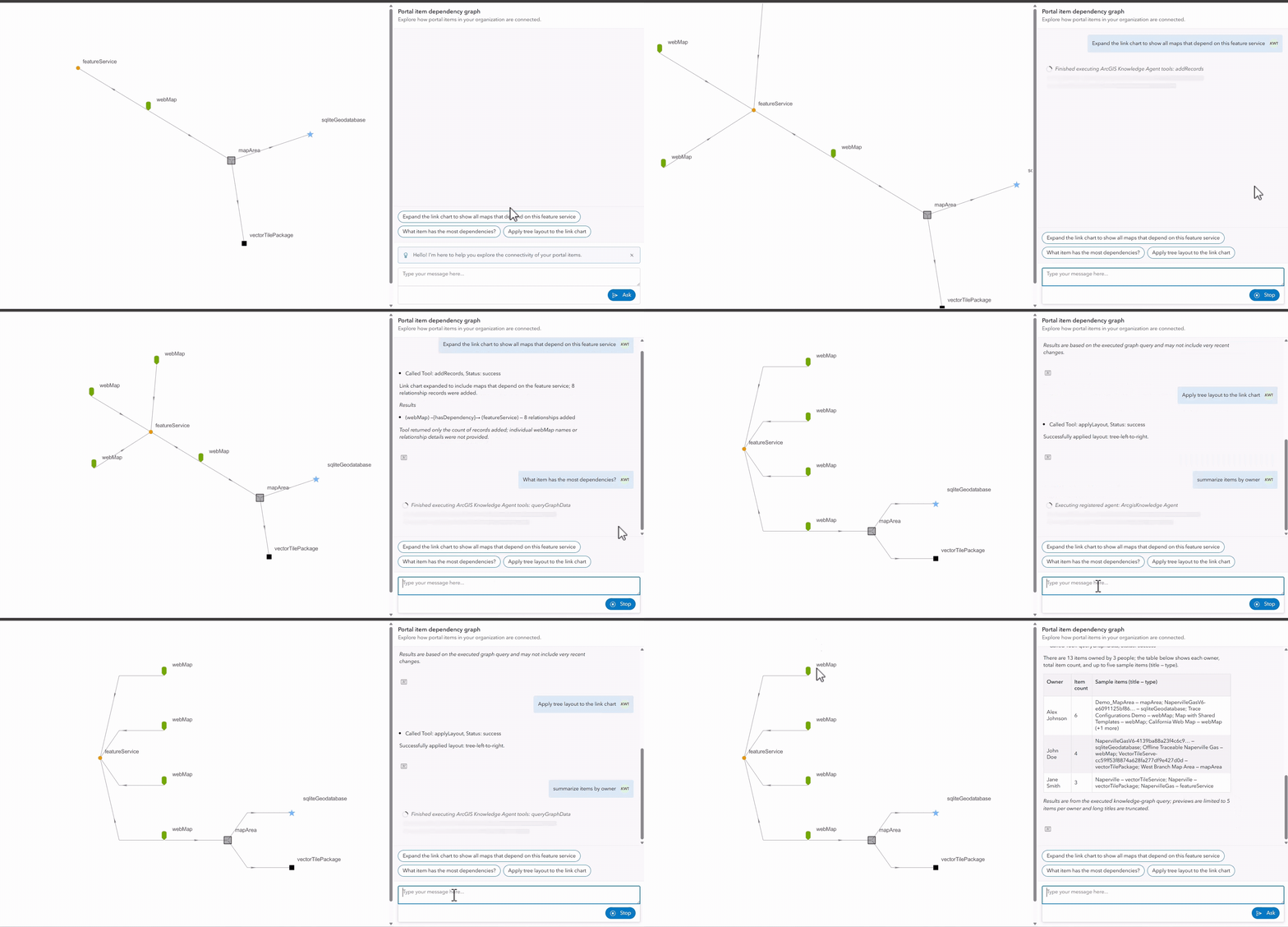
In addition, a new out-of-the-box agent called knowledge agent is available in the AI components (beta) in the ArcGIS Maps SDK for JavaScript. You can ask questions of a knowledge graph service that can span many different relationships, such as “who are our top suppliers by spend” and get summarized answers with results visualized in a link chart or map. Ask follow-up questions to expand those results, find indirect paths between entities, and update the link chart directly from the chat, all without needing to write queries.
Add conversational experiences without code
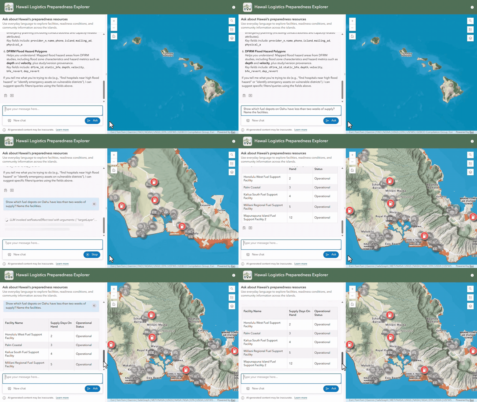
For teams that don’t want to code, start by creating a map with your data, then use the ArcGIS Instant Apps Data Explorer template (beta) to enhance it with a conversational experience. Available in ArcGIS Enterprise 12.2 and ArcGIS Online, the Data Explorer gives organizations a no-code way to create agentic mapping apps that let users across your organization interact with existing maps and data through natural language. Ask questions like “Show which fuel depots have less than two weeks of supply?” and other geospatially related inquiries to get answers faster.
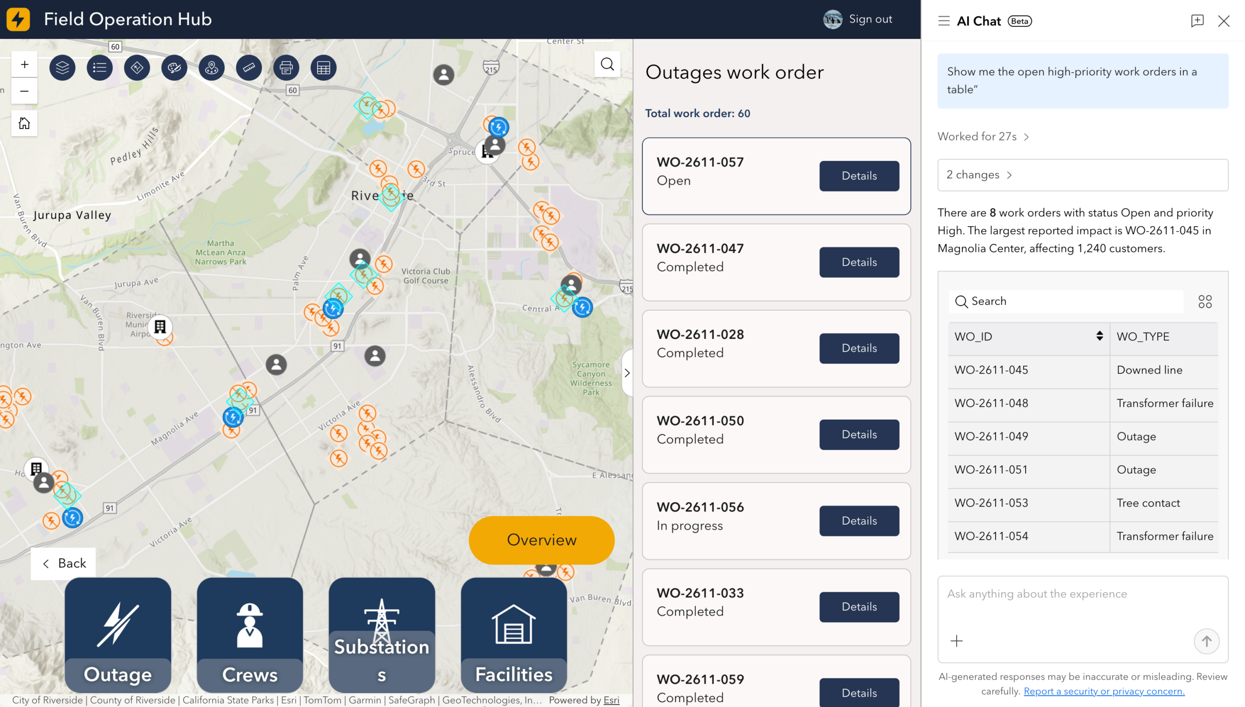
You can also create agentic mapping applications with ArcGIS Experience Builder applications. Now available in beta in ArcGIS Online, AI chat lets users interact with configured ArcGIS Experience Builder apps through natural language, without rebuilding anything. App authors can enable AI chat in the app’s settings, and customize the chat name, style, tone, layout, and instructions to fit the app’s purpose. End users within your organization can interact with the app and access data through natural language to explore maps, find locations, run spatial queries, and print maps, all by describing a task.
AI tools & models: Turn data into actionable insight
AI tools and models, included with ArcGIS, accelerate how users create, extract, and analyze many types of geospatial data, including imagery, vector, text, time series, and 3D. In the release of ArcGIS Pro 3.8, we introduce a new foundation model, an embeddings dataset, and several AI tools that help users turn data into actionable insight.
Find new market opportunities with foundational models and embeddings
Accelerate similarity search and predictive modeling across USA communities
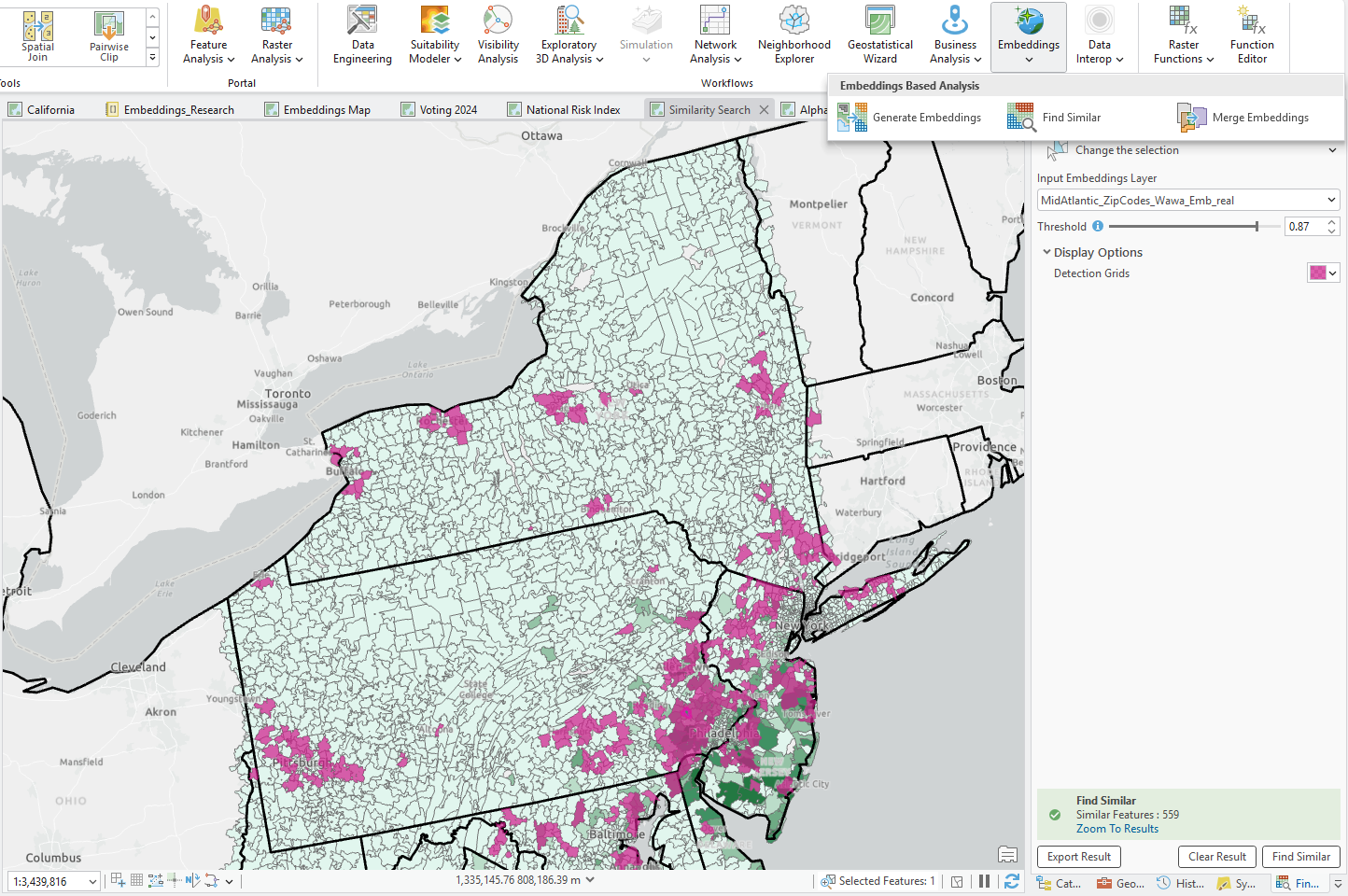
The USA geodemographic embeddings 2026 layer is now in general availability. This dataset transforms demographic, socioeconomic, environmental, and census-derived variables, including data from the U.S. Census Bureau and American Community Survey (ACS), into embedding attributes that capture geodemographic and environmental characteristics across the United States. This helps analysts build more efficient workflows for predictive modeling, clustering, and similarity search for use cases like estimating health outcomes and identifying new market opportunities.
Earth observation foundation model turns multi-sensor imagery into insight
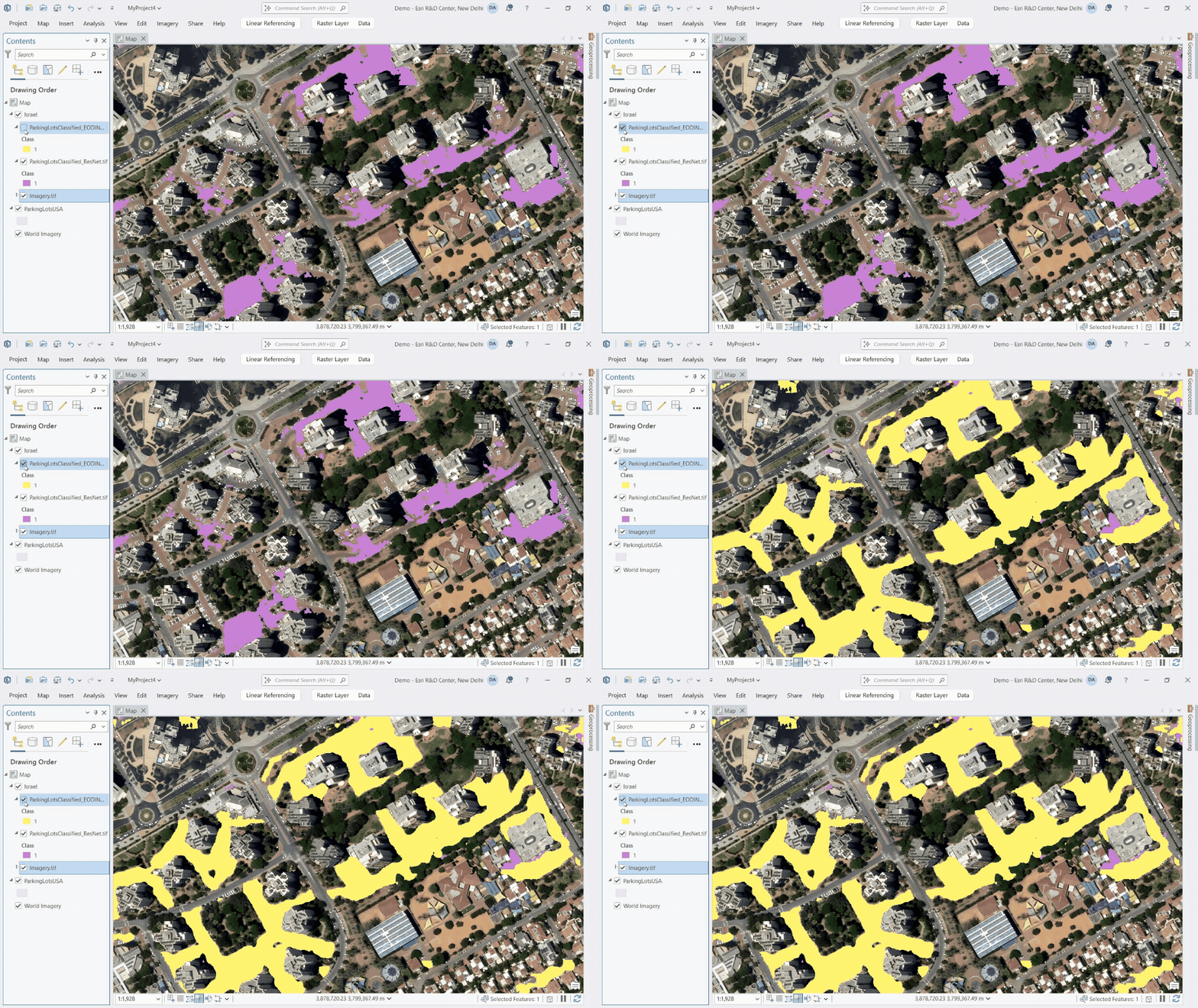
The earth observation foundation model (EO-DINO), developed by Esri, helps organizations extract information from remotely sensed imagery over a broad range of tasks with less labeled data. Trained using high-resolution RGB world imagery, multispectral satellite imagery, and SAR, EO-DINO captures fine-grained geographic details about the Earth across multiple sensors. Customers can access it as a deep learning package (.dlpk) in the ArcGIS Living Atlas and use it to identify similar features across large areas, detect changes, and differentiate Earth surface materials and land cover more accurately. This model generates geographic embeddings that work with analysis tools or works as a backbone for fine-tuning downstream models for environmental monitoring use cases and more.
Leverage AI tools and services to transform data into GIS-ready information
Expanding the new embeddings-based analysis toolset in ArcGIS Pro
- The Find Features By Description Tool lets users identify features in imagery using natural language prompts. It compares imagery embeddings with text embeddings generated from a user-provided feature description such as “large airport”. Use this tool with existing imagery embeddings or create your own text embeddings using the Generate Embeddings Using AI Models tool and a compatible vision-language foundation model such as GeoRSCLIP, which is available as a deep learning package (.dlpk) in ArcGIS Living Atlas.
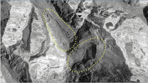
- The Detect Changes Using Embeddings tool compares imagery embeddings generated from two periods to identify areas of change. Unlike pixel-level change detection, comparing embedding representations enables detections of semantic change in geographic locations over time. Additionally, analysts can refine results by specifying what changes they are interested in preserving and what changes to ignore, which incorporates human validation into the workflow.
Turn 3D reality capture into analysis-ready GIS features
The new Detect Objects In 3D Space tool in ArcGIS Pro automatically identifies objects in oriented imagery, 3D meshes, and Gaussian splats. This tool uses trained AI models to extract features such as windows, cars, or rooftop air conditioning units, and places them at the correct depth in 3D space so that they can be visualized and analyzed in their actual 3D context. For example, extracted 3D windows can be classified according to their waterfront view, which enables use cases such as identifying premium waterfront properties or assessing infrastructure.

Turn photographs, reports, or observations into usable geographic data with ArcGIS Online AI premium services
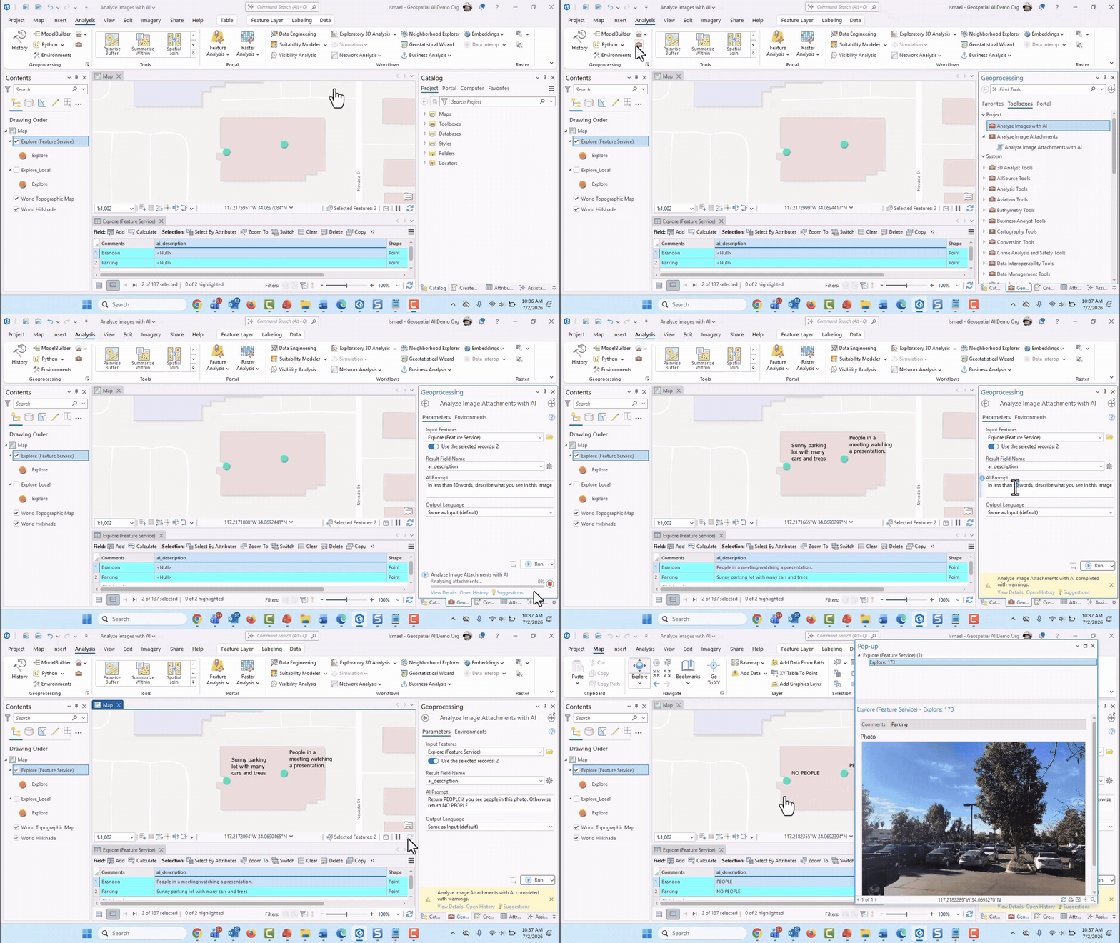
Now generally available in ArcGIS Online, three AI premium services, text analysis, image analysis, and text translation, let you turn unstructured content like photographs, long reports, and field notes into GIS-ready data you can map, analyze, and act on. With natural language, you can extract information from images and text, and automate language translations, saving time and reducing manual data preparation. These services are available through the arcgis.ai module in the ArcGIS API for Python, AI calculations in ArcGIS Survey123, and the AI Analysis Toolbox Sample that users can download for ArcGIS Pro. Note: these services will consume credits; and ArcGIS Enterprise 12.2 can be configured to leverage these ArcGIS Online services.
AI assistants: Complete your ArcGIS workflows faster
These embedded assistants are here to help support your ArcGIS workflows making it easier for you to use and learn ArcGIS. This November update introduces assistants to ArcGIS Enterprise 12.2 in beta as well as two assistants in ArcGIS Online that are now generally available.
Twelve AI assistants will be in ArcGIS Enterprise 12.2 in beta later this year. AI assistants across ArcGIS support a wide range of workflows such as:
- Content management (item details assistant)
- Mapping & analysis (ArcGIS Business Analyst assistant)
- Code generation (ArcGIS Notebooks assistant & ArcGIS Arcade assistant)
- Storytelling (ArcGIS StoryMaps assistant)
- Survey creation (ArcGIS Survey123 assistant)
- Imagery workflows (ArcGIS Excalibur assistant & ArcGIS Drone2Map assistant)
- And more
Included with user types at no additional cost, AI assistants are here to enhance your experience across ArcGIS.
Generally available assistants in ArcGIS Online
Two AI assistants in ArcGIS Online have passed security baselines to be generally available, each with a transparency card that provides information on guardrails, security practices, and AI models used, so users can see the scope of each assistant. The item details assistant helps create ready-to-use metadata for better discoverability of content, and the ArcGIS StoryMaps assistant helps support creating engaging and interactive ArcGIS StoryMaps stories. To find the transparency cards, go to the ArcGIS Trust Center webpage.
Configure and control access
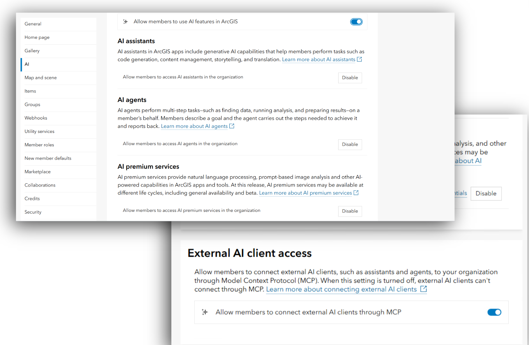
AI features are opt-in by default – they’re off until you decide otherwise. Administrators can turn AI agents, AI assistants, and AI premium services on or off, and users can download pretrained models as deep learning packages or use the built-in tools at any time. For ArcGIS Enterprise users, external client access can also be controlled, so you decide whether outside agents can connect to your ArcGIS content through MCP.
Control goes beyond just turning features on or off. There is a role privilege that can be assigned with custom roles, letting you control exactly who in your organization has access to AI assistants and premium services. More granular control for who has access to AI agents is coming soon. This means you can enable AI for individuals without opening it up to everyone, keeping control in the hands of your administrators.
Your trust and security matters
Our approach to AI is different. We are focused on responsible AI, built on six guiding principles: security, privacy, transparency, fairness, reliability, and accountability. Trust isn’t something you tack on after building a feature. It’s built into the process from the start, and it means answering the questions that matter to you before you ever turn anything on. For more information, check out arcgis.trust.com
Common questions about security
If I use AI in ArcGIS, will my data be exposed or used to train models?
When you use AI in ArcGIS, your prompts and data are not used to train AI models, and they remain private unless you explicitly authorize Esri to have visibility (such as providing feedback). When third-party AI services are involved, enterprise-class instances are used to segment and protect your data. You retain ownership of everything you provide
Note: There are two pretrained AI models, Vision Language Context-Based Classification and Image Interrogation, that can connect to OpenAI on your authorization. When you use them, your data is shared with OpenAI. Please review the detailed documentation for more information.
What about beta features? Is my data treated the same way?
For beta features, Esri development teams will be able to see your prompts and data because the intention of a beta is to gather feedback to make improvements. If you’re working with sensitive data, you have the option to turn beta features off, giving you full autonomy over what’s shared and what isn’t.
Where can I learn about the AI models used by ArcGIS?
AI assistants that reach general availability come with a transparency card detailing what guardrails are in place, what models are used, the scope of usage, and more. Various assistants have transparency cards today. Check them out.
For AI tools and models, Deep Learning Packages in the ArcGIS Living Atlas include item description pages with intended use, model architecture, training data used, tuning guidance, performance metrics, and potential limitations.
Transparency cards for agentic capabilities are coming soon. In the meantime, the same safeguards apply to agentic capabilities in beta as they do to AI assistants in beta.
Leverage geospatial AI today
Geospatial AI isn’t a separate thing you add to your GIS work. It’s the next chapter of it. The same science-backed location intelligence that has defined ArcGIS for decades, now accelerated. The same commitment to trust, now extending to every AI capability. The capabilities are here, the guardrails are built in, and the control stays with you. Talk to your administrator about enabling AI in your organization and start putting geospatial AI to work today.


Article Discussion: