We are looking forward to connecting with everyone in Washington, D.C. at the Esri Federal GIS Conference (FedGIS) on February 7-8, 2023. There will be many ways to learn more about Esri, ArcGIS, and ArcGIS StoryMaps at the event. Of course, you can engage with our StoryMaps team, too.
Science in Action
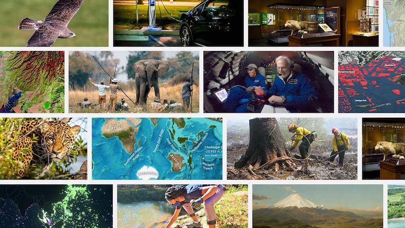
This year’s conference theme is GIS – Linking Science to Action. ArcGIS StoryMaps is the perfect storytelling tool to bring action to the amazing scientific GIS work you do. It allows you to showcase your incredible GIS work – like web maps and apps – in an interactive story that makes an impact. Simply add your own text, images, and multimedia to immerse your readers and inspire them to take action.
If you’re interested in learning more about ArcGIS StoryMaps, here are the highlights to help you plan your time.

Plenary
You won’t want to miss the keynote address by Jack Dangermond, Esri president, at the Plenary. Featuring a variety of accomplished federal government thought leaders and product demonstrations, the main stage will be filled with inspiring ways GIS is making a positive impact across the national government and in society.

ArcGIS StoryMaps at the Esri Expo
If you’re wondering where to find our team throughout the event, we’ll be in the booth at the Esri Expo! Please come and visit us on Tuesday, February 7 from 12:30 pm to 6:30 pm EST and Wednesday, February 8 from 10:45 am to 5:15 pm EST.


ArcGIS StoryMaps FedGIS Sessions
Whether you’re new to ArcGIS StoryMaps or you’ve been using its predecessor, Esri Story Maps, for years, we have sessions for everyone.

ArcGIS StoryMaps: The Basics, What’s New, and What’s Coming
1:45 p.m. to 2:45 p.m. EST
Room 146 A | WEWCC
Looking to create your first story? ArcGIS StoryMaps helps you tell remarkable stories with custom maps that inform and inspire. We’ll share a step-by-step guide to using the ArcGIS StoryMaps builder to bring your content to life. You’ll find it easier than ever to make beautiful and informative multimedia narratives. You’ll learn about new storytelling features and get a sneak peek into our plans for upcoming storytelling capabilities.
Featured Speakers:
Jennifer Bell, Sr. Product Manager, ArcGIS StoryMaps
Owen Evans, Lead Product Engineer, ArcGIS StoryMaps
Abby England, Product Engineer, ArcGIS StoryMaps
ArcGIS StoryMaps: How Agencies Manage Their ArcGIS StoryMaps Programs
4:15 p.m. to 5:15 p.m. EST
Room 146 A | WEWCC
In this panel discussion you’ll learn about successful ArcGIS StoryMaps programs created by federal government agencies. You’ll get useful advice, tips, and resources from the people behind those programs, and you’ll learn how you can make ArcGIS StoryMaps a key component of your organization’s communication efforts.
Featured Speakers:
Michelle Thomas, Lead Communication Strategist, ArcGIS StoryMaps
Allen Carroll, Sr. Principal Product Engineer, ArcGIS StoryMaps
Rafael “Rafa” de Ameller, NOAA
Tiffany Small, NOAA
Juan Pablo Hurtado Padilla, NOAA

ArcGIS StoryMaps: The Basics, What’s New, and What’s Coming
11:00 a.m. to 12:00 p.m. EST
Room 151 A | WEWCC
This session is also held on February 7.
Looking to create your first story? ArcGIS StoryMaps helps you tell remarkable stories with custom maps that inform and inspire. We’ll share a step-by-step guide to using the ArcGIS StoryMaps builder to bring your content to life. You’ll find it easier than ever to make beautiful and informative multimedia narratives. You’ll learn about new storytelling features and get a sneak peek into our plans for upcoming storytelling capabilities.
Featured Speakers:
Jennifer Bell, Sr. Product Manager, ArcGIS StoryMaps
Owen Evans, Lead Product Engineer, ArcGIS StoryMaps
Abby England, Product Engineer, ArcGIS StoryMaps
Public Safety: Public Information Sharing
12:15 p.m. to 1:00 p.m. EST
Safety and Security Theater | WEWCC
The interactive, media-rich nature of ArcGIS StoryMaps makes them an effective tool for public education. You will learn top tips for making stories that help achieve objectives like conversions, engagement, and other things you didn’t know about ArcGIS StoryMaps.
Featured Speaker:
Renee Bernstein, Esri
ArcGIS StoryMaps: How Agencies Manage Their ArcGIS StoryMaps Programs
2:45 p.m. to 3:45 p.m. EST
Room 151 B | WEWCC
This session is also held on February 7.
In this panel discussion you’ll learn about successful ArcGIS StoryMaps programs created by federal government agencies. You’ll get useful advice, tips, and resources from the people behind those programs, and you’ll learn how you can make ArcGIS StoryMaps a key component of your organization’s communication efforts.
Featured Speakers:
Michelle Thomas, Lead Communication Strategist, ArcGIS StoryMaps
Allen Carroll, Sr. Principal Product Engineer, ArcGIS StoryMaps
Rafael “Rafa” de Ameller, NOAA
Tiffany Small, NOAA/NESDIS Visualization Lab
Juan Pablo Hurtado Padilla, NOAA
Sharing 3D Content and Authoring 3D Experiences
4:00 p.m. to 5:00 p.m. EST
Room 156 | WEWCC
In this session, we will show how you can leverage your 2D and 3D data to create exciting and intuitive 3D web experiences. We will cover the fundamentals of publishing 3D content, authoring web scenes, and how to use them as a base for configurable 3D web applications such as ArcGIS StoryMaps, ArcGIS Instant Apps, and ArcGIS Experience Builder.
Featured Speaker:
Gert Van Maren, 3D GIS Specialist, Esri
Moving From the Classic Esri Story Maps Templates to ArcGIS StoryMaps
5:15 p.m. to 6:15 p.m. EST
Room 103 B | WEWCC
ArcGIS StoryMaps is the professional, modern storytelling tool that enables you to communicate internally and with the public while incorporating your organization’s maps and geospatial data. This session will provide guidance and resources to help you successfully transition from the Classic Esri Story Maps templates to ArcGIS StoryMaps. It will answer questions about when and how to remake classic stories using ArcGIS StoryMaps and clarify which storytelling features are available at each ArcGIS Enterprise version.
Featured Speakers:
Owen Evans, Lead Product Engineer, ArcGIS StoryMaps
Virginia Leslie, Sr. Product Engineer, ArcGIS StoryMaps
Abby England, Product Engineer, ArcGIS StoryMaps
ArcGIS StoryMaps: Sharing Stories in State and Local Government
5:15 p.m. to 6:15 p.m. EST
Room 103 A | WEWCC
State and local governments use ArcGIS StoryMaps to share their stories, give presentations, provide reports and context to their GIS work, crowdsource from the community, and give context for programs and policies. Join this session to learn about the many use cases, best practices, and tips for accessibility, sharing, collaboration options, and more.
Fairfax county is using ArcGIS Story maps to reach their audience and showcase their good work. Sandra will share tips and tricks for authoring stories and discuss how they’re using Esri tools to communicate their work.
Featured Speakers:
Ross Donihue, Lead Content Strategist, ArcGIS StoryMaps
William Hackney, Writer and Content Specialist, ArcGIS StoryMaps
Sandra Woiak, Fairfax County Government
Try StoryMaps at Home
Did you hear Esri has a new personal storytelling tool, StoryMaps? If you stop by the Esri Expo, our team can help you learn more about how you can use this powerful, personal storytelling tool to create engaging content about the things you’re most passionate about outside of work.
Plan Your Agenda
There is so much to see and do over the two days. Be sure to check out the Detailed Agenda to add these sessions to your schedule and explore other interesting topics.

Registration is still open!
If you would like to attend FedGIS, registration remains open until February 8, 2023.

We can’t wait to see you in person, and learn more about you and your work. Please stop by a session and/or the booth. All questions are welcome!


Article Discussion: