ArcGIS StoryMaps is the professional tool for harnessing the power of maps to communicate your work using geospatial storytelling. The easy-to-use builder enables you to combine maps, 3D scenes, embedded content, multimedia, and more to create an interactive narrative that can inspire interest — and action — from your readers.
Each month, our team uses community feedback to help inform new capabilities that can enhance your storytelling adventures. Check out what’s new this month!
Quick links
- Offline preview in briefings
- Sync map extents in briefings
- Swipe block in frames
- Image gallery enhancements
- Outline enhancements
- Line chart enhancements
- And more…
Offline preview in briefings
Remote locations. Secure facilities. In transit. There are many reasons to present geospatial information without an internet connection, and briefings in ArcGIS StoryMaps brought that capability to our community in 2024. But creating a presentation that is truly ready for offline use requires a few important steps, and we’re excited to share a new way to help you confirm that your briefing is ready for its offline moment.
From the briefing builder, select Preview, then switch from Online preview to Offline preview. Navigate your briefing to identify any warnings stating Offline media not configured. When Offline media is properly configured, it will appear for review.
To configure Offline media in the briefing builder, go to media Options then the Offline tab. Here, you can Add offline media.
Learn how to create alternative media using screen recordings for offline presentations.

Sync map extents in briefings
Whether you’re comparing before-and-after conditions or examining different variables, having multiple maps on a slide stay synchronized as you pan and zoom keeps every view anchored to the same geographic context. This creates a smoother experience for presenters and readers while supporting side-by-side decision-making.
From the briefing builder, add at least two maps to a slide then click Slide actions to Enable map sync. When toggled on, all maps on that slide will sync to the last edited map; when toggled off, all maps will return to their originally specified extent.
Maps bring geospatial stories to life, so it’s essential to understand your options as an author — and how those choices affect the reader’s experience. Learn more about map extents in ArcGIS StoryMaps.
Swipe block in frames
Short-form storytelling with frames in ArcGIS StoryMaps is an opportunity to grab your reader’s attention on the fly, but your content needs to communicate quickly. New to frames, the swipe block makes that easy. Already popular in stories and briefings, swipe blocks help readers compare maps or images with a simple gesture. Choose between horizontal and vertical swipe directions, creating comparisons that feel natural for both the content and the viewing experience.
Note: The vertical swipe capability is coming to stories and briefings; it is available only in frames as of now.
From the frame builder, select Swipe from the block palette and Add media. Select Rotate to change from vertical to horizontal swipe motion.
Frames recently came out of beta, and we would love to hear what you think — share your feedback at ArcGIS StoryMaps Frames Feedback.
Image gallery enhancements
Images help readers connect with your information, absorb content more quickly, and break up long sections of text. Whether you need to grab their attention, immerse them in a place, or provide visual evidence, strengthen your geospatial storytelling with these image gallery enhancements.
Frames
Image galleries are now available in frames.
Briefings
Previously, image galleries in briefings were limited to a single layout. Now, both Dynamic squares and Jigsaw layouts are available.
Stories
Image galleries can now be added to Sidecar media panels.
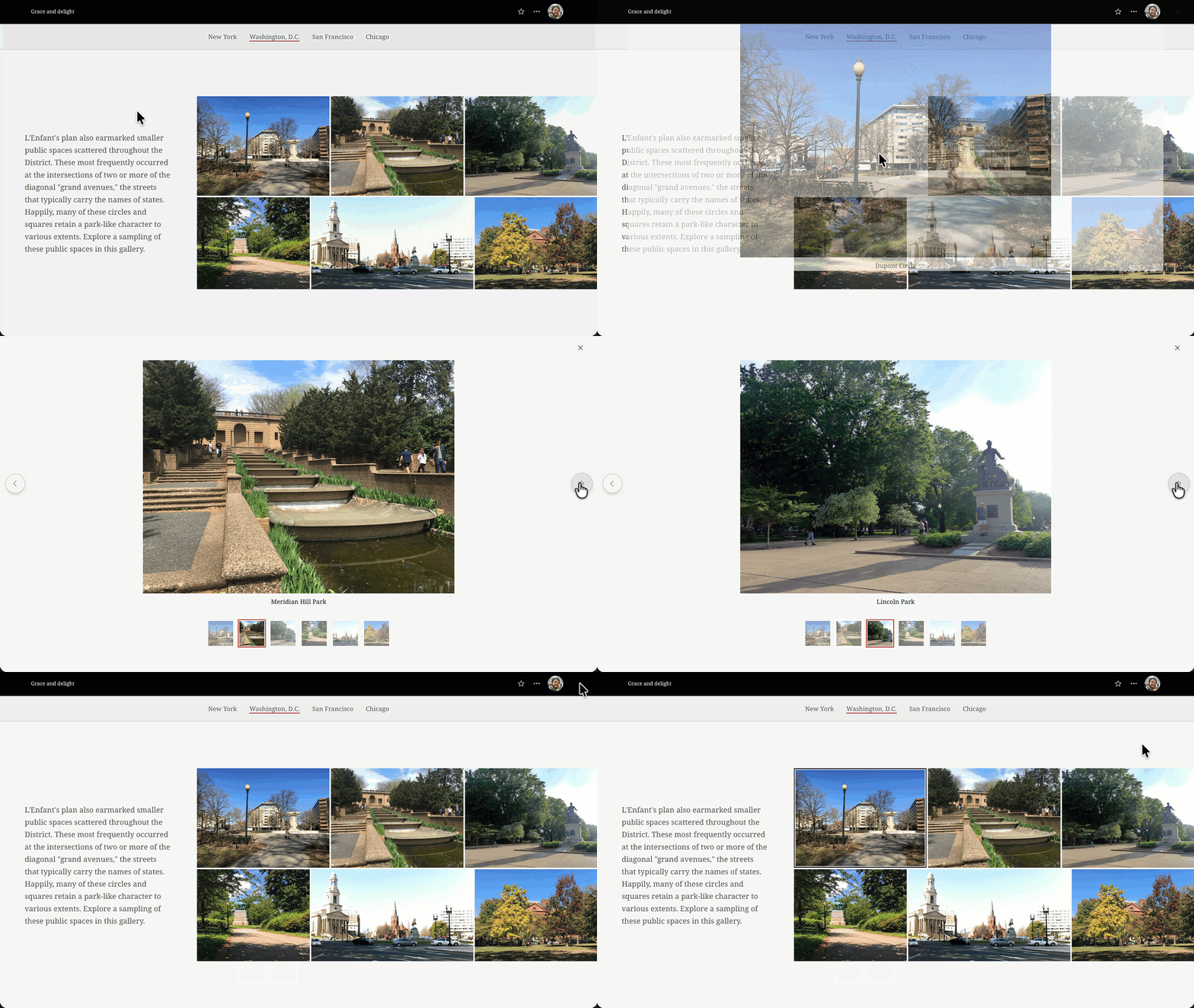
Media in storytelling does more than simply illustrate the narrative; it plays a crucial role in deepening your story’s impact. Learn how to choose effective media for your story.
Outline enhancements
In May 2026, we introduced Outline to make it easier to navigate and organize your story as you build. We continue to enhance this new feature to improve accessibility and navigation:
- Click on a heading or block item from the outline to jump to that item in the builder.
- Click the chevron to drop down the list of blocks under a heading item.
- Click on a heading ellipsis to Jump to section; click on a block ellipsis to Move up, Move down, Jump to block, or Delete.
- Use keyboard shortcuts to navigate the outline.
The way you organize your geospatial story matters. Learn how pacing, structure, and intentional design choices help craft compelling stories that keep your audience reading from beginning to end.
Line chart enhancements
When intentionally integrated into a geospatial narrative, data visualization can enhance the clarity and impact of your story — and create moments of pause and reflection for your readers among longer sections of text. To this point, we’re happy to add new options for visualizing your information.
Whether it’s to better align your data visualizations with the visual identity of your story or to more naturally represent fluctuating data, you can now choose to apply Smoothed lines to your line charts.
Learn how to use charts, infographics, and tables effectively in ArcGIS StoryMaps.
And more…
- Text panel width and placement can now be adjusted in guided map tours.
- Undo and redo are now available in frames.
- Item details for a theme can now be modified when publishing.
Check out the release notes for more details about other small changes and fixes released this month.
Build a story with us. Register for 2026 ArcGIS StoryMaps Live, a chat series that walks through practical techniques for crafting geospatial stories that resonate.
How are you bold in the pursuit of better? Learn more about the 2026 ArcGIS StoryMaps Competition, open from September 8 through December 11.
Thank you to Ashley Du and Will Hackney for their contributions to this post.
All Adobe Stock images are © 2026 Adobe Stock. All rights reserved.

Article Discussion: