Agriculture at Esri’s User Conference
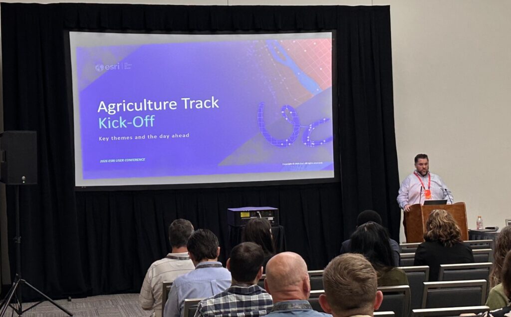
It was an exciting conference and successful year for the GIS Agriculture community! Not only did the community have many more papers than in recent years (six!), but two Special Achievements in GIS (SAG) were awarded to members of this community[see Section I.]. This is a testament to the great work you all are doing to drive GIS adoption into a challenging industry that has been stressed by volatility in recent years.
This year also highlighted a monumental shift in Esri’s approach to the Ag industry day, where the focus is on “business first” over technology. A major theme throughout the day was the emphasis on careful and “ole school” engineering practices tightly coupled to well-defined business drivers, rather than getting caught up in all the AI hype [see reprint of my talk in Sect. III below].
Underlining that shift – we were also joined by a distinguished panel who is on the forefront of GIS, AI, and Agriculture . The panel had a great discussion about the challenges their organizations are facing, the state of the industry, and the future of Ag [Sect. II].
The takeaways from the panel were certainly seen in the sessions throughout the day. Issues ranging from climate change (or “weird weather” as we call it in the US) [Sect. IV.A-D] to driving economic efficiencies [Sect. IV.E-F] were reflected in all the papers presented and serve as requirements for where Esri needs to go to support the Ag industry. To support the industry, Dr. Elvis Takow detailed [Sect. V] the key, current capabilities in the technology stack and how to carefully navigate the geospatial AI journey.
While this blog serves to document 2026, we look forward to many new capabilities from Esri during the year as we move to empower the Ag GIS community for a successful 2027 user conference.
I. Celebrating Special Achievements in (Agricultural) GIS
Bunge received Esri’s SAG award in recognition for the way Tijs Lips’ and Pitt Onn Wong’s Bunge team has applied GIS at global scale to strengthen responsible sourcing, sustainability, and transparency in the palm oil supply chain. By combining ArcGIS Pro, ArcGIS Online, satellite-based deforestation alerts, supply chain maps, and ground verification workflows, Bunge can trace sourcing areas to mills and supply landscapes, monitor 113.9 million hectares, support EUDR requirements, and demonstrate traceability to customers and stakeholders. As highlighted on pp. 56-7 of their 2026 Sustainability Report, this work turns sustainability commitments into operational practice—protecting biodiversity, supporting human rights, and helping suppliers, including smallholder farmers, participate in more sustainable value chains. Bunge’s achievement stands as a powerful example of how GIS can drive measurable environmental and social impact across global agriculture.
The Sugar Cane Growers Cooperative (SCGC) of Florida earned the SAG award in recognition of managing one of agriculture’s most complex harvest logistics operations using a modern, real-time, GIS-driven enterprise system. Because sugar cane must be processed within 24 hours of harvest, SCGC needed to coordinate continuous harvesting, transportation, equipment assignments, and mill capacity across 150 consecutive days with exceptional precision. Working with Esri Professional Services, the team consolidated six disparate systems into a unified ArcGIS-based operational environment powered by real-time data processing, web maps, dashboards, and mobile workflows. The result replaced paper tickets and disconnected spreadsheets with live spatial intelligence that field crews, managers, directors, and executives can use anytime to track harvest progress, optimize resources, reduce downtime, and improve mill efficiency. This transformation has delivered more than $5.5 million in operating expense savings and a triple-digit ROI.
II. The Agriculture Special Interest Group (SIG) Panel

This year’s panel was constructed to represent the three pillars of success for a geospatial AI journey: 1) business discipline 2) in-depth knowledge of AI and 3) a solid foundation in GIS.
Baxter Clark, VP-Operations at SCGC, brought a business-first perspective to improving how agriculture operations run, which comes from his roots on a cotton farm and experience spanning farming, agronomy, seed technology and consulting. Corteva’s Dr. Hoda Helmi, whose PhD is in AI, emphasized the need to reduce point solutions that prevent coordination at the enterprise level. Her team’s work with the One Seed Digital Twin initiative is a perfect example of how to integrate data, optimize using predictive models, and incorporate agentic AI into closed-loop pipelines. Drawing from over 20 years of GIS experience, Melissa Gayley from Bunge stressed the need for a hub and spoke architecture to bring together pockets of GIS expertise in order to accommodate Bunge’s growing GIS needs.
III. An (Agriculturally) Intelligent World Starts with Trusted Geospatial Data
Reprinted from AG SIG presentation.
Artificial intelligence is advancing quickly, but in agriculture, speed alone is not enough. A recommendation that arrives too late, is based on incomplete data, or cannot be trusted can affect decisions that are tied directly to yield, supply chains, and long-term producer confidence. That is why the most important conversation about AI in agriculture is not only about algorithms. It is about the data, human expertise, and geospatial infrastructure required to make those algorithms reliable.
That theme was reinforced throughout the Ag SIG panel discussion. As I listened, I was struck by how much the current conversation around AI echoes earlier periods in the field’s history. I began my career in AI in 1984, and I am often asked what has changed since then.
My answer is that two significant developments have reshaped the field:
- First, computational capacity has increased to the point where many long-standing AI methods can now operate at meaningful scale.
- Second, the ease of deploying AI has introduced new responsibilities around data quality, transparency, and trust.
On the one hand, the growth in computational power has accelerated progress dramatically. In 1987, my teammates at NASA were using neural networks to classify crops and other land cover types with multispectral satellite imagery—what many would now describe as GeoAI. At that time, training a neural network on a single Landsat image could take weeks.
Because computing resources were expensive and limited, engineering discipline mattered tremendously. A single mistake could delay a project by days or weeks, so teams had to be deliberate, careful, and rigorous in how they designed and executed their work.
Today, the same kind of work can often be completed far more quickly, using modern cloud infrastructure, accessible tools, and highly automated development workflows.
On the other hand, that ease of use can create a false sense of confidence. It is increasingly common to aggregate large volumes of data, apply sophisticated algorithms, and assume that useful answers will emerge. Yet without careful data governance, domain expertise, and “ground-truth” validation, AI systems can produce unreliable outputs that are difficult to detect and even harder to correct.
In agriculture, unreliable information can have serious consequences. Agriculture is inherently time-sensitive. If decision-support tools provide the wrong recommendation, or provide the right recommendation too late, the result can be reduced yield during the season. Those impacts can then extend downstream across processing, logistics, and distribution.
Poor outcomes also erode trust in technology. I hear echoes of the 1990s, when AI was frequently presented as a solution to nearly every problem. By the end of that decade, many practitioners had stopped using the term AI altogether, even as the underlying techniques continued under names such as business intelligence, analytics, and data science.
Fortunately, today’s AI landscape also includes substantial scientific and engineering progress. The question, then, is how we avoid repeating the mistakes of the past. I would argue that the answer was reflected in the panel discussion itself.
First, we need more leaders like Corteva’s Dr. Hoda Helmi. AI, bioinformatics, computational biology, and related disciplines require deep expertise, education, and sustained effort. These are not fields that can be mastered through tools “knowledge” alone. Corteva’s investment in this area is important because scientific rigor is essential to reducing unreliable outputs and ensuring that AI-driven insights are grounded in evidence.
Second, we need more leaders like SCGC’s Baxter Clark. I had the opportunity to meet Baxter and his team recently, and I was impressed by their disciplined approach to continuous improvement. Their work is grounded in operational outcomes, return on investment, and measurable business value before moving to the next challenge. [Section IV.F]
Third, we need more leaders like Bunge’s Melissa Gayley. Unquestionably, It is hard to find professionals with both decades of GIS experience and deep agricultural industry knowledge. As organizations move beyond a single commodity group and begin managing multiple commodities, enterprise GIS becomes increasingly important. The ability to translate operational business problems into scalable geospatial data infrastructure is essential. Bunge is doing important work in this area, and I recommend reviewing the related article- Years Ahead of Regulation: Inside Bunge’s Traceability and Monitoring Platform.
The final answer is choosing the right technology partner. This is especially important in agriculture, where there may be only one opportunity to introduce a new technology to a time-constrained producer. The market also includes many point solutions, including organizations that must generate revenue faster than the broader industry can adopt and integrate new tools. Connecting these solutions requires effort, and there is no guarantee that every provider will remain viable year after year. That is why the foundational work being done by Dr. Helmi and her team is so important.
This community has a critical role to play. You are part of one of the most stable segments of the technology industry, and the decisions you make today are more likely to endure than many of the tools currently receiving attention. GIS has already demonstrated that kind of durability. With that foundation, you are well positioned to help ensure that AI and analytics in agriculture are built on trustworthy, well-engineered data infrastructure.
The key to reducing unreliable outputs is the essential work behind the scenes: designing and maintaining the geospatial data models that support AI and analytics. Reliable analytics require a rigorous spatial framework. Fortunately, Esri has spent decades developing that infrastructure, making it faster to configure agricultural solutions that can adapt over time and are supported by a platform and company built for long-term use. Given that agriculture is inherently geospatial, ArcGIS provides a strong foundation for building the technology stack that supports it.
If the current AI hype cycle eventually fades, the underlying need will remain: agriculture will continue to depend on accurate, trusted, geospatially enabled intelligence.
IV. Agriculture Session Papers
IV.A Mapping Global Regeneration: Using GIS to Scale Carbon, Water & Supply Chains
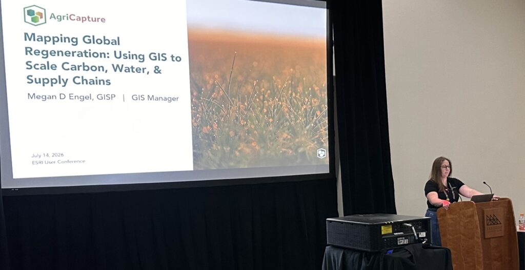
Environmental markets reward farmers and landowners for reducing emissions, conserving water, and restoring land. This creates opportunities for companies to invest in regenerative agriculture and measurable climate impact. AgriCapture has expanded from U.S. carbon projects to programs across India, Brazil, Paraguay, and Argentina. Using Esri tools, AgriCapture manages diverse land types and markets, ensuring global scalability, traceability, and transparency through our integrated inventory management platform.
IV.B ArcGIS-Engineered CSI:GeoAI-based MRV of Carbon for “Carbon Credits” Allocation

At present, “carbon credits” are allocated to landowners solely based on crop models and assumptions of before vs after scenarios of agricultural practices. This research delivers a novel GeoAI-driven Carbon Sustainability Index (CSI) and a decision-support dashboard published in ArcGIS Online to provide a MRV of carbon balance in agricultural system based on carbon storage (biomass) and emissions (CO2 and CH4). The project uses ArcGIS Pro for an end-to-end geospatial workflow to engineer a scalable, Python-based framework to automate geoprocessing of LiDAR and satellite data for CSI.
IV.C Revolutionizing Rangelands with Geospatial Technologies
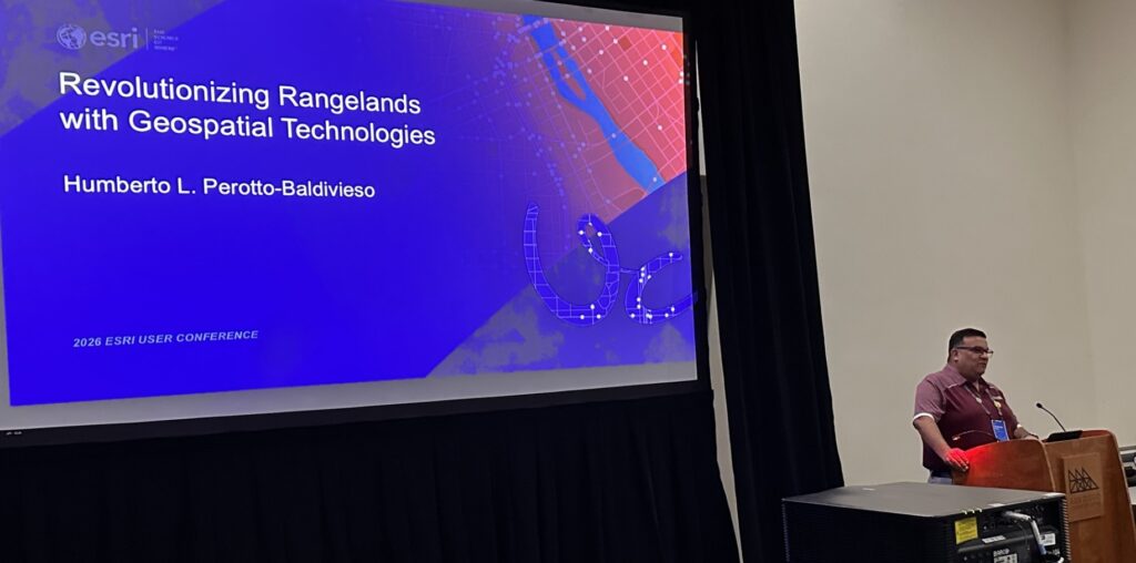
TAMU is using drone-derived data combined with fieldwork to develop workflows in ArcGIS Pro to gain novel information on how rangeland ecosystems are managed and the ideas TAMU can bring to the table to maintain and/or improve these ecosystems. Using Pix4D and ArcGIS Pro, TAMU is refining methods to estimate forage mass at the landscape scale, detect invasive species, and look at the temporal dynamics of grasses in semi-arid environments. All this information provides new and novel insights on rangelands dynamics and useful data for livestock production, wildlife habitat, and rangeland health.
IV.D From Field to Credit: Generating High-Quality Carbon Credits with Esri

Agoro Carbon™ is accelerating the global transition to climate-positive agriculture practices by empowering farmers and ranchers with agronomic expertise, geospatial insights, and carbon credit incentives. Agoro’s business is rooted in the lifecycle of spatial data, spanning across ArcGIS Pro, ArcGIS Field Maps, ArcGIS Online and ArcGIS Dashboards. Tools like the dashboard allow for real-time data sharing with stakeholders. These tools allow for cost-effective operations while generating carbon credits with high integrity through streamlining our measuring, reporting, and verification (MRV) process.
IV.E From Vineyard to Action: Grapery’s Real-Time Data Journey with ArcGIS

Grapery needed a way to turn field data into action without drowning in spreadsheets and manual entry. Using ArcGIS Online, SQL Server, and Oracle databases, Grapery built a live pipeline that moves data straight from the vineyard to the people who need it most. The result: real-time updates, better decisions, and a system that scales with Grapery’s growth.
IV.F Transforming Agricultural Operations through GIS Innovation
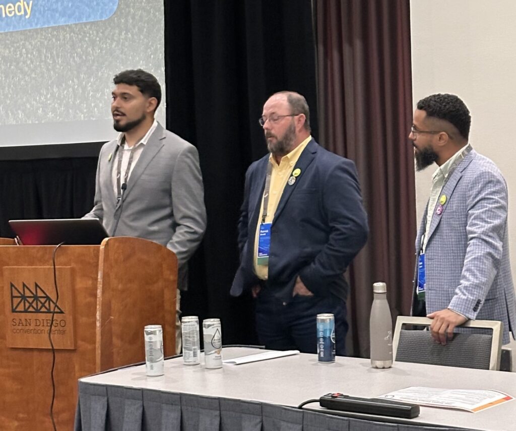
What was once a paper-driven, reactive operation has evolved into a fully connected, real-time agricultural system powered by ArcGIS. Today, SCGC coordinates its 180-day harvest with precision, enabling faster data-driven decisions, improved efficiency, and millions in operational savings.
V. Technologies for Agriculture

Reflecting Dr. Helmi’s approach to Corteva’s One Seed initiative, Dr. Elvis Takow reinforced the need to build up from solid geospatial data management infrastructure incrementally towards an enterprise agentic platform. Stay tuned for more from Esri on the application of Agent-to-Agent (A2A) communication and Model Context Protocol (MCP) framework to the ArcGIS foundation.