I recently had the opportunity to read an excellent story published by one of our Esri partners, 3-GIS. They posted a fantastic article about the great work they did with Emerald Broadband, a service provider in the pacific northwest. As someone who spent most of my life in Oregon and loves all things GIS in the telecom industry, I wanted to learn more.
In the heart of Lane County, Oregon, Emerald Broadband is on a mission to bridge the digital divide. As a public benefit internet provider, their commitment to delivering high-speed internet to underserved communities has made them a key player in the region since their establishment in 2016. To fuel their expansion and ensure efficient network management, Emerald turned to 3-GIS as a trusted resource to overcome challenges in data storage and accessibility.
The Challenge:
Emerald Broadband faced a critical challenge in managing their network data. Storing information through KML files proved to be a cumbersome process, lacking essential features like querying, consistent labeling standards, and other capabilities crucial for effective design and management. The absence of a robust, searchable database hindered the organization’s ability to understand their network’s status comprehensively and work cohesively.
The Solution:
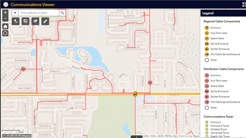
Recognizing the need for a powerful network asset management system, Emerald Broadband strategically chose 3-GIS | Web as the solution to revolutionize their network operations. This dynamic platform not only addresses the existing challenges surrounding Emerald’s fiber network, but also serves as a comprehensive system of record and engagement leveraging Esri ArcGIS. By combining best in class network management with web GIS capabilities, everyone throughout the organization gains real-time access and understanding of the current network assets while seamlessly planning and designing future expansions.

Empowering Connectivity with 3-GIS | Web:
Emerald Broadband’s selection of 3-GIS | Web has ushered in a new era of efficiency and collaboration. With accurate network data consolidated into a single, searchable system, the organization can now effortlessly document the connectivity of fiber strands. This transformation enables Emerald Broadband to share critical information with stakeholders who may not have a background in mapping, fostering clearer communication and understanding.

Key Benefits:
- Enhanced Network Visibility: 3-GIS | Web provides Emerald Broadband with an unparalleled level of network visibility, allowing for real-time monitoring and understanding of their infrastructure.
- Streamlined Collaboration: The platform’s user-friendly interface ensures that everyone within the organization, regardless of their background, can access and contribute to the network data, fostering seamless collaboration.
- Efficient Planning and Expansion: By utilizing 3-GIS | Web for planning and designing future network expansions, Emerald Broadband can make informed decisions that align with their mission to provide affordable high-speed internet to more communities.
- Accessible Data Sharing: The platform’s capabilities extend beyond the tech-savvy, enabling Emerald Broadband to share critical network information with stakeholders who may not have a mapping background, promoting transparency and community engagement.
Conclusion:
Emerald Broadband’s strategic collaboration with Esri and 3-GIS has not only addressed their immediate challenges but has set the stage for a transformative journey towards enhanced connectivity. By leveraging the power of 3-GIS | Web, Emerald Broadband is not just providing internet services; they are empowering communities, fostering collaboration, and building a foundation for a digitally inclusive future in Lane County, Oregon. As the partnership between Emerald, Esri, and 3-GIS continues to evolve, the impact on communities and the digital landscape is poised for even greater heights.
Read the Emerald Broadband story here: Expanding fiber accessibility in Oregon
Learn more about Esri in Telecommunications here: www.esri.com/telecom


