GIS-Powered Innovation Is Breaking Down Information Silos and Putting Answers at Staff and Customer’s Fingertips
A developer evaluating a property contacts Covington Water District with seemingly straightforward questions: Is the parcel within the district’s service area? Where is the nearest water main? Is there an existing meter? Will a developer extension agreement be required? What might be the connection cost?
Answering those questions often requires staff to review geographic information system (GIS) data, development standards, permitting requirements, customer records, asset information, and engineering documentation stored across multiple systems. What appears to be a simple request can quickly become hours of research.
Covington Water District saw an opportunity to change that. Rather than building another reporting tool, the district developed an AI-powered assistant that allows employees to interact with utility information through natural conversation, receiving maps, charts, reports, and answers in seconds. The result is a fundamentally different way to access and use knowledge across the organization.
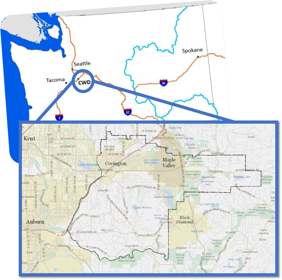
Covington Water District serves approximately 50,000 customers across a 55-square-mile service area in King County, Washington. The district manages more than 90,000 assets and 325 miles of transmission and distribution infrastructure with a staff of just 45 employees.
GIS is a core operational system, with roughly 80 percent of employees using GIS-related applications as part of their daily work. Over the years, the district implemented specialized systems for billing, asset management, permitting, GIS data, and operational monitoring. While each system supports a critical business function, information often resides in separate repositories.
As the volume of data grew, staff increasingly needed to search multiple systems, consult subject matter experts, and assemble information from different sources before providing complete answers.
The Challenge
Covington Water District’s challenge was never a lack of data, but was the effort required to access it.
Developers, customers, engineers, operators, and managers routinely need answers from information that spans multiple systems. Questions about water availability, infrastructure proximity, consumption patterns, service connections, and development requirements often require significant research.
The district processes hundreds of water availability requests annually along with countless phone calls and customer inquiries. Valuable information existed throughout the organization, but accessing it often depended on knowing whom to ask and where to look.
“We have many systems and many experts in each system,” said Covington Water District lead developer Dan Dulan. “But we didn’t have a layer that sat on top of everything and allowed people to interact with all of that information at once.”
GIS at the Core
The GIS team knew that GIS had to be at the center of any solution.
“GIS touches everything,” said Dan Dulan. “Everything in the district has a spatial component.”
Pipes, meters, parcels, customers, facilities, and infrastructure all share this characteristic: location. That made GIS the logical framework for bringing information together across departments.
“Location stays the same even when ownership changes,” said engineering department manager Steve Lee. “GIS is the central nervous system.”
The district’s ArcGIS Utility Network implementation created a modern geospatial foundation capable of connecting information across business systems and operational workflows. Today, the AI assistant can access utility network information, GIS feature attributes, business records, and supporting documents through a single conversational interface.
Staff can ask questions in plain language and receive maps, reports, analytics, and visualizations without needing specialized GIS or database expertise.
From Reports to Conversations
Unlike traditional reporting tools that answer one question at a time, the district’s assistant supports an interactive conversation.
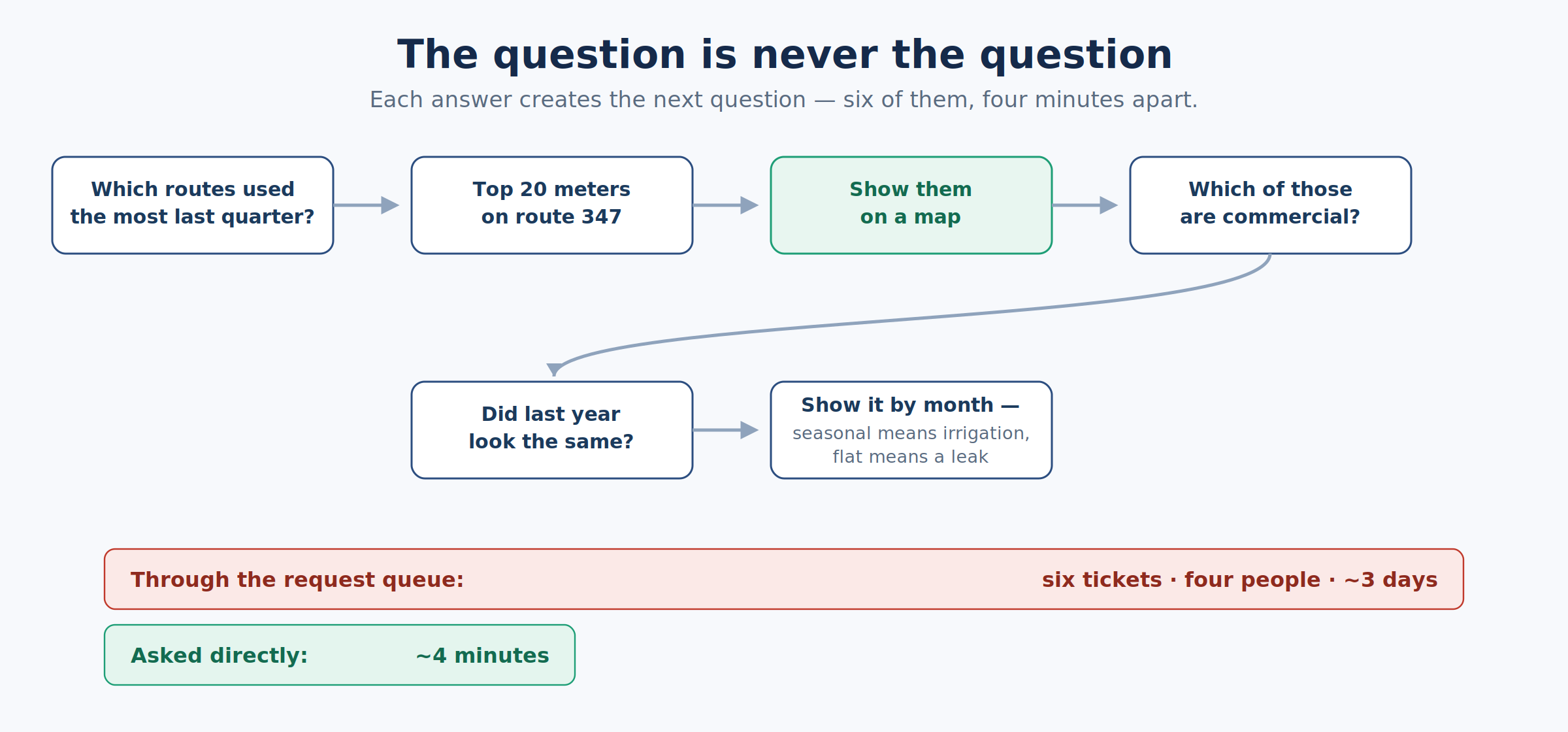
A user might begin by asking which service area consumed the most water and then request a map, compare historical trends, filter results, or generate a chart. Each question builds on previous responses, allowing staff to investigate issues as they emerge.
“Being able to talk with your data in natural language is very powerful,” said Dan Dulan. “The data is out there, but it’s locked.”
Instead of requiring users to know where information resides, the system helps them focus on the questions they need answered. Questions that once required multiple systems, several experts, and days of effort can now be explored in minutes.
ASKED AND ANSWERED—REAL QUESTIONS, AS TYPED
Location/Spatial Identification
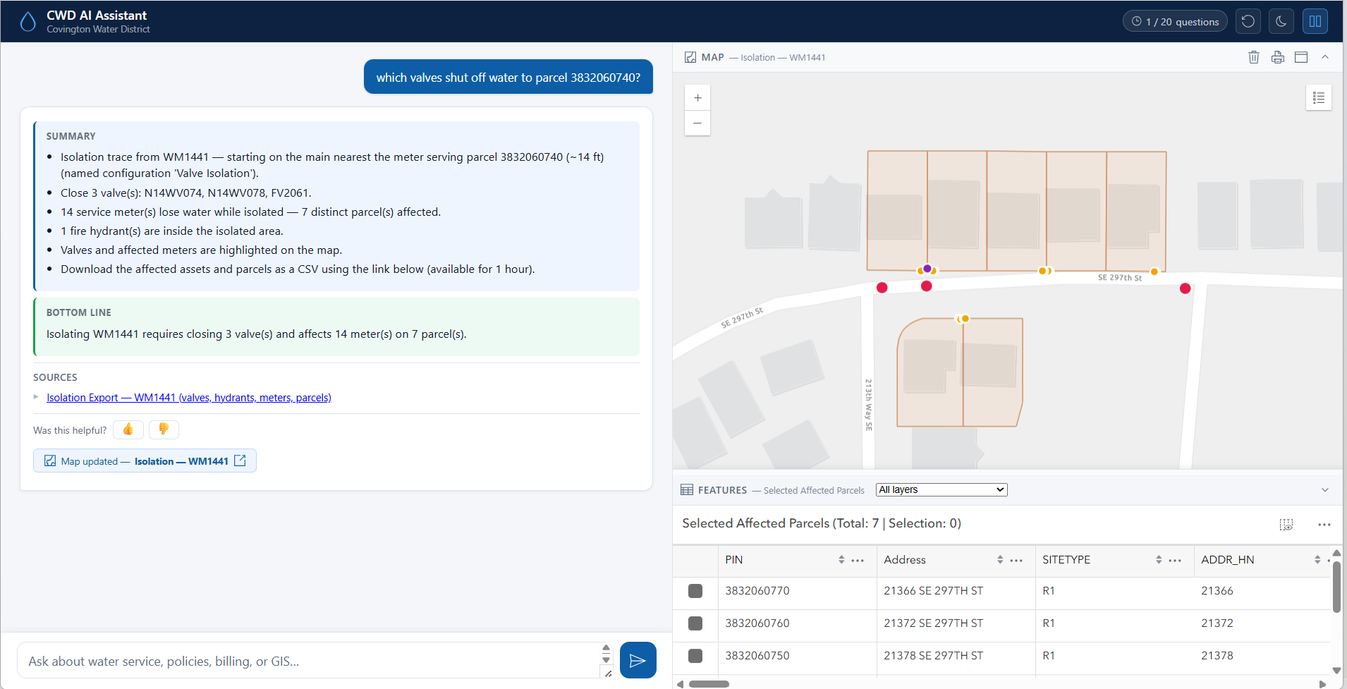
- “what is the nearest fire hydrant to parcel 3832060740?”
- “show all water mains within 300 feet of 0766500030”
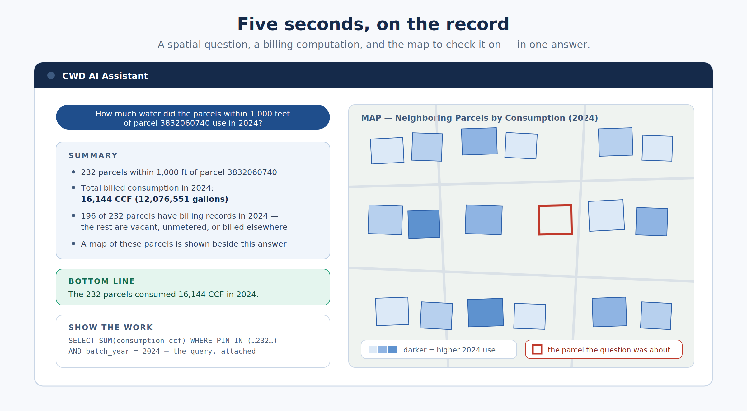
- “how much water did the parcels within 1,000 feet of parcel 3832060740 use in 2024?”
Working the Map
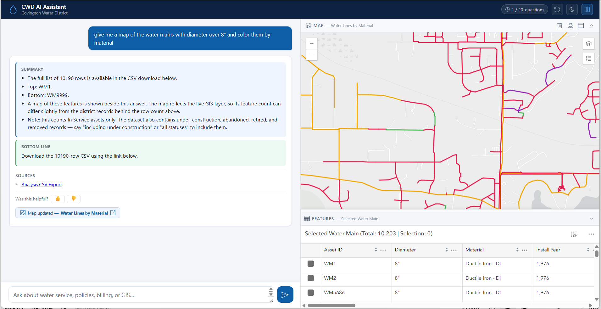
- “map the mains in zone 660 colored by material, hide the parcels, and switch to satellite”
- “which one had the lowest consumption?”*
Planning a Shutdown
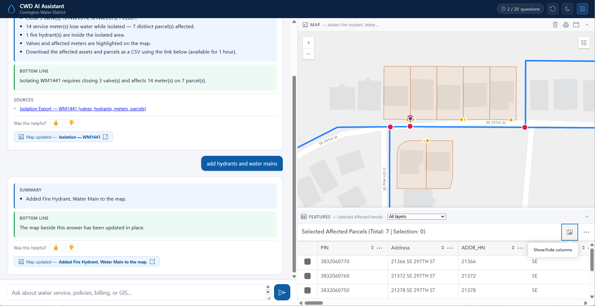
- “how many parcels are affected by a shutdown on this main?”*
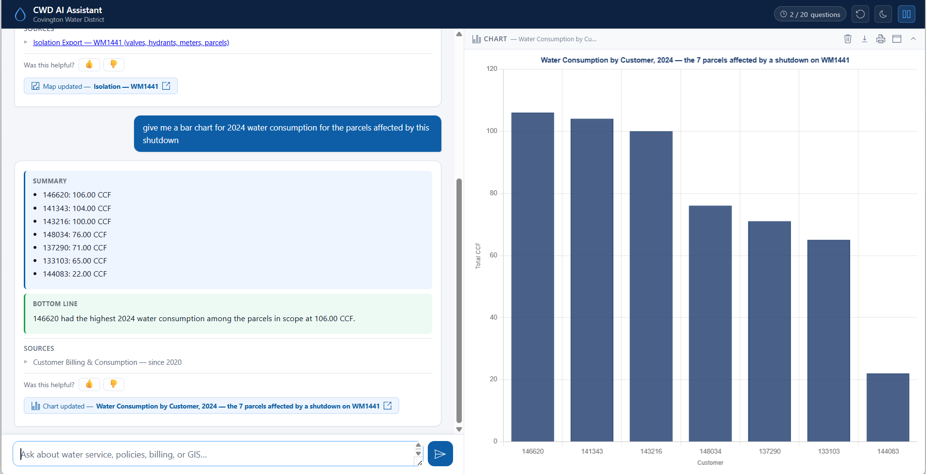
- “give me a bar chart for 2024 water consumption for the parcels affected by this shutdown”
Billing at a Glance
- “stacked bar chart of billing by route and charge type in 2024”
- “line chart of monthly billing for 2023 vs 2024 on route 15”
- “give me a bar chart of the top 10 streets by total billing in 2024”
- “KPI summary of all billing in 2024”
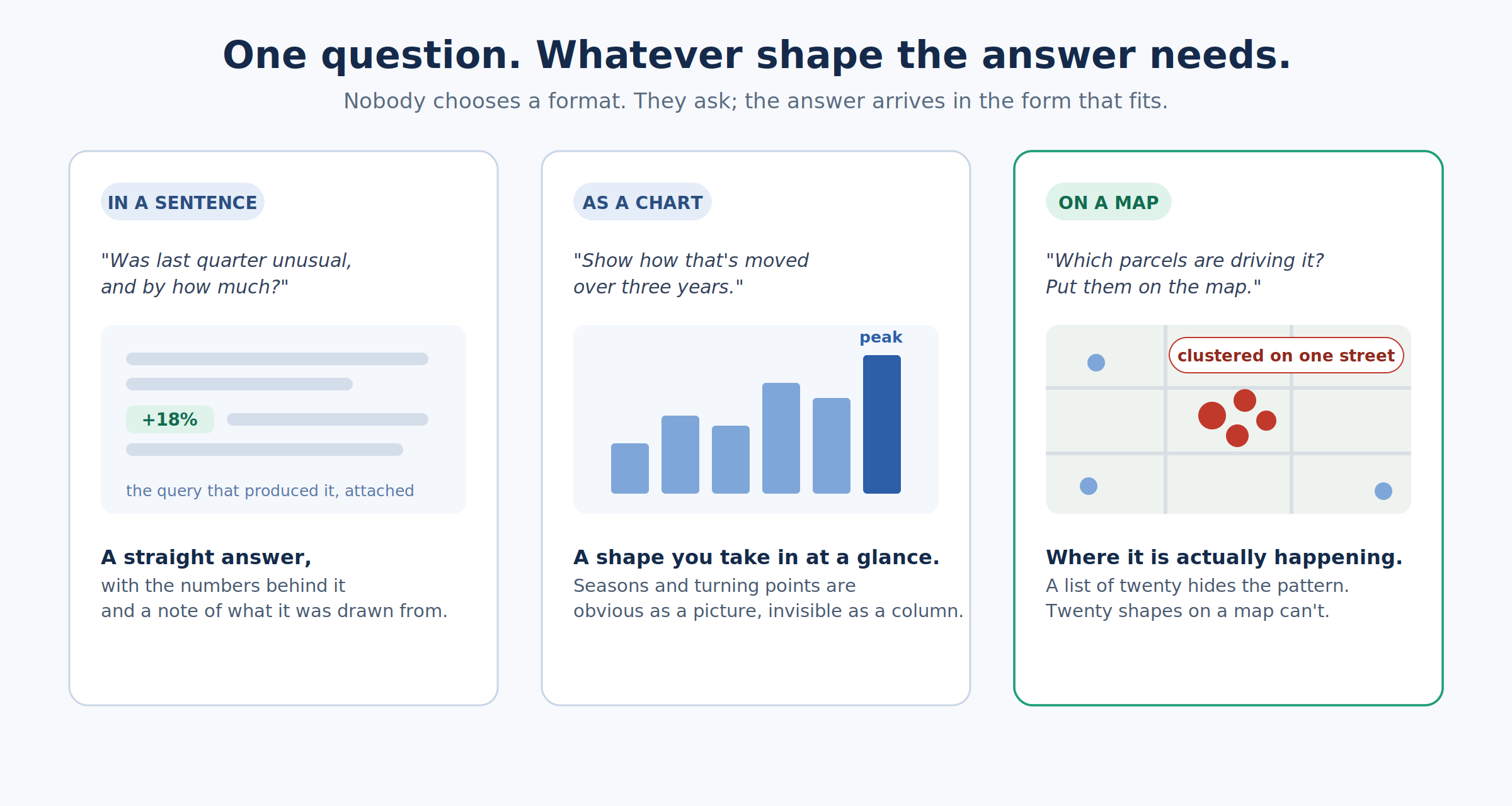
Every query was answered in seconds—as a map, a chart, or a number, with the query attached, with no form and no query builder. (*Answered from the map already on-screen—no new query needed.)
Maps Are Answers, Not Attachments
Many utility questions are inherently spatial. Identifying nearby infrastructure, evaluating development opportunities, analyzing water use, or understanding service impacts requires geographic context.
Recognizing this, the district designed maps as a core component of the assistant rather than as an afterthought. Users can generate maps directly from natural-language questions, visualize Utility Network information, perform proximity analysis, evaluate consumption patterns, and explore results geographically.
Every question can return a map, chart, report, or summary in seconds.
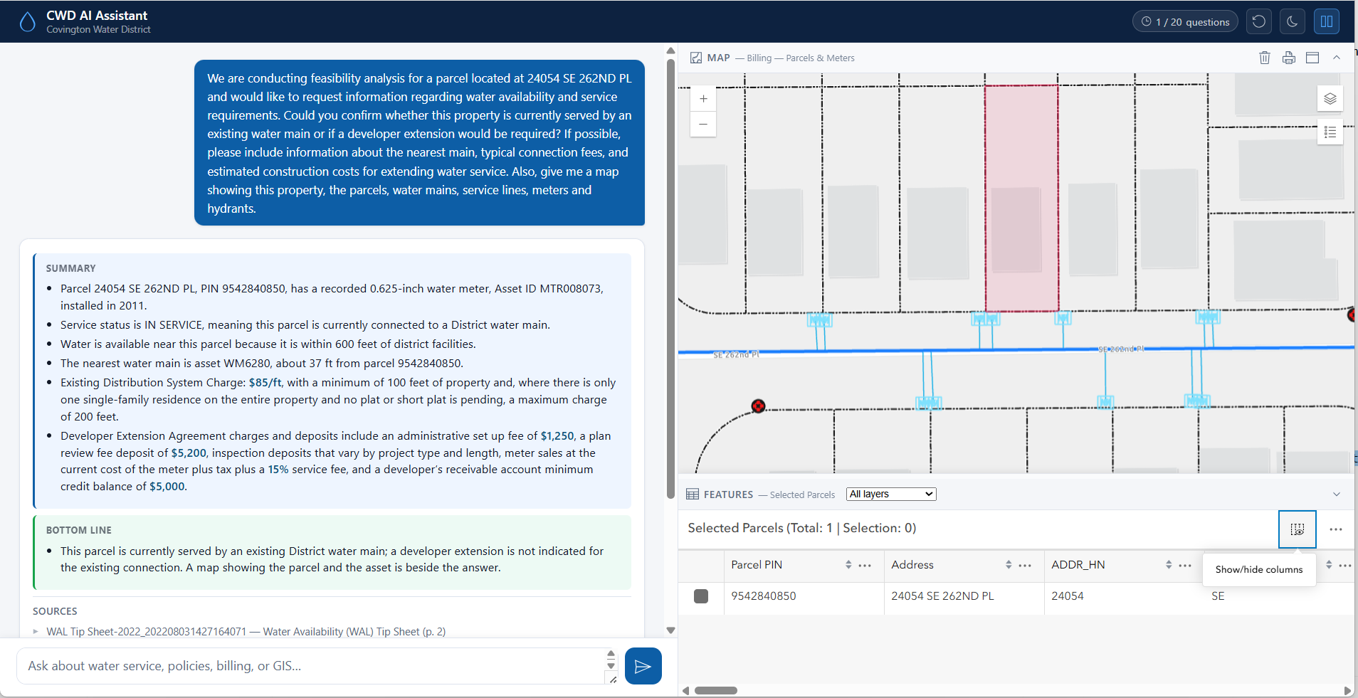
As the team often explains, a list tells you what happened; a map helps explain why.
Recent enhancements allow users to perform Utility Network traces through natural language, identifying affected assets, isolation valves, and impacted customers through conversational queries.
Built by Staff, Grounded in Years of Investment
One of the most remarkable aspects of the project is that it was conceived, designed, and developed entirely by Covington Water District staff. The effort brought together Dan Dulan, GIS coordinator Mike Velasco, GIS analyst Shawn Buck, engineering leadership, IT personnel, project coordinators, and subject matter experts from across the organization. Together, they designed the architecture, integrated data sources, developed governance practices, validated outputs, and continuously refined the platform.
The project represents the culmination of more than a decade of technology modernization, GIS maturity, data governance, cybersecurity, resilience planning, disaster recovery, and organizational commitment. Those investments created the foundation needed to develop the AI assistant responsibly and manage the risks associated with emerging technology.
As AI capabilities evolved, the district expanded its governance practices to address how employees interact with AI-generated information, how new capabilities are reviewed, and how innovation is balanced with risk management. The district’s steady progress also helped demonstrate the value of its investments to leadership.
“Along the way, the district’s board of commissioners saw progress,” said Lee. “They saw we weren’t wasting resources.”
That evolution continues as the technology changes. “AI is moving so quickly that as I try to update policies, I’m already behind,” said IT manager Kurt Zager. “The policies are constantly evolving alongside the technology.”
Building Trust
Trust is essential to adoption.
To reduce risk and build confidence, the assistant was intentionally designed as a read-only system. The platform was designed to answer questions, not edit information. It queries copies of district databases and cannot modify operational systems. The large language model does not directly access district data or use utility information for training. Instead, it interprets user intent while district-controlled processes execute validated GIS and database queries, retrieve information, and return results.
Transparency is built into every interaction. Responses include source citations and supporting query information, allowing users to understand how answers were produced. Every question and response is logged, creating a traceable audit trail that supports accountability, troubleshooting, and continuous improvement.
“We have to put eyes on everything,” said Zager. “Human intervention is still critical before anything leaves the district.”
Human Validation
Covington Water District understood that trusted answers require more than technology. “You cannot build AI tools without human validation,” said Dan Dulan. The team compares assistant outputs with Power BI dashboards, GIS analyses, engineering workflows, business processes, and source documentation. Subject matter experts also review responses within their areas of proficiency to confirm consistency and accuracy.
Staff participating in beta testing can submit feedback through built-in evaluation tools. Questions, responses, and user comments are captured to help developers understand how employees use the platform and continuously improve its performance.
The district is also investing in training, documentation, and user education as well as regular Tech Tuesday sessions, where employees discuss emerging technologies and provide feedback on tools being developed across the organization. These efforts help staff understand both the capabilities and limitations of AI.
Key Lessons
According to the team, AI was never the starting point.
Success depended on three foundational elements: leadership, data, and people. Years of investment in GIS, Utility Network modernization, data governance, cybersecurity, and organizational collaboration created the conditions that made the assistant possible.
The district’s experience demonstrates that organizations pursuing AI should focus first on trusted data and governance while recognizing that governance and innovation must evolve together.
What’s Next
The assistant is currently being beta tested internally, with plans to support additional operational and public-facing use cases. Planned enhancements include integrating SCADA systems, ArcGIS Velocity, and additional real-time operational information to further expand decision-support capabilities. GIS will continue serving as the foundation that connects systems, data, and workflows across the organization.
The greatest impact of Covington Water District’s AI assistant may not be faster reporting. Reports were never the goal.
The goal was to unlock knowledge!
By combining GIS, enterprise data, and AI within a secure and governed framework, Covington Water District is transforming how information flows across the organization. Questions that once required multiple systems, specialized expertise, and days of effort can now be explored through conversation.
As the platform continues to evolve, the district’s vision remains simple: Eliminate information silos, preserve institutional knowledge, and put trusted answers at every employee’s fingertips.
Stay Connected with Esri’s Water Team
ArcGIS is an enterprise geospatial platform that enables modernization of workflows with easy-to-use applications for the field and office. Strengthen your organization with geospatial solutions that will increase efficiency and provide insight for decision-makers.
Visit the Esri Water Utilities web site for more information.
Join the Water Utilities Community
Follow #EsriWater on social media: X | LinkedIn
Subscribe to the Water Industry newsletter “Esri News for Water Utilities and Water Resources“