Written by Albany Zavarce and Chris Reagan, Spalding County Water Authority
Introduction
The Spalding County Water Authority (SCWA) serves more than 16,000 customers throughout Spalding County, Georgia. Its water distribution system includes over 531 miles of water mains, multiple pressure zones, 3,829 valves, and 3,286 fire hydrants. SCWA works closely with the City of Griffin, which supplies treated water to SCWA through its reservoir and treatment infrastructure. As SCWA continues expanding its services, it is currently constructing its first lift station and developing its wastewater collection and treatment facilities. Recognizing that these new responsibilities require greater operational efficiency, SCWA identified the modernization of its business processes as a critical step in supporting future operations and long-term growth.
As recently as 2024, SCWA had limited geographic information system (GIS) capabilities, relying mainly on the use of information scattered across paper forms, spreadsheets, and disconnected processes, maximizing the cost, and limiting informed decision-making and collaboration between field crews, office staff, and leadership. ArcGIS Online was implemented, but with no clear management processes, data was duplicated and outdated.
Today, SCWA’s GIS program is supported by two GIS analysts and a GIS manager, along with staff across multiple departments who bring GIS experience to their daily work. This collaborative approach allows teams to contribute and share data from different operational perspectives while maintaining a clear, centralized, and accessible system. The result is a streamlined workflow, improved data quality, and better coordination across the organization.
The Challenge
SCWA’s goal was never to implement GIS technology. The objective was to improve how the organization operated and better serve its customers.
Just about four years ago, SCWA hired a general manager, Joseph Johnson, who shifted the course to an independent water utility rather than a county department. New water service requests and other utility services relied heavily on paper forms and manual handoffs, making the process of decision-making and coordination inconsistent. Progress updates regarding new water services frequently required phone calls or emails, and reporting of status could take days to compile.
Through the integration of GIS workflows, SCWA significantly improved operational efficiency by reducing processes that once took days to just a few clicks. ArcGIS Survey123, ArcGIS Field Maps, and web applications such as ArcGIS Dashboards were implemented to streamline service updates, centralize data management, and enhance communication between office and field staff, resulting in faster, more accurate workflows.
This led to a simple guiding principle:
Every GIS project should either improve decision-making or increase operational efficiency.
Rather than trying to modernize every process simultaneously, SCWA focused on solving one meaningful operational problem at a time.
Building a Practical GIS Strategy
Instead of beginning with large, complex initiatives, SCWA’s GIS manager, Chris Reagan, and general manager Joseph Johnson meet weekly during a GIS backlog grooming session to identify opportunities where GIS can improve existing workflows. Joseph, as SCWA representative stakeholder, brings forward operational needs and priorities based on his understanding of SCWA’s challenges, while Chris facilitates GIS-based solutions to address those needs. Once a project is identified, Chris works with the GIS analyst team to further develop and implement the solution, with a focus on making processes more efficient for both office staff and field crews.
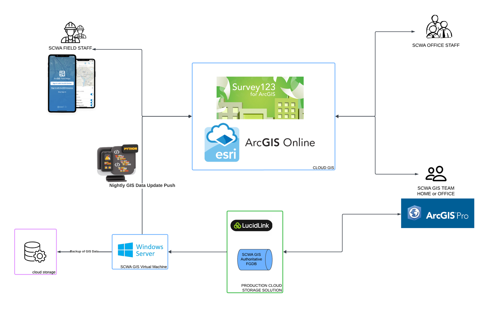
Using a variety of Esri products such as ArcGIS Pro, ArcGIS Online, ArcGIS Survey123, ArcGIS Field Maps, ArcGIS Dashboards, and Microsoft Power Automate, the GIS team was able to build practical workflows that were easy for staff to adopt and which provided immediate operational benefits.
Each successful implementation created confidence in the next project. Employees experienced firsthand how GIS could simplify their daily work, while leadership gained better visibility into operations through real-time information and dashboards. This incremental approach allowed GIS adoption to grow naturally throughout the organization.
“When I started, everything revolved around paper. [Now] we spend less time looking for information and more time actually using it to solve problems and help our customers. That’s a major win for our team. It is crazy when I think about pulling that huge map on antique paper out looking for water lines. It makes me giggle.” —Charlie Hearn, Office Manager, Spalding County SCWA
“GIS is the way of life. I can’t live without it. When you look at everything we do throughout the day, GIS is involved in so much of it. Before GIS, if we needed to find information, we might have to look through 100 different paper maps. Now, GIS makes everything so much easier because all of that information is in one place.” —Danny Pryor, Water Superintendent, SCWA
Improving the New Water Service Process
SCWA also redesigned its new water service workflow, which processes approximately 250 service requests each year.
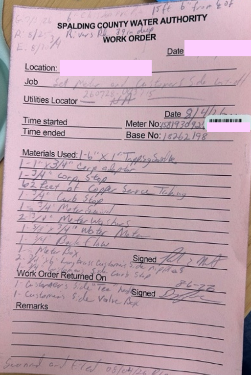
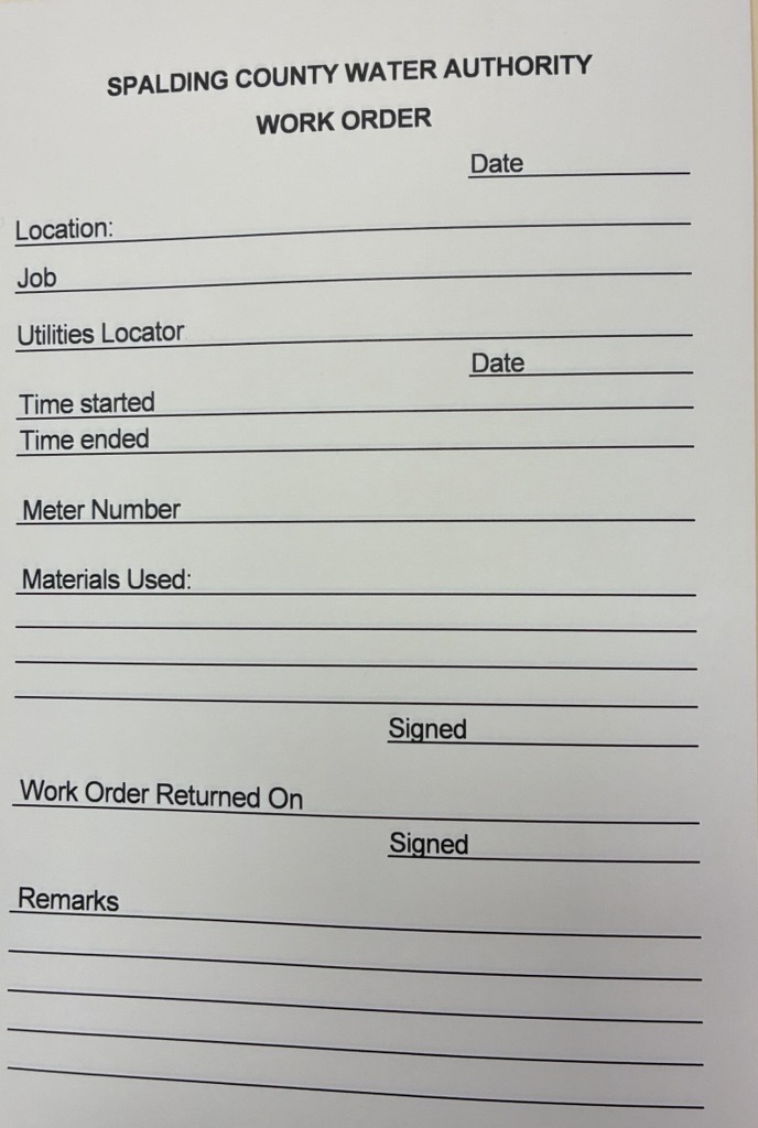
The previous process relied heavily on paper-based methods and manual communication between the office and field staff, which included one to two office staff and two to four field operations staff. Customers would come into the office to complete a water service request form, which generated three carbon copies. The office kept the white copy, while the maintenance crew received the pink and yellow copies to take to the customer’s property for meter installation. After completing the installation and recording the materials used, the crew kept the pink copy and returned the yellow copy to the office. Charlie Hearn, the office manager, would then scan the yellow copy along with the service contract and send the documents to the City of Griffin for billing. Once the City of Griffin entered the service into their records, they would contact Charlie to confirm that it had been processed.
By integrating GIS technologies such as ArcGIS, SCWA created a digital workflow that connects office staff, field crews, and management. Requests now move through the process more efficiently, notifications are automated, and leadership can monitor project status without requesting updates from staff. The result is faster communication, better coordination, and improved customer service.
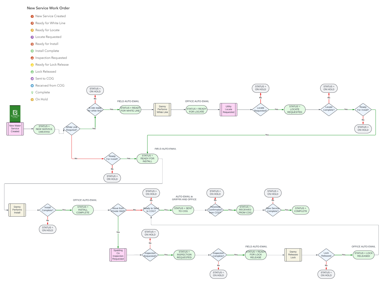
“[The] process has become more efficient with GIS because we can quickly verify the information needed to serve a customer. Today, GIS allows us to locate a property almost instantly and see the existing water infrastructure, parcel information, and nearby mains. That means we can answer questions more quickly, determine whether service is available, identify potential issues early, and provide better information to both customers and developers.” —Charlie Hearn, Office Manager, SCWA
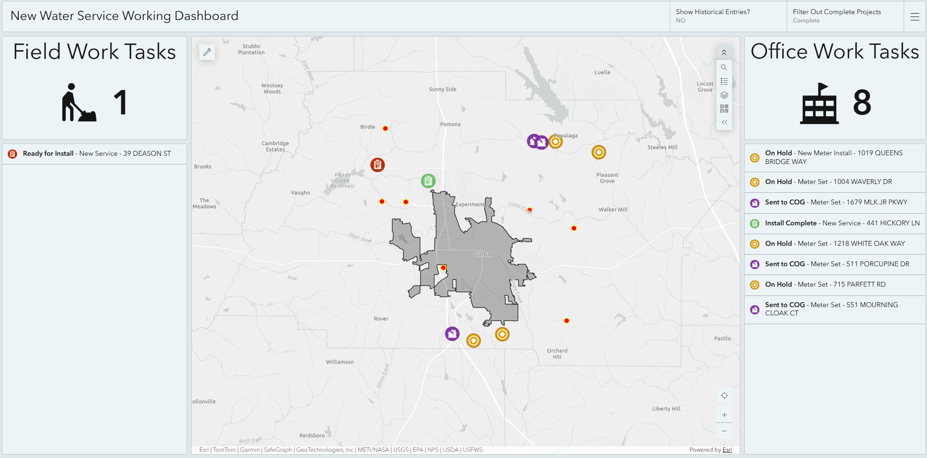
“The new water service process is easier and faster. It’s a game changer for us. Before, nothing was on the computer, so if we needed past information, we had to go through millions of papers in filing cabinets. Now, we mainly rely on GIS, and everything is right there.” —Danny Pryor, Water Superintendent, SCWA
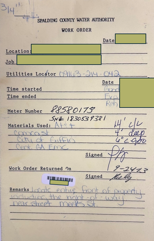
“We can now evaluate and process new service requests much faster with greater accuracy, giving developers and customers quicker, more reliable answers.” —Joseph Johnson, General Manager, SCWA
Modernizing Hydrant Inspections
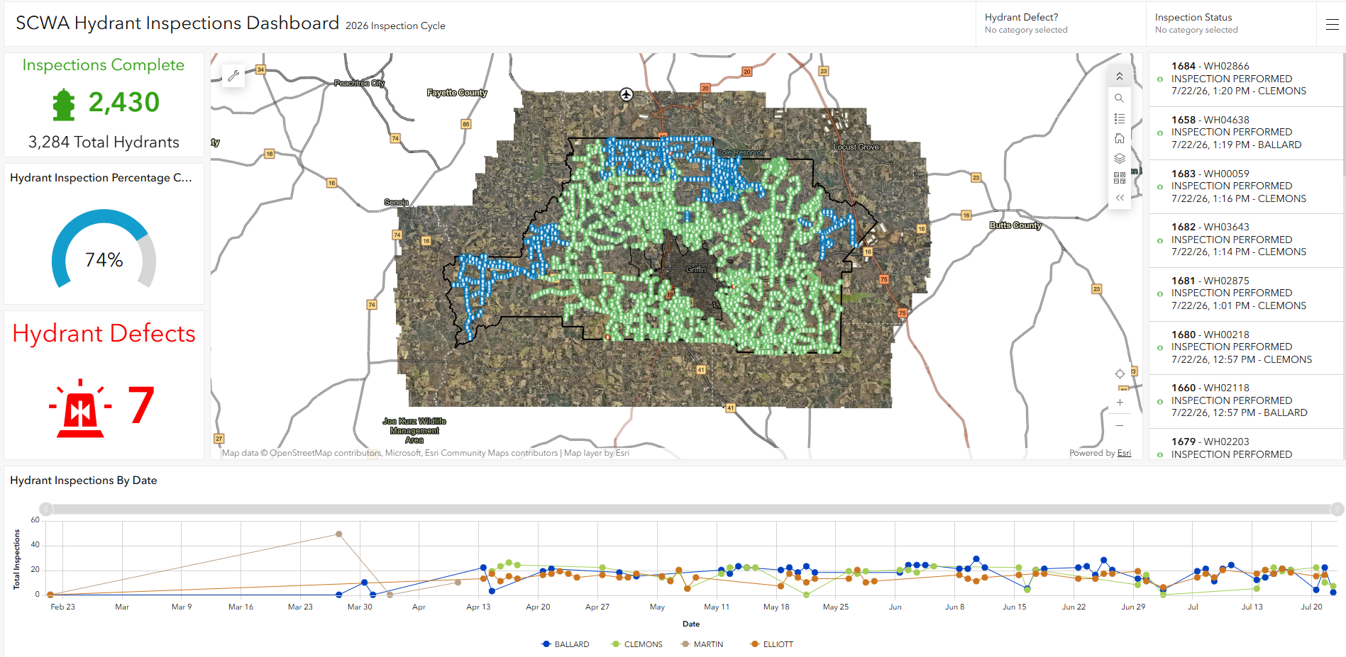
Hydrant inspections became one of SCWA’s first major operational improvements because they offered significant value with a reasonable implementation effort. Previously, inspections relied on paper forms, requiring field crews to manually record data and re-enter it into office systems, making tracking, reporting, and management inefficient. By implementing ArcGIS Survey123 and ArcGIS Field Maps, inspectors can now complete and submit inspections directly from mobile devices, eliminating duplicate data entry and improving data accuracy. Inspection results are immediately available, allowing supervisors to monitor progress in real time through ArcGIS Dashboards instead of waiting days for manual reports. Because hydrant inspections are performed annually, the GIS-based workflow provides lasting value by creating a repeatable, efficient process that can continue to deliver operational benefits year after year.
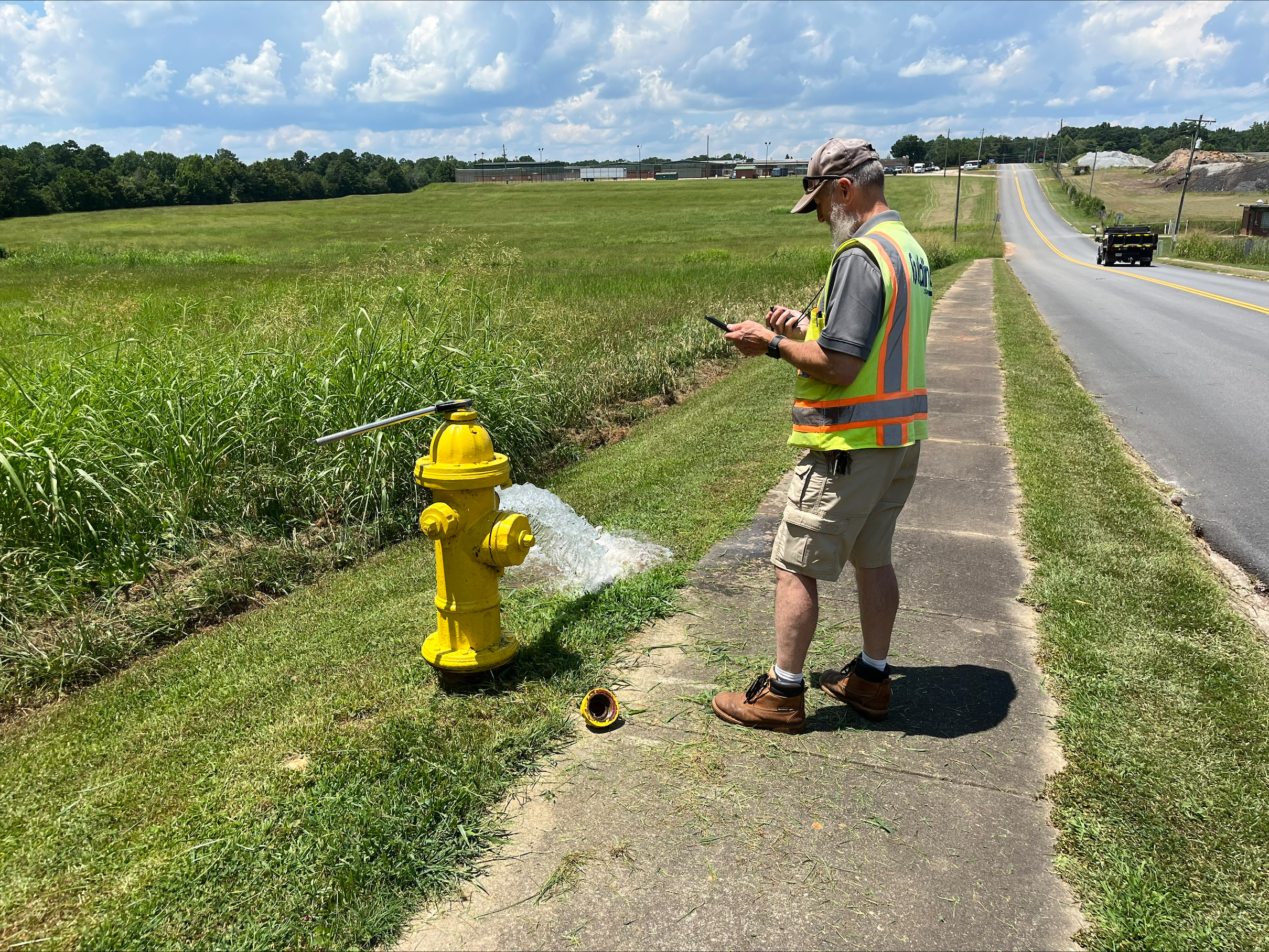
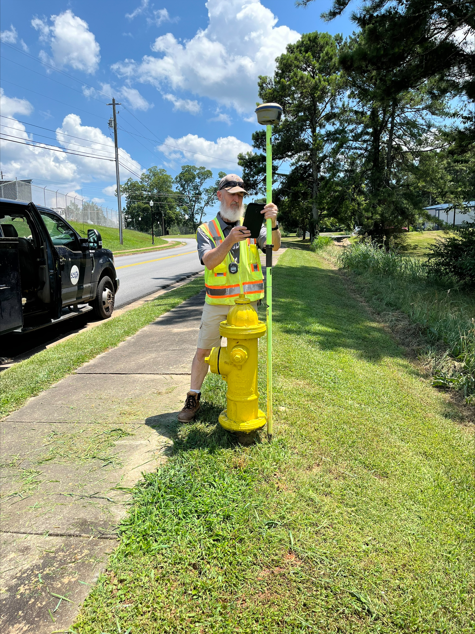
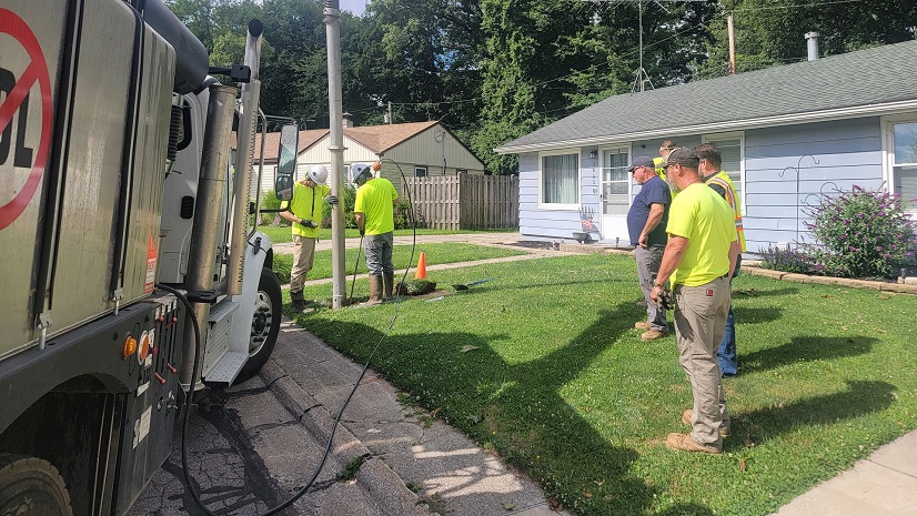
SCWA utility system tech Greg Ballard conducts a routine hydrant inspection, documenting field conditions and collecting information to support accurate infrastructure records and maintenance activities.
“Esri and the apps Chris created using the GIS technology has been a great addition to our work environment. It not only pinpoints all of our assets but keeps track of all of our work so we can refer back for information. We can also review maps to keep up with our progress and keep track of what we have and haven’t done. Plus, all the data from our assets is right at our fingertips. All this has made my job much easier.” —Greg Ballard, Utility System Tech, SCWA
“It’s much easier to track, and it completely changed our whole hydrant maintenance system. Before, the workload was twice as much. We had to take paper copies to Excel from the fire department, but now everything is in one system that we can access in the field on our iPads. It’s easier to manage and understand. We basically reinvented our own wheel with the tablets.” —Danny Pryor, Water Superintendent, SCWA
Streamlining Lead and Copper Rule Compliance
When the revised Lead and Copper Rule required utilities to inventory service line materials, SCWA saw the mandate as an opportunity to modernize another critical business process.
Field crews used ArcGIS Field Maps and Survey123 to document service line materials during inspections conducted between April 2025 and June 2026. Over that period, crews inspected more than 8,000 service lines. Automated workflows updated GIS records and operational dashboards in real time, giving leadership immediate visibility into inspection progress and supporting more informed operational decision-making.
By completing the project internally using ArcGIS technologies, SCWA developed a powerful and sustainable GIS solution that enables staff to efficiently manage the entire workflow in-house. The implementation of this system streamlined data collection, tracking, and updates, allowing employees to complete tasks more quickly while maintaining accurate records. SCWA estimates that completing the project internally avoided approximately $1 million in contractor costs. Although the organization invested time in training staff to use the new GIS tools, that investment has resulted in long-term operational savings, improved efficiency, and a scalable solution that continues to support daily operations and can evolve to meet future needs.
“Investing in GIS gave us accurate, reliable data that improves decision-making, increases efficiency, and better prepares us for future growth.” —Joseph Johnson, General Manager, SCWA
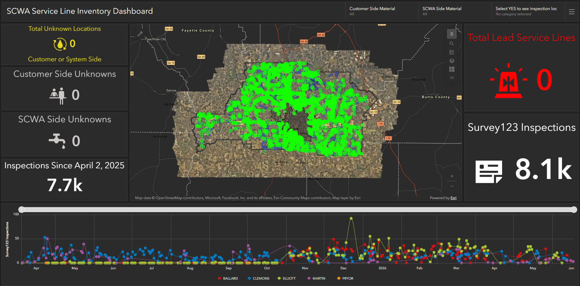
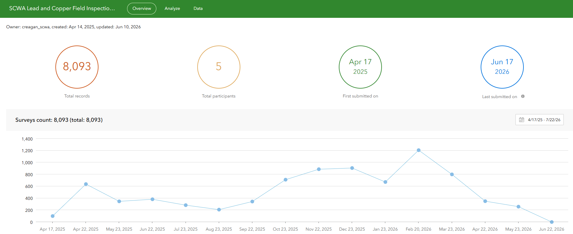
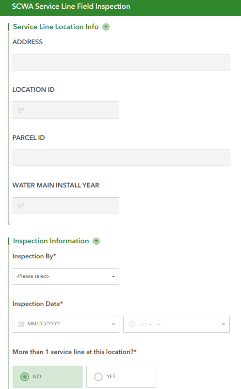
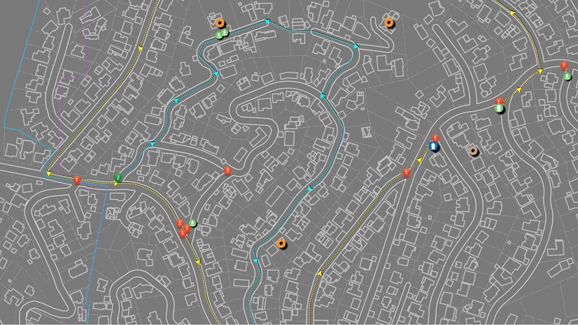
The current design of the dashboard and Survey 123 displays the service line inventory of the Lead and Copper Rule that provides stakeholders the ability to monitor progress in real time.
Results
Over the course of two years, GIS technology has become an essential component of SCWA’s daily operations, transforming how the organization manages data and makes decisions. Rather than functioning as a stand-alone technology, GIS has become a core business strategy that supports every stage of the workflow. By integrating GIS into daily operations, SCWA has reduced processes that once took weeks to real-time updates, minimized paper-based workflows, improved data accuracy, reduced rework, and increased field productivity by enabling staff to complete more inspections and service activities efficiently.
Perhaps the most significant achievement has been organizational adoption.
Rather than asking employees to change everything at once, SCWA introduced practical solutions that addressed everyday challenges. As staff experienced the benefits firsthand, confidence in GIS grew naturally. Each successful project created momentum for the next, transforming GIS from a specialized mapping function into a trusted business system that supports decision-making across the utility.
“When Chris first told us he was going to implement an app for new water service requests, I’ll admit I was nervous. I didn’t know what to expect. It didn’t take long to realize I had nothing to worry about. The app was intuitive, easy to learn, and whenever I suggested something that would make the process better, Chris made the improvements. That made a big difference because it felt like the app was being built with the people who actually use it every day in mind. I had spent so many years doing the process manually that efficiency almost felt wrong at first.” —Charlie Hearn, Office Manager, SCWA
As the Organization Evolves
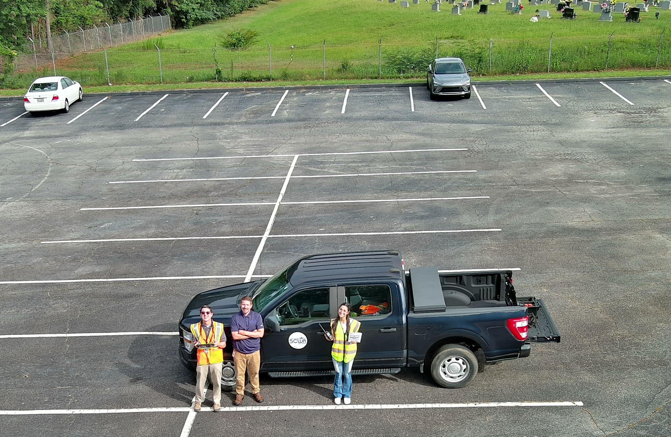
Looking ahead, SCWA remains committed to strengthening its GIS foundation as it continues to expand both its technological capabilities and utility infrastructure. Future initiatives include implementing ArcGIS Enterprise and ArcGIS Utility Network to enhance outage management by identifying affected customers, safely isolating damaged infrastructure, and supporting the utility’s new wastewater system, which is scheduled for completion by the end of 2026. Additional initiatives include expanding drone operations, integrating GIS with OpenGov, and continuing to enhance asset management workflows. As ArcGIS technologies continue to evolve, SCWA’s approach remains consistent: identifying meaningful operational challenges, developing practical GIS solutions, and creating lasting organizational value through continuous innovation and improvement.
“When I look back at where we started, the biggest accomplishment isn’t any one application, map, or dashboard. It’s seeing people who once relied on paper and spreadsheets now asking, ‘Can GIS do this?’ That question tells me we’ve changed the way people think about information. We didn’t build GIS overnight. We built it one problem at a time, and along the way, it became part of the culture at SCWA.” —Chris Reagan, GIS Manager, SCWA
“GIS has evolved from a simple mapping tool into a core business system that supports engineering, operations, planning, and customer service. GIS has transformed how we manage our infrastructure by turning data into actionable information that saves time, improves service, and supports smart growth.” —Joseph Johnson, General Manager, SCWA
For more information about SWCA, please visit: https://www.scwa.us/
Stay Connected with Esri’s Water Team
ArcGIS is an enterprise geospatial platform that enables modernization of workflows with easy-to-use applications for the field and office. Strengthen your organization with geospatial solutions that will increase efficiency and provide insight for decision-makers.
Visit the Esri Water Utilities web site for more information.
Join the Water Utilities Community
Follow #EsriWater on social media: X | LinkedIn
Subscribe to the Water Industry newsletter “Esri News for Water Utilities and Water Resources“