Leveraging the Power of Real-Time Geospatial Interagency Collaboration
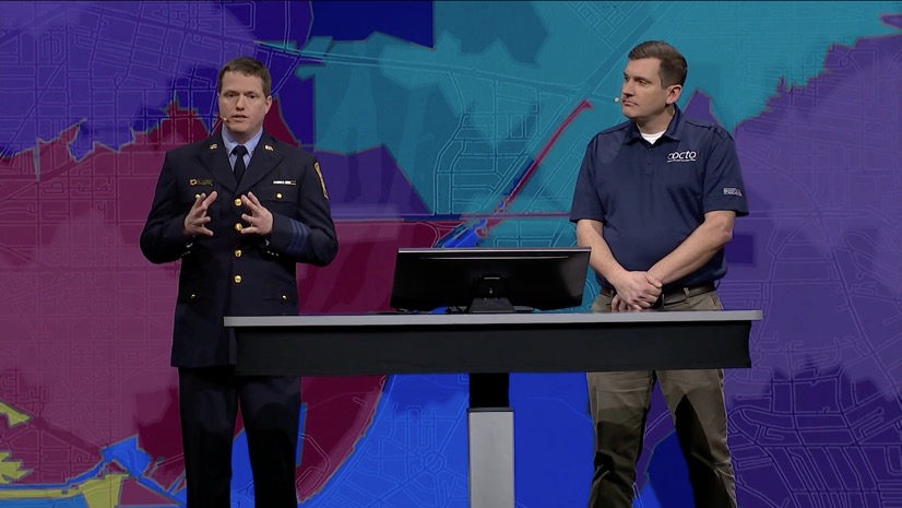
In Ohio, Dayton Fire Department (DFD) has embraced cutting-edge geospatial technology to enhance its operational efficiency during special events and for disaster response. By implementing Esri’s ArcGIS Mission application, DFD transformed how it manages resources and personnel locations and shares critical data to be incorporated into real-time command and control. In a recent interview, DFD’s team members—including Lieutenant Chris Rowlett, Captain Ryan McElroy, and geographic information system (GIS) coordinator Brian Arnold—shared insights into their deployment of ArcGIS Mission during a high-profile North Atlantic Treaty Organization (NATO) event in the city over Memorial Day weekend. Their experience offers valuable lessons for fire departments and public safety agencies looking to modernize their operations with geospatial tools.
Dayton Fire Department
Dayton Fire Department serves a population of approximately 150,000 people and has a force of 325 employees, operating out of 12 fire stations. Equipped with eight engines, four trucks, seven frontline medic units, multiple district chiefs, and an incident support unit, DFD handles a significant call volume—nearly 43,000 incidents annually, with 75-80 percent being medical calls, as well as approximately 365 structure fires per year. The department also coordinates a regional hazmat team and responds to heavy rescue incidents, making it a critical player in both routine and specialized operations.
The Challenge: Managing Complex Events and Disasters
Dayton faces operational challenges ranging from large-scale special events, like the annual air show and the historically large Saint Patrick’s Day celebration at the University of Dayton, to disaster response, like the tornado outbreak that struck the metropolitan area a few years ago. McElroy, who also serves on the Federal Emergency Management Agency’s (FEMA) Ohio Task Force 1 (OH-TF1), highlighted the limitations of traditional methods: “One of the big issues was the difficulty tracking where our crews were in real time, what they were doing, and whether we were duplicating efforts”. Radio-based communication and handwritten notes often led to inefficiencies, particularly during high-volume events where triaging calls and managing resources in real time were critical.
For example, the Saint Patrick’s Day event at the University of Dayton attracts 10,000–20,000 attendees, often placing stress on traditional dispatching methods. “We’re triaging 15 to 20 calls stacked up on the board, trying to move crews efficiently without walking over each other on the radio,” McElroy explained. These challenges underscored the need for a solution that could provide real-time situational awareness and streamline communication.
ArcGIS Mission: A Game Changer for Command and Control over Special Events
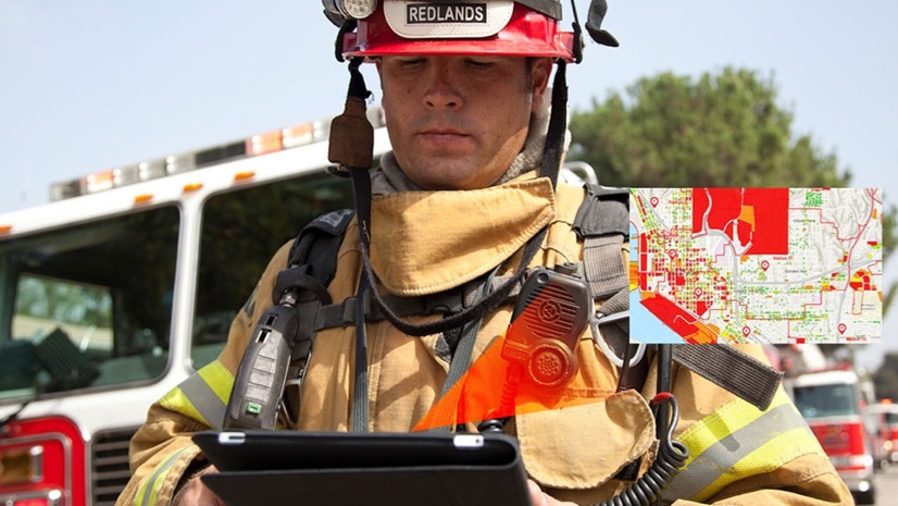
The deployment of ArcGIS Mission during the NATO event marked a significant step forward for DFD. The application, part of Esri’s comprehensive geospatial platform, enabled the department to track the current locations of personnel and apparatus, dispatch tasks, and share data seamlessly within a secure operational footprint. “We pivoted from our traditional methods to something more event-based, allowing us to dispatch crews, track their locations, and push out information quickly,” McElroy noted.
One key success was the ability to manage a suspicious package incident in a parking garage without relying on radio transmissions. “We sent the pertinent information directly to the EOD [explosive ordnance disposal] team via the app, and it turned out to be just a gym bag,” McElroy shared, highlighting the efficiency of silent, app-based communication. Joint hazard assessment team (JHAT) members in the field simply received the location of the suspicious item on their mobile maps along with other details. This capability reduced radio clutter and ensured rapid response.
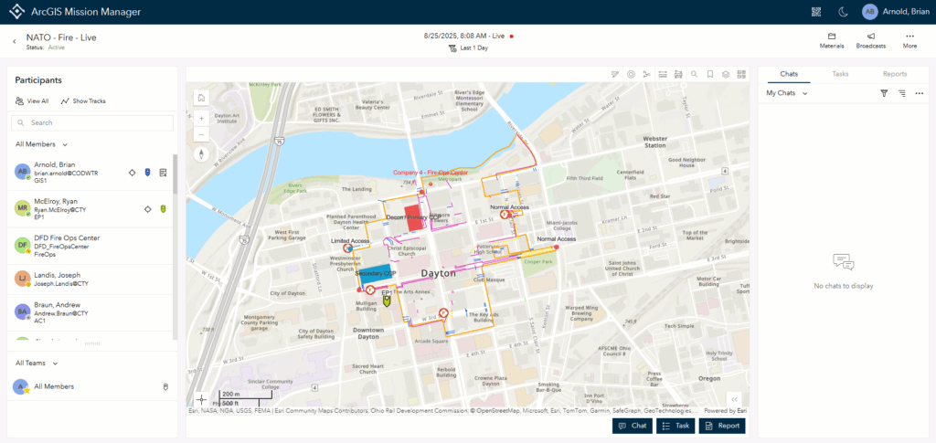
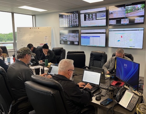
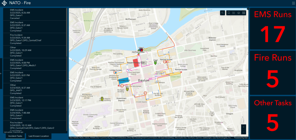
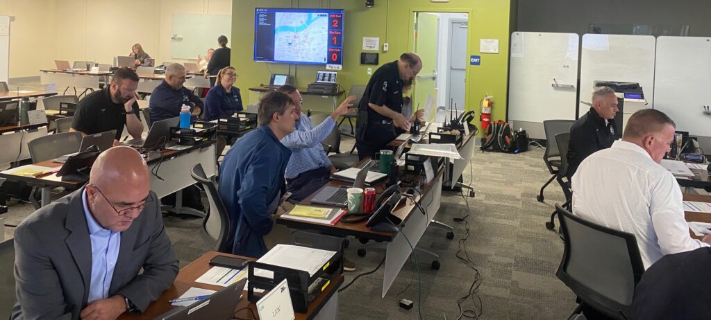
The department also utilized ArcGIS Dashboards providing the Emergency Operations Center (EOC) a unified view of the event area and associated live field activities. “We customized the dashboard to show the location of all resources and the types of runs—fire, EMS [emergency medical services], investigations—so everyone in the room could see it in real time,” McElroy said. This transparency was critical for coordinating with multiple agencies, including the Ohio State Highway Patrol, the Federal Bureau of Investigation (FBI), the Secret Service, and the Ohio National Guard’s 52nd civil support team, all present in the EOC.
Overcoming Deployment Challenges
The collaboration of Esri and the DFD’s internal GIS team, led by Arnold, ensured a smooth rollout of ArcGIS Mission. One challenge was user adoption, particularly with personnel closing the mobile app out of habit, which caused temporary loss of location sharing. “That was more of a training issue than a problem with the app itself,” McElroy explained. Just-in-time training proved effective, with the platform’s user-friendly interface enabling even GIS novices and field personnel to adapt quickly.
Collaboration Across Departments
The ArcGIS Mission deployment’s success relied heavily on collaboration between DFD and the city’s GIS team. Arnold played a pivotal role in configuring maps and integrating data, such as police-provided event perimeters and address layers, to enhance situational awareness. “Without Brian’s GIS expertise, it would have been much harder to roll out something functional,” McElroy emphasized. This partnership underscores the importance of having a dedicated GIS professional to support public safety operations.
Lessons Learned and Advice for Other Departments
DFD’s experience offers valuable insights for other fire departments considering ArcGIS Mission:
- Plan and train early: “Give yourself lead time before a major event to run exercises and get the app in users’ hands,” McElroy recommended, citing the buildup to the NATO event.
- Engage stakeholders: Sharing dashboards with decision-makers and partner agencies in the EOC enhanced coordination and demonstrated the department’s capabilities. “It’s about showcasing what we’re doing and sharing it with the city’s leadership team,” Rowlett said.
- Leverage GIS expertise: “Make sure you have someone like Brian who’s well-versed in GIS. It’s critical for setting up functional maps and workflows,” McElroy advised.
Looking Ahead
Dayton Fire Department plans to expand its use of ArcGIS Mission for command and control over events, like the annual fireworks and air shows, as well as during disaster response. The department is also exploring Esri’s off-the-shelf ArcGIS Solutions for fire accreditation analysis and for community risk reduction, which could further streamline operations. As DFD continues to refine its processes, the department’s story serves as a model of how geospatial technology can enhance public safety.
For fire departments and public safety agencies looking to modernize their operations, Dayton’s experience with ArcGIS Mission highlights the power of real-time data, streamlined communication, and interagency collaboration. As McElroy aptly summarized, “The ability to put this app in someone’s hand, explain it, and have them use it effectively is amazing”.
Get more information on ArcGIS Mission and Esri’s fire, rescue and EMS solutions.