The Los Angeles Geospatial Summit is hosted each year by the University of Southern California (USC) Spatial Sciences Institute. Held live and in person February 25, 2022 (for the first time since February 2020), Los Angeles Geospatial Summit was a prime opportunity for students and young professionals from communities throughout Southern California to connect with geographic information system (GIS) industry leaders to gain insights through workshops, Lightning Talks, panel discussions, and speed networking.
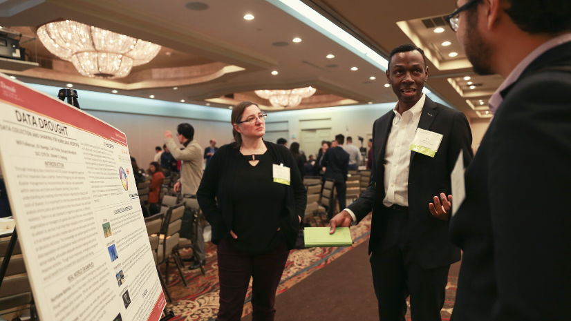
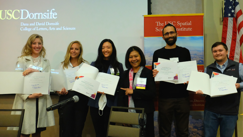
This year students were able to share their application of geospatial skills and analysis through the Esri Student Poster Competition. Students from Cal State University, Long Beach; Cal Poly Pomona; University of Redlands; and the University of Southern California presented their research posters during the summit. Esri awarded prizes in the following categories: Most Innovative Use of Technology, Most Compelling Communication Using Maps, and Most Suitably Applied Methodology or Analysis.
The poster competition provides students with the experience in working with faculty leads in preparing their posters and describing their research. Students have expressed to me that the poster sessions [give them some of] the most important soft skills they need as budding geospatial professionals. The Esri poster competition has become an important professional development opportunity for participating students.
Esri Student Poster Competition
At this year’s 2022 Los Angeles Geospatial Summit, Esri was honored to host and sponsor the Esri Student Poster Competition. Students were asked to represent their diligent work via posters for the chance to win in one of three categories:
- Most Innovative Use of Technology
- Most Compelling Communication Using Maps
- Most Suitably Applied Methodology or Analysis
The Esri Student Poster Competition judges—from Hexagon, Tableau, and Esri—had been invited to participate. There were many well-executed posters submitted to the competition; however, three winners for each category ultimately had to be chosen. Esri education team member Mark Stewart was one of the judges for this exciting competition.
The diversity of projects and the innovative applications of GIS made the judging a challenge, but it also made it fun. All three of the judges remarked how far geospatial education has come since our own college days, and we genuinely enjoyed reviewing all the contest entries.
Poster Competition Winners in Three Categories
Each year USC invites faculty from GIS academic programs across Southern California to have their students submit abstracts to present posters at the Los Angeles Geospatial Summit. Students from USC, Cal Poly Pomona, Cal State Long Beach, Cal State Northridge, and University of Redlands participated in the 2022 poster competition. Here are the winners of each category.
Category 1: Most Innovative Use of Technology
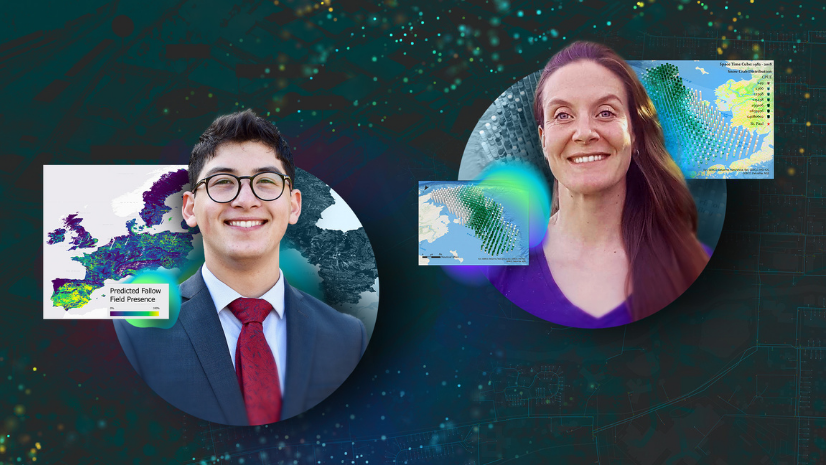
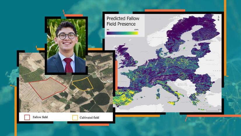
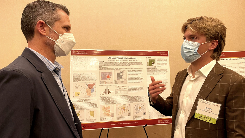
The winner in the category of Most Innovative Use of Technology was the project USC Urban Trees Initiative Phase 2.
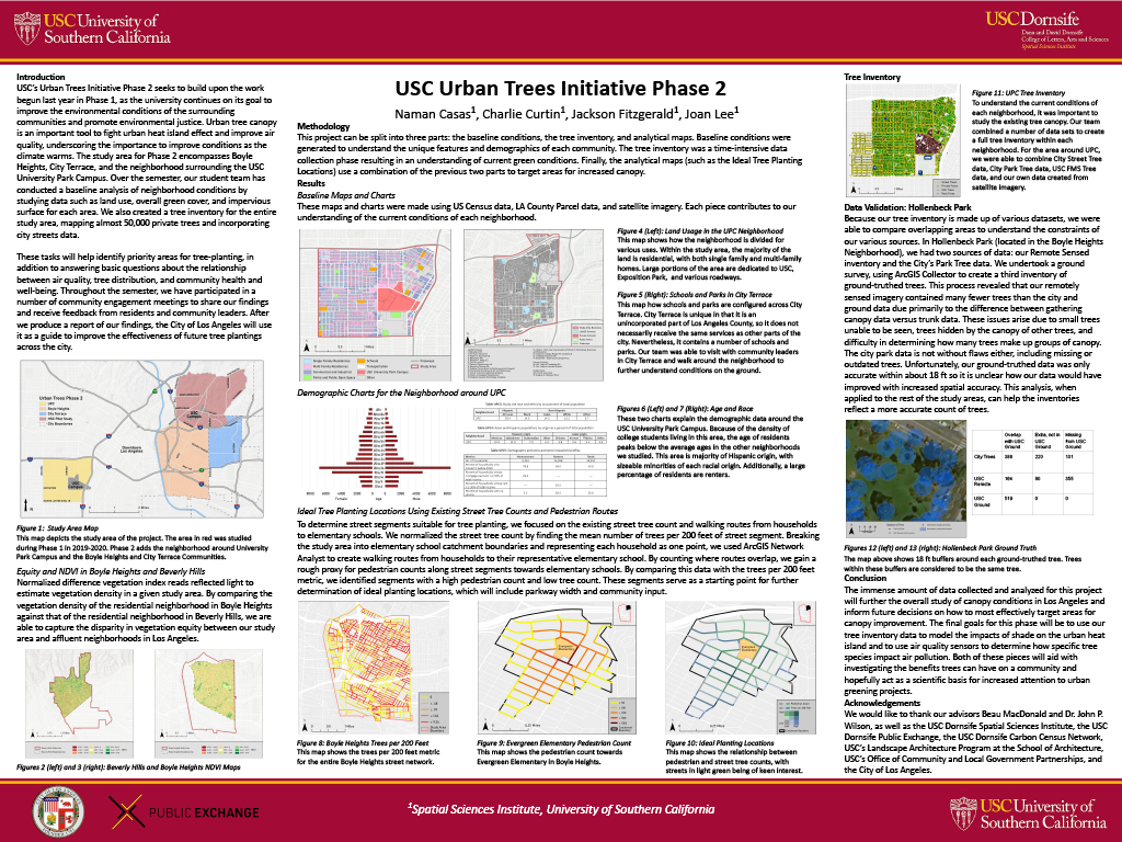
As Los Angeles begins to plant more trees to improve environmental conditions, it is important to understand the most effective and equitable means of doing so. This project studies current conditions of urban tree canopy in various neighborhoods throughout Los Angeles. “I joined this team because I wanted to be involved in research that would have concrete impacts on people living in Los Angeles,” says Jackson Fitzgerald, poster competition winner recipient. This project ensured that trees can be leveraged to combat climate change, reduce the urban heat island effect, and improve air quality.
[The Los Angeles] Geospatial Summit was a wonderful opportunity to learn about geospatial technology in a way that is impossible in the classroom.
Category 2: Most Compelling Communication Using Maps
The winner in the category of Most Compelling Communication Using Maps was the project Little Fisherman’s Cove Landslide Risk Assessment.
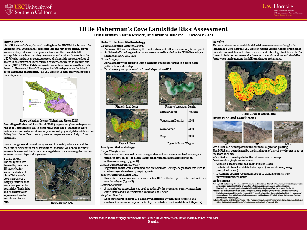
This poster displayed its team’s process of data acquisition, GIS analysis, and cartography application to create a landslide-risk analysis for a portion of the road leading into USC’s Catalina Island campus. The team members used a drone and Global Navigation Satellite System (GNSS) technology to collect data before analyzing it in ArcGIS Pro through a weighted-overlay methodology. They identified spots within the study area that are at notable risk of landslide and offered strategies for mitigation.
As a senior, I feel that I have learned a lot about GIS and spatial sciences through my undergraduate education, and it felt validating winning this poster competition. This experience has made me more driven to continue into this field.
Category 3: Most Suitably Applied Methodology or Analysis
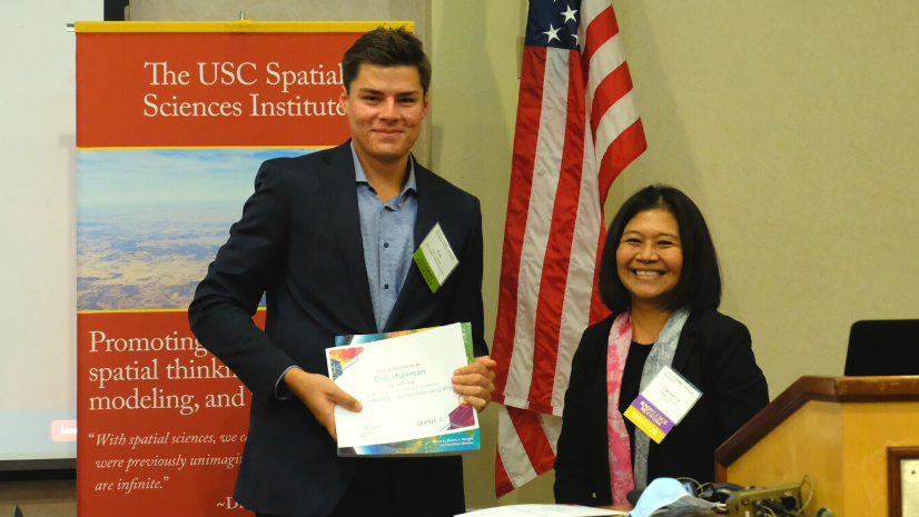
The winner in the category of Most Suitably Applied Methodology or Analysis was the project DEM Resolution Comparison for Landslide Vulnerability Analysis.
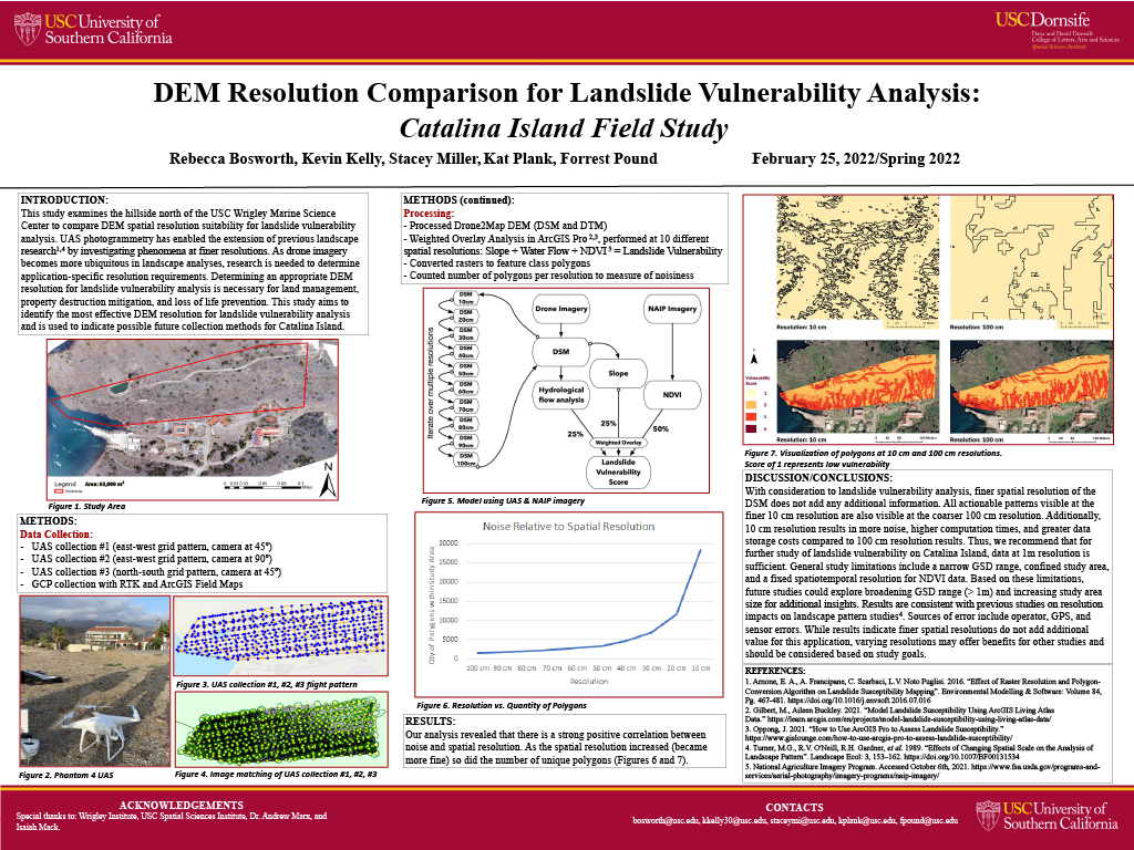
The team in this project investigated spatial resolution options of digital elevation models (DEMs) to assess the landslide vulnerability of a USC study site on Catalina Island. “We were interested in a practical application using tools that we had available including Unmanned Aerial Systems [UAS] and high-precision GPS instruments. We designed the experiment to be repeatable at various study sites,” says Rebecca Bosworth, poster competition winner. She and the team found that less costly low-spatial-resolution information provided the same conclusions as costly high-spatial-resolution DEMs. For this particular case, they proved that high-spatial-resolution products may not always be necessary depending on the application.
The summit was a fantastic and timely forum for students to meet with leaders and peers in the profession to discuss how the geospatial community can support various efforts during ongoing, rapidly changing world events.
Esri Resources for Students and Young Professionals
Events such as the Los Angeles Geospatial Summit allow the opportunity for higher education students to connect with peers, mentors, and professionals from many different geographic areas. These networking opportunities can be integral in kick-starting a career in the geographic field.
Each year I am blown away by how innovative students are in using GIS technology to research pressing topics. The summit and poster competition are a unique opportunity to showcase their geospatial skills and present their research to industry leaders.
Esri offers many resources to assist higher education students in their path to career success. These resources include the following:
- Esri recruiting events
- Esri student programs that include internships and assistantships
- Esri Young Professionals Network
- Employment opportunities listed on Esri Careers
- Students in Higher education website