Middlesex Water Company is a regulated water and wastewater utility serving customers across New Jersey and Delaware. The organization manages water, wastewater, and related infrastructure systems that support essential public services. The utility’s operations rely on maintaining accurate and aligned data across enterprise systems to support daily operations, regulatory requirements, and long-term planning.
Introduction
Middlesex Water Company has taken a long-term, deliberate approach to maintaining alignment between its geographic information system (GIS) and enterprise systems, including Esri ArcGIS—used to manage and visualize the company’s utility network—and its Oracle-based asset management environment. As a regulated water utility, the organization depends on accurate, synchronized data across platforms to support daily operations, reporting, and planning. Rather than relying on tightly coupled, version-dependent integrations, Middlesex focused on establishing a stable, upgrade-safe integration strategy. This approach has enabled the organization to support major system changes, including its transition from Oracle Utilities Work and Asset Management (WAM) to Oracle Utilities Work and Asset Cloud Service (WACS) and broader cloud adoption, while maintaining consistent data alignment and operational continuity.
The Challenge
In 2008, Middlesex Water Company made a strategic decision to use GIS as the system of record for its water distribution and wastewater collection infrastructure. As the organization expanded its use of geospatial technology to support operations, engineering, planning, and asset management, maintaining the accuracy and integrity of network data across enterprise systems became increasingly important.
In 2010, when Middlesex implemented Oracle WAM as its enterprise asset management platform, the organization faced a new challenge: ensuring that critical asset information remained synchronized between GIS and asset management systems. Middlesex recognized that traditional custom integrations often create tight dependencies between applications, leading to increased maintenance requirements, greater upgrade complexity, and higher risk of data inconsistencies over time.
Middlesex sought an approach that would support the long-term role of GIS as the authoritative source for network information while allowing enterprise systems to evolve independently. The goal was to establish a reliable, sustainable integration framework capable of maintaining alignment between ArcGIS and asset management systems through future technology changes, upgrades, and modernization initiatives.
Over the following decade and a half, that strategy was put to the test as Middlesex’s technology landscape continued to evolve. Major initiatives, including the transition from Oracle WAM to Oracle WACS and broader cloud adoption efforts, reinforced the importance of having an integration approach that could adapt to change without disrupting critical business processes. Middlesex needed to ensure that GIS and asset management data remained accurate, synchronized, and trusted across the enterprise while minimizing the operational burden associated with maintaining integrations.
“Technology platforms will change. Business requirements will change. What should not change is confidence in your data. One of the greatest benefits of our long-standing partnership with Geonexus has been the ability to maintain alignment between GIS and asset management systems through multiple generations of technology. That stability has allowed Middlesex to continue modernizing our enterprise environment while preserving GIS as a trusted foundation for operational and strategic decision-making.”—Michael J. Hanna, Manager of Asset Management, Middlesex Water Company
Partner
Geonexus worked closely with Middlesex Water Company to implement a productized integration strategy connecting Esri ArcGIS with the utility’s Oracle asset management systems. The partnership focused on replacing tightly coupled, custom integrations with a standardized platform that enables upgrade-safe synchronization across systems. Geonexus provided both the integration platform and implementation approach needed to support Middlesex through system upgrades and cloud-related changes. This collaboration enabled Middlesex to maintain data alignment, reduce integration complexity, and support ongoing system evolution without introducing additional operational burden.

The Solution
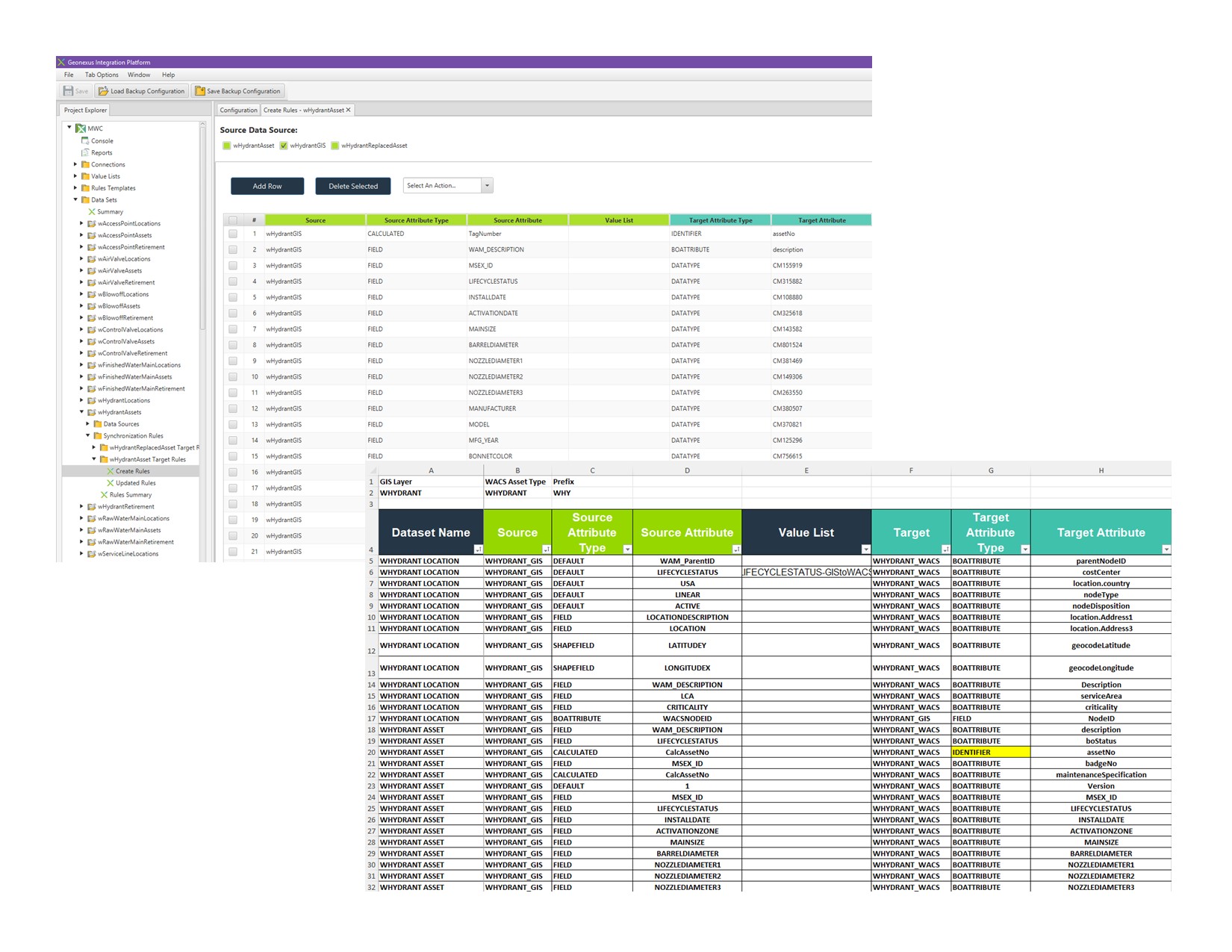
Rather than developing custom point-to-point interfaces that would require redevelopment as applications changed over time, Middlesex adopted the Geonexus Platform as a configurable integration framework designed to support long-term synchronization between systems.
“Through our partnership with Geonexus, we’ve achieved seamless integration between GIS and our asset management system, enhancing visibility into asset attributes and location and providing the business with a single, reliable view of its assets to support informed, data-driven decision-making.”—Georgia Simpson, Vice President of IT, Middlesex Water Company
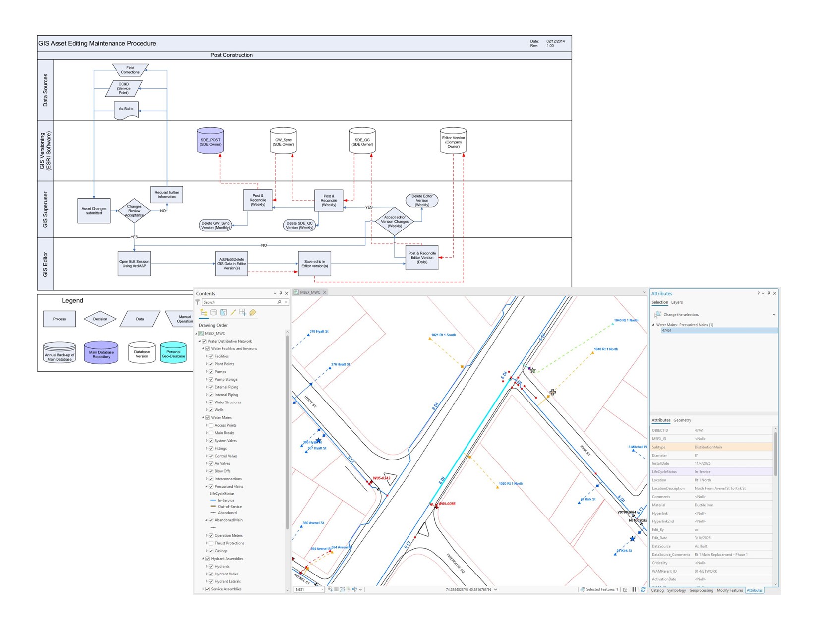
The implementation established clear ownership of business data and defined how information would flow between applications. ArcGIS remained the authoritative source for network and spatial asset information, while Oracle WAM managed asset maintenance and operational records. The Geonexus Platform enabled the two systems to exchange information through a standardized, maintainable architecture that reduced dependencies on specific software versions and minimized the need for custom integration development.

This approach became a foundational component of Middlesex’s broader GIS strategy, helping the organization strengthen GIS as an enterprise business system that supports operations, engineering, planning, and asset management. By establishing a reliable integration architecture, Middlesex created a platform capable of supporting ongoing modernization efforts while maintaining confidence in the accuracy and consistency of enterprise data.
Since 2010, the value of this approach has been demonstrated through multiple ArcGIS upgrades, evolving business requirements, the transition to Oracle WACS, and broader cloud adoption initiatives. This same architecture has provided a strong foundation for Middlesex’s ongoing transition to Esri’s ArcGIS Utility Network. The architecture also positions the organization to support expanded cloud services, mobile workforce applications, advanced analytics, operational dashboards, and future digital transformation initiatives without requiring significant redevelopment of core integrations.
The Results
By adopting a productized, upgrade-safe integration approach, Middlesex Water Company has been able to maintain consistent alignment between Esri ArcGIS and the utility’s Oracle enterprise systems throughout major system transitions. The organization successfully supported its migration to Oracle WACS without disrupting data synchronization between systems. This ensured that ArcGIS continued to provide a reliable, up-to-date representation of the system for operational awareness and decision-making. This approach reduced the operational effort required to maintain integrations, minimized the risk of data inconsistencies during upgrades, and improved the reliability of enterprise data across platforms. As a result, Middlesex established a foundation that supports long-term system evolution while maintaining confidence in the accuracy and consistency of its operational data.
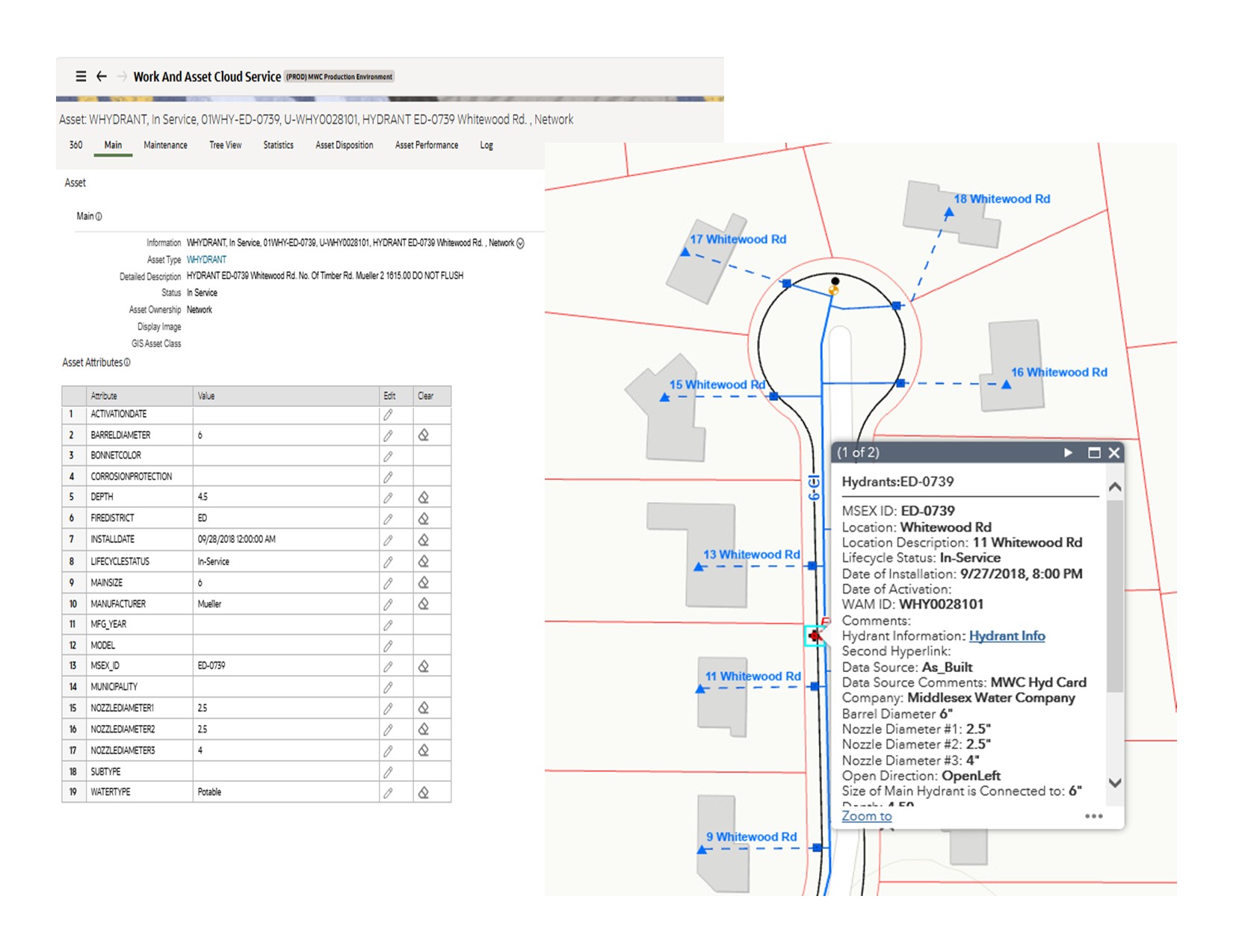
“We may not see the integration itself, but we see the benefits every day. Having GIS and WACS synchronized means crews, planners, engineers, and managers are working with the same information. That shared understanding improves communication, supports better decision-making, and allows us to focus on maintaining our system rather than reconciling data.”—Dan Watters, Director of Operations, Middlesex Water Company
Stay Connected with Esri’s Water Team
ArcGIS is an enterprise geospatial platform that enables modernization of workflows with easy-to-use applications for the field and office. Strengthen your organization with geospatial solutions that will increase efficiency and provide insight for decision-makers.
Visit the Esri Water Utilities web site for more information.
Join the Water Utilities Community
Follow #EsriWater on social media: X | LinkedIn
Subscribe to the Water Industry newsletter “Esri News for Water Utilities and Water Resources“